A former castle checkpoint became a geisha district, a literary neighborhood and Tokyo’s “Little Paris”—all on the same steep street.
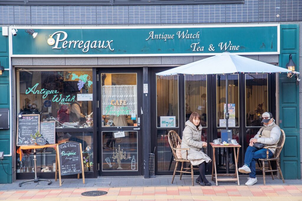
To a visitor unfamiliar with Japan, Kagurazaka can feel almost impossible to categorize. Stone-paved alleys suggest an old geisha quarter. A red Buddhist temple anchors the main shopping street. French schools, bakeries and restaurants support the nickname “Little Paris.” Modern apartments rise beside lanes that seem designed for another century.
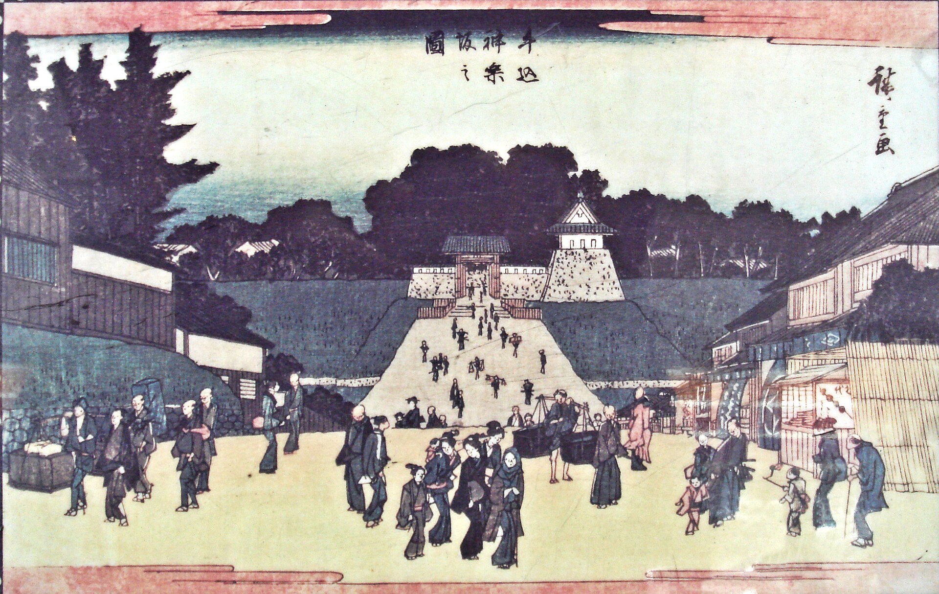
The explanation begins at the bottom of the hill. Kagurazaka grew beside Ushigome Mitsuke, a guarded crossing in Edo Castle’s outer moat. Officials, samurai, worshippers, merchants and travelers climbed from the moat toward the Ushigome plateau. Temples and warrior estates shaped the blocks; shops followed the traffic; geisha businesses later occupied the more secluded side streets. Publishers, writers and performers added another cultural layer, and a postwar French institution gave the district its modern international identity.
Kagurazaka is therefore not a preserved Edo street or a Japanese imitation of Paris. It is a slope whose strategic position repeatedly attracted new forms of movement, culture and hospitality.
Quick Facts
- Japanese name: 神楽坂
- Municipality: Shinjuku City, Tokyo
- Main access: Iidabashi, Kagurazaka and Ushigome-kagurazaka stations
- Known for: Bishamonten Zenkoku-ji, stone-paved lanes, geisha culture, publishing, restaurants and French cultural institutions
- Key geography: a road climbing from Edo Castle’s former outer moat onto the Ushigome plateau
- Main historical layers: castle defenses, samurai estates, temple commerce, hanamachi culture, literature, war, postwar dining and French-Japanese exchange
Why Kagurazaka Became What It Is Today
Kagurazaka’s character came from the interaction of route, slope and landholding. The road began at a fortified crossing and climbed toward upland neighborhoods. Large samurai and temple plots produced long walls, irregular boundaries and narrow rear lanes. The main street carried public movement; side streets offered privacy.
That contrast later supported two kinds of commerce at once. Shops, festival stalls and everyday businesses faced the public avenue. Restaurants, geisha houses and service entrances used quieter lanes. Publishing and performance networks developed nearby, while railway and subway access enlarged the audience. The district’s modern appeal rests on this coexistence rather than on one surviving historical period.
The Outer Moat and Ushigome Mitsuke
At the foot of Kagurazaka, modern railways and roads follow the former outer-moat corridor. In the seventeenth century, Ushigome Mitsuke controlled a bridge and gate on Edo Castle’s defensive perimeter. A mitsuke was a guarded checkpoint, not simply a place name.
The gate buildings disappeared, but surviving stonework near Iidabashi preserves part of the defensive landscape. The relationship remains clear: Kagurazaka-dori begins beyond the old crossing and rises toward the plateau. What appears today as a shopping slope began as infrastructure connecting the castle-side city with Ushigome.
How the Hills and Valleys Shaped the Streets
Kagurazaka lies on the eastern edge of the Ushigome plateau. The main avenue climbs steadily from Iidabashi, while short slopes and steps branch into small valleys and higher residential ground. This relief creates sudden changes in street width, view and atmosphere.
Temple compounds and former warrior estates reinforced the irregular pattern. Yokoteramachi—literally “side-temple town”—still reflects the concentration of religious land. Wakamiyacho, Fukuromachi and other old names preserve fragments of the older geography. Some lanes retain long-established alignments, while paving and buildings are often modern reconstructions.
Samurai Estates and Temple Streets
During the Edo period, the Ushigome uplands contained daimyo and hatamoto residences, temples, shrines, service households and smaller commercial zones. Kagurazaka was not a merchant downtown and not a single military enclave. It was a mixed outer-castle district.
Large compounds shaped the scale of the blocks. Walls and gates faced major roads, while rear approaches served kitchens, servants and deliveries. After the Meiji Restoration ended the feudal estate system, these plots were subdivided or reused for residences, schools, publishers and businesses. The inherited street pattern made later development uneven and helped preserve intimate side lanes beside a busy commercial street.
Zenkoku-ji and the Temple Approach
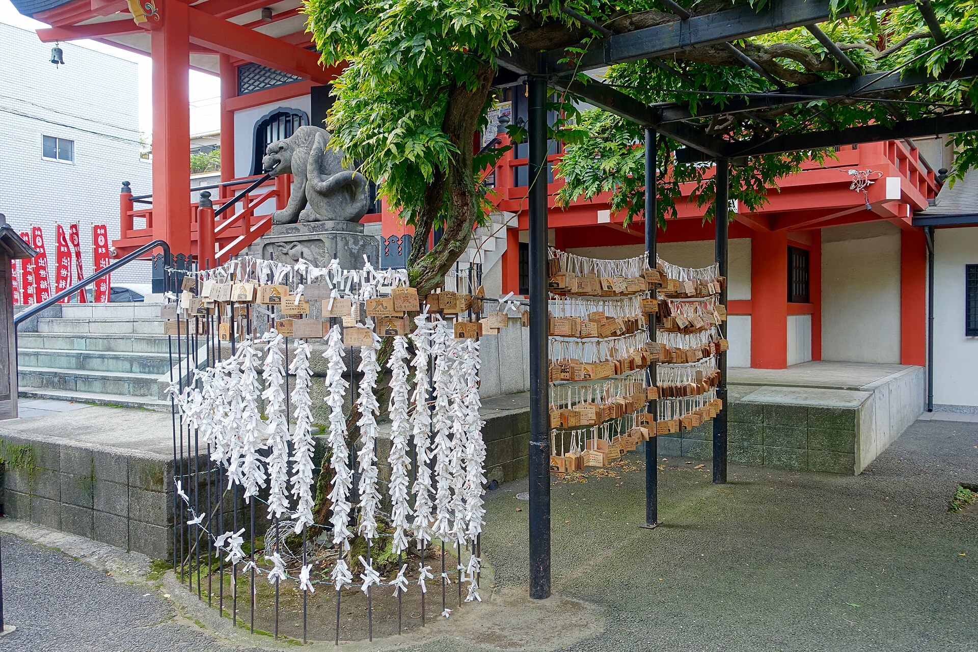
Bishamonten Zenkoku-ji is Kagurazaka’s most visible religious landmark. The temple was founded in the late sixteenth century and moved to its present location in 1792. Its position directly on the active slope made it both a place of worship and an engine of commerce.
Festival visitors and worshippers supported stalls, teahouses and shops. This was a monzen-machi relationship: commerce developed before the gate of a religious institution. A pair of stone tigers dedicated in 1848 preserves donor names and old place names, while wartime damage on the statues links Edo-period devotion with twentieth-century destruction.
From Castle Road to Commercial High Street
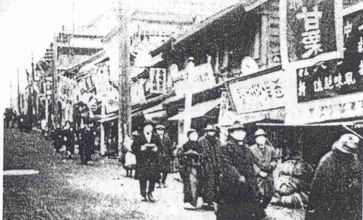
Kagurazaka’s commercial life depended on movement. In Edo, residents, retainers and worshippers passed between the moat, temples and upland neighborhoods. In the Meiji period, former samurai land changed hands and the population grew. Shops, rented housing, publishers and entertainment businesses multiplied.
Iidabashi developed into a major transport junction, bringing customers from across Tokyo. The main street became a public commercial stage, while the side lanes retained more discreet uses. This front-and-back pattern remains one of Kagurazaka’s strongest urban characteristics.
How the Geisha District Developed
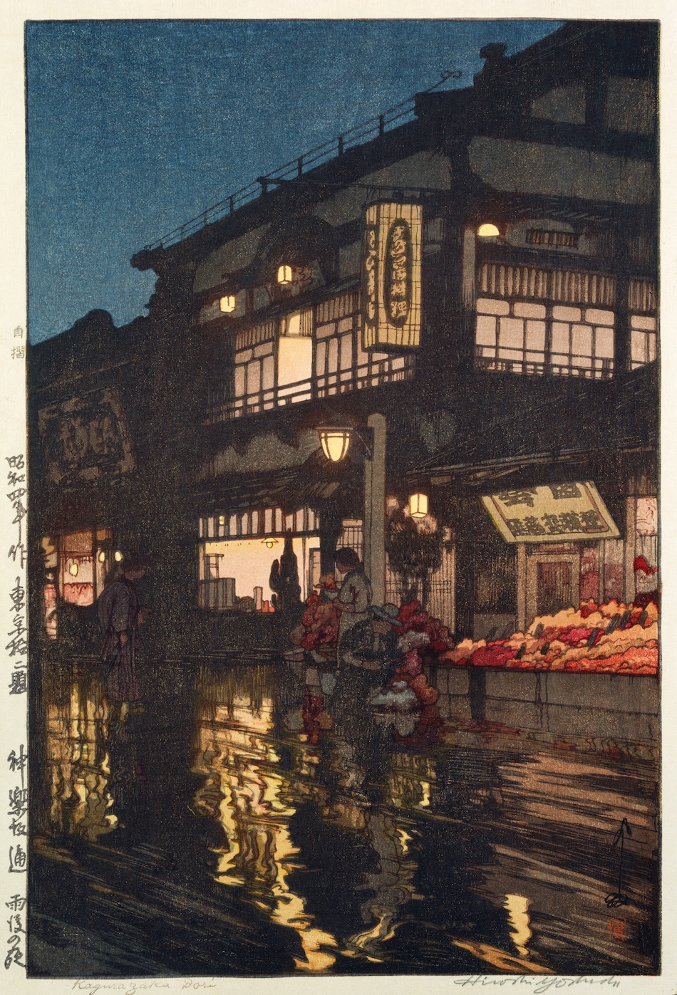
Kagurazaka’s geisha district did not cover the whole neighborhood and was not fully formed in the early Edo period. The recognizable hanamachi, or flower district, expanded mainly from the late Edo through the Meiji, Taisho and early Showa eras.
The district’s location was ideal for hospitality. Government officials, businesspeople, writers and publishers could reach Kagurazaka easily, dine on or near the main street, and then enter quieter lanes for private banquets and performance. Restaurants, geisha houses and booking organizations formed a linked professional system.
Geisha were trained entertainers specializing in music, dance, song and conversation. Their work belonged to a regulated hospitality economy and should not be reduced to prostitution. The side lanes supported privacy, controlled entrances and service circulation while remaining close to the public avenue.
Earthquake and the Expansion of Entertainment
The Great Kanto Earthquake of 1923 devastated much of Tokyo, especially the eastern low city. Kagurazaka suffered damage but escaped the scale of destruction seen in many older entertainment districts. That relative survival changed its fortunes.
Customers, businesses and performers sought functioning venues in the western city. Kagurazaka’s geisha and restaurant economy expanded as metropolitan nightlife shifted. The district’s prominence was therefore shaped partly by disaster elsewhere.
Writers, Publishers and Performers
Kagurazaka and the wider Ushigome area became important to modern literary and publishing culture. Writers could live nearby, publishers and printers operated in the surrounding districts, and restaurants provided meeting places for editors, performers and artists.
Ozaki Koyo lived in Yokoteramachi and led the Kenyusha literary circle. Izumi Kyoka had strong connections to the neighborhood, while composer and koto innovator Miyagi Michio lived nearby in Nakamachi. Theatre and performance networks also developed around local institutions.
Kagurazaka’s cultural reputation came from proximity and repeated encounters rather than from a formal cultural campus. A publisher’s office, a geisha banquet room, a shrine festival and a writer’s residence could all belong to the same neighborhood economy.
War and Postwar Reconstruction
Air raids in 1945 destroyed large parts of Kagurazaka and the wider Ushigome area. Homes, restaurants, religious buildings and businesses burned. The present district cannot be understood as a complete architectural survival of its prewar peak.
What survived more strongly were routes, institutions, business relationships and place names. Postwar rebuilding restored the shopping street and restaurant economy, while geisha culture continued on a smaller scale. New concrete buildings and apartments gradually replaced temporary structures.
Why the Alleys Still Feel Historic
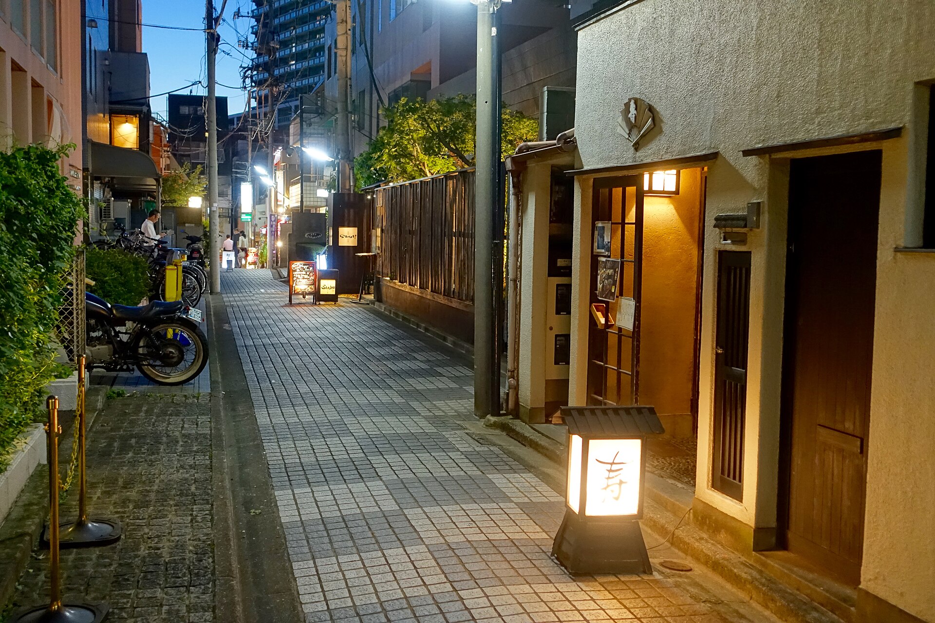
Hyogo Yokocho, Kakurenbo Yokocho, Kenban Yokocho and Geisha Shinmichi feel separate from the main avenue because their width, bends, walls and changes in level reduce long views and slow movement. Restaurants can remain only steps from Kagurazaka-dori while appearing secluded.
Much of the visible paving and many façades are modern. Their value lies less in preserving every original material than in maintaining the scale and sequence of the older spatial pattern.
How Kagurazaka Became “Little Paris”
Kagurazaka’s French identity is a postwar development. The French cultural institute began operating in the Iidabashi-Kagurazaka area in 1952, bringing language education, cinema, exhibitions and French-Japanese exchange.
Students, teachers, diplomats and artists supported French restaurants, bakeries and bookstores. The nickname “Little Paris” later became useful tourism branding. It reflects genuine institutions and culinary culture, but it should not be mistaken for an old historical identity.
The attraction lies in juxtaposition: a visitor can move from Bishamonten worship and geisha lanes to French lessons and contemporary dining within a short walk.
Redevelopment and Preservation
High land values and demand for central housing have brought apartments, offices and larger buildings into Kagurazaka. At the same time, the district’s lanes and restaurant culture have become economically valuable as heritage.
Preservation is therefore a negotiation. Residents need safe buildings, accessibility and viable businesses; visitors value low-rise streets and intimate lanes. Stone paving and restrained façades can help preserve visual scale, but they may also create an idealized image of “old Japan.” The most meaningful continuity lies in topography, route hierarchy, religious sites, old names and mixed use.
What to Look For Today
- Former Ushigome Mitsuke: surviving stonework and the moat corridor explain why the slope begins here.
- Kagurazaka-dori: the public route that carried officials, worshippers, shoppers and diners.
- Zenkoku-ji: the temple that strengthened festival traffic and approach commerce.
- Hyogo and Kakurenbo Yokocho: narrow lanes revealing the district’s private hospitality geography.
- Kenban Yokocho and Geisha Shinmichi: traces of the professional flower district.
- Yokoteramachi: temple boundaries and a quieter street pattern.
- Tokyo French Institute: the postwar cultural layer behind the “Little Paris” image.
Timeline
| Seventeenth century | Edo Castle’s outer moat and Ushigome Mitsuke organize the crossing below the future Kagurazaka street. |
| 1792 | Zenkoku-ji moves to Kagurazaka and strengthens temple commerce. |
| 1848 | The stone tigers at Zenkoku-ji are dedicated. |
| Late nineteenth century | Former samurai land is reorganized; commerce, publishing and the geisha district expand. |
| 1923 | Relative survival after the Great Kanto Earthquake helps Kagurazaka’s entertainment economy grow. |
| 1945 | Air raids destroy much of the built environment. |
| 1952 | The French cultural institute begins operating in the area. |
| Late twentieth century onward | Dining, tourism, redevelopment and preservation reshape the neighborhood. |
Frequently Asked Questions
Was Kagurazaka always a geisha district?
No. The area first developed around a castle gate, samurai estates, temples and commerce. The recognizable geisha district expanded mainly from the late Edo through the early twentieth century.
Are the stone-paved lanes unchanged from Edo?
No. Some street alignments and the scale of the lanes are older, but paving, façades and buildings were repeatedly changed by earthquake, war and redevelopment.
Why is Kagurazaka associated with France?
The association developed after World War II through the French cultural institute, language education and a concentration of French restaurants and bakeries.
Can visitors still encounter geisha culture?
A small professional community continues, but working premises are private. Visitors should respect residents, performers and restaurant guests.
Sources and Further Reading
- Shinjuku City Cultural and Tourism Resources: Kagurazaka course
- Shinjuku City and Shinjuku Convention & Visitors Bureau: Kagurazaka map
- Shinjuku City: Zenkoku-ji stone tigers
- Tokyo Updates: Kagurazaka’s historical and French cultural layers
- GO TOKYO: Kagurazaka area guide
- Tokyo French Institute: institutional history
Related Neighborhood Histories
Compare Kagurazaka with Waseda, another district shaped by education and publishing, and Asakusa, where religious crowds produced a different entertainment landscape. Browse the Tokyo Neighborhood Histories directory.