A book that transformed Japanese medicine began with a dissection at an execution ground now hidden beside commuter railways and apartment towers.
That dissection took place at Kozukappara in 1771. Japanese scholars compared the body before them with illustrations in a Dutch anatomy book, and the experience helped launch the translation project that produced Kaitai Shinsho three years later. Today, the same area is compressed between temples, memorials, railway tracks and the dense urban landscape around Minami-senju Station.
Minami-senju’s abrupt changes of scale make sense once this history is understood. The district repeatedly received functions that Edo and Tokyo needed near the city—but not at its center. It became the southern gateway to the Senju post town, the site of punishment and burial, a freight and industrial corridor, a day-labor and inexpensive-lodging area, and finally a major zone of riverside housing and disaster-prevention redevelopment.
These roles did not simply replace one another. Each inherited land, routes and boundaries from the previous layer. The old highway still leads toward Senju Ohashi. Memorial temples preserve fragments of Kozukappara. Railway yards continue the gateway’s logistics function. East of the station, Shioiri’s towers and parks occupy land reorganized by industry and large-scale planning. Minami-senju is therefore one of the clearest places to see how Tokyo repeatedly transforms its urban edge.
The Southern Gateway of Senju
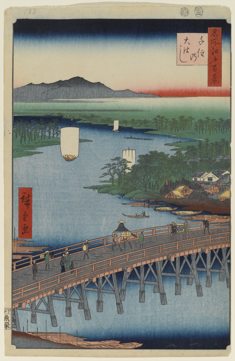
Historical Senju-shuku extended across both sides of the Sumida River. The best-known post-town streets now lie around Kita-senju, but travelers leaving Edo first passed through the southern approach in what is now Minami-senju before crossing Senju Ohashi.
The bridge, first completed in the late sixteenth century, fixed the route north from Edo. During the Tokugawa period, the Nikko and Oshu highways turned Senju into a major post station. Inns, transport services, roadside shops and religious sites developed along the road.
The modern names Kita-senju and Minami-senju can therefore be misleading. They belong to the railway city. The Edo-period post town was a continuous transport landscape divided later by the river, ward boundaries and separate stations.
Why Kozukappara Was Placed Here
The Kozukappara execution ground was established near Edo’s northeastern gateway during the early Tokugawa period. Its location followed the spatial logic of the early modern city: punishment was made visible along a major road, but the site itself remained outside the dense political and commercial center.
Kozukappara should not be treated merely as a place of gruesome spectacle. Its deeper importance lies in how punishment, burial, memorialization and later infrastructure occupied the same ground. The execution site remained in use until the early Meiji period, after which rail construction and urban growth altered its boundaries.
Ekoin and Enmei-ji: Preserving a Changed Memorial Landscape
Kozukappara Ekoin was founded in 1667 to pray for prisoners and others who had died through punishment. The precinct contains memorials and graves associated with the execution ground, including memorial graves connected with Yoshida Shoin and Hashimoto Sanai.
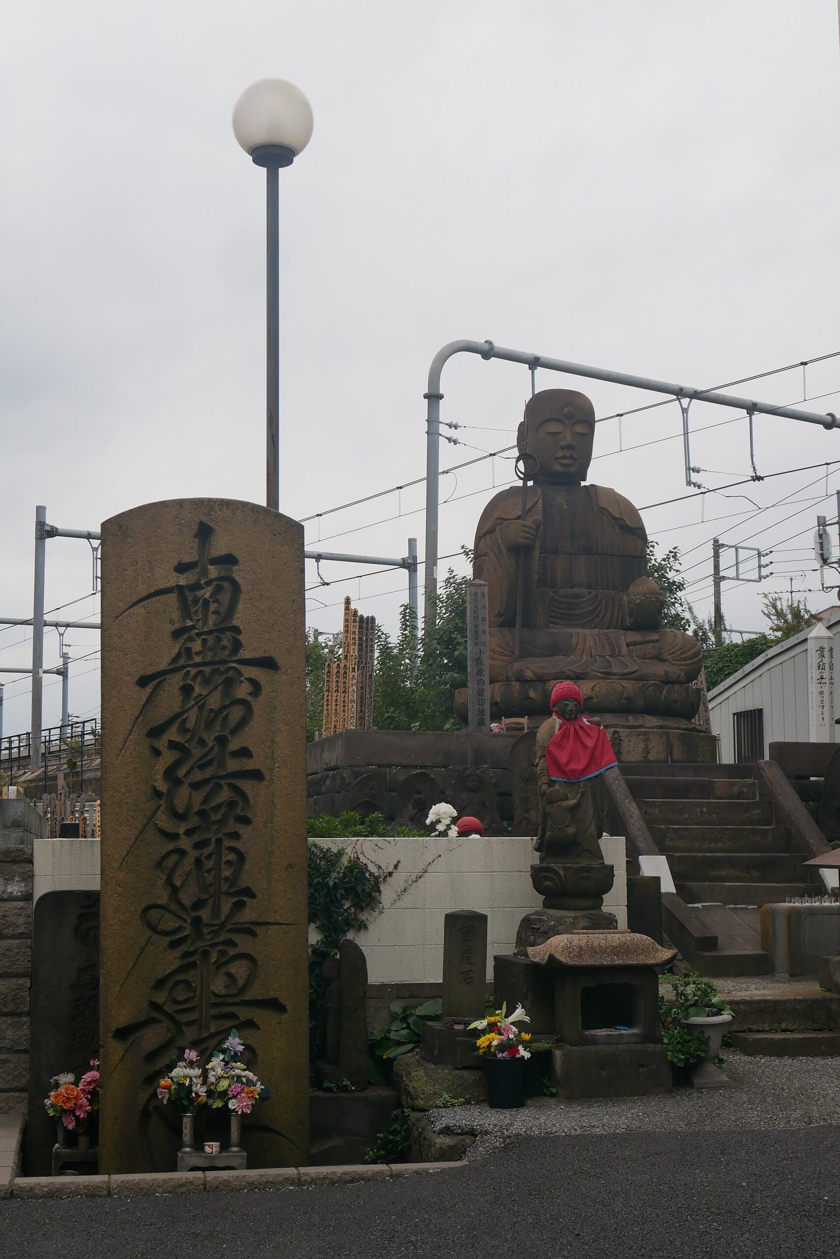
Nearby Enmei-ji contains the large stone image popularly known as Kubikiri Jizo. The memorial was erected in the eighteenth century and later moved when railway construction reorganized the area.
The present temples do not reproduce the execution ground exactly. They preserve a memorial landscape repeatedly altered by transport infrastructure, rebuilding and changing attitudes toward the dead.
Kozukappara and the Birth of Kaitai Shinsho
Minami-senju also occupies an important place in the history of Japanese medicine. In 1771, Sugita Genpaku, Maeno Ryotaku, Nakagawa Junan and others observed a dissection at Kozukappara. Comparing the body with illustrations in a Dutch anatomical book convinced them of the text’s accuracy and encouraged a difficult translation project.
The resulting Kaitai Shinsho was published in 1774. The distinction between the dates matters: the observation occurred in 1771, while the book appeared three years later. Ekoin’s Kanzo memorial commemorates this connection between anatomical study, translation and the execution ground.
Railways Replace the Highway as the Main Organizing System
The Meiji government abolished the post-station system and closed the execution ground. Soon afterward, railway construction introduced a new geography of embankments, sidings, stations and restricted land.
The old road had organized development in a narrow line. Railways required broad, continuous parcels. They improved long-distance access while also creating barriers within the neighborhood. Streets that had once connected directly were interrupted by tracks and railway land.
This shift did not erase Minami-senju’s role as a gateway. It modernized it. The district remained important because it still connected central Tokyo with the northeast, but movement was now organized by trains rather than horses, porters and highway inns.
Sumidagawa Freight Station and the Industrial District
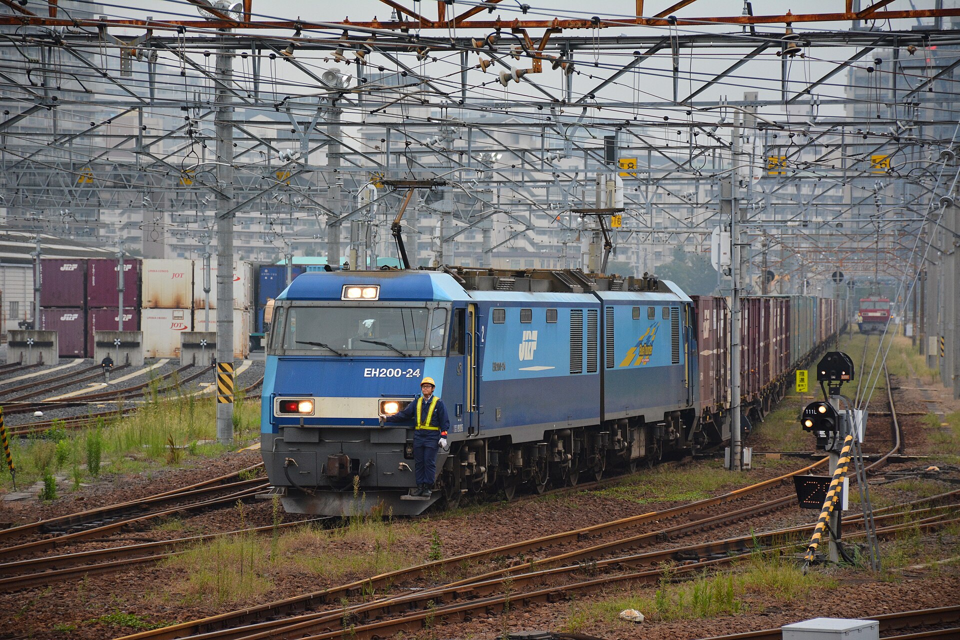
Sumidagawa Freight Station became one of the defining facilities of modern Minami-senju. Rail freight linked the district with national distribution networks, while the Sumida River and nearby waterways supported the movement of bulky goods.
Factories, warehouses and freight facilities benefited from this combination of railway and water access. They also occupied enormous sites. The yards and industrial compounds created hard edges between residential areas and preserved large parcels long after some industrial functions changed.
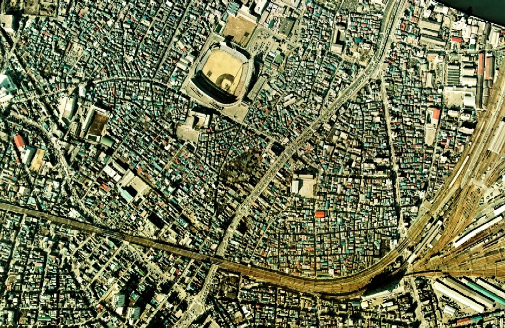
Those inherited parcel sizes later made comprehensive redevelopment possible. The modern apartment complexes and parks of eastern Minami-senju were built not on an empty landscape, but on land already reorganized by logistics and industry.
Postwar Minami-senju: Housing, Labor and Large Sites
After the war, modest housing, workshops, railway infrastructure and industrial land stood close together. Some streets retained a fine-grained residential and commercial pattern, while railway and industrial properties remained much larger.
Southwest of the station lay the wider social geography associated with Sanya, known for inexpensive lodging and a day-labor market. Minami-senju Station served this area, but Minami-senju and Sanya are not interchangeable names.
The district’s history should be understood through labor, housing and uneven urban investment rather than stigma. Workers living in or passing through the area supported construction and metropolitan growth, while transport infrastructure divided neighborhoods that were physically close.
Tokyo Stadium: A Short-Lived Postwar Landmark
Tokyo Stadium opened in 1962 and served as the home of the professional baseball team commonly known as the Daimai or Tokyo Orions. It closed in 1972.
The stadium’s brief life is important because it shows how postwar Tokyo reused large peripheral sites for mass entertainment. Yet it never replaced the district’s deeper transport and industrial structure. Even during the stadium years, railway lines, freight facilities and working neighborhoods continued to define Minami-senju.
Shioiri: Redevelopment as Disaster Prevention
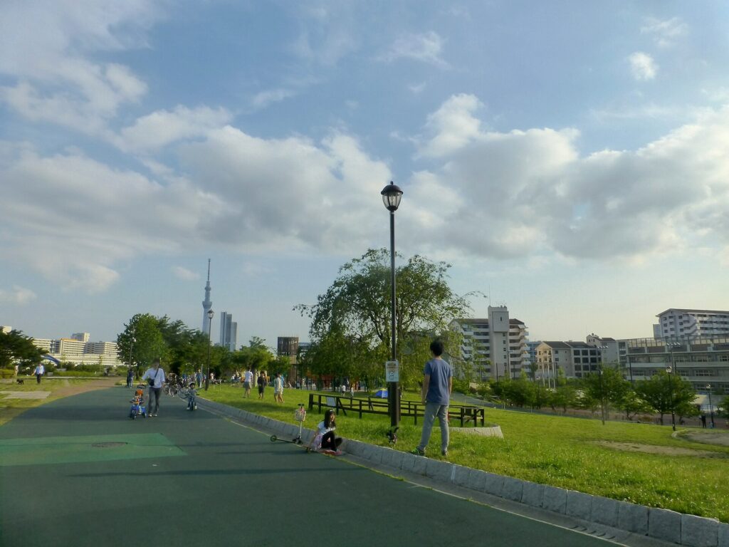
Shioiri’s apartment towers, broad streets and riverfront parks represent the district’s most visible recent transformation. The Shirohige West redevelopment reorganized a large area of eastern Minami-senju through housing, roads, schools, medical facilities, parks and evacuation space.
Arakawa City records a project area of 48.8 hectares and completion in 2010. The project was not simply a housing scheme. It formed part of a wider disaster-prevention strategy for the fire-vulnerable lowlands of eastern Tokyo.
The redevelopment brought safer infrastructure and public amenities, but it also replaced older factories, workshops and dense residential patterns. Shioiri should therefore be read as a new historical layer rather than a landscape without a past.
The Station Hub after 2005
The opening of the Tsukuba Express in 2005 strengthened Minami-senju as an interchange with JR East and the Tokyo Metro Hibiya Line. Better regional access increased the residential appeal of Shioiri and the wider station district.
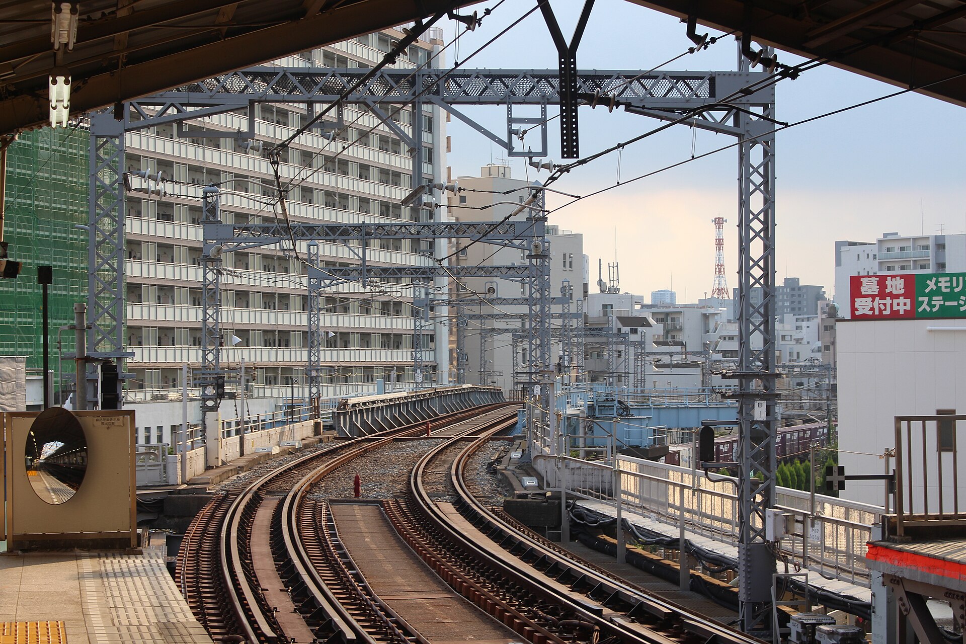
At the same time, the railways continue to divide local movement. Tracks and freight land compress east–west circulation into a limited number of crossings. This is why areas only a short walk apart can feel like separate towns.
Four Landscapes to Read Today
- The former Nikko Kaido: the linear route of the southern post-town approach.
- Ekoin and Enmei-ji: memorial spaces preserving the history of Kozukappara and anatomical study.
- The station and freight zone: the railway-age landscape of metropolitan movement and logistics.
- Shioiri: large-scale housing, parks and disaster-prevention infrastructure created through redevelopment.
Together, these landscapes show how Tokyo repeatedly reassigned difficult edge land to functions the central city needed but could not easily accommodate.
How Minami-senju’s Layers Fit Together
| Historical layer | Main function | Urban effect | Visible legacy |
|---|---|---|---|
| Post-town gateway | Highway travel and river crossing | Created a linear roadside settlement | Former Nikko Kaido and Senju Ohashi |
| Kozukappara | Punishment and burial | Placed difficult institutions at Edo’s edge | Ekoin, Enmei-ji and memorials |
| Railway and industry | Freight, production and distribution | Created large parcels and physical barriers | Tracks and Sumidagawa Freight Station |
| Postwar large-site use | Housing, labor and entertainment | Mixed small neighborhoods with major facilities | Street scale and former stadium site |
| Redevelopment | Housing and disaster prevention | Reorganized eastern Minami-senju | Shioiri towers, roads and parks |
Timeline
- Late 16th century: Senju Ohashi strengthens the northern route from Edo.
- Early Edo period: Senju-shuku develops; Kozukappara becomes an execution ground.
- 1667: Kozukappara Ekoin is founded.
- 1741: The large Jizo memorial now at Enmei-ji is erected.
- 1771: Scholars observe a dissection at Kozukappara.
- 1774: Kaitai Shinsho is published.
- Early Meiji period: The execution ground closes.
- Late 19th century onward: Railways, freight and industry reshape the district.
- 1962–1972: Tokyo Stadium operates in Minami-senju.
- 2005: The Tsukuba Express opens.
- 2010: The Shirohige West redevelopment project is completed.
Frequently Asked Questions
Was Minami-senju part of Senju-shuku?
Yes. It formed part of the southern approach to the post town before travelers crossed the Sumida River toward the better-known northern section.
Where was the Kozukappara execution ground?
It occupied land around the present Ekoin and Enmei-ji area near Minami-senju Station. Railway construction later altered the site.
What is the connection with Kaitai Shinsho?
Japanese scholars observed a dissection at Kozukappara in 1771. Their translation work contributed to the publication of Kaitai Shinsho in 1774.
Is Minami-senju the same as Sanya?
No. Sanya is a wider historical and social area near the station, but it is not another name for all of Minami-senju.
Why does the neighborhood change so sharply from west to east?
The west preserves the old highway and memorial landscape, while the east was reorganized by railways, industry and large-scale redevelopment.
Sources and Further Reading
- Arakawa City: Ekoin
- Arakawa City: Enmei-ji and the Kozukappara Execution Ground
- Arakawa City: Shirohige West Urban Redevelopment Project
- Arakawa City: Minami-senju Station Area Project Overview
- Arakawa City: Shioiri Park
- Arakawa City Library: Kozukappara Ekoin
- Japan Freight Railway Company
Explore More with TimeWalk Japan
Walk from the former Nikko Kaido and the Kozukappara memorial sites through the station area to Shioiri. The short distance reveals how a highway gateway, an execution ground, a freight district and a planned riverside neighborhood occupy the same urban corridor. Continue with TimeWalk Japan’s Neighborhood Histories.