Tokyo’s most famous nightlife district was built on samurai estates, army barracks and American military land—before becoming a global center of art and business.
Today, Roppongi is known around the world for clubs, luxury towers, embassies, museums and international business. It can appear to be a place created by modern nightlife and twenty-first-century redevelopment. In reality, its identity was produced by a much longer sequence of land conversions: feudal estates became military compounds, wartime sites became occupation facilities, and former institutional land later became Tokyo Midtown and other major developments.
This explains why radically different versions of Tokyo coexist within a few blocks. Neon-lit streets meet embassy districts, a surviving U.S. military facility, postwar cultural institutions, quiet residential slopes and giant mixed-use towers. Roppongi became international not through one dramatic reinvention, but because each political era reused the large properties, strategic roads and elevated terrain left by the one before it.
Why Roppongi Became What It Is Today
Roppongi’s modern identity grew from an unusual overlap. Large properties inherited from the era of warrior estates could be converted to military, government or institutional use. Nearby occupation facilities brought American personnel and businesses serving foreign customers. Embassies and international organizations across the wider Azabu–Akasaka area supported a permanent multilingual community. The Hibiya Line improved access in the 1960s, while taxis, cars, broadcasting and entertainment networks connected the district to a metropolitan nightlife economy.
Later, Roppongi Hills and Tokyo Midtown added offices, residences, hotels, museums, public spaces and disaster-prevention infrastructure. They did not replace the nightlife district. Instead, they made Roppongi a place where late-night bars, diplomatic life, global business, art institutions, military remnants and high-rise housing occupy neighboring blocks.
Plateaus, Valleys and Roads
Roppongi stands on the dissected uplands commonly associated with the Azabu plateau. Ridges and hollows shape the approaches from Azabu-juban, Nogizaka and Akasaka, while named slopes preserve a local vocabulary of elevation. The crossing itself is a junction on major roads, but the surrounding street network changes quickly from broad arterial routes to narrower lanes and steep descents.
Topography influenced property size, movement and visibility, but it did not dictate a single social pattern. Broad upland sites could hold estates and institutions; valleys and road junctions encouraged commerce and circulation. Modern road widening, rebuilding and redevelopment altered many routes, so a surviving slope or narrow lane should not automatically be treated as unchanged Edo fabric. What persists most clearly is the relief itself and the way movement still gathers at a few strategic crossings.
Before Edo and the Uncertain Origin of the Name
The origin of the name Roppongi—literally “six trees”—is not settled. Local traditions connect it either with six prominent trees or with six daimyo families whose names contained characters meaning tree. These explanations are memorable, but they remain traditions rather than a proven single origin.
The modern address of Roppongi also should not be projected backward. Before the present town boundaries were established, the area included limited commoner settlements such as Iigura Roppongi-cho and Ryudo Roppongi-cho, alongside lands identified by other Azabu place names. Fields, paths, religious sites and scattered settlements existed before Edo’s full urban expansion, but surviving evidence does not justify imagining a compact premodern “Roppongi district” matching today’s map.
The Edo Period: Samurai Estates and Temple Lands
By the late Edo period, much of the area now called Roppongi was divided among daimyo residences, hatamoto compounds, temple precincts and smaller commoner districts. The towns bearing the Roppongi name occupied only part of the landscape. Large walls and gates, service routes, temple approaches and slopes created a patchwork very different from the continuous commercial frontage familiar today.
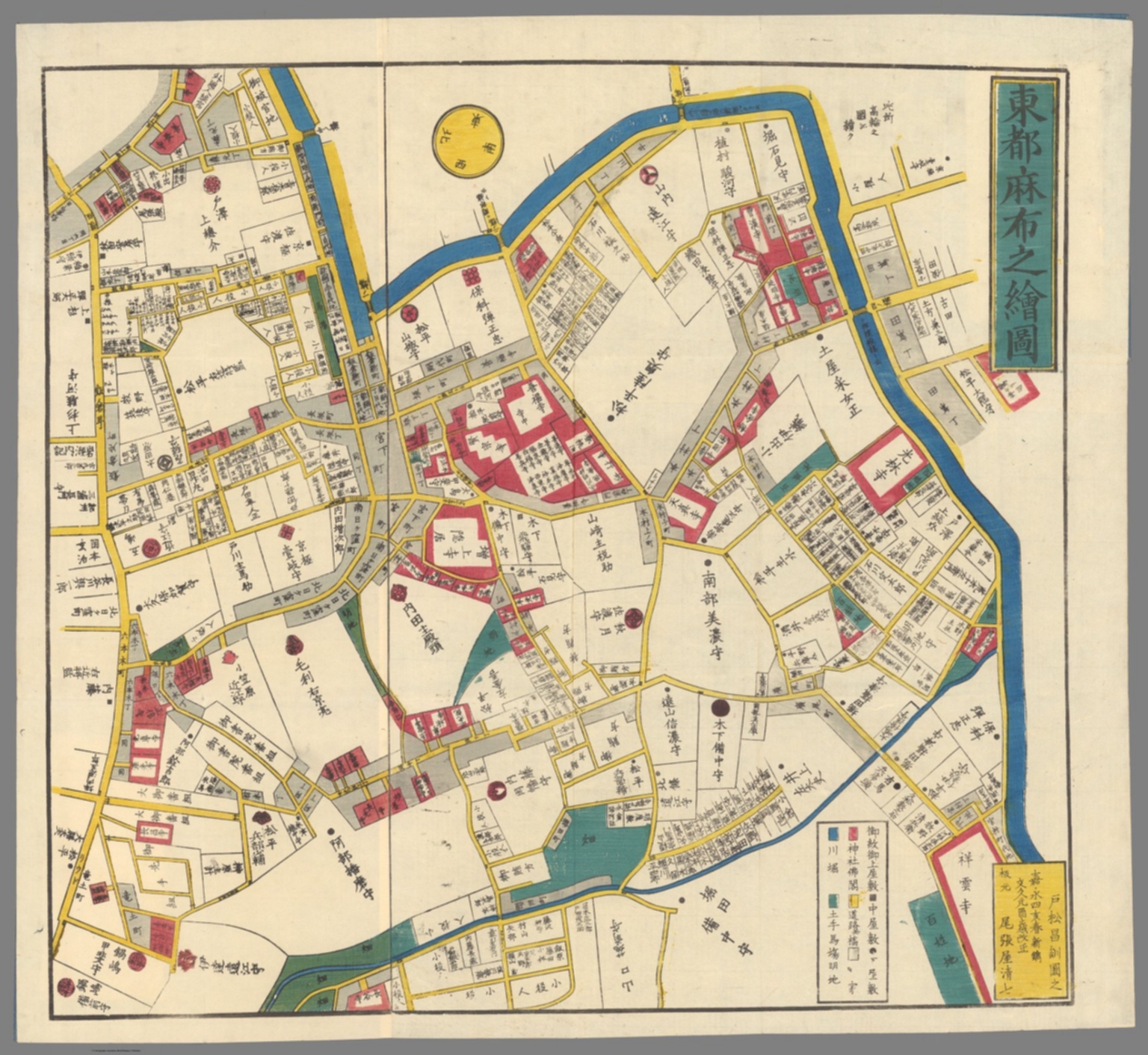
Kiriezu maps—commercially published sectional maps of Edo—help reveal this pattern. They label estates, temples, roads and town divisions, but their orientation and scale vary, and they were made for practical urban navigation rather than modern surveying. Read comparatively, the Azabu sheet shows why later Roppongi inherited both large institutional parcels and irregular smaller streets.
From Daimyo Estates to Military Land
The Meiji Restoration broke the political system that had sustained the daimyo estate landscape. Former warrior properties passed through state ownership, military use, aristocratic residence, institutional occupation and private development. Roppongi was never wholly military land, yet military and government sites became especially consequential because they occupied large, strategically placed parcels.
The long history of the Tokyo Midtown site is the clearest example. The land is associated with a Mori family suburban residence in the Edo period. In the modern era it became an Imperial Japanese Army garrison, was used after the war for U.S. military officers’ housing, and later housed the Defense Agency’s Hinokicho offices. When the agency moved, the site became available for a major mixed-use redevelopment. This sequence belongs to Tokyo Midtown, not to Roppongi Hills, whose land was assembled through a separate redevelopment process south of the crossing.
Earthquake, Modern Roads and Wartime Tokyo
The Great Kanto Earthquake of 1923 affected Tokyo unevenly. Roppongi did not experience the same blanket fire destruction as parts of the eastern low city, but buildings, infrastructure and urban planning were still shaped by the disaster and the wider reconstruction of Tokyo. Road improvement and the city’s continued growth toward the southwest increased the strategic importance of routes through Azabu and Akasaka.
Wartime mobilization strengthened the role of military land. Air raids in 1945 damaged and destroyed buildings across Minato, though the pattern varied block by block. Postwar Roppongi therefore combined surviving boundaries and institutions with burned sites, temporary structures, new commercial buildings and properties requisitioned by the occupation authorities.
Occupation and the American Military Presence
After Japan’s surrender, former military properties in and around Roppongi were requisitioned or repurposed. American personnel moving between barracks, offices, housing and entertainment districts created demand for restaurants, bars, tailoring, transport and English-speaking services. This helped give parts of Roppongi a foreign-facing commercial character.
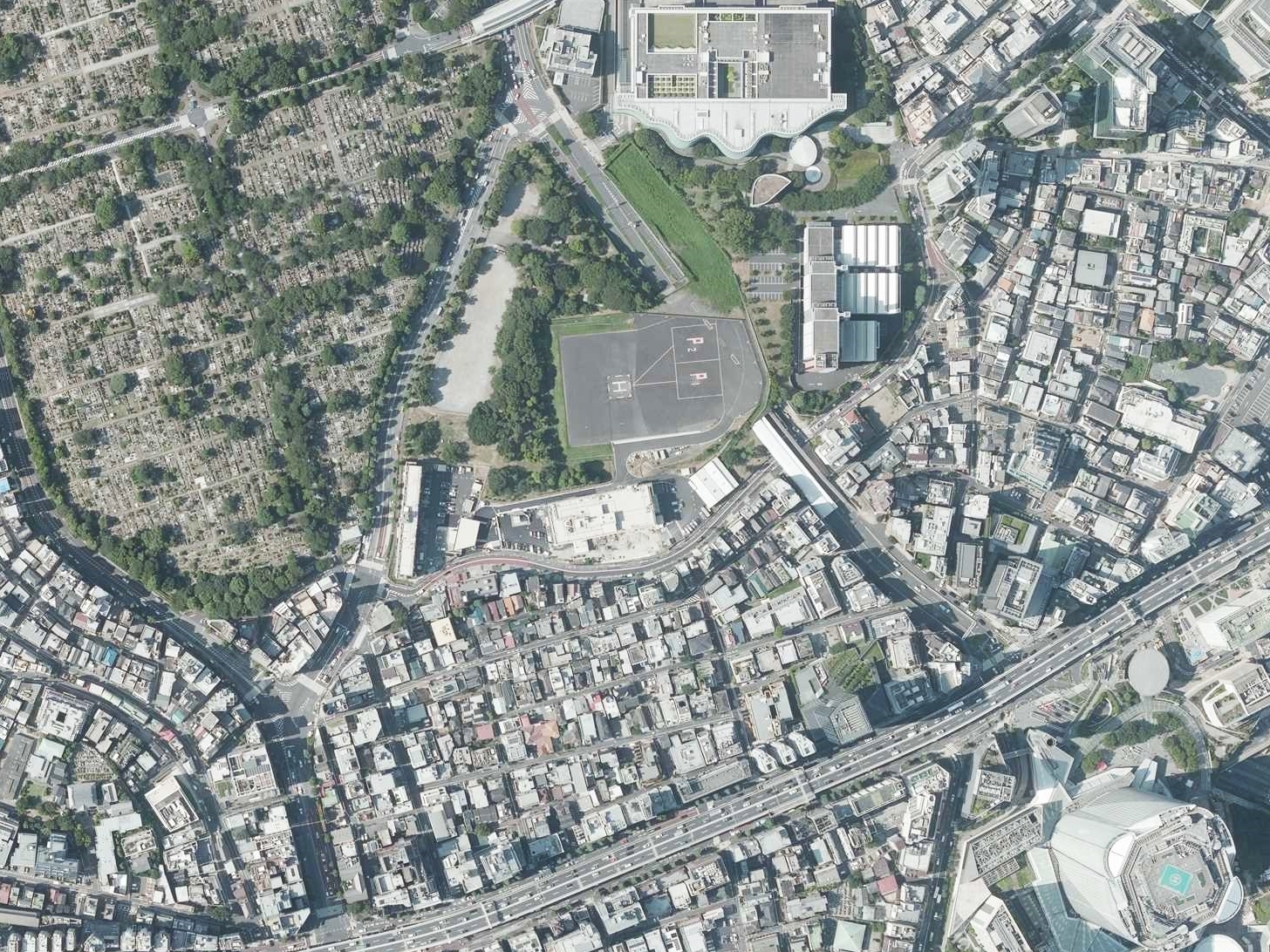
The continuing U.S. presence is visible near the Akasaka Press Center and Hardy Barracks. Japan’s Ministry of Defense still lists the Akasaka Press Center as a designated U.S. Forces Japan facility in Minato. The adjacent heliport is especially prominent from the air. A modern aerial photograph documents the current spatial relationship, not the appearance of the occupation years. The military presence was important, but it was only one part of Roppongi’s internationalization.
From Occupation District to International Quarter
A durable international quarter requires more than transient military customers. Roppongi benefited from its position between embassy districts in Azabu and Akasaka, foreign-oriented housing, international schools and churches, hotels, corporate offices, media businesses and restaurants capable of serving different languages and schedules. These networks made the area useful to diplomats, journalists, artists, executives and long-term foreign residents.
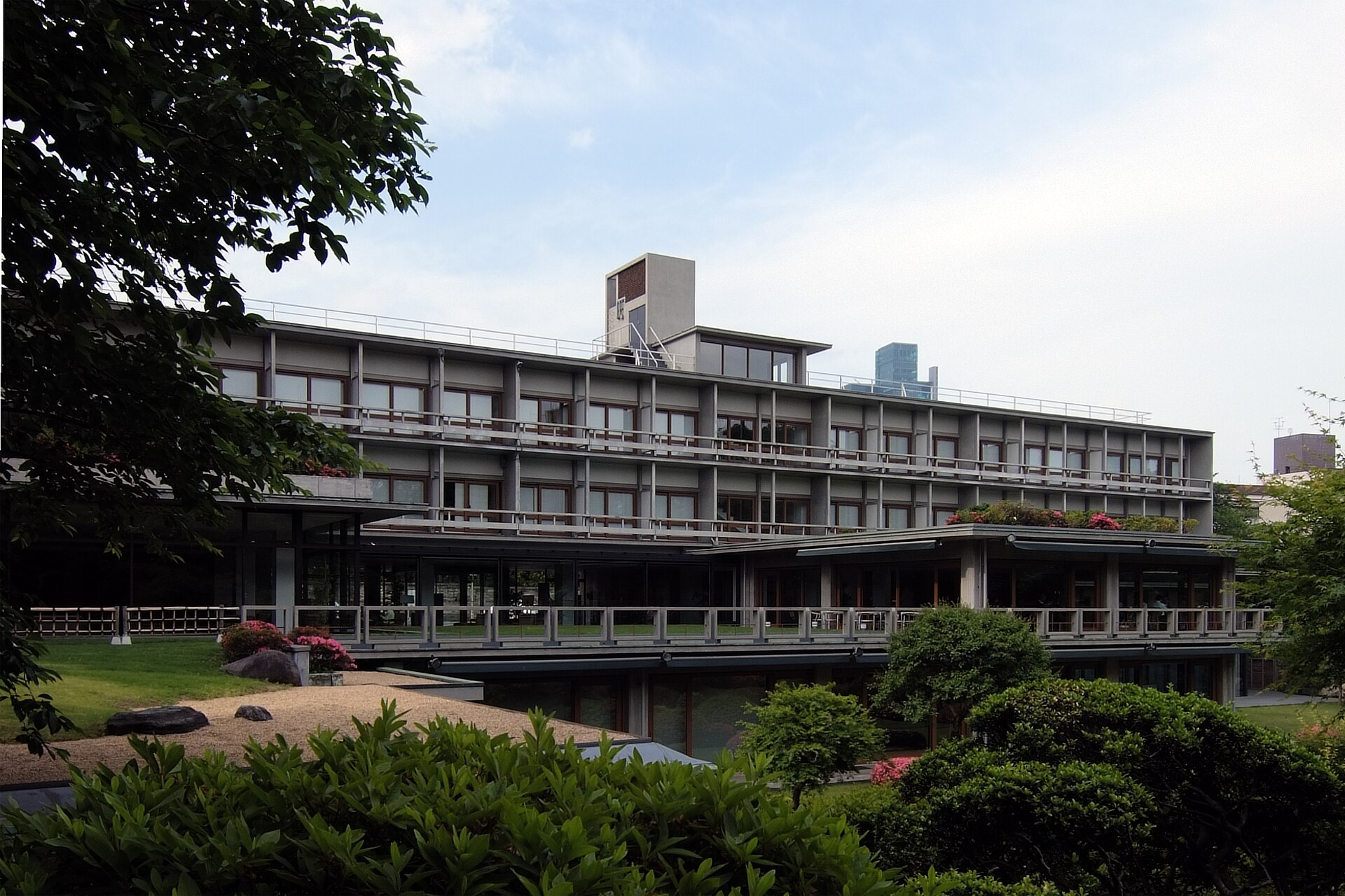
The International House of Japan gave this internationalism an institutional and intellectual form. Incorporated in 1952 to promote cultural exchange and intellectual cooperation, it officially opened on June 11, 1955. Its modernist building was designed by Kunio Maekawa, Junzo Sakakura and Junzo Yoshimura on the former Iwasaki estate. The garden and architecture created a setting for sustained exchange rather than nightlife, showing how Roppongi’s global identity developed through several social worlds at once.
The Hibiya Line and the Roppongi-zoku
Roppongi Station opened with the full Hibiya Line in 1964, giving the district direct rail access between central Tokyo and the southwest. The subway did not invent Roppongi’s entertainment life, but it enlarged its audience and made evening movement easier. At the same time, taxis and private cars remained central to a district whose appeal included late hours and destinations away from major railway terminals.
In the 1960s, the label Roppongi-zoku—roughly, the “Roppongi set”—was applied to young artists, musicians, actors, models and other fashionable people who gathered in particular cafés, restaurants and nightspots. It described a cultural moment tied to postwar affluence, cars, media and cosmopolitan aspiration. It should not be treated as another name for the later disco boom or club culture.
Nightlife, Discos and the Club Era
Roppongi’s nightlife changed repeatedly. The 1960s scene centered on smaller venues, cultural networks and the Roppongi-zoku image. During the 1970s and 1980s, larger discos linked dancing, fashion, imported music, corporate entertainment and the expanding consumer economy. In the bubble years, conspicuous spending and late-night mobility intensified the district’s reputation.
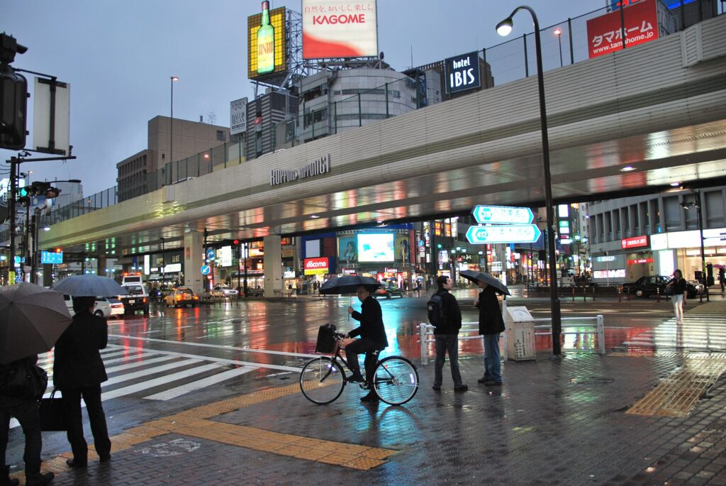
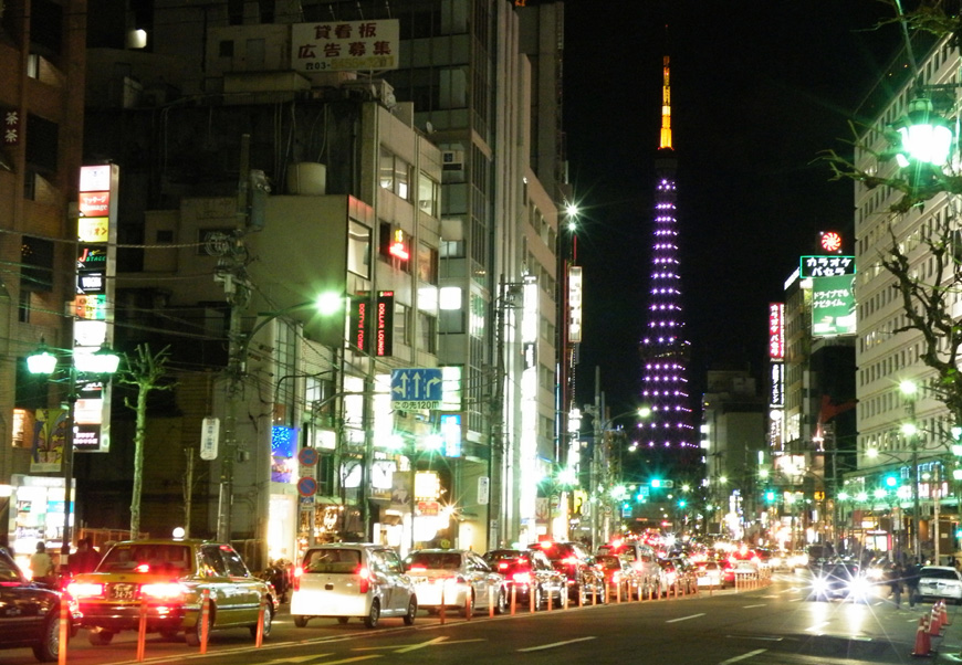
After the bubble collapsed, bars and clubs continued but the market diversified. Some venues served foreign residents and visitors, others catered to Japanese music scenes, and many opened, closed or moved rapidly. The 1990s and 2000s club era cannot be reduced to the 1980s disco model: customer groups, music, security, real-estate costs and operating patterns changed. A 2009 night photograph captures the enduring visual identity of neon and traffic, not the streetscape of those earlier decades.
Roppongi Hills and the Reinvention of Roppongi
Roppongi Hills opened in 2003 after a redevelopment process that Mori Building says took about seventeen years. Unlike a simple conversion of one government site, the project required long negotiations with numerous landowners and residents across an existing neighborhood. Its plan combined offices, apartments, shops, a hotel, cinema, streets, open space and cultural facilities, while emphasizing fire safety and disaster preparedness.
The Mori Art Museum and Tokyo City View placed contemporary culture high in the central tower, making art part of the development’s public identity. The project also reorganized routes across steep terrain and created new pedestrian connections. Yet it involved land consolidation and commercialization as well as public-space improvements. Its history is therefore one of negotiation and urban restructuring, not merely the arrival of a landmark skyscraper.
From Military Land to Tokyo Midtown
Tokyo Midtown opened in 2007 on the former Defense Agency Hinokicho site. Its land history differs sharply from Roppongi Hills: a large military and government compound was redeveloped after the agency moved, rather than a dense mixed neighborhood being assembled over many years. The resulting complex combines offices, residences, hotel, retail, medical and design functions with Midtown Garden and connections to Hinokicho Park.
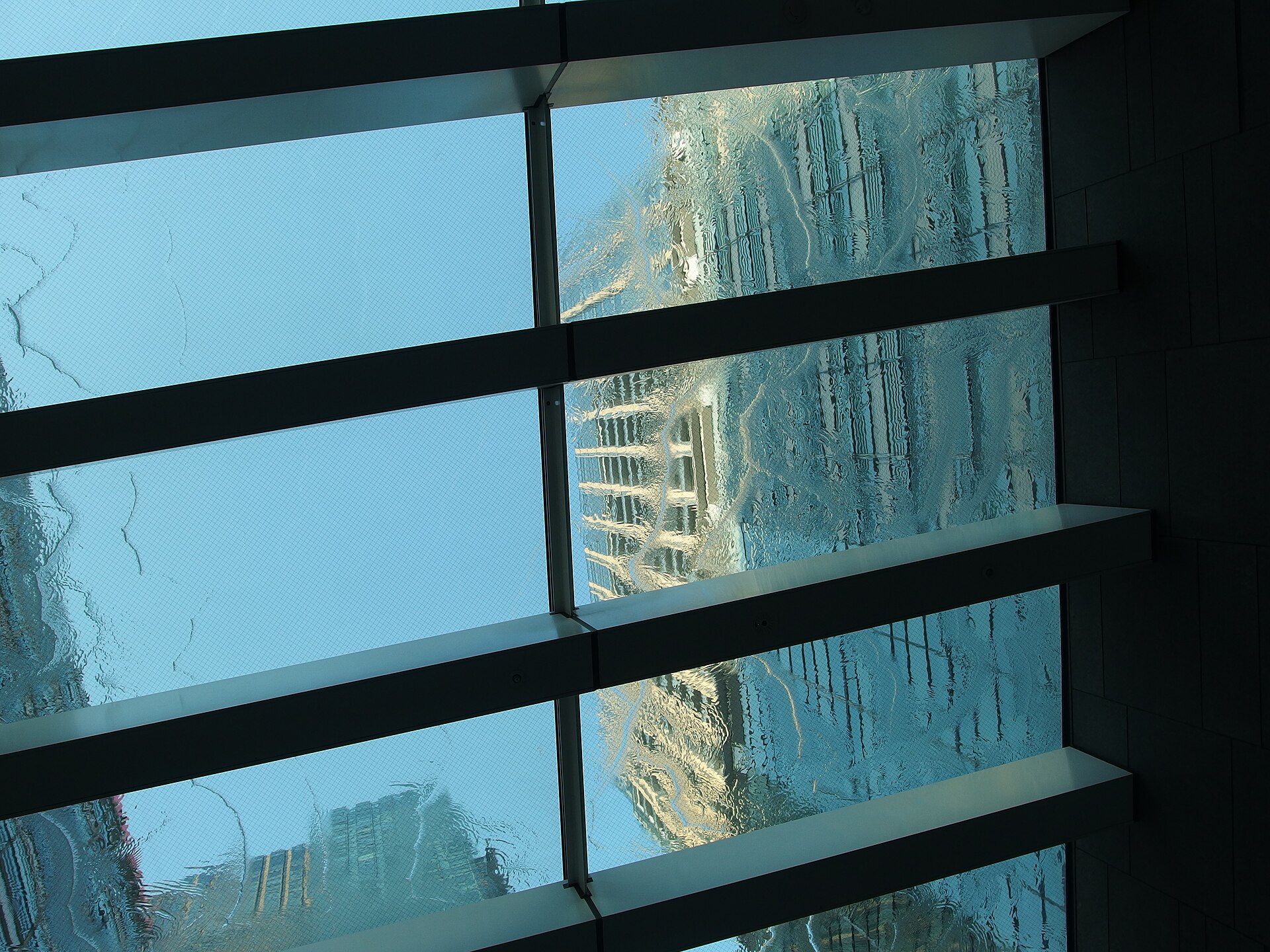
The Suntory Museum of Art relocated to the complex, while 21_21 DESIGN SIGHT added a design-focused cultural institution. The project retained and transplanted trees and emphasized landscape and public space, but it also transformed formerly restricted land into a highly managed commercial environment. The Midtown image makes visible a long sequence from estate to army, occupation housing, defense administration and global redevelopment.
Art, Business, Residence and Nightlife Today
The opening of the National Art Center, Tokyo in 2007 strengthened a cultural triangle with the Mori Art Museum and Suntory Museum of Art. Roppongi could now be promoted as an art district as well as a nightlife destination. The Oedo Line, fully opened in 2000, improved metropolitan access, while offices and luxury housing increased the daytime and residential population.
These additions did not produce a uniform district. Around the crossing, late-night commerce remains visible. Behind the avenues are apartments, embassies, schools, temples and quiet slopes. Tokyo Midtown presents landscaped corporate urbanism; Roppongi Hills offers a vertically mixed city built through neighborhood redevelopment; the Akasaka Press Center preserves a military footprint; and the International House sustains a postwar tradition of intellectual exchange. Roppongi’s defining characteristic is coexistence.
Historical Traces You Can Still See
The most reliable historical evidence in today’s streets is often spatial rather than architectural. Notice how roads descend from the crossing, how retaining walls and slopes separate levels, and how large compounds interrupt otherwise fine-grained streets. At the International House, the 1955 modernist building and garden embody postwar cultural diplomacy. Around Hinokicho Park and Tokyo Midtown, public landscape occupies land once associated with military and defense administration.
Near the Akasaka Press Center, the perimeter and heliport reveal a continuing U.S. military presence beside civilian Roppongi. In Roppongi Hills, changes in elevation and the reconstructed street network show how redevelopment had to negotiate a preexisting hillside neighborhood. Old place names, temples and cemeteries survive around the wider Azabu boundary, while the crossing remains the best place to see how traffic routes still organize the district.
A Transformation Table
| Period | Dominant Land Use | Main Drivers | Lasting Traces |
|---|---|---|---|
| Edo period | Samurai estates, temples and small commoner districts | Shogunal land allocation and local topography | Slopes, temple sites and large-property patterns |
| Meiji to 1945 | Military, government and institutional land | State formation, army expansion and urban growth | Former compound boundaries and road alignments |
| Occupation and early postwar | Requisitioned facilities, housing and foreign-oriented commerce | U.S. presence, reconstruction and international exchange | Akasaka Press Center and postwar institutions |
| 1960s–1990s | Entertainment, restaurants, discos, bars and offices | Subway access, media, affluence and late-night mobility | Roppongi Crossing and nightlife streets |
| 2000s–present | Mixed-use towers, museums, residences and landscaped public space | Redevelopment, disaster planning, global business and cultural policy | Roppongi Hills, Tokyo Midtown and the art institutions |
Timeline
- Edo period: Warrior estates, temple lands and limited commoner districts occupy the area now called Roppongi.
- 1868 onward: Former estate land is reassigned to military, state, institutional and private uses.
- 1923: The Great Kanto Earthquake accelerates rebuilding and metropolitan road planning.
- 1945: Air raids and defeat produce destruction, requisition and a new occupation landscape.
- 1952: The International House of Japan is incorporated.
- 1955: The International House officially opens in Roppongi.
- 1964: The Hibiya Line opens through Roppongi as the line reaches full operation.
- 2000: The Toei Oedo Line fully opens, adding a second subway connection at Roppongi.
- 2003: Roppongi Hills opens.
- 2007: Tokyo Midtown and the National Art Center, Tokyo open, strengthening Roppongi’s business and art identity.
Frequently Asked Questions
Why is the area called Roppongi?
The name means “six trees,” but its origin is uncertain. Traditions refer either to six conspicuous trees or to six daimyo families with tree characters in their names; neither explanation is conclusive.
Was Roppongi always a nightlife district?
No. Edo-period Roppongi was largely a landscape of samurai estates, temples and small settlements. Its nightlife reputation developed mainly after the war and changed substantially from the 1960s through the disco and club eras.
How did the American military presence shape Roppongi?
Occupation facilities and continuing U.S. military sites brought foreign personnel and encouraged restaurants, bars, transport and services able to serve them. But embassies, housing, companies, hotels and international institutions were also essential.
What stood on the Tokyo Midtown site before redevelopment?
The site passed through several major uses: an Edo-period Mori family residence, an army garrison, postwar U.S. officers’ housing and the Defense Agency’s Hinokicho offices before Tokyo Midtown opened in 2007.
How are Roppongi Hills and Tokyo Midtown historically different?
Roppongi Hills was assembled through a long neighborhood redevelopment involving many rights holders. Tokyo Midtown reused the former Defense Agency site, a large institutional parcel with an estate and military history.
When did Roppongi become an art district?
The transformation accelerated in the 2000s. The Mori Art Museum opened with Roppongi Hills in 2003, and Tokyo Midtown plus the National Art Center, Tokyo opened in 2007.
What historical traces can visitors still see?
Look for slopes and elevation changes, temple and cemetery sites, the International House and garden, the Akasaka Press Center perimeter, Hinokicho Park, and the contrasting street plans of Roppongi Hills and Tokyo Midtown.
Sources and References
- Minato City, Place-name history of the Azabu area
- Tokyo Midtown, History of the site
- Mori Building, Roppongi Hills development
- International House of Japan, History
- International House of Japan, Building and Garden
- Ministry of Defense, Designated USFJ facilities and areas
- Tokyo Metro, Corporate history
- Toei Transportation, Oedo Line history
- The National Art Center, Tokyo, About
Related Stories
Learn how historical maps should be compared with the modern city in How to Read Old Japanese Maps in Modern Tokyo, and how present-day blocks are organized in Why Most Tokyo Streets Have No Names.
Related Neighborhood Histories
The neighboring History of Azabu explains the wider landscape of temples, estates, embassies and valley-floor commerce. Browse the Tokyo Neighborhood Histories directory for more districts.
Related Self-Guided Walks
Explore available routes in the Self-Guided Walks directory.
Walk Tokyo with TimeWalk Japan
Roppongi’s history is easiest to understand at street level, where slopes, old property lines and redevelopment meet. Join TimeWalk Japan on Meetup for English-language walks and history events.