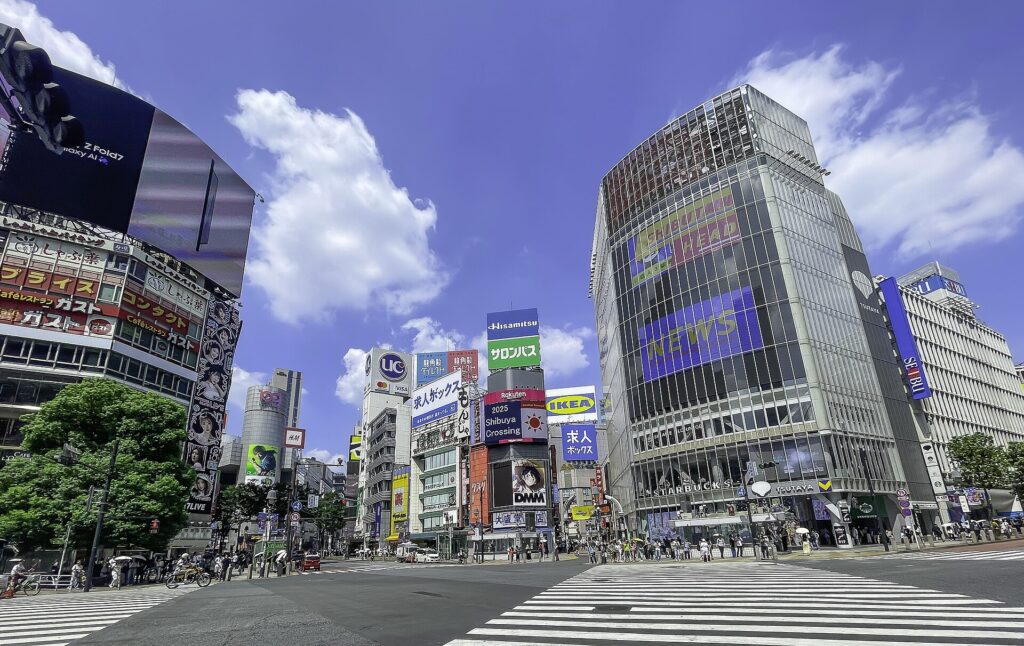
Shibuya’s world-famous crossing exists because railways were forced into a narrow river valley. The crowds, giant screens and stacked station buildings look like pure twenty-first-century spectacle, but the district’s intensity began with geography: roads descended from surrounding plateaus into the same low ground where trains, trams and the Shibuya River all had to compete for space.
That collision created more than a transport hub. Private railway companies turned passengers into shoppers, department stores fought to control the streets, and later fashion, music and media businesses turned the station district into a stage for young people. Even Shibuya’s apparent chaos has a historical logic. Each generation added another line, passage, plaza, retail complex or cultural institution without ever escaping the valley beneath it.
Modern Shibuya exists because difficult terrain concentrated movement, and concentrated movement created commercial and cultural power. The crossing is not the origin of Shibuya’s fame. It is the visible result of more than a century of railways, private urban development, retail competition and repeated reconstruction.
Quick Facts
- Japanese name: 渋谷
- Municipality: Shibuya City, Tokyo
- Main station: Shibuya Station
- Historical focus: the valley floor, Shibuya River, Miyamasuzaka, Dōgenzaka and the station district
- Key layers: village landscape, Ōyama Kaidō, railway and tram terminal, department-store urbanism, postwar reconstruction, youth culture and station redevelopment
Why Shibuya became what it is today
Six forces shaped modern Shibuya. First, the Shibuya River cut a branching valley into the eastern Musashino plateau. Second, transport routes converged on that low ground: an Edo-period highway, the Yamanote railway, Tamaden trams, private railways, subways and major roads. Third, railway companies turned passenger flows into retail and real-estate development. Fourth, Tokyu, Seibu, PARCO and smaller cultural businesses competed to define what Shibuya represented. Fifth, magazines, music, fashion and street life made the area a platform for successive youth cultures. Sixth, large public and private projects repeatedly rebuilt the station to improve transfers, pedestrian circulation, flood resilience and commercial value.
A station built in a valley
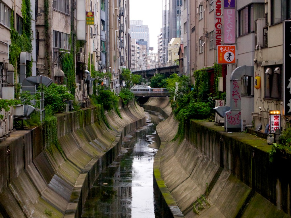
Shibuya lies where the Yodobashi plateau is cut by the Shibuya River and its tributaries. Around the station, Miyamasuzaka climbs east and Dōgenzaka climbs west, while the river and railway occupy the lower ground. This topography explains why Shibuya Station feels unusually complicated. Lines approached from different directions at different dates and could not all be placed on one level. Surface tracks, elevated private railways, underground subways, roads and the river competed for limited space.
Later projects added decks, passages and towers rather than starting from an empty site. Shibuya Station is therefore less a single building than a layered junction assembled over more than a century.
Before the railway: villages on Edo’s western edge
By the Edo period, the wider area was organized through villages including Kami-Shibuya, Naka-Shibuya and Shimo-Shibuya. Fields, woodland, temples, shrines and scattered settlement occupied the outer edge of the shogun’s capital. The Ōyama Kaidō crossed the district on the route toward Setagaya, the Tama River and Mount Ōyama. Its line survives in the east–west movement between Miyamasuzaka and Dōgenzaka, although the modern streets reflect repeated widening and rebuilding.
The slopes mattered. They connected the valley floor with higher ground and later became commercial approaches to the station. What had once been a rural road landscape became the framework for a metropolitan center.
The first railway and the rise of the terminal
Shibuya Station opened in 1885 on the Nippon Railway’s Shinagawa Line, an ancestor of today’s Yamanote Line. It was initially a modest station outside Tokyo’s dense built-up core. Its importance grew as the city expanded westward and new transport companies connected suburban districts to the valley.
The Tamagawa Electric Railway, commonly called Tamaden, opened service from Shibuya toward the Tama River area in 1907. It carried passengers and, in its early years, freight. By terminating in Shibuya, it tied the station to a much larger western hinterland and helped convert a railway stop into a transfer point.
Private railways and department-store urbanism
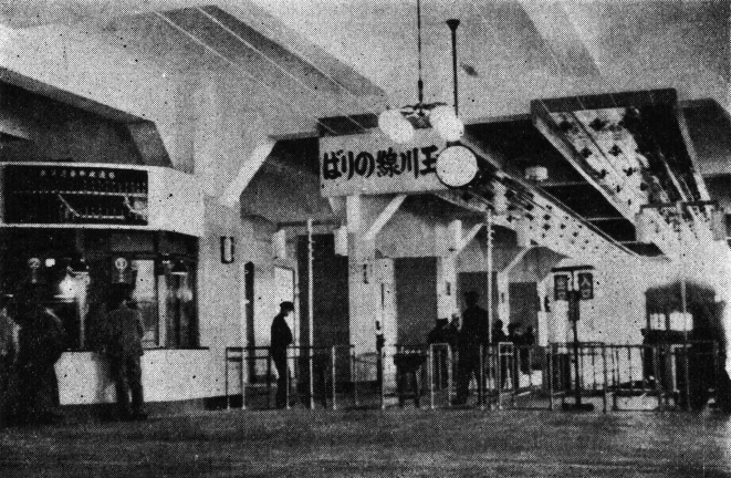
The interwar decades made Shibuya a multi-line terminal. The Tokyo-Yokohama Railway reached Shibuya in 1927 and later became part of the Tokyu Toyoko Line. The Inokashira Line opened in the 1930s, and the Ginza Line reached Shibuya in 1938. Each line approached the valley differently, producing the station’s vertical complexity.
Private railway companies did more than operate trains. They developed housing along their lines and built retail facilities at terminals. Transport, suburban growth and department stores reinforced one another. The Toyoko Department Store opened at Shibuya in 1934, helping turn the station into a place to transfer, shop, dine and encounter new metropolitan lifestyles.
Earthquake, war and postwar reconstruction
After the Great Kantō Earthquake of 1923, population and commerce shifted toward western Tokyo. Shibuya benefited because its railways and private investment could convert that movement into growth. Air raids in 1945 then damaged the district and disrupted transport and commerce.
Postwar Shibuya was rebuilt through public works, railway-company investment, road construction, entertainment and both regulated and informal commerce. Station plazas, bus facilities and streets were repeatedly altered as traffic increased. Different blocks followed different ownership and redevelopment paths, which is one reason the area never acquired a single uniform urban form.
Reading Shibuya in 1963
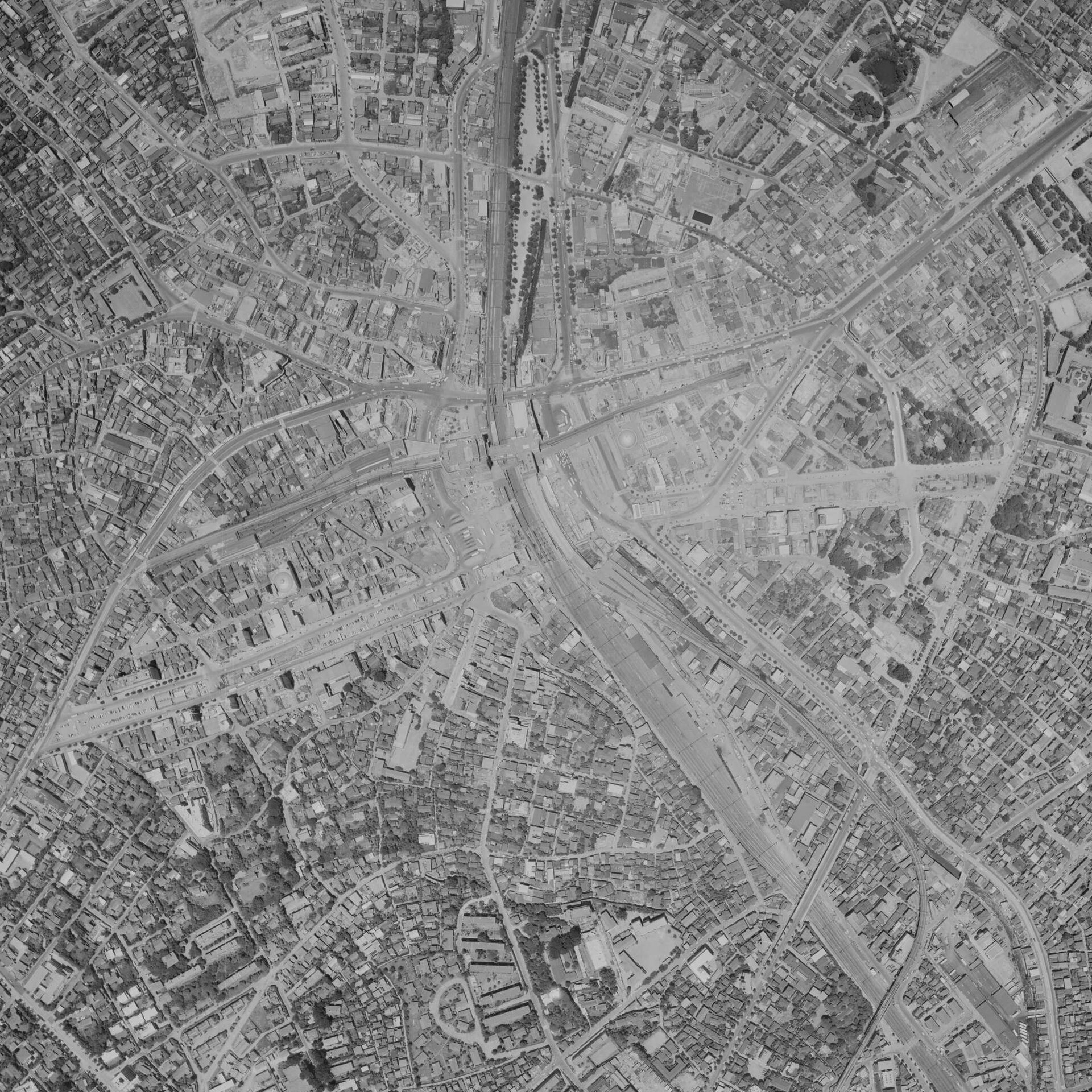
An aerial photograph from 1963 shows a terminal already dense but not yet enclosed by today’s towers. Railway alignments divide the district, roads funnel traffic toward the station, and compact building blocks climb the slopes. The valley is visible in the convergence of transport corridors and the contrast between the low station zone and the rising streets on either side.
Tokyu, Seibu and PARCO compete to define the district
Tokyu’s transport and retail network gave it a dominant role around the station, but Shibuya’s cultural identity was never made by one company alone. Seibu Department Store opened in Shibuya in 1968, followed by PARCO in 1973. Their expansion north of the station helped turn the route toward Kōen-dōri into a zone of fashion, design, theater, film and advertising.
Corporate rivalry changed the geography of consumption. Tokyu-associated facilities emphasized terminal flows, while Seibu and PARCO promoted a broader cultural district in which shopping was linked to exhibitions, performance, publishing and lifestyle media. Independent music venues, cinemas, cafés and street businesses added further layers.
How Shibuya became a youth-culture capital
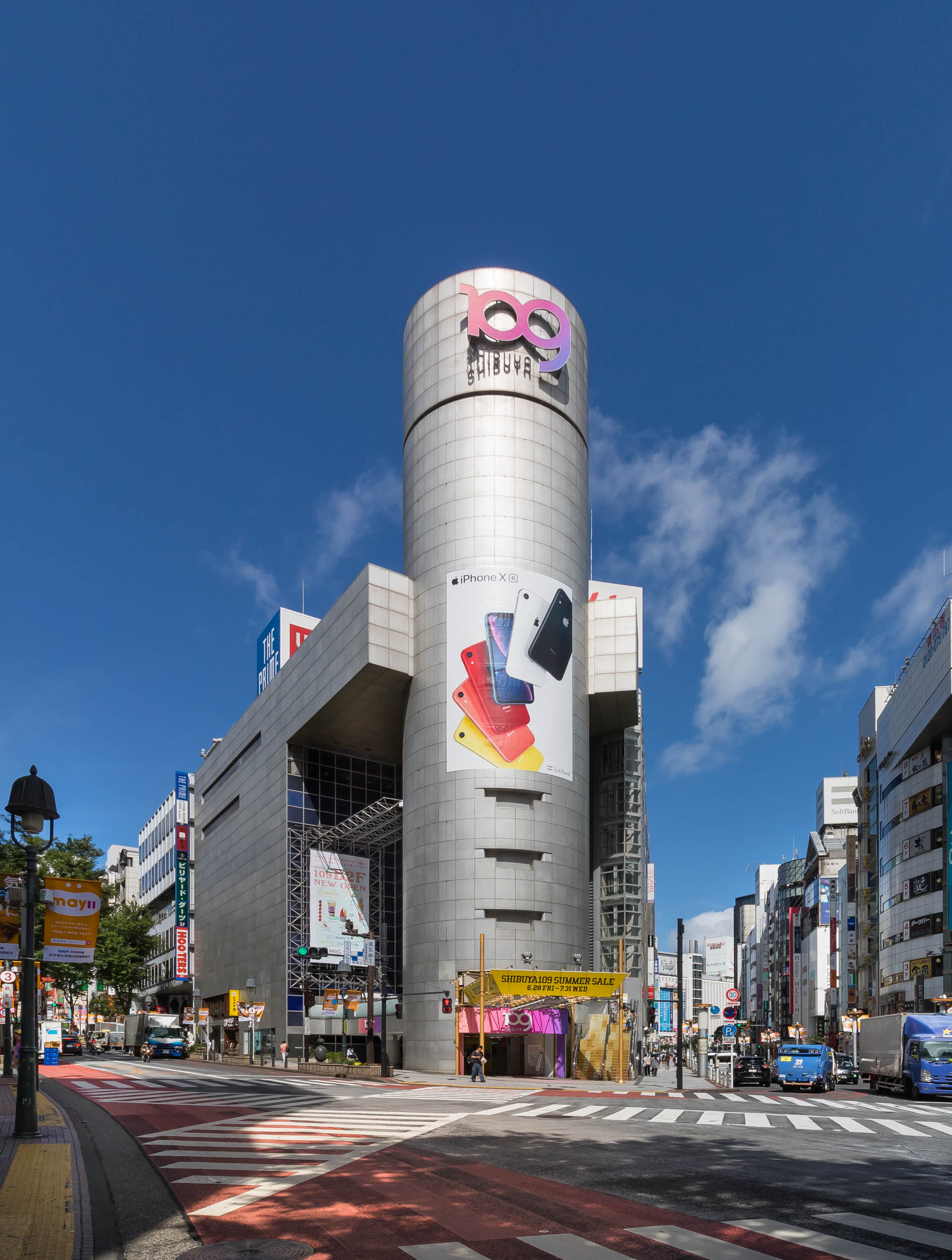
Shibuya’s youth culture was never one style or one generation. In the 1970s, design, film, theater and fashion associated with PARCO helped frame the district as a place of new lifestyles. SHIBUYA109 opened in 1979 and made the station’s west side a powerful fashion destination. Center-gai and surrounding streets offered dense, walkable spaces where retail, music and meeting places overlapped.
In the 1990s, magazines, television, record shops, clubs and street observation amplified styles associated with teenage and young-adult consumers. During the 2000s and 2010s, digital media changed how trends circulated, while redevelopment, tourism and office growth broadened the district’s users. Youth culture remained important, but it became one identity among several.
Rebuilding the station again
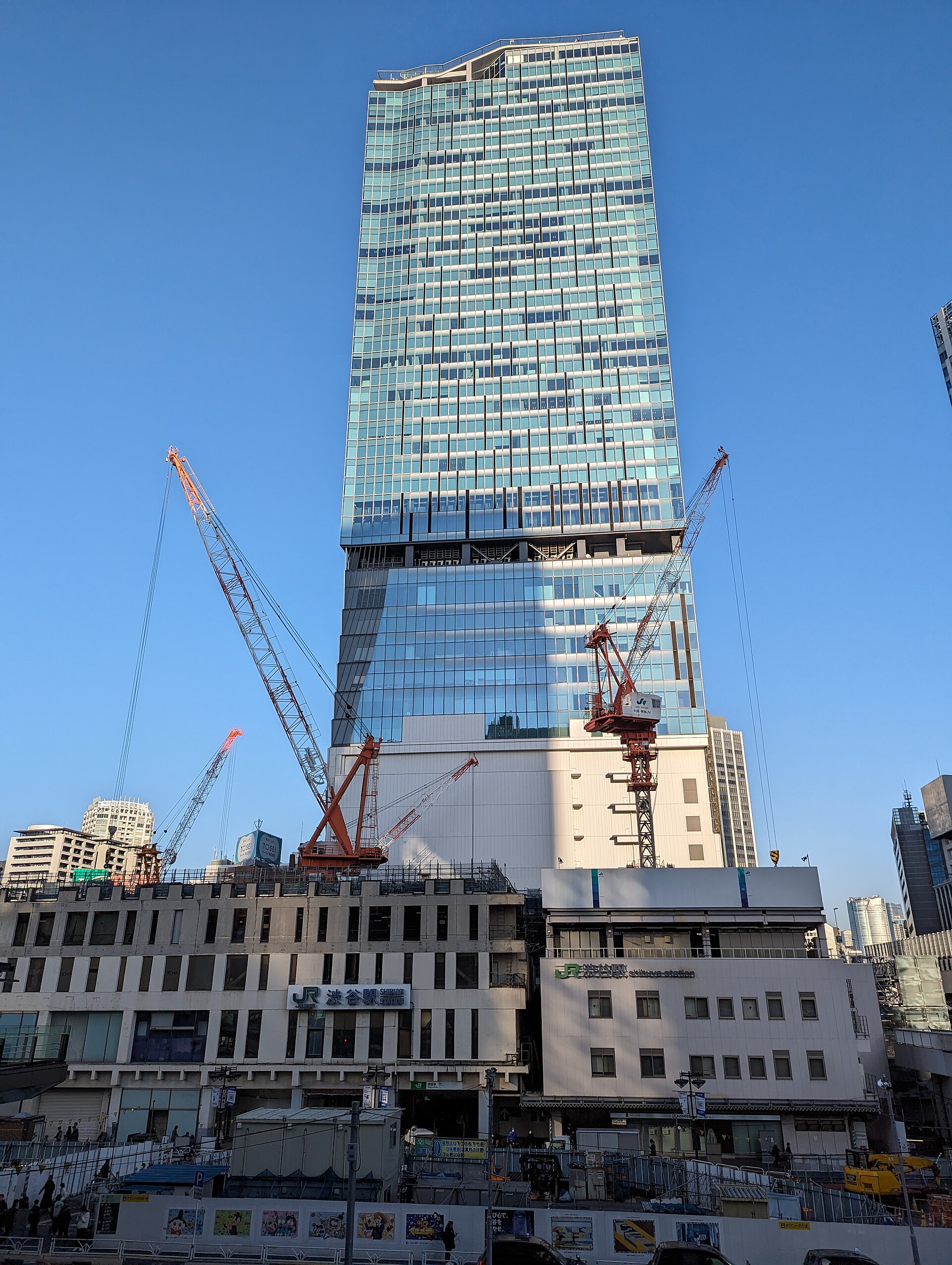
The twenty-first-century station project reorganized rail services and released land for redevelopment. The Tokyo Metro Fukutoshin Line reached Shibuya in 2008. In 2013, Tokyu moved the Toyoko Line underground and began through service with the Fukutoshin Line. Removing the old elevated terminal made a broader remaking of the station district possible.
Shibuya Hikarie opened in 2012, Shibuya Stream in 2018 and the east tower of Shibuya Scramble Square in 2019. New decks and passages reconnect districts divided by tracks and roads, while river improvements and underground storage address flood risk. These projects do not erase Shibuya’s topography; they are engineering responses to it.
Historical traces you can still see
- The Shibuya River at Inari Bridge: the visible downstream section reveals the watercourse beneath the modern district.
- Miyamasuzaka and Dōgenzaka: walking either slope makes the valley structure immediately clear.
- The station’s changing levels: elevated, surface and underground routes show how lines were inserted at different periods.
- Hachikō Square: a station-front public space repeatedly redesigned around intense pedestrian movement.
- SHIBUYA109 and Center-gai: landmarks of late twentieth-century fashion and youth-oriented commerce.
- Shibuya Stream: a contemporary attempt to reconnect development, public space and the river.
Timeline
| Date | Turning point |
|---|---|
| Edo period | Kami-, Naka- and Shimo-Shibuya villages develop along rural roads and the Ōyama Kaidō. |
| 1885 | Shibuya Station opens. |
| 1907 | Tamagawa Electric Railway service begins from Shibuya. |
| 1927 | Tokyo-Yokohama Railway reaches Shibuya. |
| 1934 | Toyoko Department Store opens at the terminal. |
| 1938 | Ginza Line service reaches Shibuya. |
| 1945 | Air raids damage the district; postwar rebuilding follows. |
| 1968 | Seibu Department Store opens in Shibuya. |
| 1973 | Shibuya PARCO opens. |
| 1979 | SHIBUYA109 opens. |
| 2013 | Toyoko Line moves underground. |
| 2019 | Shibuya Scramble Square east tower opens. |
Frequently asked questions
Why is Shibuya Station so complicated?
Different railway and subway lines entered a narrow river valley at different dates and elevations. Later passages and buildings had to connect inherited infrastructure rather than replace it all at once.
Why did Shibuya become associated with youth culture?
Rail access brought large audiences, while department stores, PARCO, SHIBUYA109, magazines, music venues and street-oriented retail repeatedly targeted younger consumers.
What was Tamaden?
Tamaden was the common name for the Tamagawa Electric Railway tram system. From 1907 it connected Shibuya with western suburban and Tama River districts.
What traces of older Shibuya remain?
The river at Inari Bridge, the valley slopes, the old highway axis, the station’s multiple levels and the geography of terminal retail all preserve earlier layers.
Related neighborhood histories
Compare Shibuya’s valley terminal with The History of Shinjuku, another western Tokyo center shaped by railways, retail and repeated station reconstruction. Browse the full Tokyo Neighborhood Histories directory for more districts.
Sources and references
- Shibuya City: Geography
- Shibuya City: History of Shibuya City
- Shibuya City Library: Gateway to Shibuya City History
- Tokyu Corporation: History of Shibuya’s Development
- Shibuya City: Walkable City Shibuya Infrastructure Plan
Walk Tokyo with TimeWalk Japan
Shibuya becomes easier to read when you move between its river, slopes, station levels and commercial streets. Explore TimeWalk Japan’s Self-Guided Walks and Stories for more ways to understand Tokyo through its roads, waterways and rebuilt public spaces.