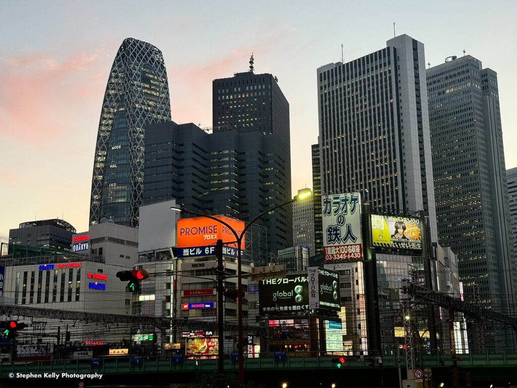
Before Shinjuku became a forest of skyscrapers and one of Japan’s busiest railway districts, it was a roadside service town built to solve a practical problem: the next official stop on the highway was too far from Edo. Three centuries later, that small transport decision still shapes the city. The old road survives east of the station, while the rail terminal, entertainment streets and government towers occupy entirely different historical landscapes.
Shinjuku is not one urban center but several cities pressed together. Naitō Shinjuku grew along the Kōshū Kaidō. The railway station opened farther west and gradually pulled commerce toward the tracks. Kabukichō began as a postwar reconstruction project for a cultural district, even though its planned kabuki theater was never built. West Shinjuku’s skyscrapers rose on the vast site of a water purification plant rather than on the old post town.
Modern Shinjuku exists because each era created a new center without completely erasing the previous one. Roads, railways, wartime destruction, black markets, entertainment planning and waterworks redevelopment produced neighborhoods with radically different street patterns and scales. The district’s apparent disorder is therefore historical evidence: Shinjuku became powerful by accumulating several competing versions of the city.
Quick Facts
- Japanese name: 新宿
- Municipality: Shinjuku City, Tokyo
- Main access: Shinjuku, Shinjuku-sanchome, Seibu-Shinjuku and Tochomae stations
- Historical layers: Edo post town, water infrastructure, railway terminal, suburban commercial center, wartime destruction, postwar markets, entertainment district, waterworks redevelopment, skyscraper subcenter and ongoing station renewal
- Related English self-guided walk: Not yet published
Where Exactly Is Shinjuku?
“Shinjuku” can refer to several overlapping geographies. Shinjuku City is one of Tokyo’s 23 special wards, created in 1947 by combining the former Yotsuya, Ushigome and Yodobashi wards. The Shinjuku Station area is a much narrower transport and commercial zone extending across both sides of the railway tracks. Shinjuku 1–7 chome is the present administrative town name east and northeast of the station.
Naito Shinjuku was the Edo-period post town along the Koshu Kaido, centered roughly on today’s Shinjuku 1–3 chome. Nishi-Shinjuku covers the former Tsunohazu and Yodobashi area west of the station, including the high-rise district developed on and around the former water purification plant. Kabukicho is the entertainment district northeast of the station, shaped by postwar land readjustment. This article follows the corridor from Yotsuya Okido and Naitocho through Shinjuku Oiwake and the station to Kabukicho and the former Yodobashi site.
Before Shinjuku: Roads, Estates and Water
The district’s first organizing structures were not railways but a highway, a domain estate and an aqueduct. The Koshu Kaido connected Edo with inland provinces to the west. In 1590, after Tokugawa Ieyasu entered Edo, land in this area was granted to Naito Kiyonari. A familiar story says that the estate’s limits were determined by how far he could ride a horse, but this should be treated as tradition rather than documentary fact.
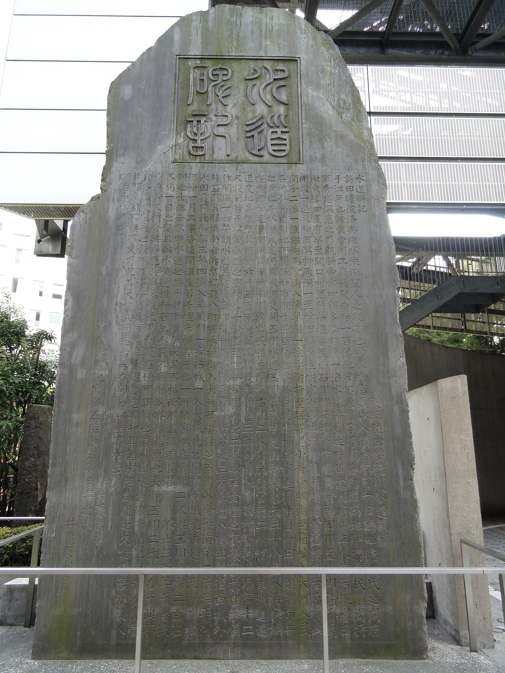
Water infrastructure also fixed an important eastern threshold. Tamagawa Josui opened in 1654, carrying water in an open channel for about 43 kilometers from Hamura to Yotsuya Okido. Near the Okido, a guardhouse monitored water quantity and quality before the supply entered conduits serving Edo. The present Tamagawa Josui–Naito Shinjuku diversion promenade is a modern landscape feature using groundwater and other water entering the Shinjuku Gyoen tunnel; it is not the original Edo canal simply restored to the surface.
Naito Shinjuku: The Post Town That Gave the District Its Name
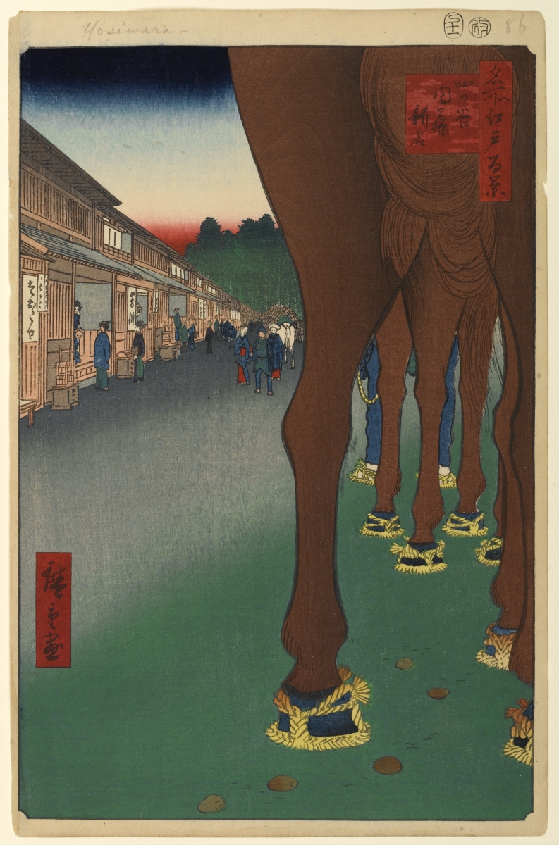
In 1697, Takamatsu Kibei and other petitioners requested permission to establish an additional post station between Edo and Takaido. The shogunate approved development in 1698, and Naito Shinjuku began operating in 1699 on land returned by the Naito family. Its name literally referred to the “new post station” associated with the Naito estate. The project joined transport policy with land development: travelers and official horse relays needed service, while petitioners and the authorities expected revenue from a newly organized settlement.
The post town did not enjoy uninterrupted success. It was abolished in 1718, amid official concern about disorder and the operation of the station, and reopened in 1772. Inns, horse relays, shops and labor tied the settlement to the wider denma transport system. Accounts of serving women and licensed or tolerated sexual labor require care: they reveal gendered work and regulation in a transport economy, not a picturesque entertainment custom.
The Naito Estate Becomes Shinjuku Gyoen
The large green space south of the old highway did not remain an Edo-period garden unchanged. It developed from the Naito estate through several modern institutions. The Naito Shinjuku Agricultural Experiment Station was established in 1872. The land came under the Imperial Household Ministry in 1879, and extensive redesign between 1902 and 1906 produced the main composition of the modern garden, including Japanese and European landscape elements.
Air raids in 1945 destroyed buildings and damaged the garden. In 1949, it opened to the public as a national garden. Shinjuku Gyoen therefore preserves the scale of an elite estate while also recording Meiji agricultural experimentation, imperial landscape design, wartime destruction and postwar conversion to public use.
A Station Built Away from the Old Center
Shinjuku Station opened on March 1, 1885, as a station on the Nippon Railway’s Shinagawa Line. It stood west of the established post-town corridor, in a comparatively less urbanized zone. The distance—roughly a kilometer between the old post-town center and the railway area—matters. The station did not inherit the old center directly; it created a second focus whose importance increased gradually.
Railway alignments, available land and the edge of the built-up area shaped the station’s location. It would be misleading to say that commerce instantly abandoned Naito Shinjuku. For decades, the highway settlement and the railway node coexisted, with commercial gravity stretching between them.
Railways Move the Center of Gravity
The Kobu Railway opened the Shinjuku–Tachikawa section in 1889 and extended an urban line from Shinjuku toward Ushigome in 1894. Later, streetcars, the Keio line, the Odakyu line in 1927, and eventually subway services multiplied the station’s catchment. Each new connection brought commuters, shoppers and suburban residents into the same transfer zone.
This network effect—not the opening of one line alone—moved the center of gravity toward the tracks. Railway companies and retailers built facilities around passenger flows, while the older road axis remained an important commercial street. Shinjuku became a broad corridor with two linked centers rather than a simple replacement of old by new.
Earthquake, Suburban Growth and the Prewar Entertainment City
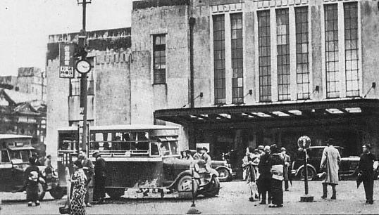
The 1923 Great Kanto Earthquake accelerated population and commercial movement toward Tokyo’s western suburbs, where damage was generally lighter than in the low-lying eastern city. But the earthquake was not the sole cause of Shinjuku’s rise. Railways, roads, residential growth and an existing commercial corridor were already in place.
The expansion of the Odakyu line in 1927, Mitsukoshi’s Shinjuku branch in 1930, growing theater and cinema activity, and Isetan’s Shinjuku store in 1933 strengthened the district. Shinjuku City’s historical chronology records that the station’s passenger numbers became Japan’s highest in 1931. The key point is not a timeless superlative but the emergence of a major western terminal serving a rapidly suburbanizing metropolis.
Destruction, Survival and the Postwar Markets
Air raids in May 1945 burned much of the former Yotsuya, Ushigome and Yodobashi wards. Around Shinjuku Station, open-air stalls and black markets formed amid shortages, rationing and disrupted distribution. These spaces supplied necessities and offered livelihoods, but they also operated within a contested economy shaped by occupation policy, police control, violence and poverty.
The 1949 directive to remove street stalls and the subsequent reorganization in 1950 pushed vendors into new or more regulated locations. Places now marketed through postwar nostalgia, including the area known as Omoide Yokocho, have changed repeatedly in layout, tenancy and building form. They should not be treated as untouched survivals of 1945.
Kabukicho: A Planned Entertainment District That Changed Course
Kabukicho emerged through postwar reconstruction rather than organic growth from the Edo post town. Land readjustment in 1948 established the town name. The name referred to a proposed kabuki theater intended to anchor a cultural district, but the theater was never built. Reconstruction was instead advanced in stages through exhibitions, a skating rink, cinemas and later the Koma Theater.
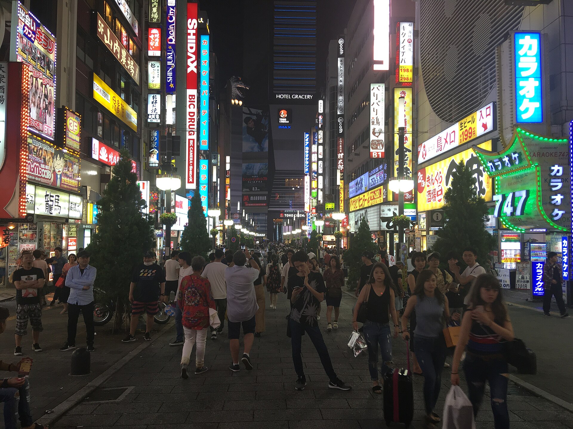
The result was a planned street framework whose commercial uses evolved beyond the original cultural vision. Kabukicho’s later nightlife, youth culture and adult businesses belong to that longer transformation. Describing it only as dangerous or exotic obscures the roles of planning, land readjustment, entertainment capital and changing regulation.
West Shinjuku Before the Skyscrapers
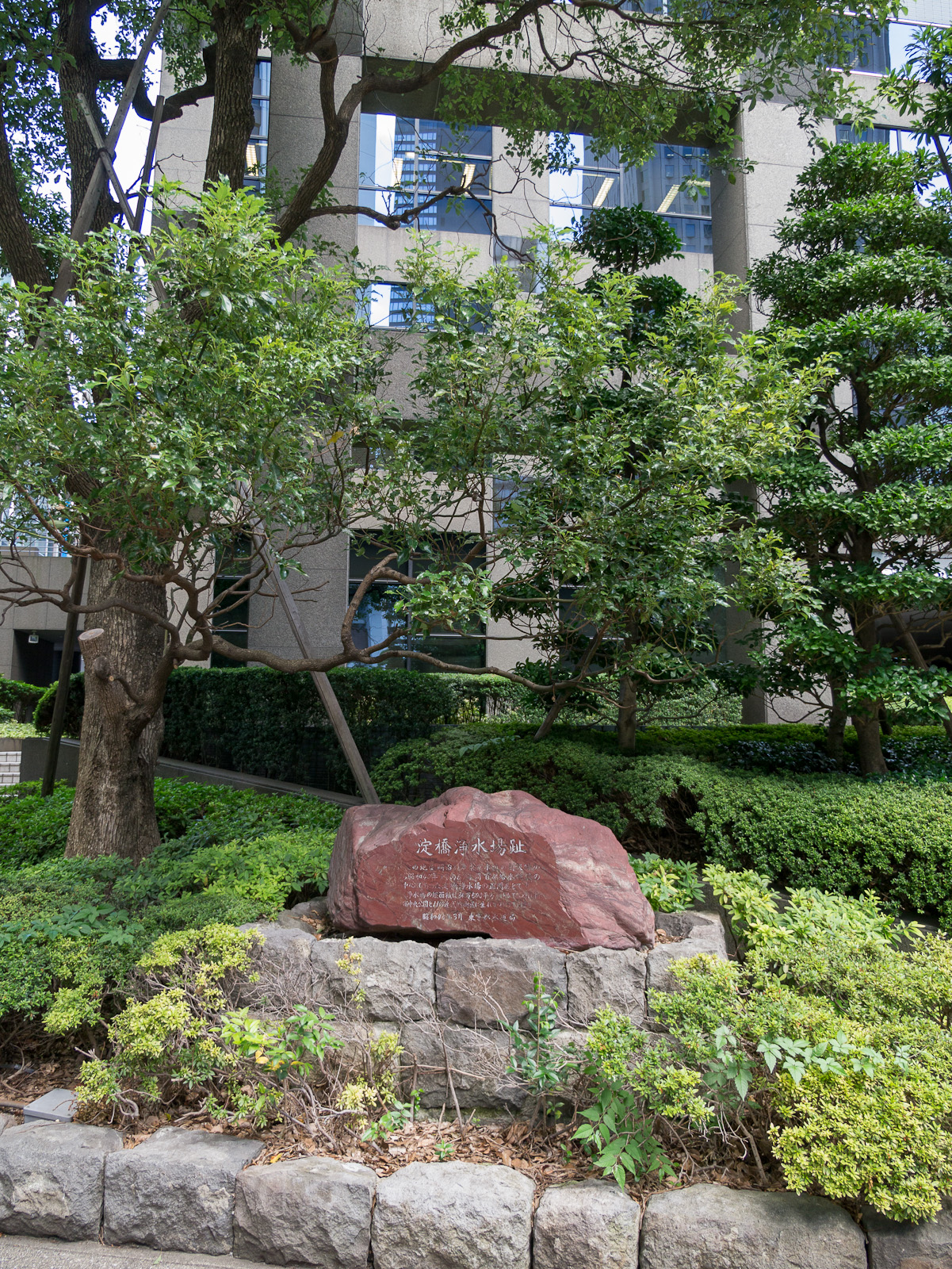
West of the station, the Yodobashi and Tsunohazu districts followed a different path. Tamagawa Josui crossed this landscape, and the Yodobashi Water Purification Plant became a foundation of modern Tokyo’s water supply. Water distribution from the plant began on December 1, 1898; filtration facilities were completed in 1899. The two dates describe stages in commissioning rather than contradictory completion dates.
The plant occupied a very large, functionally unified site. Unlike the finer parcels of the old post town or the dense commercial blocks east of the station, this infrastructure landscape created the possibility of later redevelopment at metropolitan scale.
From Water Purification Plant to Subcenter
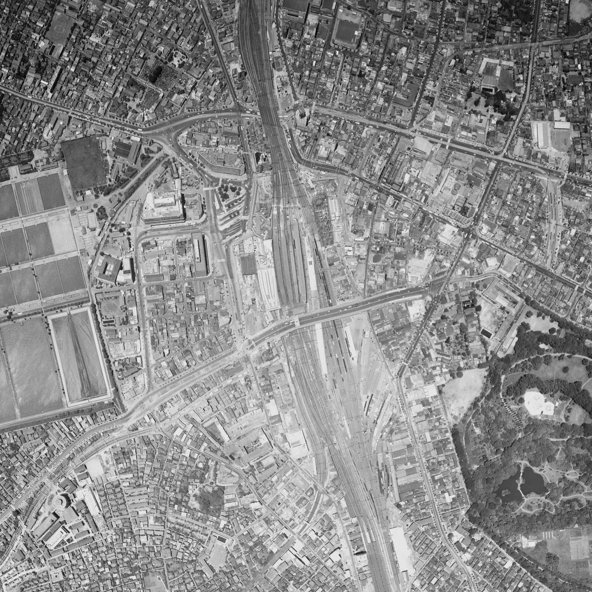
The Yodobashi plant closed on March 31, 1965, as functions shifted to the Higashimurayama Water Purification Plant. Its closure opened one of central Tokyo’s largest redevelopment opportunities. Metropolitan subcenter policy transformed the former utility site and surrounding land into broad roads, large blocks and high-rise building plots.
Keio Plaza Hotel opened in 1971 and became an early landmark of the new skyline. Office towers followed. The 1963 aerial photograph captures the transition shortly before closure; it should be read as evidence of contrasting land use, not as a basis for identifying every structure without corroboration.
The Metropolitan Government Moves West
The Tokyo Metropolitan Government began operations in its Shinjuku headquarters in April 1991. The move reinforced Nishi-Shinjuku as an administrative and business center and gave the high-rise district a powerful civic landmark. It did not mean that Tokyo’s entire center shifted from Marunouchi to Shinjuku; rather, it strengthened one node within a polycentric metropolis.
Shinjuku Grand Terminal: Another Transformation in Progress
As of July 2026, the station district is undergoing another long-term reorganization. The Shinjuku Station Immediate Vicinity Land Readjustment Project coordinates an east–west deck, redesigned station-front plazas, station-building reconstruction and changes to pedestrian and vehicle circulation. Separate private developments proceed within this broader framework.
Current Tokyo Metropolitan Government schedules indicate partial completion of the east–west deck and station-front plazas in fiscal 2035 and completion of the overall land-readjustment project in fiscal 2046. These are plans, not finished scenery, and schedules may change. The historical significance lies in the attempt to reconnect districts that railway infrastructure helped divide while accommodating an immense transfer function.
Why East, Northeast and West Shinjuku Feel So Different
The eastern corridor inherits the line of the Koshu Kaido and the finer-grained commercial fabric of the old post town. Around the east exit, department stores, retail streets and rail-oriented pedestrian flows overlay that earlier axis. Northeast Kabukicho reflects postwar land readjustment and entertainment development, producing a distinct street grid and nighttime economy.
West Shinjuku’s large parcels and broad roads derive from the waterworks site and metropolitan redevelopment. Towers, plazas and public buildings occupy a scale impossible in the older eastern fabric without extensive land assembly. This is an interpretation based on documented land histories: street width, block size and building form preserve the consequences of earlier uses even when the original structures are gone.
How the Past Still Shapes Shinjuku Today
Naito Shinjuku survives most clearly in the district name and the eastward highway axis. Tamagawa Josui recalls the infrastructure that sustained Edo. The station concentrates regional transport and commerce. Postwar market reorganization helps explain pockets of narrow lanes and small restaurants near the tracks. Kabukicho embodies a reconstruction plan that changed direction. The former Yodobashi site explains the western superblocks, while the Metropolitan Government building confirms the area’s administrative role. Today’s station project is the latest effort to connect these accumulated centers.
What You Can Still See Today
- Yotsuya Okido and the waterworks monument
- Tamagawa Josui–Naito Shinjuku diversion promenade
- Taiso-ji and the old highway corridor
- Shinjuku Gyoen’s northern edge and Naitocho
- Shinjuku Oiwake
- Shinjuku Station and its east–west divide
- Omoide Yokocho, understood as a changed postwar commercial space
- Hanazono Shrine
- Kabukicho’s postwar street framework
- Former Yodobashi Water Purification Plant monument
- Shinjuku Central Park
- Nishi-Shinjuku skyscraper district
- Tokyo Metropolitan Government Building
Related Stories and Guides
Explore more articles in Tokyo Neighborhood Histories. A dedicated English self-guided walk for Naito Shinjuku is in preparation and is not linked here until it is published.
Sources and Further Reading
- Shinjuku City: origin and history of the city name
- Shinjuku City historical chronology: Edo period
- Shinjuku City historical chronology: Meiji period
- Shinjuku City historical chronology: postwar years
- Ministry of the Environment: History of Shinjuku Gyoen
- Tokyo Metropolitan Government Bureau of Waterworks: Tamagawa Josui history
- Tokyo Metropolitan Government Bureau of Waterworks: modern waterworks history
- JR East: Shinjuku Station information
- Tokyo Metropolitan Government: Shinjuku Station Immediate Vicinity project