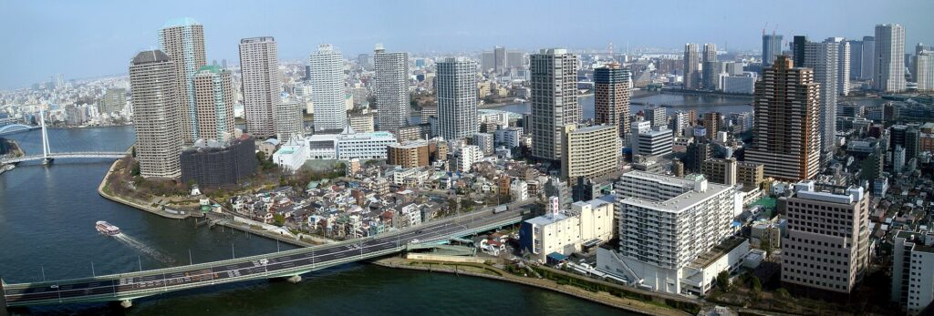
Tsukishima’s narrow alleys, monjayaki restaurants and waterfront towers look like different versions of Tokyo. In fact, they came from the same industrial plan.
The island was reclaimed from Tokyo Bay in the late nineteenth century to create land for factories, transport and storage. Its large blocks were later divided for workers’ homes and neighborhood shops. When industry declined and rail access improved, some of those same blocks became sites for high-rise housing.
Tsukishima’s history is therefore not a conflict between an old district and a new skyline. It is the story of one industrial grid being reused for work, housing, commerce and redevelopment.
Tokyo Built New Land for Industry
Before modern Tsukishima existed, the mouth of the Sumida River was a landscape of tidal shallows, waterways and older islands. Nearby Tsukuda had an Edo-period fishing community, while Ishikawajima developed shipbuilding and other industrial activity.
During the Meiji period, Tokyo needed more waterfront land as the capital modernized its harbor and industrial economy. The first major reclaimed section associated with Tsukishima was completed in 1892. Earth and other fill created new ground where shallow water had been.
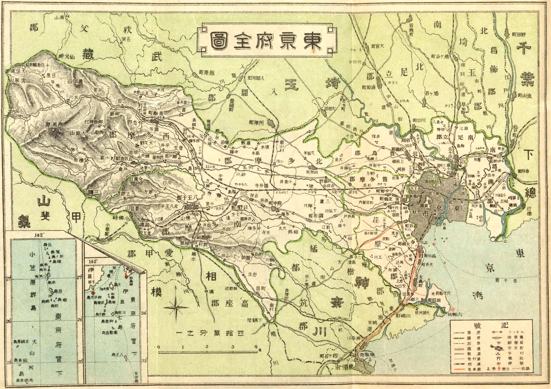
The new island was laid out with broad streets and regular blocks. This grid made it easier to move goods, divide industrial sites and connect factories to the water.
Factories Brought Workers to the Island
Tsukishima offered something crowded central Tokyo could not easily provide: large waterfront sites with access to boats, warehouses and transport routes. Factories, metalworking businesses, workshops and storage facilities spread across the wider district.
Industry also created demand for housing. Workers needed to live close to their jobs because commuting options were limited. Shops, bathhouses, schools, clinics and restaurants followed the growing population.
This made Tsukishima more than a factory zone. Work and daily life developed side by side inside the same planned blocks.
Worker Housing Created the Alleys
The original blocks were large, but affordable homes required smaller plots. Landowners and builders divided the interiors into long, narrow parcels reached by small access lanes.
Many workers lived in nagaya, wooden row houses divided into compact homes. A single lane could serve several households, workshops and shared facilities.
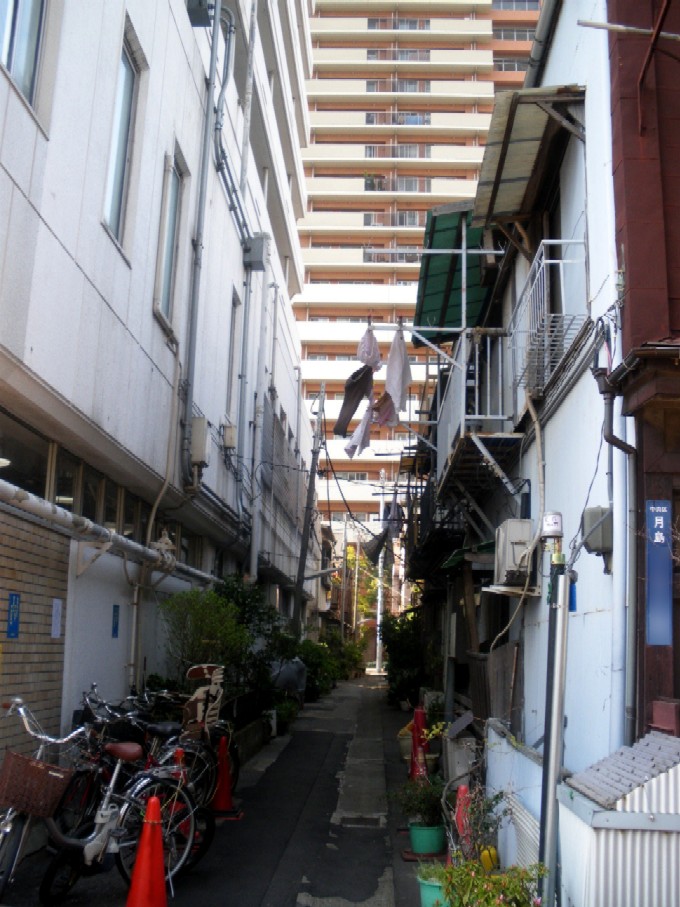
Tsukishima’s alleys were therefore not accidental spaces left between buildings. They were a practical response to the need to fit many homes inside an industrial grid.
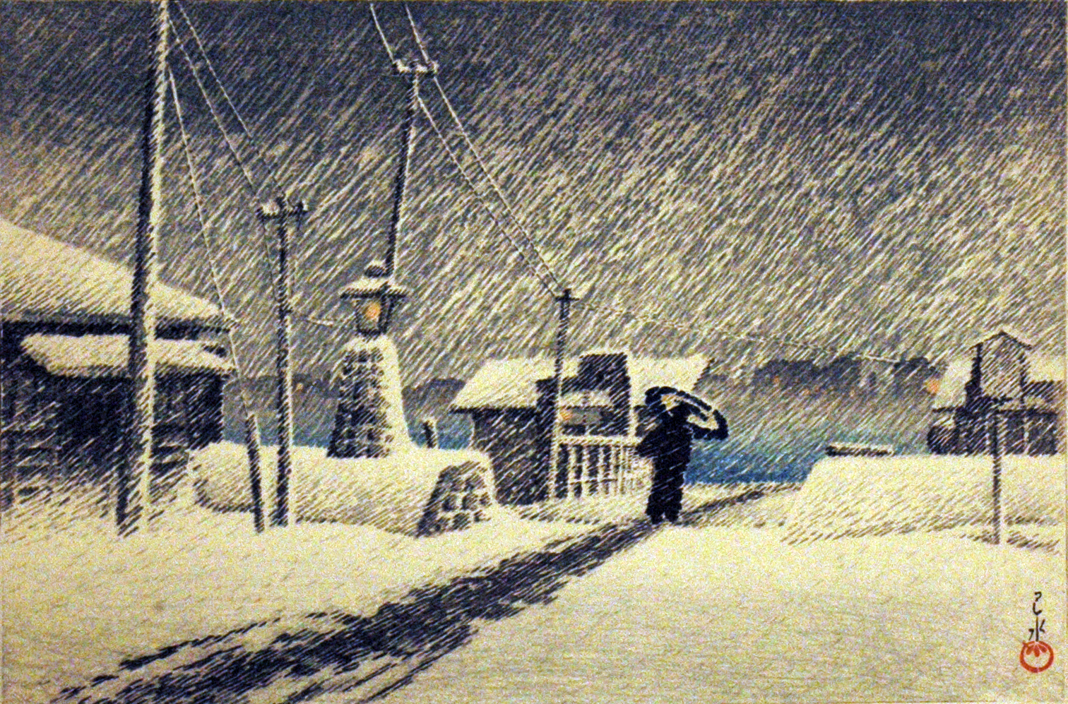
Bridges Connected the Factory Town to Central Tokyo
Early residents depended heavily on ferries. These boats carried workers, shoppers and goods across the Sumida River, but travel depended on weather, operating hours and landing points.
Bridges gradually changed that isolation. Aioi Bridge provided an important land connection in the early twentieth century. Kachidoki Bridge opened in 1940 between Tsukiji and the waterfront districts, while Tsukuda Bridge opened in 1964.
Each bridge shortened journeys and made the island more closely connected to the rest of Tokyo. Roads, buses and trucks replaced many of the functions once performed by boats.
Earthquake, War and Rebuilding Added New Layers
The Great Kanto Earthquake of 1923 and wartime air raids both affected Tokyo’s waterfront. Damage varied from block to block, and Tsukishima was repeatedly repaired and rebuilt rather than preserved unchanged.
A lane may preserve an old property line even when the buildings beside it are much newer. The important historical feature is often the relationship among narrow plots, deep blocks and shared access routes, not the age of one individual house.
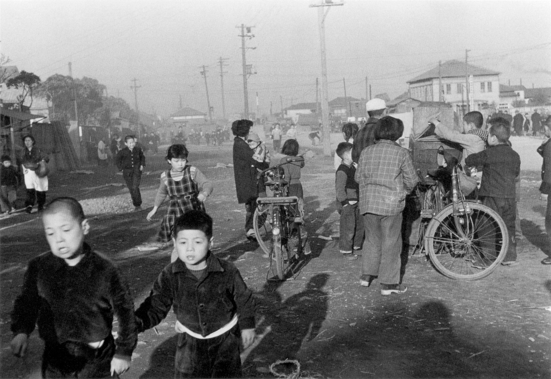
After World War II, shortages encouraged residents to repair, adapt and replace buildings as materials became available. Small stores and restaurants remained important because many people still shopped close to home.
A Neighborhood Shopping Street Became Monja Street
Nishinaka-dori developed inside the residential part of Tsukishima. Its success came from its location: it served people living in the surrounding blocks rather than traffic along the waterfront.
The street supported food sellers, household shops and small restaurants long before it became a visitor destination. Its narrow shopfronts and pedestrian scale reflected the dense worker neighborhood around it.
Monjayaki is a thin savory mixture cooked on a hot griddle and eaten with small metal spatulas. It grew from inexpensive local snack and home-cooking traditions. Specialist restaurants became more visible after the war, and later promotion turned Nishinaka-dori into Tsukishima Monja Street.
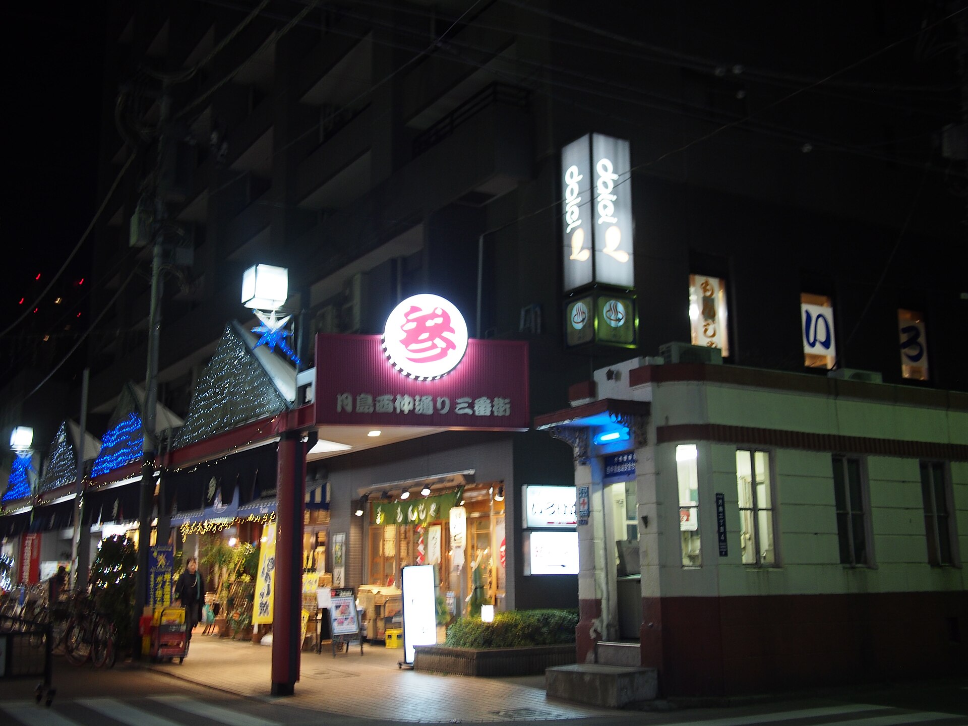
Monjayaki did not create the street. It gave a new public identity to a commercial route that already existed because workers and their families lived nearby.
Subways and Former Factory Sites Made Towers Possible
Tsukishima Station opened on the Yurakucho Line in 1988, and Oedo Line service followed in 2000. Fast rail access made the island attractive to people who wanted to live near central Tokyo.
At the same time, changes in industry released large factory and warehouse sites for redevelopment. These parcels were easier to combine and rebuild than the small residential plots inside older blocks.
High-rise apartments therefore appeared beside low-rise streets. The contrast reflects different patterns of land ownership and reuse. Former industrial sites supported large projects, while fragmented residential blocks retained narrow lots and alleys.
Why the Towers and Alleys Belong to the Same Story
The skyline may suggest that new Tsukishima is replacing old Tsukishima. Historically, both came from the same structure.
Reclamation created large blocks. Industry brought workers. Housing subdivision created lanes. Dense residential life supported Nishinaka-dori. Bridges and subways improved access. Former industrial land then became suitable for high-rise redevelopment.
Tsukishima’s most visible contrast is therefore also its clearest historical explanation: the island has repeatedly adapted the same industrial grid to meet new urban needs.
What to Notice When You Visit
The Broad Grid
Start with the main streets and regular blocks. They preserve the framework of the reclaimed industrial island.
The Lanes Inside the Blocks
Turn toward the interior and the scale changes. Narrow access routes and deep plots show how workers’ homes filled the original blocks. Observe from public streets and respect private entrances.
Nishinaka-dori
Look beyond the restaurant signs. The small shopfronts and short walking distances reveal its earlier role as a neighborhood shopping street.
Towers Beside Low-Rise Streets
Where a tower rises behind small houses and shops, the difference between former industrial parcels and fragmented residential lots becomes visible.
Timeline
- 1892: The first major reclaimed section associated with Tsukishima is completed.
- Early twentieth century: Industry, worker housing and new bridges reshape the island.
- 1923: The Great Kanto Earthquake is followed by reconstruction.
- 1940: Kachidoki Bridge opens.
- 1945 onward: Homes, workshops and shops are repaired and rebuilt after the war.
- 1964: Tsukuda Bridge opens.
- 1988: Tsukishima Station opens on the Yurakucho Line.
- 2000: Oedo Line service begins.
- Late twentieth century onward: Monjayaki tourism and high-rise redevelopment reshape the district’s public image.
Frequently Asked Questions
Is Tsukishima a natural island?
No. Modern Tsukishima was created mainly through reclamation completed from the late nineteenth century onward.
Why does Tsukishima have narrow alleys?
Large reclaimed-land blocks were divided into smaller plots for workers’ homes and workshops. Lanes provided access to buildings inside those blocks.
What is monjayaki?
Monjayaki is a thin savory mixture cooked on a griddle and eaten with small spatulas. It became closely associated with Tsukishima through local restaurants and later promotion.
Why are there so many towers?
Improved rail access and the redevelopment of former factory and warehouse sites made large apartment projects possible.
Sources and Further Reading
- Chuo City Library, historical maps and social surveys of Tsukishima.
- Chuo City, historical materials on Tsukishima and waterfront bridges.
- Tokyo Metropolitan Government, redevelopment project information.
- Tokyo Metro and Toei Transportation, station histories.
Related Neighborhood Histories
Compare Tsukishima with Tsukiji, where temples, government institutions and the fish market shaped a different waterfront district, or explore Nihonbashi, whose commercial history developed around bridges, roads and waterways.
Walk Tokyo’s History with TimeWalk Japan
TimeWalk Japan organizes history walks and cultural events that connect streets, landscapes and historical sources. See upcoming activities on our Meetup page.