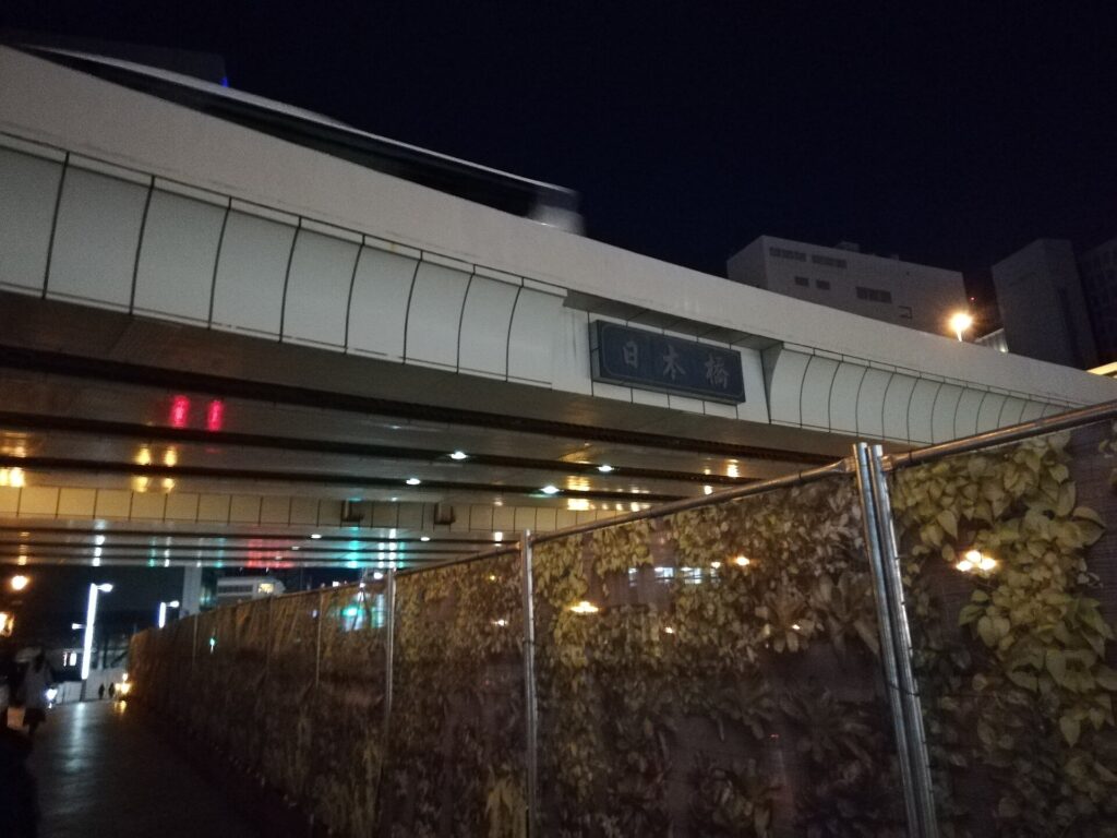
Japan’s national road system still begins on a bridge that modern Tokyo nearly buried beneath an expressway.
Nihonbashi became Edo’s commercial heart because this crossing stood where the shogunate’s highways met a dense network of rivers, canals and wharves. Fish, timber, paper, medicines, money and news all passed through the same compact district. The bridge was not merely a landmark; it was the operating center of a city built on movement and exchange.
Modern Nihonbashi exists because every later era reused that centrality. Edo wholesalers became modern corporations, merchant houses became department stores, money-changing networks became banks and securities markets, and a river once crowded with cargo boats became the route of an elevated expressway. Today, the bridge, river, financial institutions and redevelopment projects reveal how Tokyo repeatedly rebuilt its commercial center without abandoning the location that made it powerful.
Quick Facts
- Japanese name: 日本橋
- Municipality: Chuo City, Tokyo
- Main access: Nihombashi, Mitsukoshimae and Shin-Nihombashi stations
- Historical layers: Edo town planning, roads and waterways, fish-market logistics, merchant and wholesale districts, publishing, department stores, banking and securities, modern bridge engineering, postwar expressways and urban renewal
- Related English self-guided walk: None confirmed
- Related walking resource: A Japanese-language TimeWalk course exists
Where Exactly Is Nihonbashi?
Nihonbashi is first the name of a bridge, but it is also the name of a much larger historical district. Modern Chuo City contains many addresses carrying the name, including Nihonbashi, Nihonbashi Muromachi, Nihonbashi Honcho, Nihonbashi Hongokucho and Nihonbashi Kabutocho. From 1878 to 1947, Nihonbashi Ward covered an area broader than the compact shopping district many visitors now imagine.
English signage creates another small puzzle. The bridge and district are usually written Nihonbashi, while Tokyo Metro uses Nihombashi Station. Both refer to 日本橋, but the station spelling reflects a long-established railway romanization. A search for either form may therefore lead to the same part of Tokyo.
This history is not organized around a station catchment. Its central zone is the connected commercial and financial landscape linking Nihonbashi Bridge, the riverbanks, Muromachi, Honcho, Hongokucho and Kabutocho. Ningyocho, Hamacho, Yokoyamacho, Bakurocho and Kodenmacho also belonged to the broader Nihonbashi world, but each has its own urban history and should not be absorbed into a single neighborhood story.
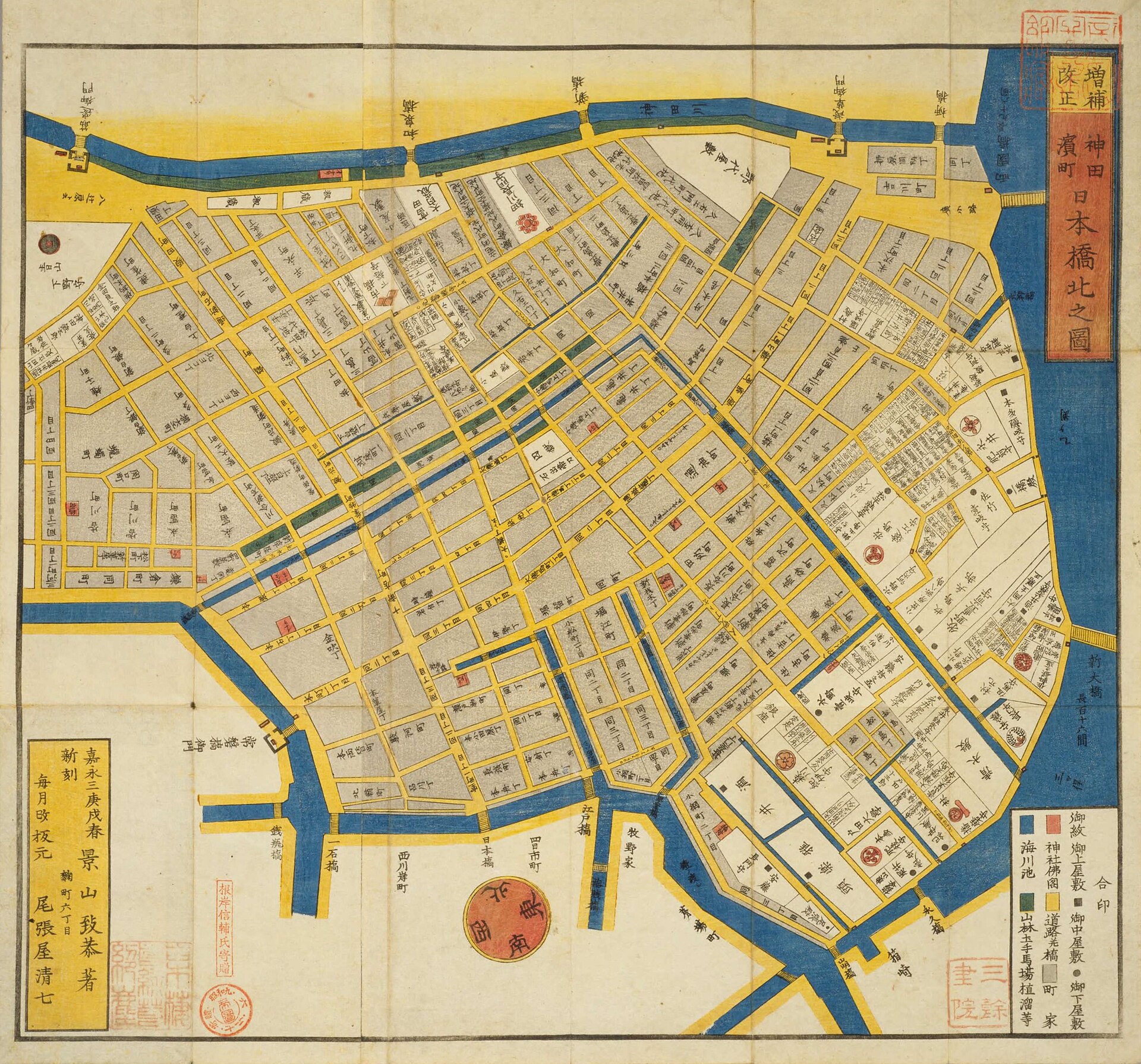
The 1850 kiriezu above is a district guide, not a modern survey map. Its orientation, scale and emphasis differ from contemporary mapping, yet it helps show how roads, waterways, estates, temples and merchant quarters formed an interdependent urban field.
Before the Bridge: Building a Commercial Capital
When Tokugawa Ieyasu entered Edo in 1590, the settlement was not yet the enormous metropolis it would become. The castle town was expanded through excavation, land reclamation, river alteration and the construction of moats and canals. The shoreline lay closer to the future city center than it does today, and low-lying ground had to be reshaped for streets, warehouses and residences.
This work served political power. Edo Castle needed food, timber, fuel, labor and military access. Daimyo estates, samurai districts and townspeople’s quarters were arranged within a system that directed goods toward the shogunal capital. Nihonbashi emerged inside this planned structure, not as an isolated market that happened to grow beside a bridge.
The river network included natural channels modified by engineering as well as excavated canals and inlets. Nihonbashi River, Kaedegawa, Horidomegawa and numerous smaller waterways connected river landings to streets and storehouses. Administrative boundaries used today should not be projected backward onto this landscape; the commercial system crossed the lines later drawn on maps.
The Bridge That Became the Center of the Road Network
The first Nihonbashi is traditionally dated to 1603, the year the Tokugawa shogunate began. In 1604 the bridge was designated the starting point for the major highways later grouped as the gokaido, the Five Highways. These dates describe related but distinct developments: a bridge was built as part of the castle town, and the following year it acquired an official role in the road system.
Roads radiating from the bridge tied Edo to post towns, domains and ports across Japan. Travelers, official processions, messengers, commodities and news entered the city through a network measured conceptually from this crossing. The bridge therefore became both infrastructure and symbol: it was useful because it connected streets, and important because government made it a point of reference.
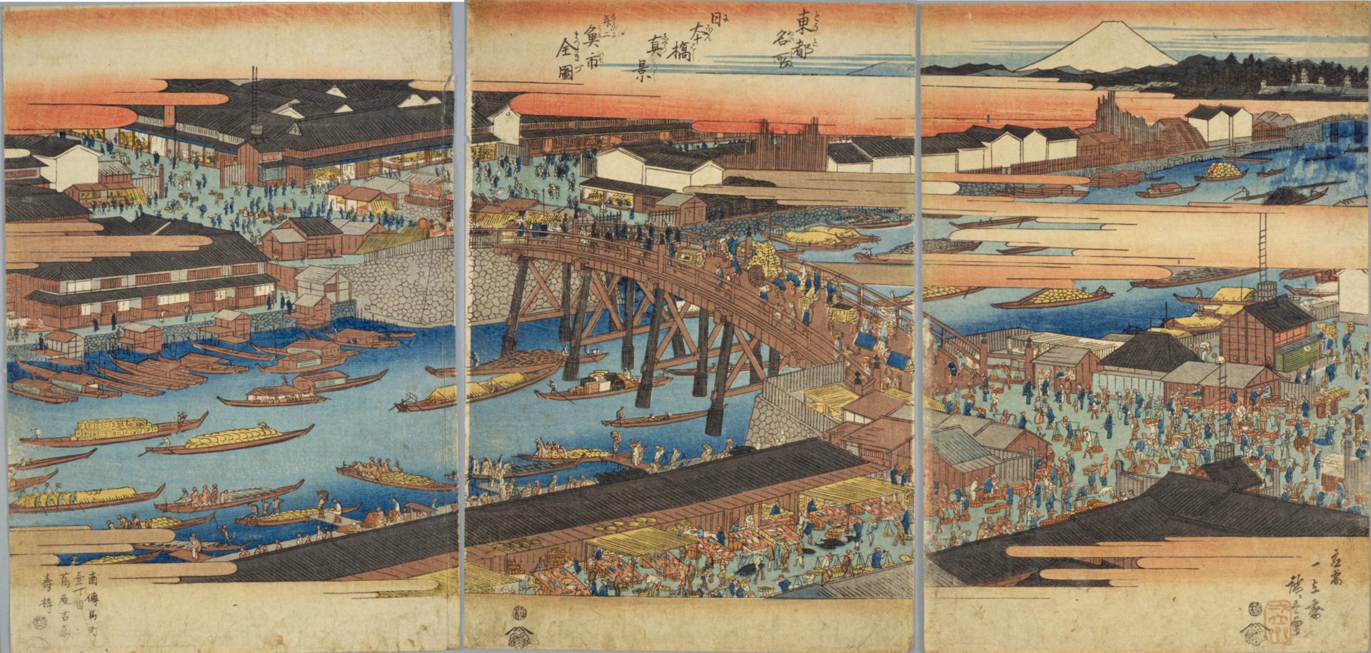
Hiroshige’s print conveys the bridge’s cultural prominence and commercial animation, but it is an artistic image rather than a measured record. It should be read as evidence of how Nihonbashi was imagined and represented, not as a photograph of every detail.
Modern road-origin markers continue the memory of centrality without preserving an unchanged Edo institution. The Tokyo City road marker, the present Japan Road Origin Marker embedded at the bridge center, and the accessible replica near the bridge belong to modern systems of national roads and urban administration. They inherit the idea of a starting point, but not the exact legal framework of the shogunate.
Roads Above, Waterways Below
Nihonbashi prospered because land and water transport reinforced each other. Large loads could move by boat through Edo Bay and the river network, reach a kashi or river landing, and then be divided for delivery by cart, porter or packhorse through narrow streets. Long-distance routes brought other goods overland. The bridge stood at the transfer point between these systems.
Urban form supported this exchange. Riverfront lots offered access to unloading places and storehouses. Merchant plots often had narrow street frontages and extended deep behind the shop, separating display, accounts, storage and residence. Wholesalers, or tonya, organized credit, warehousing and distribution rather than simply selling across a counter. Nearby craftsmen processed materials, while inns, eating places and entertainment businesses served the people moving through the district.
This explains why commerce clustered rather than dispersing. A fish dealer benefited from boat access, but also from porters, brokers, buyers, ice or preservation practices, and rapid information about prices. A paper merchant benefited from publishers and book dealers. A money changer benefited from wholesale transactions. Each trade reduced costs for the others.
Uogashi: Feeding Edo from the Riverbank
The Nihonbashi uogashi was a fish-market district along the river near the bridge. Official and local accounts preserve a tradition that fishermen associated with Tsukuda supplied fish to Edo Castle and sold surplus near Nihonbashi. Because parts of this origin story are transmitted as tradition, it is safer to describe them as such than to present every detail as fully documented fact.
What is clear is the market’s urban function. Edo became one of the world’s largest cities, and feeding it required wholesale institutions, scheduled arrivals, auction or negotiated sale, credit, sorting and rapid redistribution. River transport brought marine products close to the city’s commercial core. Buyers then carried them outward to retailers and kitchens. The market linked the bay, fishing communities, wholesalers and consumers.
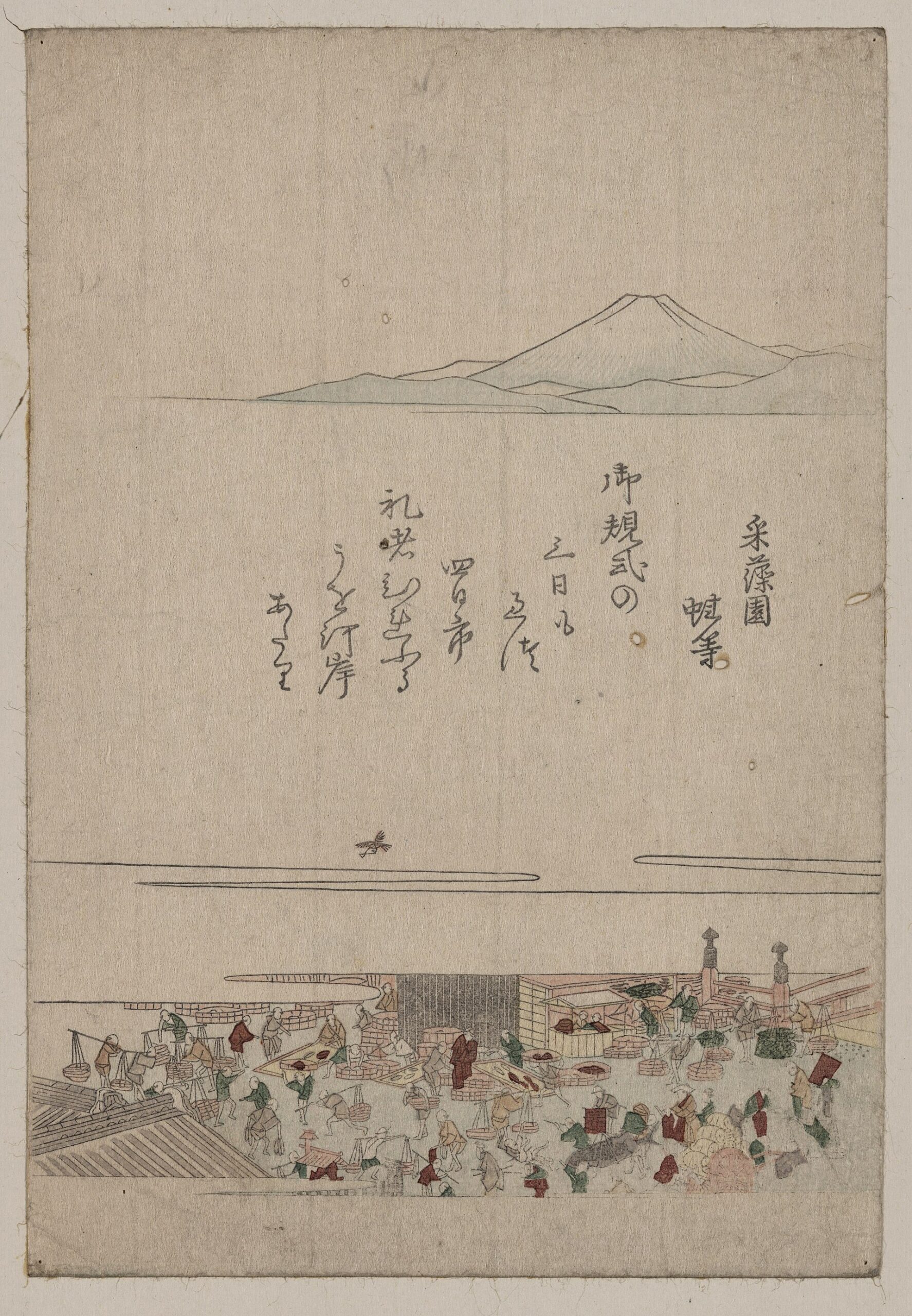
The 1804 print is an artistic representation of the market and riverbank. It documents the importance of the place, but individual work processes or buildings should not be identified solely from its visual details.
The Great Kanto Earthquake of 1923 devastated the market and much of central Tokyo. Trading continued through temporary arrangements rather than moving instantly into the later permanent market. A provisional fish market operated in the Tsukiji area, and Tokyo’s Central Wholesale Market at Tsukiji formally opened in 1935. The institutional move therefore unfolded over years of emergency operation, planning and reconstruction.
Merchants, Wholesalers and Long-Established Shops
Nihonbashi’s famous stores are best understood as products of a wider commercial ecology. Mitsui’s Echigoya opened in the district in the seventeenth century and became known for retail practices such as cash sales at stated prices. Other businesses dealt in blades, dried foods, paper, medicines and textiles. Honcho became associated with medicinal wholesalers, while districts farther east developed strong textile and general-wholesale functions.
The point is not that every present company is legally identical to an Edo shop. Corporate reorganizations, mergers, name changes and changes of business form complicate claims of uninterrupted continuity. The deeper continuity lies in place-based networks: access to customers, credit, suppliers, skilled employees and reputational value made Nihonbashi a rational place to remain or return.
Long-established businesses also reveal how wholesale and retail overlapped. A shopfront visible to travelers might depend on regional procurement, warehouses near waterways, account relationships with domain producers, and distribution to smaller retailers. Nihonbashi’s commercial importance came from this hidden system as much as from celebrated names.
A Center of Print, Information and Urban Culture
Markets exchange information as well as goods. Book wholesalers, publishers, printers and paper merchants clustered in and around Nihonbashi because the district offered customers, transport and financial services. Printed guides, commercial notices, illustrated books and popular fiction could circulate through the same routes that carried physical merchandise.
The celebrated Kidai Shoran, generally dated to around 1805, presents a long painted view of Nihonbashi-dori filled with shops and street activity. A reproduction can be seen today in the area; the original is held separately. Like other pictorial sources, it is selective and composed, but it gives modern viewers a rare way to study how commerce occupied the street.
Entertainment districts nearby were connected but not identical to the bridge-centered business zone. The theater quarters and later culture of Ningyocho or Asakusa belonged to broader networks of publishers, performers, audiences and transport. Nihonbashi supplied money, paper, publicity and customers, while neighboring districts supplied stages and attractions.
From Echigoya to the Department Store City
In the Meiji period, the merchant house evolved into modern corporate forms. Mitsui’s retail business became Mitsukoshi, which adopted the department-store model and new forms of advertising, display and customer service. Shirokiya and Takashimaya also helped make the Nihonbashi area a center of large-scale urban consumption.
The department store was not simply an Edo shop enlarged. It depended on joint-stock organization, modern accounting, mass procurement, rail and streetcar access, new architecture and a growing middle-class culture of browsing. Nihonbashi remained valuable because its old commercial prestige could be converted into modern brand authority.
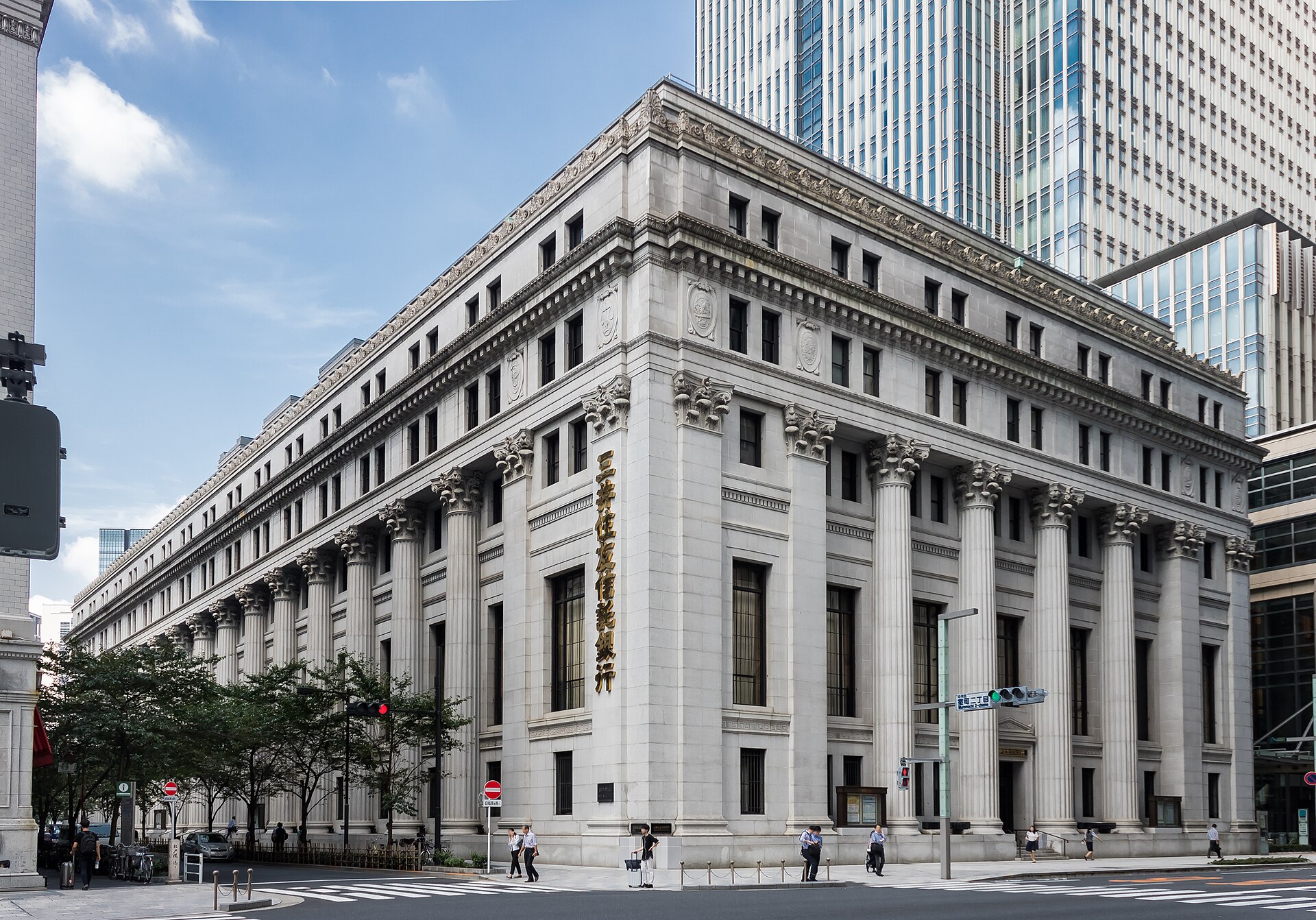
Completed in 1929, the Mitsui Main Building demonstrates this shift from merchant-house capital to modern corporate finance. Its monumental stone exterior and protected cultural-property status make it an architectural landmark, but its historical significance lies equally in the concentration of banking, trading and corporate management around Muromachi.
From Money Changers to Banks and the Stock Exchange
Edo-period finance in Nihonbashi included the shogunate’s gold mint, the kinza, as well as private money changers and merchant credit. Commercial transactions required currency exchange, loans and settlement across regions using different coinages and accounting practices. Financial expertise therefore grew beside wholesale trade.
The Bank of Japan began operations in 1882 at a different location before moving to its present Hongokucho site in 1896. Its Old Main Building was constructed from September 1890 to February 1896 and designed by Tatsuno Kingo. It became an Important Cultural Property in 1974. The site’s relationship to the former gold-mint area made the new central bank appear as a modern national institution planted within an older monetary landscape.
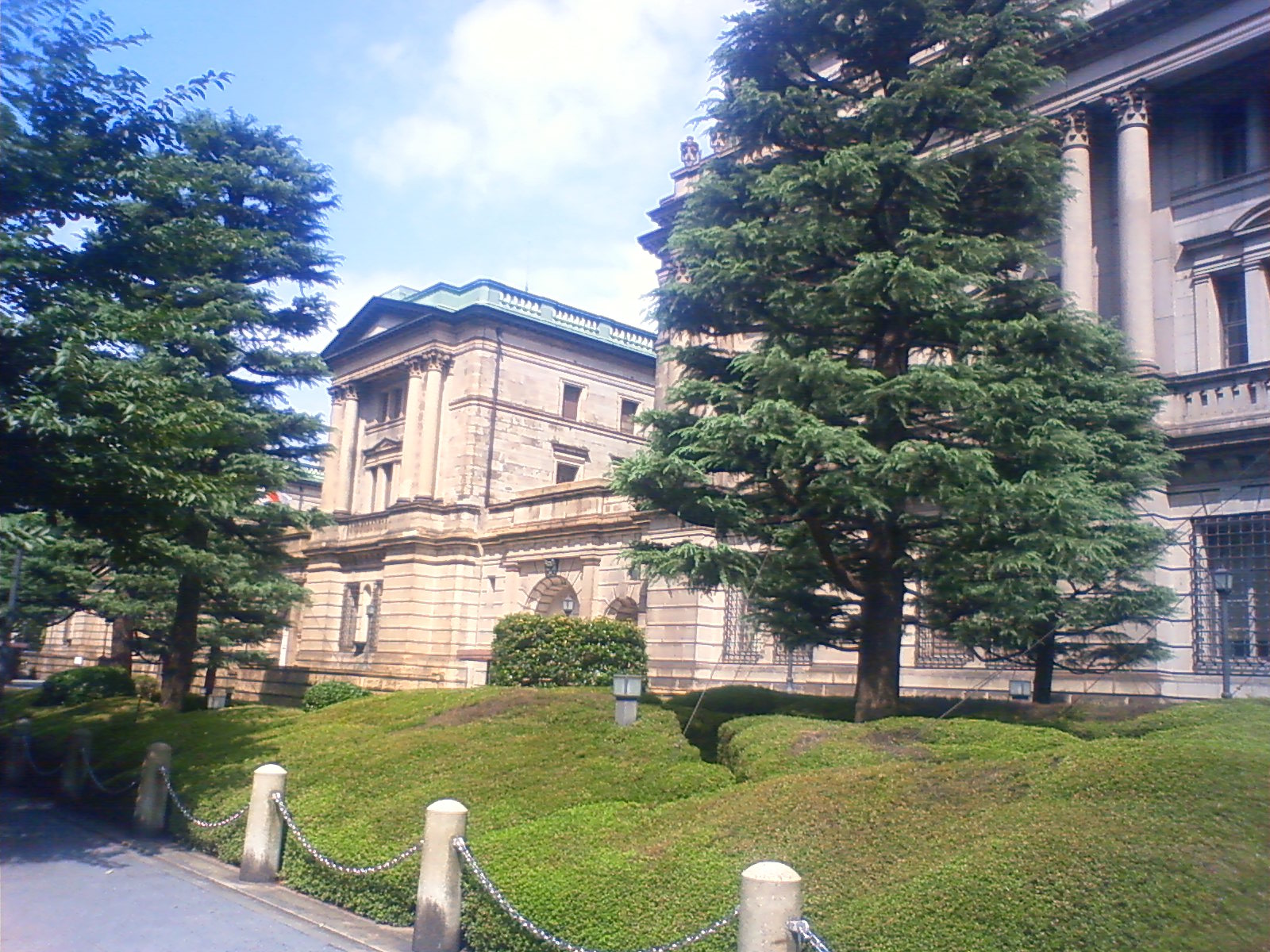
A popular story says the building was deliberately shaped like the Japanese character for yen when viewed from above. That should not be presented as a confirmed design intention. The well-documented facts—date, architect, construction and institutional role—are more revealing than the legend.
Nearby Kabutocho became the center of securities trading. The First National Bank and the Tokyo Stock Exchange were part of a broader transformation in which merchant capital, government policy and new corporate law created modern financial markets. The Tokyo Stock Exchange was established in 1878; later institutional reorganizations eventually produced today’s Japan Exchange Group. Kabutocho’s reputation came from this durable concentration, not from a simple imitation of a foreign financial district.
The 1911 Stone Bridge and Modern Tokyo
Nihonbashi was repeatedly rebuilt in wood during the Edo period. The present bridge, opened on April 3, 1911, is a stone double-arch structure created for the modern city. Its lamps, sculptural decoration and broad roadway turned a working crossing into a civic monument. In 1999 it was designated an Important Cultural Property.
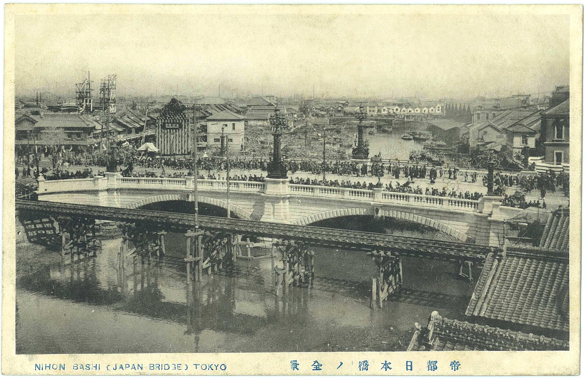
The wooden structure in the foreground is a temporary bridge used during construction, not an older permanent Nihonbashi mistakenly preserved beside the new one. The photograph shows crowds viewing the completed stone bridge, but it should not be labeled an opening ceremony without firmer evidence.
Earthquake, Market Relocation and Reconstruction
The 1923 earthquake and fires destroyed large parts of Nihonbashi’s commercial fabric. The stone bridge survived, but survival did not mean the district emerged untouched; nearby buildings, services and decorative elements required repair, replacement or reconstruction. The fish market’s destruction accelerated its relocation.
Imperial Capital Reconstruction widened roads, rebuilt bridges and reorganized parcels. These projects improved firebreaks and traffic circulation but also erased older plots and streets. Nihonbashi did not simply collapse while Ginza replaced it overnight. Department stores, banks and wholesalers remained powerful, even as Tokyo’s commercial geography became more dispersed.
War, Postwar Recovery and the Expressway Above the River
Air raids in 1945 again damaged the district. Postwar recovery restored commercial functions, while rapid economic growth brought new demands for roads and logistics. The Metropolitan Expressway’s Inner Circular Route over the Nihonbashi River opened on December 21, 1963.
Its construction is often explained only as preparation for the 1964 Tokyo Olympics. The Olympics accelerated infrastructure work, but they were not the sole cause. Tokyo faced severe congestion, limited time for land acquisition and strong pressure to build grade-separated roads. River and canal corridors offered space that could be used with fewer property purchases.
The result solved one problem while creating another. The elevated road carried traffic through central Tokyo, but darkened the river, compressed views of the bridge and reduced the waterway’s civic presence. Nihonbashi became a place where modern mobility literally overshadowed an older transport landscape.
Reclaiming the Riverfront—A Project Still in Progress
As of July 2026, the expressway has not disappeared from above Nihonbashi. A major project is underway to move the central section underground in coordination with surrounding redevelopment. Removal work at the former Gofukubashi and Edobashi entrances was completed in March 2024. A long-term closure of the Yaesu Route began on April 5, 2025, and PHASE 02 works are in progress.
Current official schedules indicate underground-route completion in fiscal 2035 and completion of elevated-structure removal in fiscal 2040. These are planning targets and may change. Renderings of an open sky and restored riverfront therefore show a proposed future, not the view visitors see today.
The project joins public infrastructure and private redevelopment. Supporters expect better river access, views and pedestrian space; the works also involve years of construction, traffic changes and difficult engineering beneath a dense business district. The significance of the project lies not only in beautification, but in a policy reversal: a corridor once valued mainly for carrying cars is again being judged as a historical and public landscape.
How the Past Still Shapes Nihonbashi Today
The bridge and road-origin marker preserve the memory of a national road network centered on Edo. The river and former wharves reveal the geography of a logistics city. Long-established shops and department stores show how merchant institutions changed their legal form, architecture and customers. The Bank of Japan, Mitsui Main Building and Kabutocho record the conversion of commercial wealth into national banking and securities systems.
Absence is also evidence. The fish market no longer occupies the riverbank, yet the wholesale system it helped create continued at Tsukiji and later elsewhere. The expressway represents the priorities of the high-growth era. The undergrounding project represents a newer willingness to spend heavily to recover historical views and waterfront space. Nihonbashi is therefore legible as a sequence of urban decisions, not a frozen Edo quarter.
What You Can Still See Today
- Nihonbashi Bridge: the 1911 stone bridge and its sculptural details.
- Japan Road Origin Marker: the marker at the bridge center and the nearby replica that can be viewed safely.
- Nihonbashi Uogashi Monument: a reminder of the former fish-market district.
- Kidai Shoran reproduction: a long visual record of Nihonbashi-dori around 1805.
- Nihombashi Mitsukoshi Main Store: a key site in the shift from merchant retail to the modern department store.
- Mitsui Main Building: the 1929 corporate landmark in Muromachi.
- Bank of Japan Old Main Building and Currency Museum: institutions connecting the former gold-mint area with modern finance; check current opening and reservation conditions before visiting.
- Fukutoku Shrine: a shrine embedded in the commercial redevelopment of Muromachi.
- Tokyo Stock Exchange and Kabutocho: the institutional center of Japan’s securities history; visitor access may require advance confirmation.
- Riverfront construction viewpoints: places to observe the expressway and ongoing undergrounding works, subject to changing closures and safety restrictions.
Continue Exploring
Browse more Tokyo Neighborhood Histories, or learn how to read old Japanese maps in modern Tokyo. A Japanese-language TimeWalk course for Nihonbashi is also available; it is not an English self-guided walk.
For the wider reconstruction story, see How the 1923 Earthquake Changed Tokyo.
Sources and Further Reading
- Chuo City: Nihonbashi Bridge
- Chuo City: Tsukiji Market and the Nihonbashi Uogashi
- Bank of Japan: History of the Bank
- Bank of Japan: Old Main Building
- Japan Exchange Group: History of the securities market
- Metropolitan Expressway Company: Nihonbashi undergrounding project
- National Diet Library and its digital collections for maps and prints
- Nihonbashi official history, a district-revitalization resource used as supplementary local interpretation
- Kono Machi Archives: Nihonbashi, a corporate-operated local archive used as supplementary material