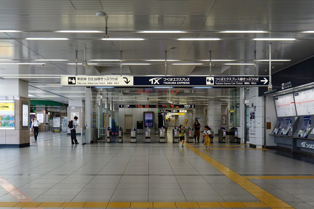
One of Tokyo’s busiest railway hubs became a transport center 271 years before its first train arrived.
Today, JR, Tobu, Tokyo Metro and the Tsukuba Express converge at Kita-senju, carrying enormous passenger flows through northeastern Tokyo. Yet the station did not create this gateway. It inherited a role established in 1625, when Senju became the first post town north of Nihonbashi on the highways to Nikko and northeastern Japan.
For four centuries, the technology changed while the urban function remained strikingly consistent. A bridge concentrated travelers at the Sumida River. The Nikko and Oshu highways created inns, transport offices and roadside commerce. Riverboats and roads supplied one of Edo’s major produce markets. Railways later shifted movement toward Kita-senju Station, and subways, through-services and the Tsukuba Express expanded the old gateway into a metropolitan interchange.
Modern Kita-senju therefore exists because each new transport network reused the advantages created by the one before it. Its crowded platforms, shopping streets, drinking alleys and university campus are different chapters in the same long history of movement and exchange.
A Gateway Before There Was a Station
Senju developed in the lowlands northeast of central Edo. Rivers made the area vulnerable to flooding, but they also carried people, agricultural produce and building materials. A dependable crossing could therefore concentrate roads, labor, warehouses and settlement.
In 1594, Tokugawa Ieyasu ordered the construction of Senju Ohashi. Adachi City describes it as the first bridge built across the Sumida River. The crossing gave the northern approach to Edo a fixed point and encouraged traffic to pass through Senju rather than around it.
The bridge seen today is not the structure used by early Edo travelers. Floods, rebuilding and modern engineering changed the riverfront repeatedly. What endured was the crossing’s strategic position. Roads continued to converge there, and later transport systems developed close to the same corridor.
1625: Senju Becomes Edo’s First Northern Post Town
In 1625, Senju was formally organized as Senju-shuku, the first post station north of Nihonbashi on the Nikko and Oshu highways. Travelers heading toward Nikko, Mito and northeastern Honshu passed through the settlement soon after leaving Edo.
A post town was not simply a row of inns. It was working transport infrastructure. Senju had to supply horses and porters, forward official travelers and goods, provide accommodation, and support the businesses required by a constant flow of people.
Honjin and waki-honjin served high-ranking travelers. Hatago accommodated a wider public. Transport offices coordinated horses and labor. Food sellers, craftsmen, wholesalers and religious institutions benefited from the traffic generated by the highway.
In 1661, settlements south of the river were added to the post town. Historical Senju-shuku therefore extended across territory now divided between Adachi City and Arakawa City. Modern Kita-senju and Minami-senju are railway-era place names; they should not be mistaken for the boundaries of the Edo-period post station.
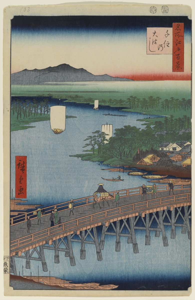
The Post Town Was a Logistics System
Senju’s prosperity depended on movement at walking, horse and boat speed. Daimyo processions, messengers, pilgrims and merchants shared the road with local residents and farmers bringing produce into town.
The official highway system created obligations as well as opportunity. Horses, porters and forwarding services had to be available when required. These duties could burden residents, but they also supported private commerce. Inns bought food and fuel. Travelers needed meals, sandals and everyday supplies. Warehouses and brokers linked road traffic with river transport.
This explains why the former highway remains more historically important than any single surviving building. Most structures along today’s Shukubamachi-dori are later replacements. The continuity lies in the route, narrow plots, alleys, temples, shrines and the close-grained commercial pattern shaped by centuries of traffic.
The Yacchaba: Feeding Edo from Senju
South of the main post-town area, Senju Kawaramachi became famous for its fruit and vegetable market, commonly called the yacchaba.
A monument erected in 1906 claimed that the market began in 1576, but Adachi City’s historical account makes an important distinction: surviving records indicate that it took formal market shape in 1735. The Senju market became one of Edo’s three major produce markets, together with Kanda and Komagome, and served as an official supplier to the shogunate.
Its location explains its success. Agricultural goods arrived from villages in and beyond present-day Adachi by road and water. Wholesalers sorted and traded the produce, which was then moved toward central Edo. By the Taisho period, specialist traders known as nageshi carried goods onward to markets such as Kanda and Kyobashi. Because they had to arrive before other morning markets opened, trading at Senju could begin around 3:00 a.m.
The post station and the yacchaba were separate institutions, but they reinforced one another. One moved travelers and official loads; the other organized agricultural distribution. Both depended on Senju Ohashi and the meeting of road and river transport.
From Highway Town to Railway Town
The Meiji government abolished the Tokugawa post-station system, ending the formal transport duties that had supported Senju-shuku. The district did not lose its importance, however. Its bridge, road, market, merchants and dense settlement remained valuable.
The decisive change came in 1896, when the Nippon Railway Tsuchiura Line—later part of the Joban Line—opened through the area and Kita-senju Station began operating. In 1899, the first section of the Tobu Railway opened between Kita-senju and Kuki.
Railways shifted the district’s center of gravity. Under the post-town system, travelers moved along the highway and stopped within a long linear settlement. Under the railway system, passengers converged on platforms and ticket gates. Shops and services increasingly gathered around the station approaches.
The old road did not disappear. Instead, Kita-senju developed two overlapping axes: the former highway, preserving the scale and memory of the post town, and the railway station, organizing modern movement and commerce.
Disaster, War and the Postwar Shopping District
The Great Kanto Earthquake of 1923 and the air raids of 1945 damaged the wider Senju area, though destruction varied from one block to another. Reconstruction replaced many buildings while preserving parts of the older street network.
After the war, shopping streets and small entertainment businesses expanded around the west side of the station. Their narrow frontages and intimate scale created a different environment from the large railway facilities nearby.
This postwar layer remains central to Kita-senju’s identity. The district’s well-known drinking alleys and inexpensive shops are not direct survivals of Edo-period inns. They belong to a later commercial culture, built around commuters, local residents and the passenger flows of the modern station.
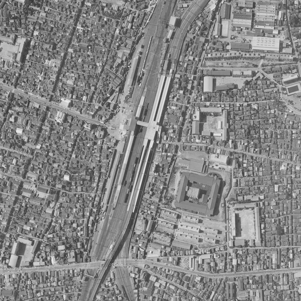
Subways Turn the Junction into a Metropolitan Interchange
Kita-senju’s role changed again when separate railway lines became connected metropolitan networks.
In 1962, the Hibiya Line reached Kita-senju and began reciprocal through-service with the Tobu Isesaki Line. Passengers from northeastern suburbs could travel into central Tokyo without changing trains at the terminal.
In 1969, the Chiyoda Line opened between Kita-senju and Otemachi. It was extended to Ayase in 1971, when through-service with the Joban Line local service also began. These connections made Kita-senju more than a place where trains happened to meet. It became an interchange linking suburban railways, JR services and cross-city subway routes.
The Tsukuba Express added another layer on August 24, 2005. Its route connected Akihabara with Tsukuba through rapidly developing areas in eastern Saitama and northwestern Chiba. Kita-senju gained a fast new axis while retaining its earlier JR, Tobu and Metro connections.
This is the railway-age version of the post town. The horses, porters and forwarding offices are gone, but the core economic principle remains: large numbers of people change direction here, and commerce grows around that transfer.
The East Side and Tokyo Denki University
The east and west sides of Kita-senju Station developed differently. The west side connects directly with the older commercial streets and former highway. The east side was shaped more strongly by railway land and residential districts.
Tokyo Denki University opened its Tokyo Senju Campus near the east exit in April 2012. The university had developed its education and research functions in Kanda, but used its centenary as an opportunity to establish a major new campus in Adachi City.
The campus brought students, faculty and visitors into the east-side streets each day. Its success depended on the accessibility already created by more than a century of railway development. In turn, the university gave the station district a new role as a place of education and research.
Senju Ohashi Explains the Whole Story
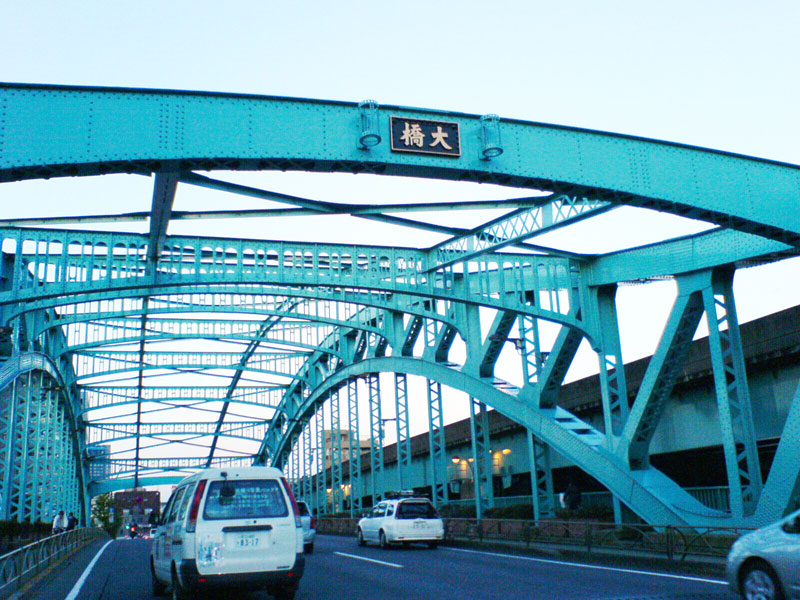
Senju Ohashi is the clearest place to understand why Kita-senju repeatedly reinvented itself.
The original bridge created a reliable northern gateway. The highway reused that crossing. The post town supported road traffic. The market connected roads with river transport. Railways later concentrated movement near the station, while subways and through-services expanded the gateway across the metropolitan region.
Very little of this history survives as untouched fabric. Bridges were rebuilt, rivers engineered, markets reorganized and stations enlarged. The continuity lies in movement and exchange rather than architecture alone.
What to Look For Today
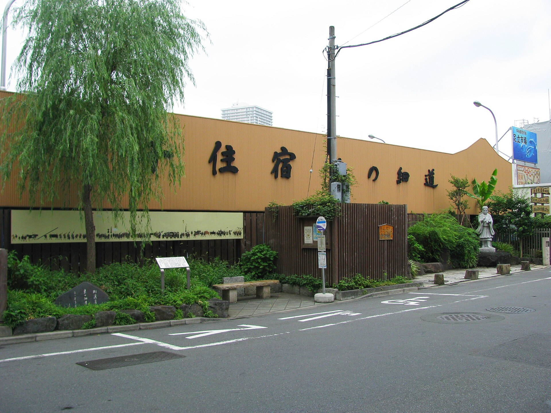
The Former Nikko Kaido
Shukubamachi-dori and nearby streets preserve the post town’s north–south route. The buildings are mostly later, but the road, narrow plots and alleys still reveal a settlement organized around highway traffic.
Senju-machi-no-eki
This local information center is a useful starting point for maps and explanations of Senju-shuku. It occupies a building that was formerly a fish shop.
The Yacchaba District
In Senju Kawaramachi, monuments and the street pattern preserve the memory of the produce wholesalers who supplied Edo and Tokyo.
Senju Ohashi
The modern bridge marks the crossing that made the post town possible. It also shows why Senju’s historical landscape extends across today’s ward boundary.
Kita-senju Station
The station is not separate from the historical story. It is the modern successor to the gateway function once performed by the bridge and highway.
How Kita-senju’s Layers Fit Together
| Historical layer | Main system | Urban effect | Visible legacy |
|---|---|---|---|
| River crossing | Senju Ohashi | Fixed the northern approach to Edo | The bridge and converging roads |
| Post town | Nikko and Oshu highways | Created lodging, transport labor and roadside commerce | The former highway, narrow plots and local markers |
| Produce market | Road and river distribution | Connected farming districts with Edo consumers | Yacchaba monuments and Kawaramachi street history |
| Railway junction | Joban and Tobu lines | Shifted movement toward Kita-senju Station | The station-centered commercial district |
| Metropolitan interchange | Metro and Tsukuba Express | Connected suburbs directly with central Tokyo | The multilayered station complex |
| University district | Tokyo Denki University | Added education and research to the east side | The Tokyo Senju Campus |
Timeline
- 1594: Senju Ohashi is completed across the Sumida River.
- 1625: Senju-shuku is established as the first post town north of Nihonbashi.
- 1661: Settlements south of the river are added to the post town.
- 1735: The Senju produce market takes formal shape.
- 1896: Kita-senju Station opens on the Nippon Railway Tsuchiura Line.
- 1899: Tobu Railway begins service between Kita-senju and Kuki.
- 1962: The Hibiya Line reaches Kita-senju and starts through-service with Tobu.
- 1969: The Chiyoda Line opens between Kita-senju and Otemachi.
- 1971: The Chiyoda Line extends to Ayase and begins through-service with the Joban Line.
- 2005: The Tsukuba Express opens.
- 2012: Tokyo Denki University opens its Tokyo Senju Campus.
- 2025: Senju marks 400 years since the establishment of Senju-shuku.
Frequently Asked Questions
Is Kita-senju the same as Senju-shuku?
No. Kita-senju is a modern station-centered place name. Senju-shuku was a longer highway settlement extending across both sides of the Sumida River.
Why was Senju important during the Edo period?
It was the first post town north of Nihonbashi on the Nikko and Oshu highways and controlled a major river crossing used by travelers heading into northeastern Japan.
What was the yacchaba?
It was Senju’s major fruit and vegetable market. Produce arrived from surrounding farming districts and was redistributed toward central Edo and Tokyo.
Why did Kita-senju become a major railway hub?
The district already occupied Tokyo’s northeastern gateway. JR, Tobu, two Metro lines and the Tsukuba Express successively reused that strategic location.
Where can visitors see traces of the post town?
The former Nikko Kaido, Senju-machi-no-eki, local temples and markers, the yacchaba district and Senju Ohashi provide the clearest historical evidence.
How is Kita-senju connected to Minami-senju?
Both grew from the wider Senju transport landscape. Modern station names and ward boundaries divide what was once a continuous post town across the river.
Sources and Further Reading
- Adachi City: Senju-shuku and Senju Ohashi
- Adachi City Museum: 400 Years of Senju-shuku
- Adachi City Museum: The Senju Yacchaba Market
- Adachi City Museum: The Arrival of Railways and Buses
- Adachi City Museum: Subways and the Railway Network
- Tokyo Metro: Corporate History
- Tsukuba Express: About TX
- Tokyo Denki University: History
Explore More with TimeWalk Japan
Walk from Kita-senju Station along the former Nikko Kaido to the yacchaba district and Senju Ohashi. The route shows how a bridge, a post town, a wholesale market and a railway interchange repeatedly reused the same urban gateway. Explore more places through TimeWalk Japan’s Neighborhood Histories.