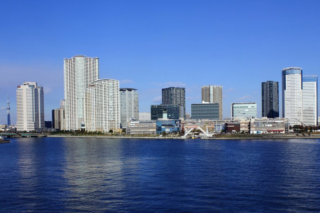
Toyosu Was Built to Be Rewritten
Toyosu did not grow from an old village into a modern neighborhood. The land itself was made in Tokyo Bay, then repeatedly reassigned to serve the city’s changing needs.
First came port engineering and reclaimed industrial ground. Then shipyards, gasworks, warehouses and freight railways organized the waterfront around production and logistics. When those industries withdrew, the same large parcels, canals and transport routes made possible a new landscape of offices, apartments, parks, shopping, university buildings and a wholesale market.
This is Toyosu’s defining pattern: the purpose changes, but the district remains metropolitan infrastructure. A former shipbuilding dock becomes a public waterfront. A freight railway bridge becomes a promenade. Former gasworks land becomes the site of Tokyo’s central wholesale market. The skyline is new, but its scale and geometry still come from industry.
Why Toyosu Looks Unlike Older Tokyo
Older districts such as Nihonbashi or Asakusa inherited narrow town lots, temple grounds and streets shaped over centuries. Toyosu was laid out much later on engineered land. Its broad roads, large blocks and straight waterfronts were created for factories, docks, storage and freight circulation.
That industrial scale survived redevelopment. Towers and shopping complexes now occupy former production sites, but they still use parcels far larger than those found in older merchant neighborhoods. The canals are no longer only working waterways, yet they continue to separate districts and determine where bridges, stations and promenades can go.
Toyosu is also not one single redevelopment project. The former IHI shipyard near Toyosu Station became a mixed-use district. Shin-toyosu developed around large public, utility and residential sites. Toyosu 6-chome, on former gasworks land, became the wholesale market. Their histories are connected, but they are not identical.
Before Toyosu: Shallow Water in Tokyo Bay
Before twentieth-century reclamation, the present district was shallow water and tidal ground in Tokyo Bay. There was no Edo-period Toyosu town beneath today’s towers. Established communities lay farther inland, especially around Fukagawa, while Tsukishima and Harumi were themselves products of other reclamation projects.
Modern port construction changed both the scale and purpose of landmaking. Tokyo needed deeper channels, wharves, factories, storage and infrastructure that could not easily fit into the crowded center. Dredging and reclamation therefore produced new ground specifically for metropolitan industry.
Koto City records the establishment of the Toyosu town name in July 1937. The characters suggest abundance and a waterside tract. It was an optimistic name for newly made land whose future was still being planned.
The Shipyard That Defined the District
Tokyo Ishikawajima Shipbuilding, a predecessor of today’s IHI, opened its modern Toyosu works in 1939. The reclaimed waterfront offered room for docks, fabrication, assembly and technical facilities that were difficult to expand at the company’s older base.
The shipyard belonged first to the industrial mobilization of the late 1930s and wartime period, then to postwar reconstruction and high economic growth. Workers came to Toyosu for industrial shifts. Cranes, workshops, storage yards and vessels shaped the view long before apartments and shopping centers appeared.
The site also created the large corporate landholding that later made coordinated redevelopment possible. When shipbuilding ended, the land did not break into hundreds of small properties. The same scale that once served heavy industry could be reorganized into offices, housing, retail, education and public space.
Freight Moved by Water and Rail
Industrial Toyosu depended on movement as much as production. Ships and barges used the canals and wharves, while trucks and a dedicated port railway moved materials between factories, warehouses and the rest of Tokyo.
The Harumi freight line crossed from Toyosu to Harumi over a steel bridge. It opened in 1957 and remained in service until February 10, 1989. Unlike a passenger line, it followed the geography of factories and wharves rather than shopping streets or residential centers.
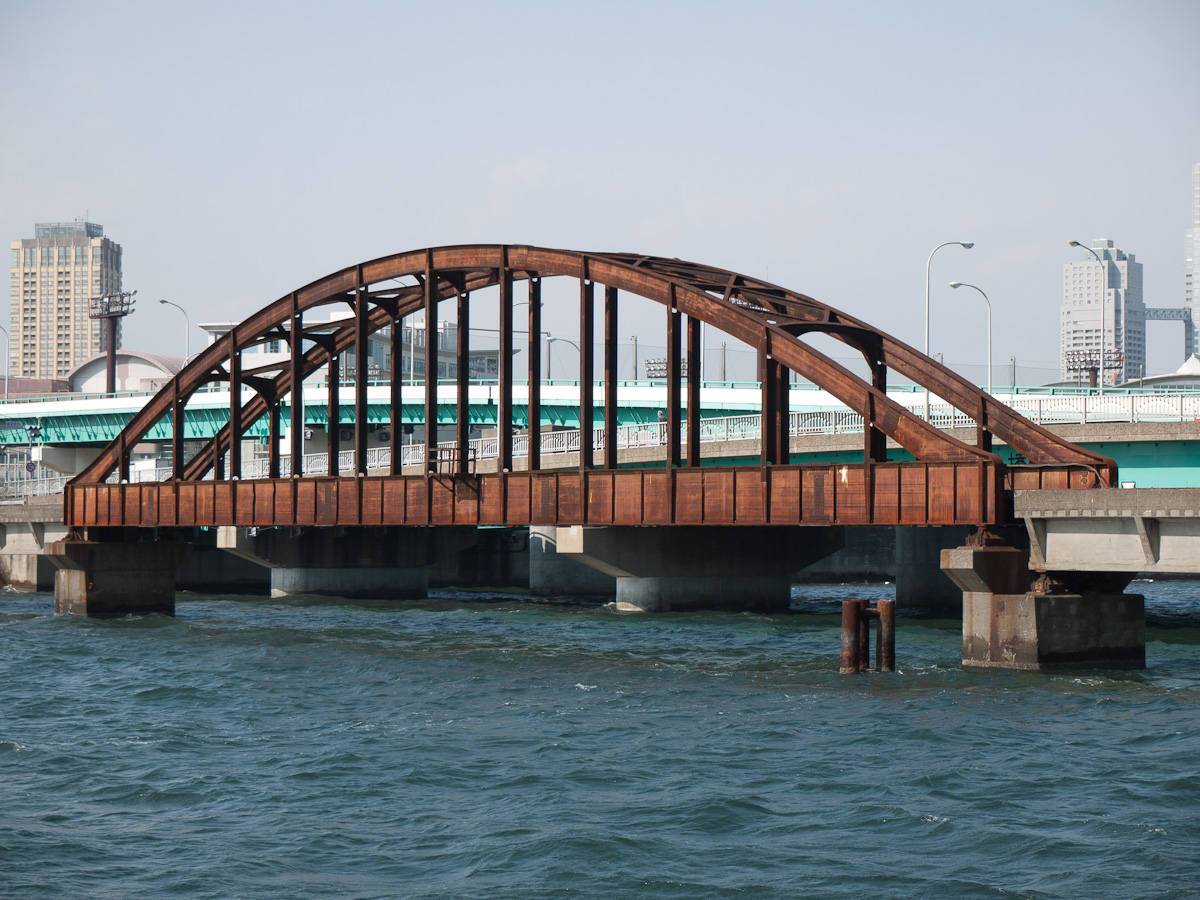
Tokyo restored the bridge and opened it as part of the Harumibashi Park promenade on September 19, 2025. Its new use is recreational, but the straight alignment still reveals the older port railway.
The Market Site Was a Different Industrial Property
The former shipyard was not the future market site. In Toyosu 6-chome, Tokyo Gas operated facilities connected with gas production. This land later became the principal site of Toyosu Market.
That industrial use left soil and groundwater contamination. Tokyo investigated and treated the site, added further measures after expert review and continued monitoring and groundwater management. The issue delayed the market’s opening and became an important part of the project’s public history.
The distinction matters when walking Toyosu. The mixed-use waterfront around the former IHI dock and the wholesale market at Shijo-mae came from different industrial properties and different redevelopment decisions.
When Industry Withdrew
From the late twentieth century, changes in shipbuilding, freight transport and port logistics reduced the need for Toyosu’s older industrial facilities. The Harumi freight line closed in 1989. IHI ended shipbuilding in Toyosu in 2002.
Factory closure alone does not create a new city. Toyosu changed because several conditions aligned: large sites remained available, central Tokyo was close, waterfront housing and offices had become attractive, and new rail connections reduced the district’s isolation.
The water’s edge also changed meaning. Land once valued because industry could be separated from dense residential districts became desirable for parks, promenades and high-rise development.
Passenger Rail Creates a New Toyosu
Toyosu Station opened on June 8, 1988, with the Yurakucho Line extension from Shintomicho to Shin-kiba. Passenger rail connected the reclaimed district directly with central Tokyo and made large-scale residential and office development more practical.
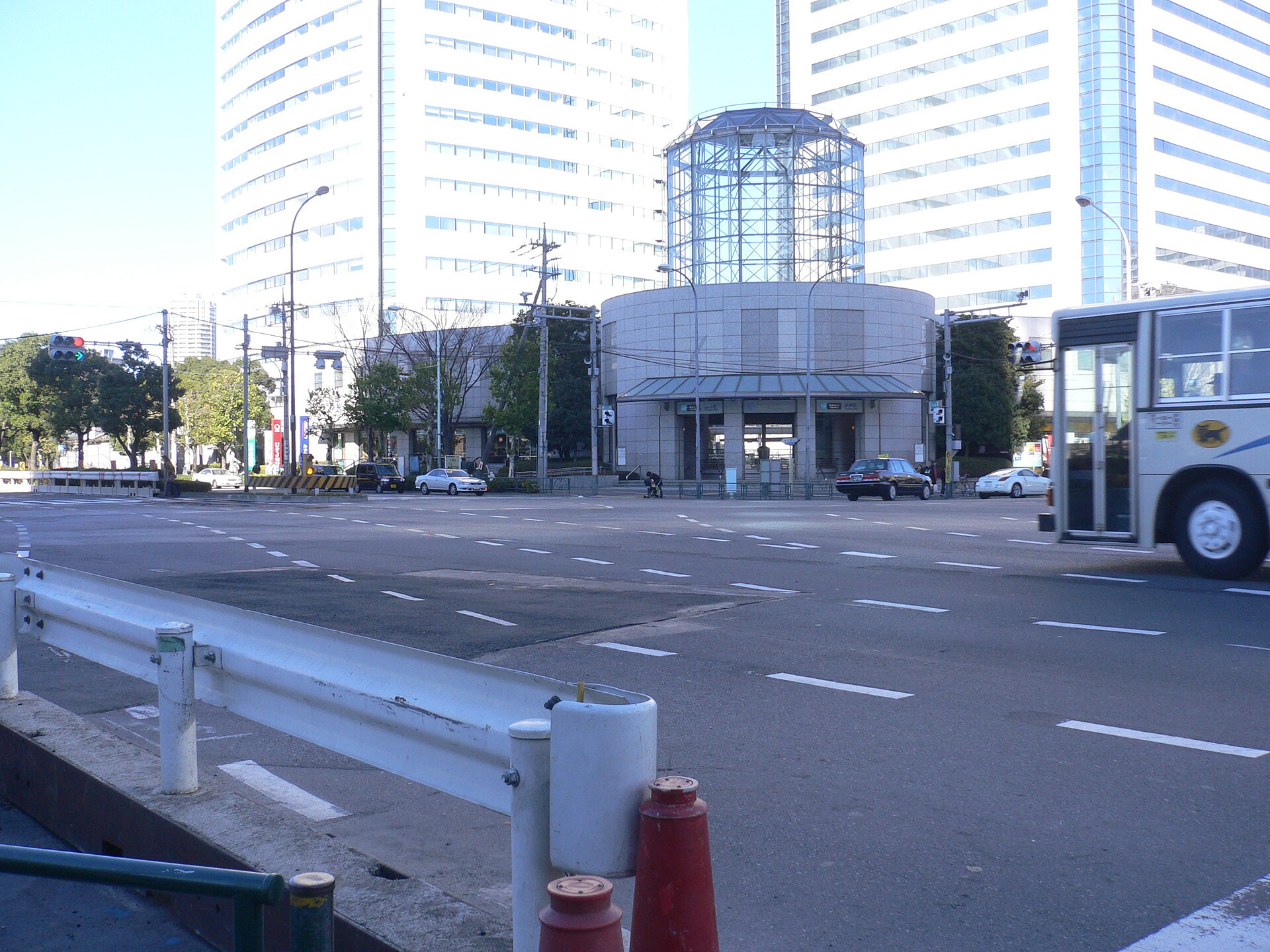
The Yurikamome extension from Ariake to Toyosu opened on March 27, 2006. Shin-toyosu and Shijo-mae stations made the southern waterfront and future market site accessible to passengers.
Toyosu still depends on several transport systems at once. The subway carries commuters toward central Tokyo. Yurikamome links the bay area. Bridges connect reclaimed islands. Trucks serve the market. Passenger urbanism and heavy logistics continue side by side.
From Shipyard to Urban Dock
After shipbuilding ended, the former IHI site in Toyosu 2- and 3-chome was reorganized as a mixed district of offices, apartments, retail, education, parks and waterfront space.
Urban Dock LaLaport Toyosu opened in 2006 on part of the former yard. Its name and layout deliberately refer to the industrial waterfront. The old shipbuilding dock was retained as a public-facing space rather than removed.
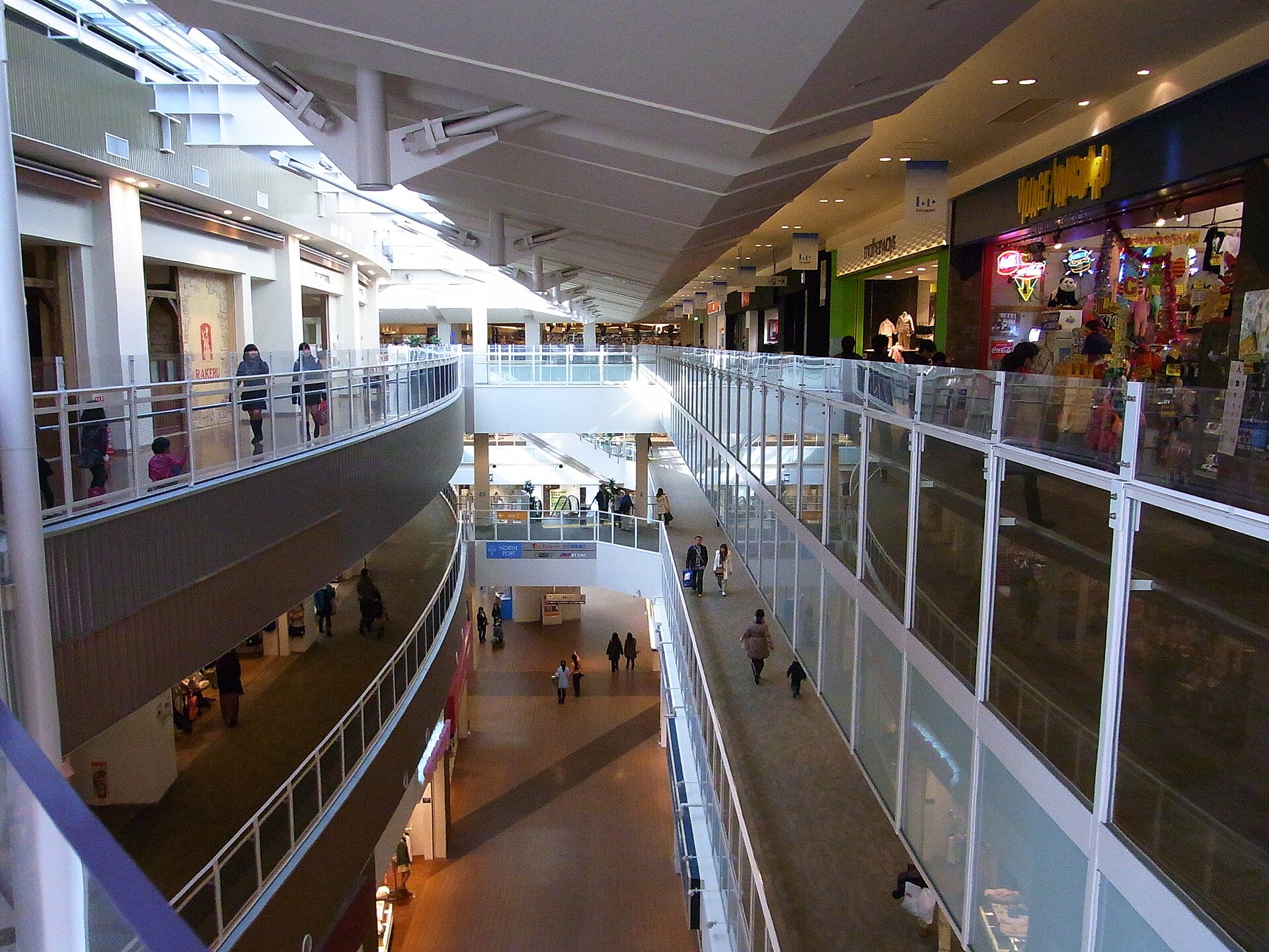
The preserved dock is not a complete industrial museum. Most workshops and production facilities disappeared. Instead, one powerful spatial trace organizes shopping, events, walking and access to the water. A crane monument and other IHI references reinforce the connection.
This is selective preservation: enough remains to explain the site’s former purpose, while almost everything around it serves a new economy.
Why the Market Moved from Tsukiji
Tsukiji’s central wholesale market had opened in 1935. By the late twentieth century, its buildings were aging, truck circulation was difficult and modern temperature control and sanitation were hard to introduce while operations continued.
Tokyo selected the Toyosu site through its market planning process in 2001. The former industrial land offered space for separate seafood and produce buildings, loading areas, internal roads and controlled logistics while remaining close to central Tokyo.
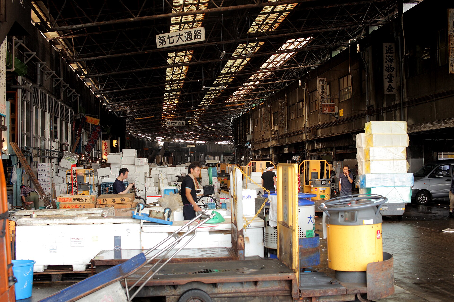
Environmental reviews and additional construction delayed the relocation. Toyosu Market finally opened on October 11, 2018. The principal inner-market wholesale functions moved, but Tsukiji Outer Market remained in Tsukiji.
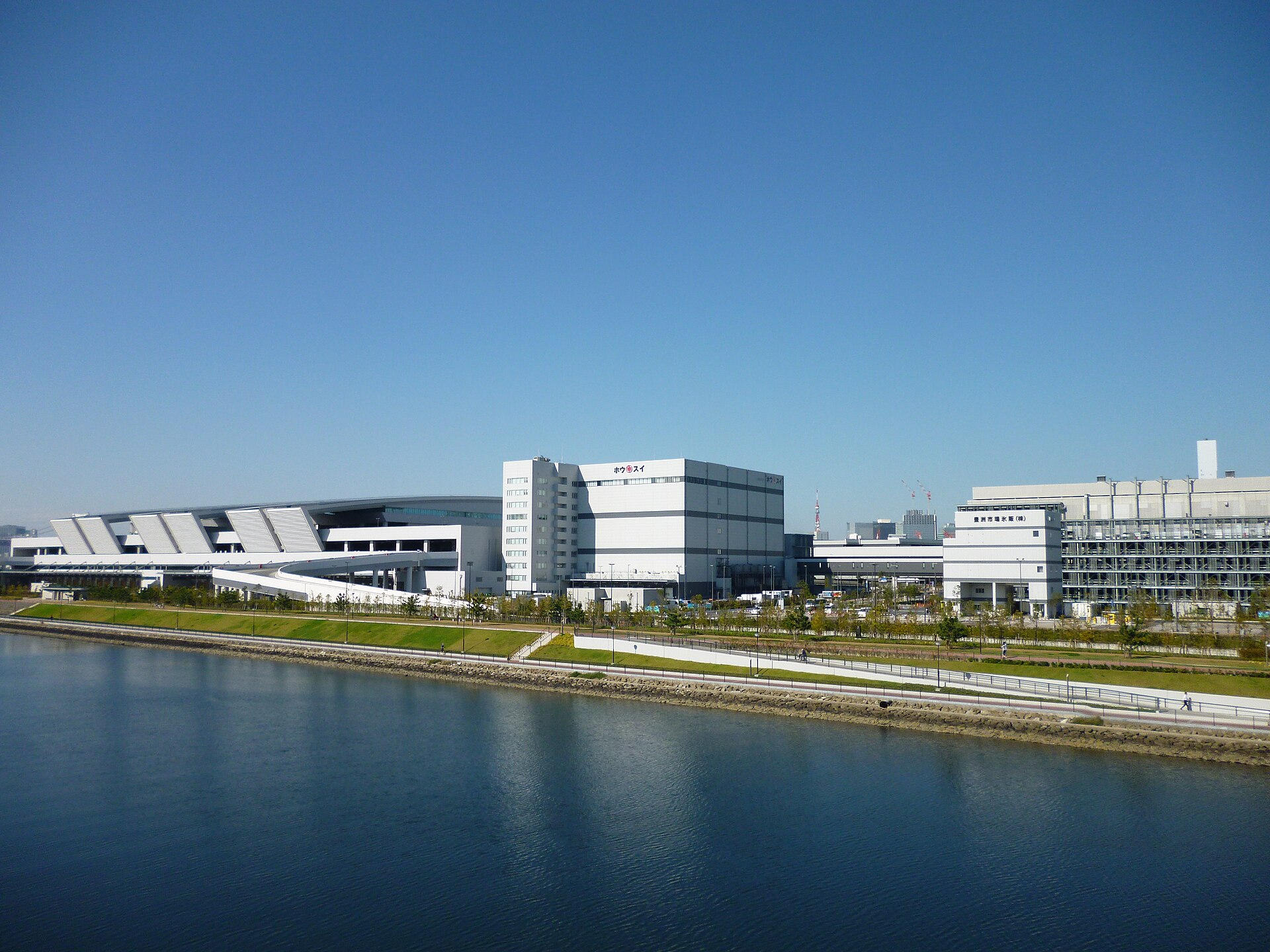
The move linked two reclaimed waterfronts from different periods: Tsukiji, where the market grew from earthquake-era reconstruction, and Toyosu, where former industrial land could support a much larger logistics complex.
Toyosu Market Continues the Industrial Story
Visitors often know Toyosu Market through tuna-auction windows, restaurants and observation routes. Its main purpose, however, is wholesale distribution. Seafood and produce arrive, are inspected and sold, then leave for retailers, restaurants and other buyers.
The market therefore did not end Toyosu’s industrial identity. It changed the goods and the technology. Shipbuilding and gas production gave way to food logistics, but the district still serves Tokyo through large sites, controlled circulation and regional supply networks.
Toyosu Senkyaku Banrai opened beside the market on February 1, 2024, adding restaurants, shops and bathing facilities. It broadens the visitor experience but is separate from the wholesale institution itself.
Reading Industrial Toyosu in Today’s Streets
Toyosu’s history is easiest to understand by following the systems that once moved ships, materials and workers. The surviving traces are not isolated monuments. Together they show how an industrial district was converted without erasing the dimensions of industry.
The Former Shipbuilding Dock
At Urban Dock LaLaport Toyosu, the retained basin shows why this waterfront could support shipbuilding. Its length, direct access to water and surrounding open space belonged to production, not leisure. Today the same geometry frames shops, events and promenades. The change in use is dramatic, but the dock still controls how people approach the waterfront.
The Former Harumi Railway Bridge
The restored bridge is now crossed on foot, yet its straight alignment and steel structure make sense only when read as freight infrastructure. It connected industrial parcels that needed direct movement of materials. The promenade preserves not merely an old bridge, but part of the logistics network that made Toyosu useful to metropolitan industry.
Canals, Bridges and Large Blocks
Toyosu’s broad roads and oversized parcels are often treated as signs of recent redevelopment. Their deeper origin lies in factories, wharves, storage yards and truck circulation. Canals divided the reclaimed land into functional zones; bridges became essential links between them. High-rise redevelopment inherited this framework rather than replacing it.
The Route from Toyosu to Shijo-mae
Traveling from Toyosu through Shin-toyosu to Shijo-mae reveals three different waterfront histories. Around Toyosu Station, the former IHI land became a mixed urban center. Shin-toyosu contains large residential, utility and public sites. At Shijo-mae, the wholesale market occupies former gasworks land. The route explains why “Toyosu redevelopment” is not one project but a sequence of separate industrial conversions.
Toyosu Market as Working Infrastructure
The market is best understood by looking beyond its restaurants and observation windows. Separate buildings, controlled entrances, elevated routes and broad truck roads reveal an institution designed to move perishable goods quickly and hygienically. Its architecture continues Toyosu’s long history as a place where Tokyo solves large logistical problems at the water’s edge.
Four Uses of the Same Engineered Landscape
| Period | Main purpose | Infrastructure | What remains |
|---|---|---|---|
| 1930s–1980s | Port industry and shipbuilding | Docks, factories, wharves and freight rail | Former dock, bridge, canals and large parcels |
| Late 1980s–2000s | Transition and passenger access | Subway, new transit and road links | Toyosu Station, Yurikamome and bridge network |
| 2000s–present | Mixed waterfront city | Offices, housing, retail, parks and university facilities | Urban Dock and coordinated high-rise district |
| 2018–present | Metropolitan food logistics | Wholesale buildings, truck circulation and controlled visitor routes | Toyosu Market and related visitor facilities |
Timeline
| Date | Change | Why it mattered |
|---|---|---|
| Before the twentieth century | The present district is shallow water and tidal ground in Tokyo Bay | No older village street plan limited later industrial design |
| July 1937 | The Toyosu town name is established on reclaimed land | New industrial ground gains a formal urban identity |
| 1939 | Tokyo Ishikawajima Shipbuilding opens its modern Toyosu works | Shipbuilding becomes the district’s dominant industry |
| 1957 | The Harumi freight line and railway bridge begin operation | Factories and wharves gain a direct rail connection |
| June 8, 1988 | Toyosu Station opens on the Yurakucho Line | Passenger access makes large-scale housing and office development practical |
| February 10, 1989 | Freight service on the Harumi Line ends | The older industrial logistics network begins to disappear |
| 2001 | Tokyo selects Toyosu through its wholesale-market planning process | Former industrial land is assigned a new metropolitan logistics role |
| 2002 | IHI ends shipbuilding in Toyosu | The former yard becomes available for coordinated redevelopment |
| March 27, 2006 | The Yurikamome extension to Toyosu opens | Shin-toyosu and the future market district gain passenger access |
| 2006 | Urban Dock LaLaport Toyosu opens | The former shipyard dock becomes the center of a public waterfront |
| October 11, 2018 | Toyosu Market opens | Tokyo’s central wholesale functions move from Tsukiji to former gasworks land |
| February 1, 2024 | Toyosu Senkyaku Banrai opens | Visitor-oriented facilities expand beside the working market |
| September 19, 2025 | The restored former Harumi railway bridge opens as a promenade | Freight infrastructure is reused as public space |
Frequently Asked Questions
Is Toyosu entirely built on reclaimed land?
Yes. The present district was created through modern reclamation in Tokyo Bay rather than developing from an Edo-period town.
What was Toyosu before the market?
It was industrial and port land containing a major shipyard, gas-production facilities, warehouses, wharves and freight railway infrastructure.
Was Toyosu Market built on the former IHI shipyard?
No. The market occupies former gasworks land in Toyosu 6-chome. The former IHI shipyard lies closer to Toyosu Station and became a mixed-use waterfront district.
Why did the market move from Tsukiji?
Tokyo cited aging buildings, limited space, difficult truck circulation and the need for modern temperature control, sanitation and logistics.
Did all of Tsukiji Market move?
No. The main inner-market wholesale functions moved to Toyosu in 2018. Tsukiji Outer Market remained in Tsukiji.
What survives from the shipbuilding era?
The former dock, a crane monument, the freight railway bridge, canals and the scale of the surrounding parcels preserve the clearest traces.
Why are Toyosu’s streets and blocks so large?
They inherit the dimensions required by factories, wharves, storage yards and freight circulation on engineered industrial land.
Toyosu’s History Is Still Doing Work
Toyosu can appear to be a neighborhood without a past because so much of its architecture is recent. In fact, its history is unusually visible once the district is read at the scale of infrastructure rather than individual old buildings.
The dock explains the shipyard. The freight bridge explains the former industrial network. The canals and large blocks explain both heavy industry and high-rise redevelopment. The wholesale market shows that Toyosu still performs a metropolitan service rather than functioning only as a residential waterfront.
Toyosu was built to be rewritten, but every new use has inherited something from the one before it. The district’s continuity lies not in an old streetscape, but in its repeated role as engineered land where Tokyo places activities too large, complex or essential for the older city center.
Related Neighborhood Histories
Read the history of Tsukiji for the market district that sent its central wholesale functions to Toyosu. For another reclaimed waterfront shaped by metropolitan infrastructure, see the history of Odaiba.
Sources and Further Reading
- Koto City: Origins of place names
- Koto City: Toyosu urban redevelopment
- IHI: Toyosu and IHI
- Tokyo Port Terminal Corporation: Port railway history
- Tokyo Metropolitan Government: Former Harumi railway bridge promenade
- Tokyo Metro: Corporate history
- Yurikamome: Line history
- Tokyo Metropolitan Central Wholesale Market: Toyosu Market timeline
- Tokyo Metropolitan Central Wholesale Market: Soil investigation and remediation
- Tokyo Metropolitan Government: Toyosu Senkyaku Banrai opening
Walk Tokyo with TimeWalk Japan
Walk from Toyosu Station to the former shipbuilding dock, cross toward the old freight bridge and continue through Shin-toyosu to Shijo-mae. The route reveals how one engineered landscape moved from shipbuilding to housing, leisure and food logistics. Current English-friendly activities are listed on the TimeWalk Japan Meetup page.