Tokyo’s Yamanote Line has a station built over a river valley, beside a railway platform that was raised for an extension that never happened. Around it, printing plants became offices, a wholesale fortress became a business landmark, and a former postal hall became a hotel-and-workspace complex. This is Gotanda: a district whose unfinished plans and obsolete industries repeatedly became the foundations of its next economy.
To visitors unfamiliar with Tokyo, Gotanda can look like an ordinary knot of trains, offices, restaurants and nightlife between Shinagawa and Shibuya. Its real importance is hidden in the landscape. The Meguro River created a flat industrial corridor between steep residential terraces. Two railways concentrated workers and customers at the crossing. Large factories and institutions left behind buildings and parcels that newer businesses could reuse.
Gotanda did not become modern by erasing its past. It became modern by repeatedly recycling the same advantages: a river valley for movement, bridges and railways for access, and adaptable space for whatever kind of work Tokyo needed next.
The River Valley Built the District before the Station Did
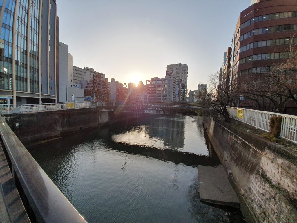
The Meguro River is Gotanda’s oldest organizing structure. The station occupies low ground between higher terraces. Streets climb east into Higashi-Gotanda and toward the residential heights beyond, while flatter Nishi-Gotanda extends west toward Osaki-hirokoji and Fudomae.
This difference in elevation shaped land use. The valley floor could carry roads, bridges, railways, workshops, warehouses and large commercial buildings. Higher ground was better suited to residences, temples and institutional sites. A few minutes of walking still reveals the contrast.
The river was both an asset and a threat. It supported crossings and later industrial activity, but it also flooded. Today’s embankments and waterside paths are part of a long effort to control the water while preserving the valley as a transport and business corridor.
Before “Gotanda”: Villages, Fields and Warrior Estates
Before the station gave the area a single recognizable name, the landscape belonged to villages and estates associated with places such as Shimo-Osaki, Kami-Osaki and Kirigaya. These older boundaries do not match modern Higashi-Gotanda and Nishi-Gotanda exactly.
During the Edo period, the wider area included agricultural land, temple property, shogunal holdings and large residential compounds maintained by daimyo and other samurai households. Such estates were not merely private houses. They contained gates, gardens, storehouses, servant quarters and service roads, and their boundaries influenced later streets and parcels.
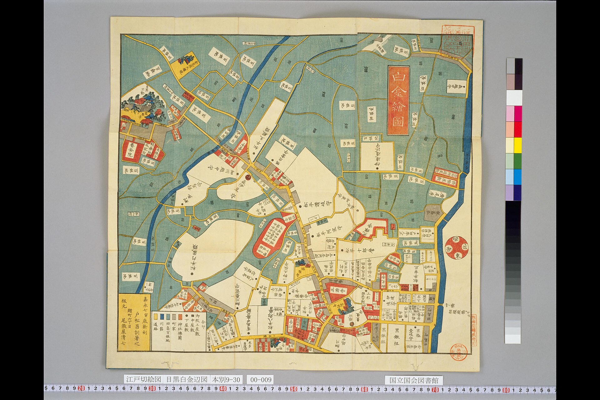
The railway therefore entered an already organized landscape. It did not create Gotanda from empty land; it redirected movement through older roads, river crossings and property divisions.
Industry Followed the River Corridor
After the Meiji Restoration, modern administration, changing land ownership and improved transport drew the southern edge of Tokyo into national markets. The Meguro River–Osaki corridor offered relatively large plots near water, roads and railway freight connections.
Manufacturers, printers, machinery firms, warehouses and distributors gathered in the broader valley. Industrialization changed daily movement: workers entered the district, suppliers delivered paper, ink, metal and equipment, and finished products left for customers across Tokyo.
This network mattered even after factories declined. Sales offices, design work, administration, logistics and supplier relationships could survive when heavy production moved elsewhere.
The Yamanote Line Gave Gotanda a Center
Gotanda Station opened on October 15, 1911, on the government railway that developed into today’s Yamanote Line. The station transformed a river crossing into a named urban center.
Rail access encouraged housing, shops, restaurants and services. Factory workers and commuters generated predictable daily demand, while businesses gained a quick connection to central Tokyo.
Gotanda became more important when a second railway arrived from the south and turned the station into an interchange.
The High Platform Is a Monument to a Railway That Was Never Built
The Ikegami Electric Railway reached Osaki-hirokoji in 1927 and extended to Gotanda on June 17, 1928. The company planned for a possible continuation toward Shirokane, so it carried the terminal high above the existing railway.
The extension never happened. The elevated Tokyu Ikegami Line platform now preserves an abandoned interwar plan in plain sight. What seems like an awkward terminal was designed as a through route into the city.
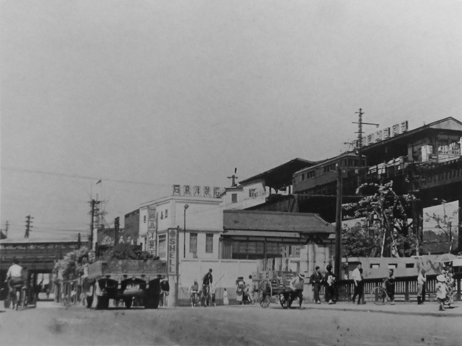
The connection nevertheless changed Gotanda. Passengers from neighborhoods along the Ikegami Line could transfer directly to the Yamanote Line, and retail followed the new flow. A Shirokiya department-store branch opened in the station building in 1929.
Printing Linked the Factory City to the Office City
Printing became especially visible around Nishi-Gotanda and the wider Osaki corridor. It required more than presses: paper suppliers, ink makers, machinery, binders, warehouses, delivery services, designers and sales staff all formed part of the industry.
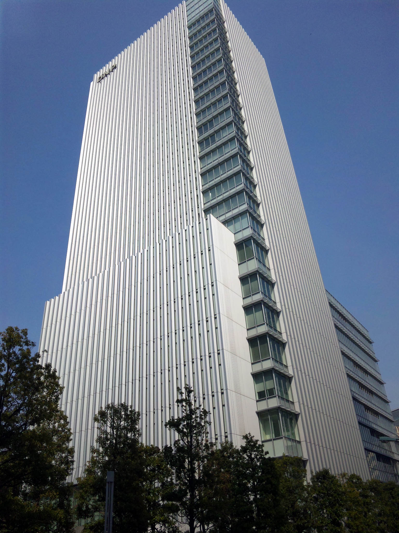
That business network helped Gotanda adapt. When production was reduced or relocated, office functions could remain. The district did not abruptly change from industrial to post-industrial; manufacturing, wholesale, sales and service work overlapped for decades.
War and Reconstruction Produced a Dense Commercial Mix
The Great Kanto Earthquake of 1923 accelerated suburban growth already encouraged by railways and industry. Later, wartime production intensified pressure on the industrial corridor, while air raids damaged parts of Shinagawa and southern Tokyo.
Postwar reconstruction did not restore the prewar district exactly. Small offices, restaurants, entertainment businesses and commercial buildings crowded around the station, while factories and warehouses continued nearby.
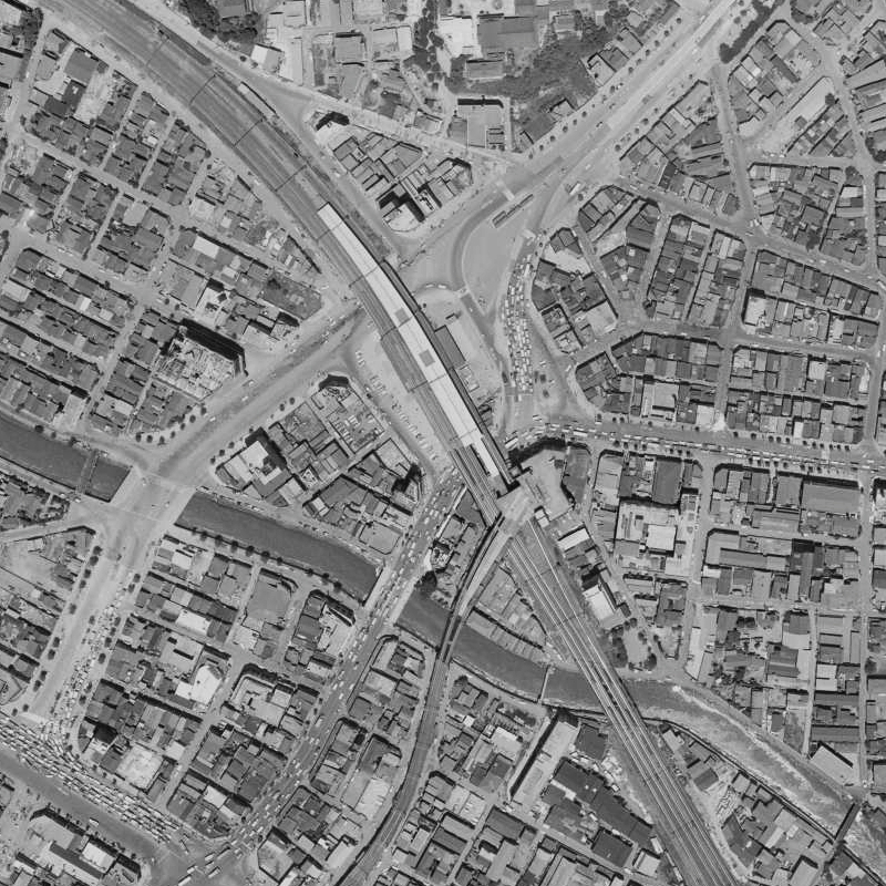
The 1963 aerial view makes Gotanda’s logic clear: railways and roads converge beside the river, compact commercial blocks occupy the valley floor, and larger industrial or institutional sites stand close to smaller streets. Properties could change use without weakening the station’s role as a center of work and movement.
TOC Turned Industrial Logistics into a Wholesale Machine
The TOC Building opened in Nishi-Gotanda in 1970. Its name comes from Tokyo Wholesale Center. The complex combined wholesale showrooms, exhibition space and offices, allowing businesses to display goods, take orders and organize distribution in one place.
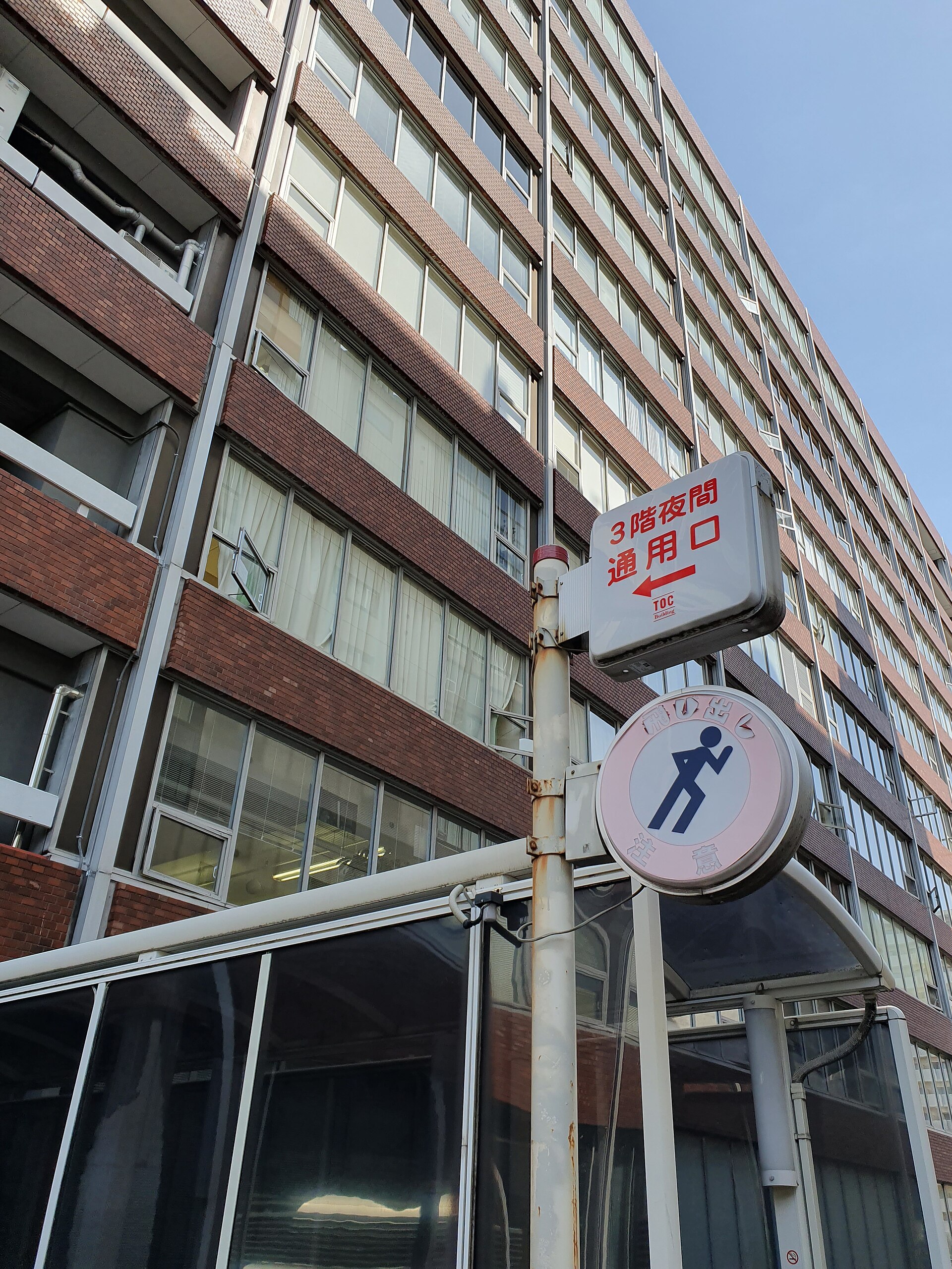
TOC worked because Gotanda already possessed suppliers, storage, transport links and a large workforce. It did not invent the district’s business role; it concentrated an existing ecosystem inside one enormous postwar structure.
Large Obsolete Sites Became Gotanda’s Development Resource
As factories and institutions closed or changed, their large parcels became opportunities. Neighboring Osaki developed major planned office and residential projects on former factory land. Gotanda retained a tighter mixture of station commerce, hotels, restaurants, printing-related firms, small offices and selected large sites.
The former Yu-Port site demonstrates this cycle. The postal savings hall and cultural facility opened in 1982 and closed in 2015. Gotanda JP Building opened there in 2024 with offices, shared workspace, a hotel, a hall, restaurants and public cultural facilities.
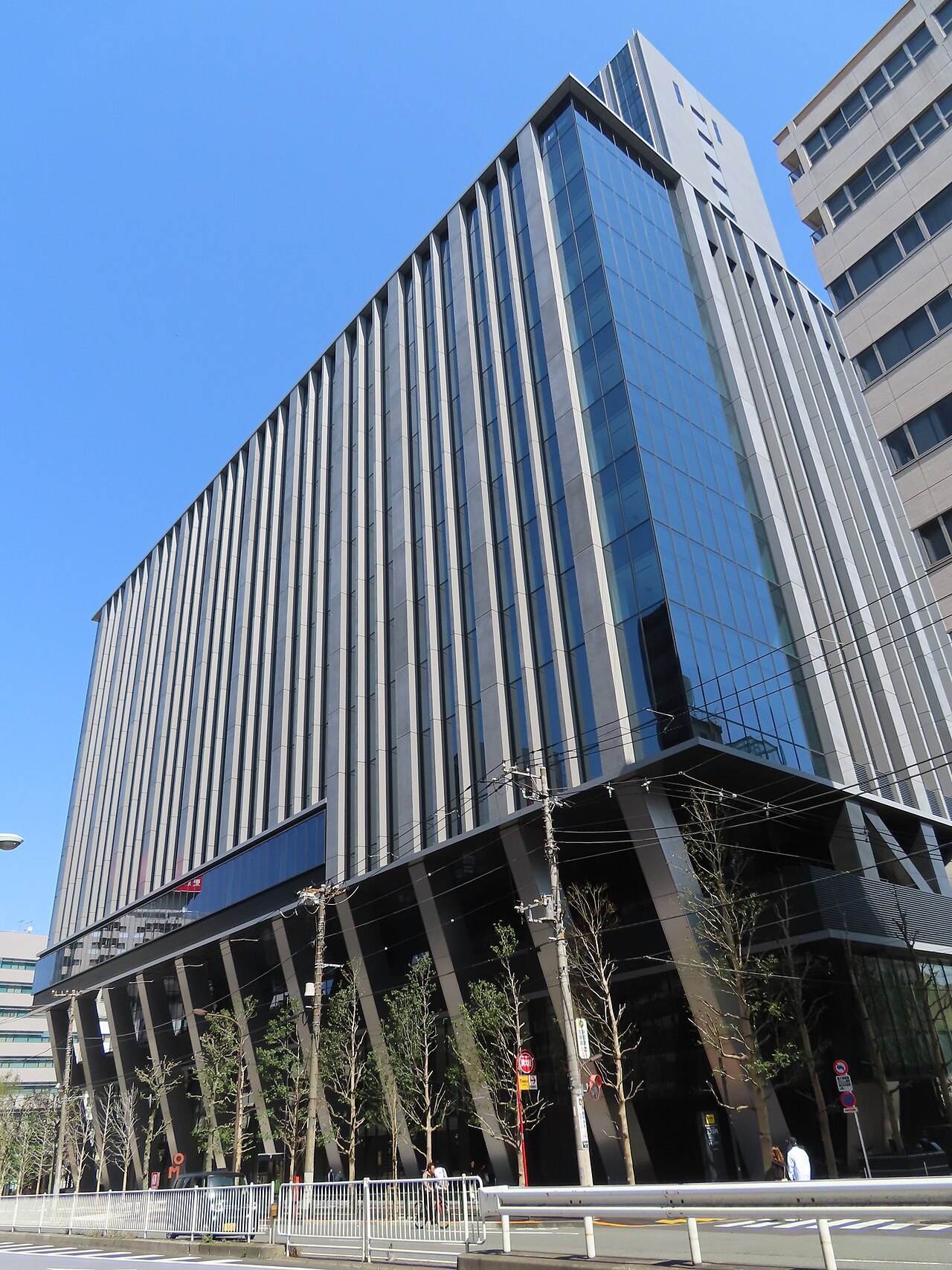
The new complex continues the site’s role as a gathering place while changing the economic activities inside it. This is Gotanda’s recurring pattern: replace the function, reuse the location.
“Gotanda Valley” Rebranded an Old Business Advantage
In the late 2010s, local technology companies and entrepreneurs popularized the name “Gotanda Valley” for the startup community. It is a recent promotional term, not a historical place-name.
The label gained traction because Gotanda offers strong rail connections, relatively adaptable office space and proximity to Shibuya, Shinagawa and central Tokyo. Yet startups are using advantages established by earlier industries: connectivity, affordable work space and dense business networks.
The products changed from printed matter and wholesale goods to software and services. The urban machine remained much the same.
What to Notice in Gotanda Today
The Meguro River and the Slopes
From a bridge near the station, compare the flat river corridor with the streets rising into Higashi-Gotanda. The topography explains why commerce and industry concentrated below while residential and institutional uses expanded above.
The Elevated Ikegami Line Terminal
Look up from the station area. The platform’s unusual height is evidence of the unrealized plan to continue the railway toward Shirokane.
Nishi-Gotanda and Osaki-hirokoji
The west-side streets reveal the overlap of printing-related offices, restaurants, postwar commercial buildings and the Ikegami Line’s elevated structure.
TOC and Gotanda JP Building
These two large complexes represent different generations of reuse: postwar wholesale concentration and twenty-first-century mixed-use redevelopment.
How Gotanda’s Layers Fit Together
| Historical layer | Main function | What it left behind |
|---|---|---|
| Village and estate landscape | Farming, temples and warrior residences | Slopes, roads and property divisions |
| Railway interchange | Commuting and transfers | A permanent center of foot traffic |
| Industrial corridor | Printing, machinery, storage and distribution | Business networks and large parcels |
| Postwar wholesale district | Showrooms, exhibitions and offices | TOC and dense west-side commerce |
| Contemporary reuse | Technology, hospitality, culture and mixed-use offices | New functions inside inherited sites |
Timeline
- Edo period: Villages, temples, shogunal land and warrior estates occupy the wider area.
- 1889: Modern municipal administration creates Osaki Village.
- 1911: Gotanda Station opens.
- 1928: The Ikegami Line reaches Gotanda.
- 1929: Shirokiya opens a station-building branch.
- 1930s: Station commerce and industrial activity expand.
- 1940s–1960s: War damage is followed by dense reconstruction.
- 1970: The TOC Building opens.
- 1982: Yu-Port opens.
- 2015: Yu-Port closes.
- 2018: The Gotanda Valley association is established.
- 2024: Gotanda JP Building opens.
Frequently Asked Questions
Why is the Ikegami Line platform so high?
It was built for a possible extension toward Shirokane over the existing railway. The extension was never completed.
How did the Meguro River shape Gotanda?
The valley created a flat corridor for bridges, railways, factories and dense commercial development, while the higher terraces favored residential and institutional uses.
Why did printing businesses gather here?
The corridor offered transport, large plots, workers and access to Tokyo’s markets. Printing also supported suppliers, warehouses, machinery firms and sales offices.
What is “Gotanda Valley”?
It is a recent name for the local startup community. The label reuses the district’s long-standing advantages in transport, office space and business networks.
Gotanda’s Secret Is Not Reinvention but Reuse
Gotanda’s industries, buildings and public image have changed repeatedly, but the district still depends on the same physical system.
The river valley provided space for movement and industry. The railways concentrated workers and customers. Printing and wholesale created business networks. Later redevelopment reused the large parcels those activities left behind.
That is why a failed railway extension, a former printing district, a wholesale complex and a startup community belong to one story. Gotanda survives by turning yesterday’s infrastructure into tomorrow’s workplace.
Related Neighborhood Histories
Read the history of Meguro to follow the same river valley through temple pilgrimage, suburban growth and flood control. For the southern gateway and railway corridor beyond Gotanda, see the history of Shinagawa.
Sources and Further Reading
- Shinagawa Historical Museum: Osaki and Gotanda, Villages under Direct Tokugawa Rule
- Shinagawa Historical Museum exhibition catalogues
- Tokyu Corporation: History of the Ikegami Line
- Tokyu 100-Year History: Ikegami Electric Railway and the Gotanda extension
- Japan Post Real Estate: Gotanda JP Building
- TOC Exhibition Hall and access information
Walk Tokyo’s Layers with TimeWalk Japan
Gotanda rewards slow observation: a river crossing, an elevated railway, a printing district and new cultural facilities can all be read within the station area. See upcoming English-friendly history walks and cultural events on the TimeWalk Japan Meetup page.