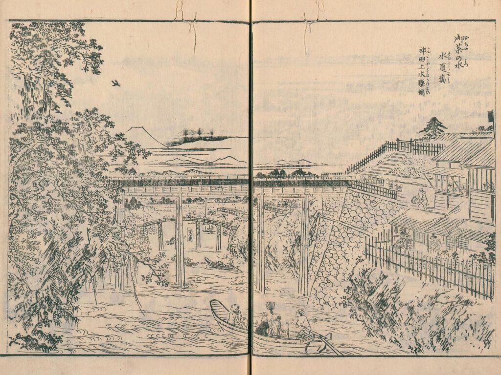
At Ochanomizu, the Kanda River runs through a deep valley beneath railway lines, steep slopes and a dense web of bridges. In the Edo period, another current once crossed above it: water from Kanda Josui passed over the river in a wooden flume. It was literally water crossing water.
Edo did not rely on groundwater wells alone. Water from springs, ponds and rivers was carried by gravity through the Kanda and Tamagawa waterworks. Outside the city it flowed mainly in open canals; inside Edo it entered underground stone and wooden conduits. Residents drew it from shared josui wells—well-like access points connected to the distribution network rather than ordinary shafts reaching groundwater.
This system was not modern pressurized plumbing. It combined topography, open channels, buried conduits, shared wells, inspection, repair and local management. Together, Kanda Josui and Tamagawa Josui helped support Edo Castle and a city often estimated at around one million inhabitants by the eighteenth century, although the exact total varies by date, area and whether samurai households are included.
Why Ordinary Wells Were Not Enough
Groundwater was usable in some parts of Edo, especially on higher ground. But the eastern lowlands near the bay, river mouths and reclaimed land often produced brackish or poor-quality water. As Tokugawa Ieyasu began developing Edo after entering the city in 1590, securing dependable water became essential to castle building, settlement and daily life.
The answer was not one single aqueduct but a layered urban water system. Water was collected from higher sources, guided along carefully chosen contours, then divided into channels and conduits serving different districts. Some households still used groundwater for appropriate purposes, but the city’s major josui networks supplied water that ordinary wells alone could not provide reliably.
Kanda Josui: Edo’s First Major Water Network
Kanda Josui drew on the watershed around Inokashira Pond and the river system now associated with the Kanda, Zenpukuji and Myoshoji rivers. Water passed through the Sekiguchi area, where the Oarai Weir regulated flow, then continued toward Koishikawa and the city.
Near present-day Ochanomizu and Suidobashi, a wooden elevated flume carried the water across the Kanda River valley. From there, underground conduits supplied parts of Edo Castle and districts including Kanda and Nihonbashi. The surviving place name Suidobashi—literally “waterworks bridge”—preserves the memory of that crossing.
The date of Kanda Josui’s creation is less certain than popular retellings suggest. A tradition connects it directly with Ieyasu’s arrival in 1590, but Tokyo water authorities note that several theories exist. The safest conclusion is that the system had taken recognizable form by the late Kan’ei era in the early seventeenth century. The distinction matters: tradition may preserve historical memory without providing a precise construction record.
A City Outgrows Its Water Supply
During the seventeenth century, Edo expanded rapidly. The growth of the shogunate, the regular presence of daimyo households under the alternate-attendance system, and the spread of samurai and townspeople’s districts pushed development onto higher ground south and west of the earlier city.
Kanda Josui and other existing sources could not adequately serve every new district. The shogunate therefore planned a much larger project to bring Tama River water across the Musashino Plateau toward Yotsuya.
The Tamagawa Plan: A River across the Musashino Plateau
The plan was approved in 1652. Construction began in 1653, and city supply began in 1654. Official histories describe the open canal from Hamura to Yotsuya Okido as having been excavated in about eight months, but that figure should be read as a historical account rather than a modern day-by-day construction log.
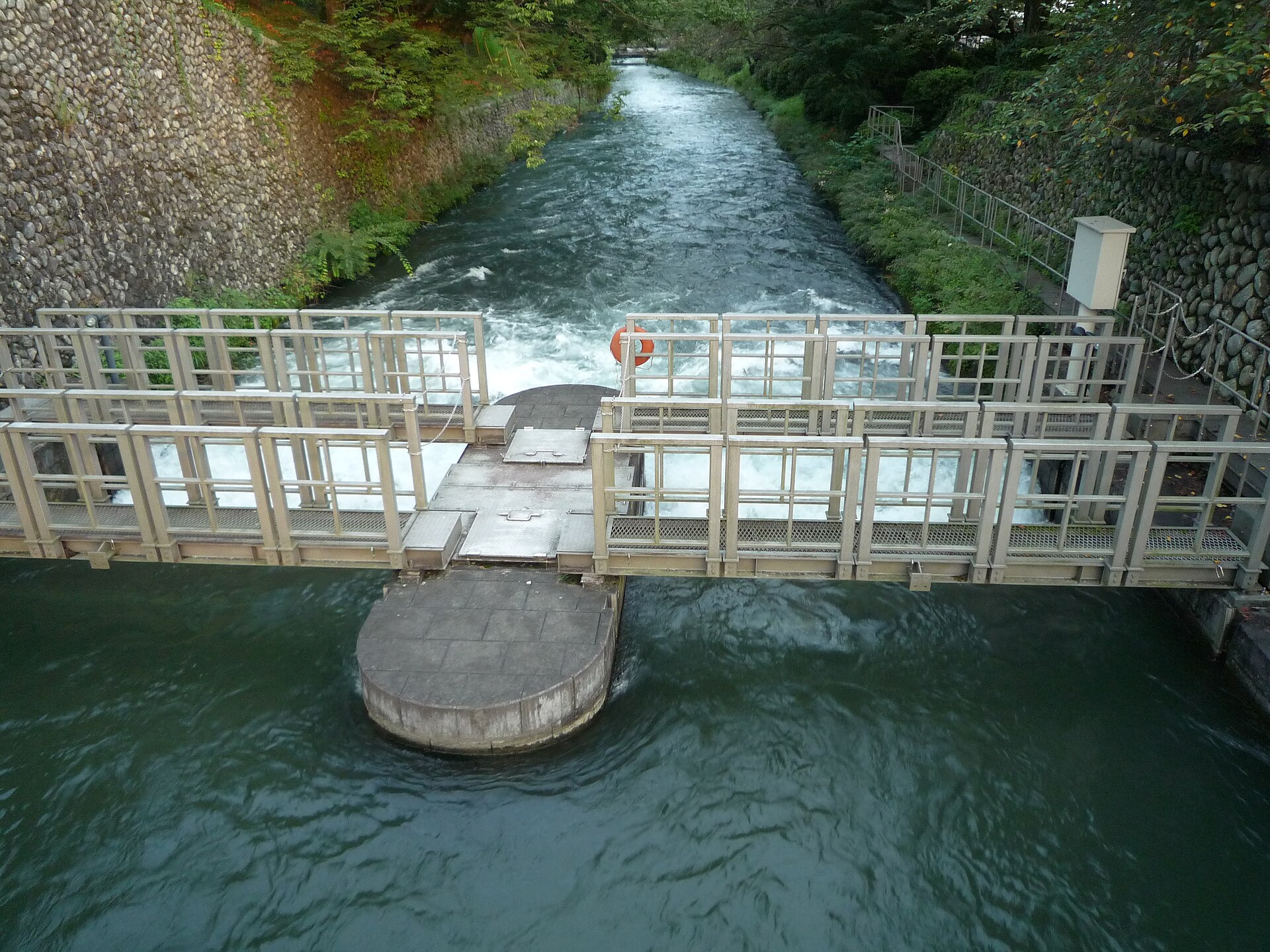
From the Hamura intake on the Tama River to Yotsuya Okido, Tamagawa Josui ran for about 43 kilometers with a total elevation difference of roughly 92 meters. Some museums round this to about 100 meters. Either way, the engineering challenge was the same: guide water over a very long distance on an extremely gentle gradient without pumps.
The Tamagawa Brothers—and the Limits of a Hero Story
Shōemon and Seiemon, later known as the Tamagawa Brothers, were appointed as contractors for the works. After the project, they received the Tamagawa family name and became hereditary water officials associated with the system.
Later stories tell of failed routes, exhausted funds and the brothers paying costs from their own resources. Other accounts connect figures such as Yasumatsu Kin’emon, Matsudaira Nobutsuna and Ina Tadaharu with advice or oversight. The documentary basis for these details is uneven, and Tokyo’s own water authorities note that several versions of the excavation history survive.
The most accurate picture is institutional rather than heroic. The project required shogunal policy, local administration, contractors, surveyors, laborers, village negotiations and later generations of maintenance workers. The brothers were central participants, but no two people could have surveyed, dug, financed and maintained the entire network alone.
How Gravity Carried Water for 43 Kilometers
Without pumps, the canal had to remain slightly lower at every stage. Surveyors favored high ground and ridge-like routes across the plateau because depressions would have forced difficult crossings or caused water to collect. If the slope was too steep, the current could damage the channel; if too shallow, flow could slow or stop.
The canal was not an absolutely uniform mathematical line. It was adapted to terrain, repaired repeatedly and later modified. Branch channels also carried water to villages and new agricultural settlements, turning Tamagawa Josui into both an urban water source and a wider regional water network.
From Open Canal to Underground City
Yotsuya Okido marked a major transition. West of the gate, Tamagawa Josui was largely an open canal. At the entrance to Edo, water was checked and regulated at a guardhouse, then sent into underground stone and wooden conduits.
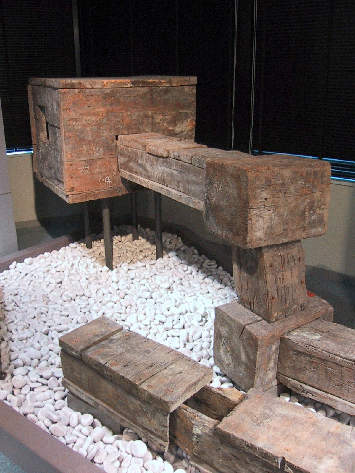
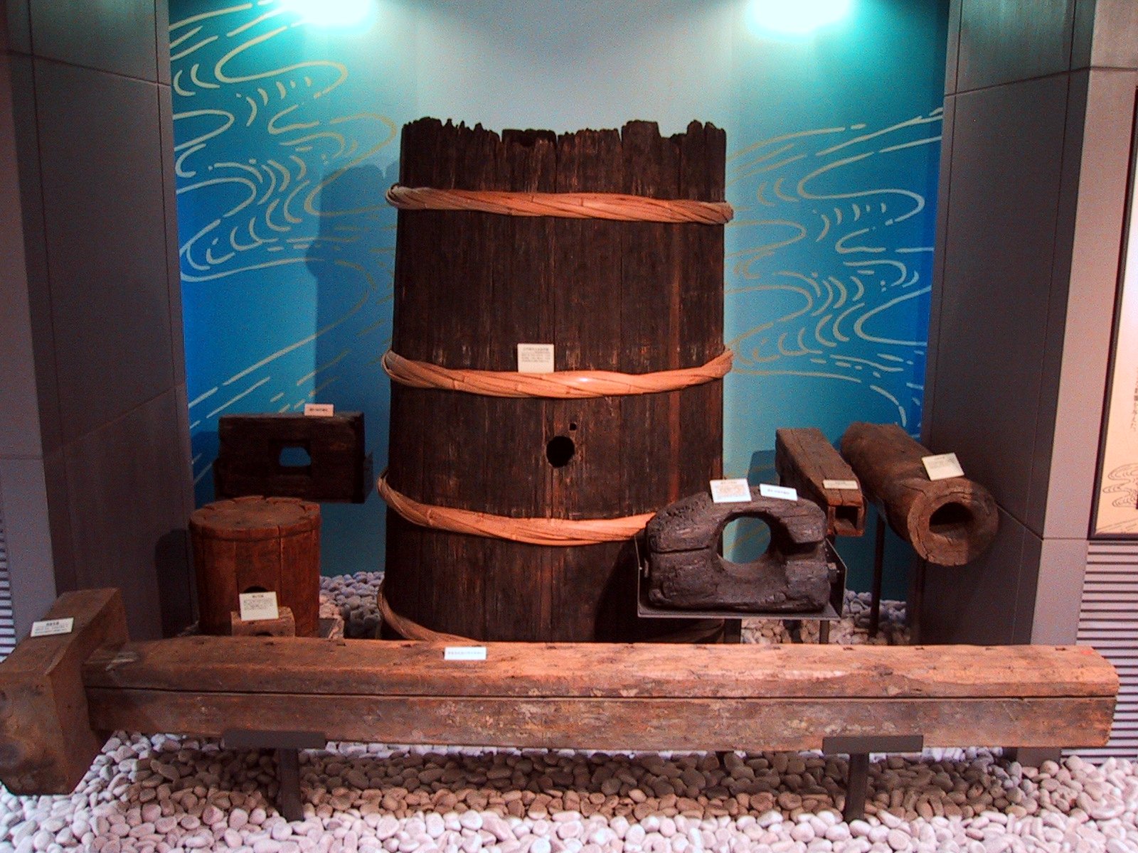
Main lines divided into branches. Stone channels were durable but expensive; wooden conduits were easier to shape and extend. Their boards and joints had to resist leakage while remaining accessible for inspection. Unlike a modern sealed pressure pipe, the system depended on water level and gravity. Rot, shifting ground and damaged joints could reduce supply or contaminate the flow.
Josui Wells: Wells Connected to a Pipe Network
A josui well looked like a well because users lowered buckets into it. Technically, however, it functioned as an access chamber connected to the buried water network. Water supplied through stone or wooden conduits collected in the chamber, where nearby residents could draw it.
This is the key to understanding many images of Edo water use. A person drawing water at a well was not necessarily reaching the natural water table. The “well” might be the final public interface of a long system beginning at a pond, spring or river dozens of kilometers away.
Who Paid for and Managed Edo’s Water?
The shogunate supervised the major waterworks, but everyday operation involved hereditary water officials, contractors, town administrators and residents. Duties included checking intake and flow, clearing channels, repairing conduits, preventing unauthorized diversions and responding to breaks.
Costs were not simply absorbed by a modern public utility. Towns and property holders could bear assessments and maintenance obligations. Access also varied by district, status and location. Edo’s system was extensive, but it was neither perfectly equal nor universally free.
Water, Fire and Public Health
Josui water supported drinking, cooking and daily household work. Shared wells and stored water could also be used during fires, but the network could not by itself prevent the large conflagrations for which Edo was famous. Wooden buildings, wind, dense settlement and limited pressure placed severe limits on firefighting.
Open canals were vulnerable to debris and pollution. Wooden pipes decayed, joints leaked and stagnant sections required attention. These weaknesses do not mean Edo’s water was uniformly unsafe, but they explain why a rapidly modernizing capital eventually required filtration, iron pipes, pressure and more systematic sanitary control.
Six Aqueducts—and Why Two Became Dominant
Edo’s water history was broader than Kanda and Tamagawa alone. Honjo (also called Kameari), Aoyama, Mita and Senkawa waterworks were also developed. Four of these later systems were abolished in 1722, leaving Kanda and Tamagawa as the principal networks.
Older explanations sometimes give one neat reason for the closures, such as concern about groundwater or cost. In practice, policy, finance, maintenance and changing demand all mattered, and the surviving evidence does not justify reducing the decision to a single cause.
From Josui to Modern Waterworks
After the Meiji Restoration, Kanda and Tamagawa Josui continued to serve Tokyo as “traditional waterworks.” Yet the expanding city increasingly needed filtered water, iron mains and pressurized distribution. Yodobashi Purification Plant became the center of the new system.
Modern water supply began in 1898 from Yodobashi toward Kanda and Nihonbashi. In 1901, direct city supply through the old Kanda and Tamagawa systems ended. Tamagawa Josui itself did not disappear: it continued as a channel feeding the purification works and later remained important as water infrastructure, historic landscape and environmental corridor.
Today, the upper section from Hamura to the Kodaira monitoring area still carries raw water for Tokyo’s modern system, while water conditions farther downstream differ by section. The restored flow seen in some lower reaches is not simply unchanged Tama River water traveling exactly as it did in 1654.
What Remains in Central Tokyo
At Ochanomizu and Suidobashi, the original elevated wooden flume is gone, but the valley, river and place names preserve its setting. The Tokyo Waterworks Historical Museum in Hongo explains the system with maps, wooden pipes and a reconstructed josui well. Nearby Hongo Kyusuijo Park displays a relocated and reconstructed section of Kanda Josui stone conduit.
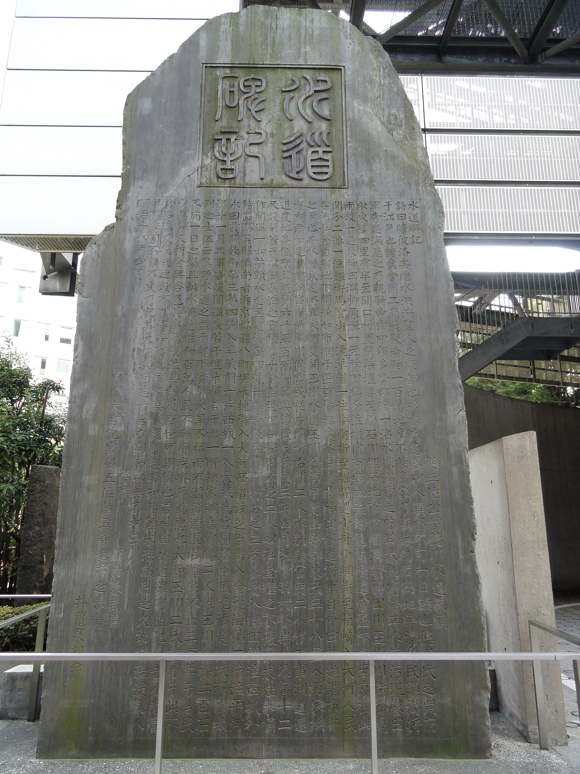
At Yotsuya Okido, a stone monument marks the former waterworks guardhouse area where Tamagawa water entering Edo was monitored. The monument dates from the modern period; it is not the Edo-period guardhouse itself.
Following Tamagawa Josui Farther West
The aqueduct can also be followed through western Tokyo. Hamura preserves the intake area; long sections near Kodaira, Mitaka and the Inokashira area survive as open water, green corridors or covered routes. The full line is too long for one casual day walk, and access conditions vary. The nationally designated historic-site area covers much, but not all, of the former 43-kilometer route.
A Compact Historical Walk: Ochanomizu, Suidobashi and Hongo
- Begin at Ochanomizu Station and look into the Kanda River valley from Hijiribashi or Ochanomizubashi.
- Walk toward Suidobashi while considering where the Kanda Josui flume once crossed the river.
- Continue to the Tokyo Waterworks Historical Museum at 2-7-1 Hongo.
- Finish at Hongo Kyusuijo Park to see the reconstructed stone conduit.
As of July 2026, the museum is open 9:30 a.m.–5:00 p.m., with admission until 4:30 p.m. Admission is free. It normally closes on the fourth Monday of each month, with holiday adjustments, and from December 28 to January 4. Check the official calendar before visiting.
A Second Visit: Yotsuya Okido
At Yotsuya Okido, the story shifts from landscape-scale canal to buried urban network. Look for the waterworks monument and imagine the former guardhouse checking water before distribution beneath Edo. The site pairs well with a walk around Shinjuku Gyoen, but opening days and admission conditions should be checked separately.
Frequently Asked Questions
How did Edo get clean water?
Water from ponds, springs and rivers was carried by gravity through Kanda Josui, Tamagawa Josui and other systems, then distributed through stone and wooden conduits to shared water-supply wells.
Did people in Edo drink groundwater?
Yes, in places where usable groundwater was available. But many districts, especially low-lying areas near the bay, also depended on josui water.
What is the difference between Kanda Josui and Tamagawa Josui?
Kanda Josui was the earlier major network serving the castle and northern and eastern districts. Tamagawa Josui was the longer mid-seventeenth-century system that supplied expanding southern and western districts.
How did water flow without pumps?
The canals and conduits followed a gentle downward gradient, using gravity and differences in water level.
How long was the Tamagawa Aqueduct?
The open canal from Hamura to Yotsuya Okido was about 43 kilometers long, with an elevation difference of roughly 92 meters.
Who built the Tamagawa Aqueduct?
The Tamagawa Brothers were the principal contractors, but the project also depended on shogunal officials, surveyors, laborers, villages and later water managers.
Did the Tamagawa Brothers build it in eight months?
Official histories preserve the account that the open canal was excavated in about eight months. It should be treated as a historical record or tradition, not a modern precision construction log.
What were wooden water pipes?
They were buried conduits assembled from wooden boards or hollowed sections, carrying water by gravity beneath Edo’s streets.
What was a josui well?
It was a well-like chamber connected to the water-supply network, not necessarily a shaft drawing natural groundwater.
Did every house have running water?
No. Many residents collected water from shared wells or access points rather than receiving water directly from a household tap.
Why were the old aqueducts replaced?
Modern Tokyo needed filtration, iron pipes, pressure, improved sanitation and stronger firefighting capacity.
Can visitors still see Edo’s water system?
Yes. Visitors can see landscapes, place names, monuments, museum displays, reconstructed conduits and surviving sections of Tamagawa Josui.
Is Tamagawa Josui still carrying drinking water?
The upper section still carries raw water for Tokyo’s modern supply. Conditions in lower sections vary, and not all visible water follows the original historical operation.
What does Suidobashi mean?
It means “waterworks bridge,” recalling the crossing where Kanda Josui once passed over the Kanda River valley.
Sources and Further Reading
- Tokyo Metropolitan Government Bureau of Waterworks: History of Tamagawa Josui
- Tokyo Waterworks Landmark: Tamagawa Josui
- Tokyo Waterworks Historical Museum
- Edo-Tokyo Museum: Tamagawa Waterworks
- EDO TOKYO Digital Museum: Urban Formation
- Shinjuku Tourism Association: Yotsuya Okido
Read Tokyo through Water and Topography
Return to the view at Ochanomizu. The wooden flume is gone, but the steep valley explains why it was needed. Suidobashi preserves the crossing in a place name; Hongo preserves the pipes in a museum and reconstructed conduit; Yotsuya marks the point where an open canal became an underground city network.
The achievement was not technology alone. Edo’s water depended on terrain, administration, labor, fees, inspection and repair. To follow those layers on today’s streets, see our guide to reading old Japanese maps in modern Tokyo and compare this supply system with the flood-control engineering of the Arakawa Floodway. Then look again at Tokyo’s slopes, rivers, bridges and greenways: they are records of how the city learned to move water.
Image credit for the featured image: Hasegawa Settan, Edo Meisho Zue (1834), National Diet Library Digital Collections, via Wikimedia Commons. Public domain.