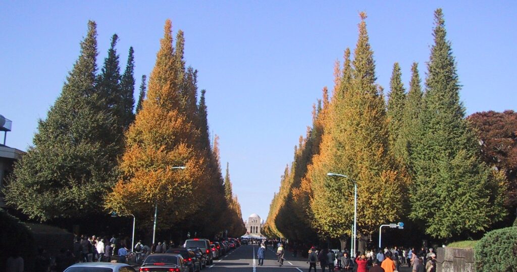
One of Tokyo’s sleekest fashion districts was built around a cemetery and a former military parade ground. Behind Aoyama’s designer boutiques, glass façades and architecture landmarks are 26 hectares of graves, an imperial memorial landscape and the remains of a road once used by pilgrims and travelers leaving Edo. The contrast is not accidental: it is the reason modern Aoyama looks unlike anywhere else in the city.
The district began as the western edge of the shogun’s capital, where samurai estates and service communities lined the route toward Mount Oyama. After the Tokugawa system collapsed, the Meiji government converted former feudal land into a public cemetery and military grounds. Emperor Meiji’s funeral then helped transform the parade ground into Meiji Jingu Gaien, while streetcars, subways and Route 246 turned the old highway into a metropolitan commercial axis.
Modern Aoyama exists because these immense public landscapes were never fully absorbed by private development. The cemetery and Gaien preserved space; Aoyama-dori concentrated traffic and offices; and smaller backstreets created room for galleries, studios and boutiques. Fashion did not erase Aoyama’s history. It grew inside an urban framework created by samurai land, death, military ceremony and state-led modernization.
Why Aoyama looks the way it does today
Modern Aoyama is the result of repeated spatial reorganization. Edo-period samurai estates, service communities and the Oyama Road formed one layer. In the early Meiji period, the new government created a public cemetery and military grounds on former feudal land. The Aoyama Parade Ground became a setting for military reviews and imperial ceremony, then part of its site was transformed into Meiji Jingu Gaien after Emperor Meiji’s death. Earthquake, war damage, road improvement, streetcars, subways and motor traffic altered movement through the district. Postwar architecture, advertising, design, galleries and fashion retail accumulated later, especially around Aoyama-dori and the eastern end of Omotesando.
The result is a district where large spaces formed by government and public institutions coexist with fine-grained private development. The cemetery and Gaien remain unusually extensive open landscapes; Aoyama-dori operates as a metropolitan traffic and business axis; and the backstreets of Kita-Aoyama and Minami-Aoyama support smaller buildings and specialized businesses.
Geography, roads and the boundaries of Aoyama
Aoyama lies on the uplands west of central Edo and Tokyo, cut by slopes and shallow valleys. Higher ground favored roads, estates and later large institutions, while differences in elevation still appear in the approaches to the cemetery and in side streets descending away from the main avenues.
The name requires care. Historical Aoyama was a broad and changing place-name. Today, Kita-Aoyama and Minami-Aoyama are official neighborhoods in Minato City, divided broadly by Aoyama-dori. Omotesando is both a street and a widely used district name extending across administrative boundaries. Its eastern section is closely tied to Aoyama, but Harajuku, Aoyama and Omotesando are not interchangeable. Meiji Jingu Gaien also extends beyond a simple modern definition of Aoyama and is best understood as a larger memorial landscape adjoining the district.
Before Edo: landscape before the name Aoyama
Roads and settlements existed on the western approaches to the future shogunal capital before the Edo period, but the evidence does not support projecting today’s broad place-name backward unchanged. Minato City’s history of local names notes that “Aoyama” is not confirmed as an older regional name before its association with the Aoyama family. The safer starting point is therefore the landscape—upland, valleys, routes and scattered settlements—rather than a timeless neighborhood boundary.
Edo Aoyama: samurai estates, service towns and the Oyama Road
The place-name is associated with Aoyama Tadanari, a senior Tokugawa retainer who received land here in 1590. The holdings of the Aoyama family became an important reference point, but they did not cover every place later called Aoyama. As Edo expanded, parts of the surrounding land developed into samurai estates, temple approaches, village ground and service communities bearing names such as Aoyama Hyakunin-cho and Aoyama Rokken-cho.
The main road was equally important. The Oyama Road, also called the Atsugi Road in later usage, connected Edo with destinations to the southwest and with pilgrimage routes toward Mount Oyama. In central Tokyo its broad successor is known as Aoyama-dori, part of National Route 246. The modern avenue is not simply an untouched Edo road: widening, engineering, streetcar construction, automobile traffic and postwar rebuilding repeatedly changed its form. Yet the corridor’s long role in carrying movement westward helped make it the district’s durable urban spine.
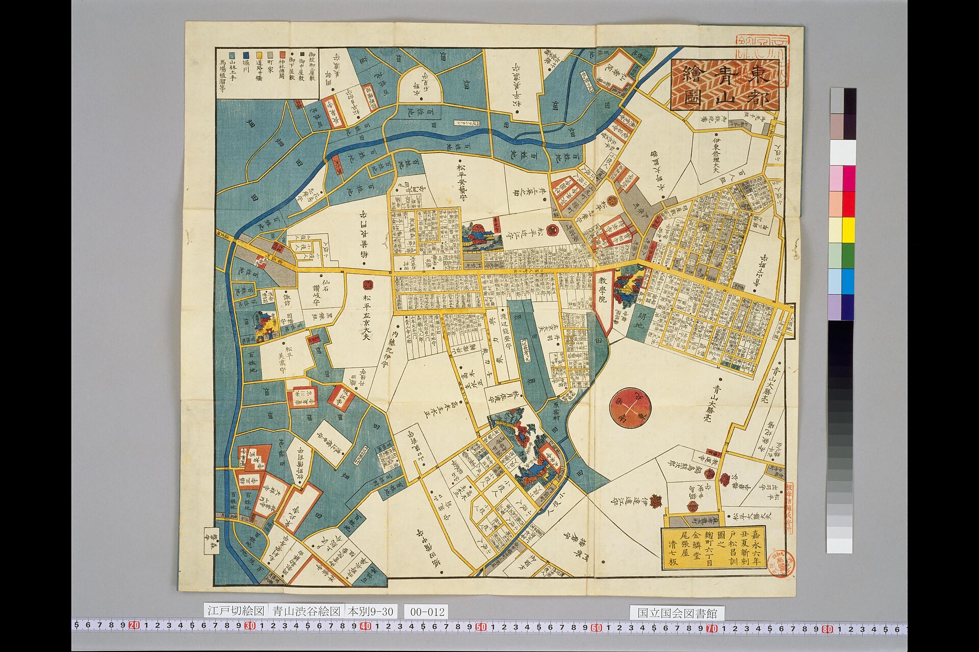
This mid-nineteenth-century kiriezu shows the mixed landscape of estates, roads and settlements on Edo’s western edge. Kiriezu were practical urban guides rather than uniform modern survey maps, so their orientation, scale and symbols should be read comparatively rather than matched building by building to the present city.
From samurai land to a public cemetery
The Meiji Restoration dismantled the feudal estate system and made large tracts of former samurai land available for new national and urban institutions. Burial policy was also changing. Under the Edo system, temples had managed most burials through parishioner relationships. In 1874 the Meiji government restricted burial within the old urban boundary and established rules for public cemeteries. Aoyama was among the sites designated and developed for public use.
Aoyama Cemetery opened on September 1, 1874. It later came under Tokyo’s municipal administration and developed into one of the capital’s major public cemeteries. A foreign cemetery section was established in the Meiji period as Tokyo’s international population grew. The cemetery was therefore more than a collection of famous graves: it embodied a new public system for managing burial in a rapidly modernizing capital.
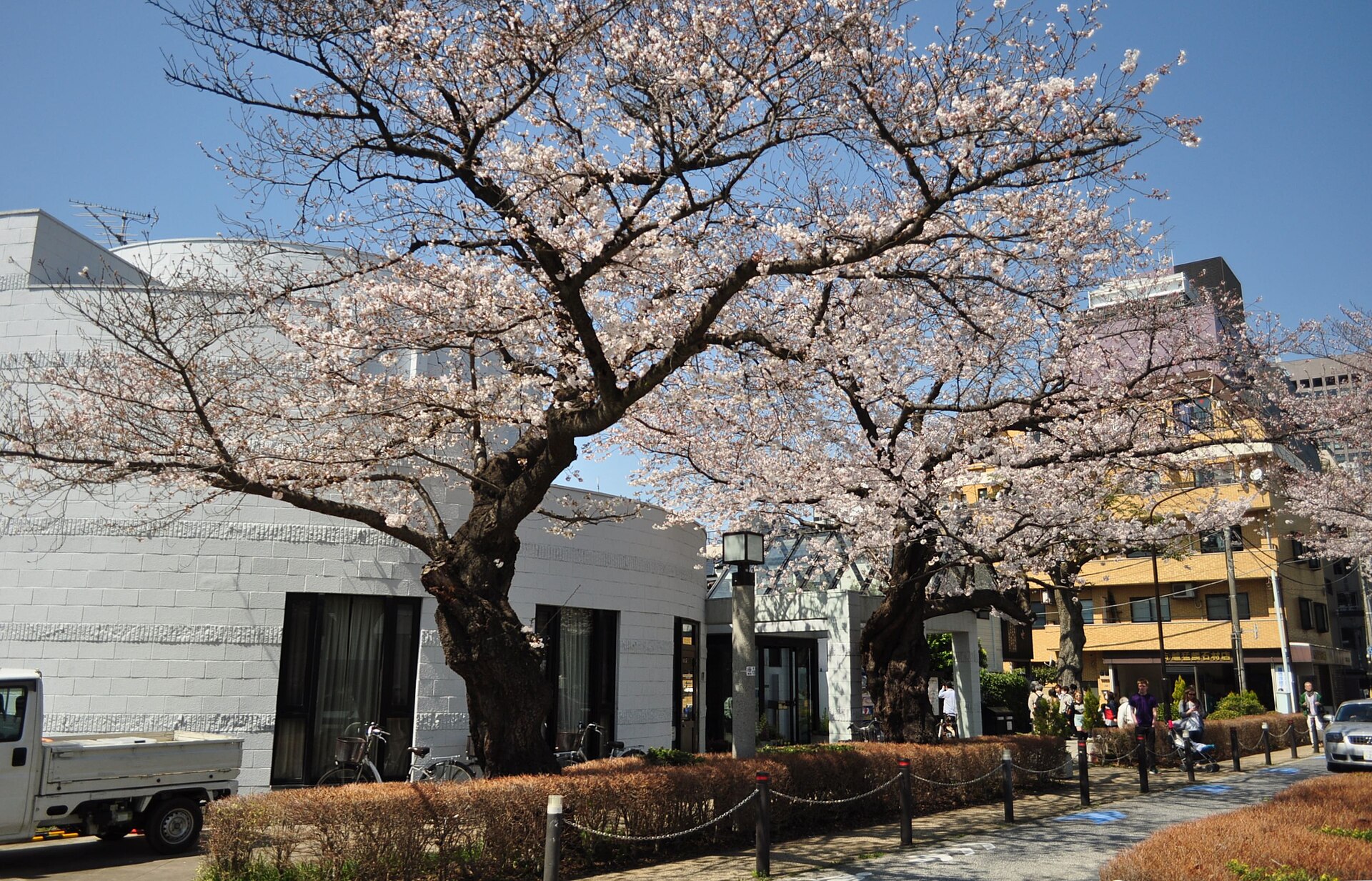
Today the cemetery covers about 26 hectares and functions visually as a major green void within Minami-Aoyama. Its tree-lined paths are a present landscape shaped by long management and planting, not a scene preserved unchanged from 1874. Even so, the size of the site still reveals the scale at which the early Meiji state reorganized former feudal land.
The Aoyama Parade Ground and imperial spectacle
Another large area of former estate and peripheral land became military space. The Aoyama Parade Ground was used for drill, reviews and ceremonies by the modern army. Such grounds required open, controlled terrain on a scale difficult to obtain in the dense center of Tokyo. Their presence reinforced the contrast between institutional land and the growing civilian city around it.
Military reviews were also public images of the new state. They brought the emperor, officers, soldiers and spectators into a carefully staged relationship. The parade ground therefore served training and logistics, but it also helped visualize national authority.
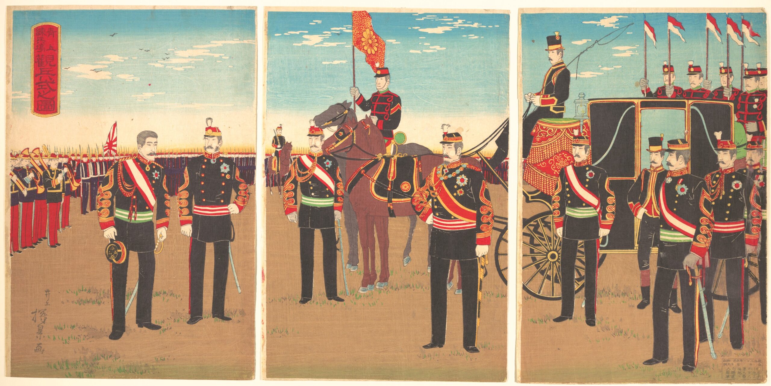
Inoue Yasuji’s 1888 triptych records the visual culture of an imperial military review. It is evidence of ceremony and representation rather than a photographic or surveyed record of every uniform, building and distance shown.
From military ground to Meiji Jingu Gaien
The decisive transition began with Emperor Meiji’s death in 1912. His state funeral was held on September 13 at a funeral pavilion on the former Aoyama Parade Ground. The association between this place and imperial commemoration shaped plans for Meiji Jingu Gaien, the “outer precinct” paired conceptually with Meiji Jingu’s inner shrine grounds near Harajuku.
Construction was organized through a national commemorative movement supported by donations and volunteer labor. A groundbreaking ceremony took place in 1918. When the Great Kanto Earthquake struck on September 1, 1923, work was interrupted and the site was opened to displaced people, with relief facilities established there. The stadium was completed in 1924, and the Gaien was formally completed and dedicated in 1926 with the Meiji Memorial Picture Gallery, baseball ground, sporting facilities and landscaped approaches.
Meiji Jingu Gaien was never merely a neighborhood park. It combined memorial purpose, imperial history, monumental planning, sport, culture and public gathering. Its broad axes and facilities reused military land but did not reproduce the parade ground exactly. The ginkgo avenue and the approach to the Picture Gallery created a new spatial order, transforming open military terrain into a civic and commemorative landscape.
Earthquake, air raids and reconstruction
The 1923 earthquake accelerated population movement and construction in western Tokyo, while Gaien itself temporarily served emergency needs. Two decades later, wartime air raids damaged wide areas of the capital. Aoyama’s postwar form emerged through rebuilding rather than simple restoration: structures were replaced, traffic demands grew, and land values favored larger offices and commercial buildings along major roads.
The cemetery and Gaien survived as large institutional landscapes while much of the surrounding built fabric was renewed. This difference in the speed of change is one reason Aoyama still alternates so sharply between long-established open space and intensely redeveloped street frontage.
Aoyama-dori: from highway to metropolitan urban axis
The old westward road corridor became a modern transportation axis through successive technologies. Streetcars brought frequent urban transit along the avenue in the early twentieth century. The Ginza subway line reached the Aoyama area before the war, tying Aoyama-itchome, Gaiemmae and Omote-sando more closely to Shibuya, Ginza and the central business districts. Later subway additions, including the Hanzomon Line and Toei Oedo Line connections, strengthened Aoyama-itchome as an interchange.
Motorization and the designation of the corridor as National Route 246 further enlarged its traffic role. Broad carriageways encouraged offices, showrooms and large commercial buildings, while the blocks behind them retained smaller lots and quieter residential streets. Aoyama-dori therefore acts not only as a road but as a boundary and development engine separating and connecting different urban textures.
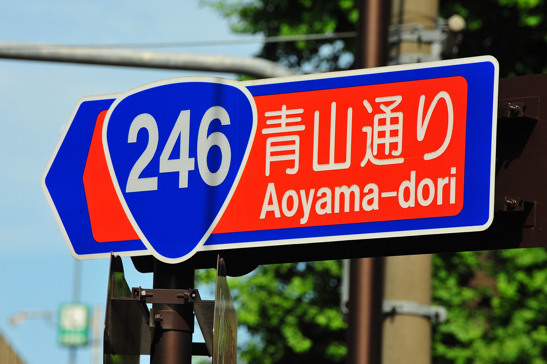
This 2009 view shows the mature automobile and commercial corridor, not the earlier Oyama Road or the immediate postwar streetscape. What persists across the periods is the corridor’s importance; its width, traffic technology and architecture have repeatedly changed.
The postwar city: Olympics, architecture and cultural industries
The 1964 Tokyo Olympics intensified redevelopment across the western center of the city. New and improved roads, sporting facilities and international attention affected the larger belt from Gaien through Aoyama to Yoyogi. Yet the Olympics were one catalyst among several. Rapid economic growth expanded office employment and consumer markets; architecture and advertising industries clustered in central locations; galleries, cafés and cultural institutions drew audiences; and improved transit made the district accessible from across metropolitan Tokyo.
Aoyama’s varied parcel structure was important. Major avenues could support prominent buildings, while side streets accommodated studios, small galleries, specialist retailers and residences. This combination allowed cultural and commercial networks to develop without producing a uniform business district.
How Aoyama became a fashion district
Aoyama was not always a fashion district, and no single boutique or architect created its reputation. From the 1960s onward, proximity to Harajuku and Omotesando, growing consumer culture, design and advertising businesses, international travel, fashion media and new retail formats gradually changed the area’s image. Omotesando’s broad avenue attracted large stores and architectural statements; Minami-Aoyama’s quieter streets offered space for boutiques, studios and galleries; Kita-Aoyama connected these commercial zones with Gaien and major transit.
The district’s fashion identity differed from Harajuku’s youth street culture. Harajuku became famous for public self-fashioning, dense youth retail and subcultures, while Aoyama was more strongly associated with design professions, galleries, established labels, high-end retail and architecture. The two areas interacted, especially along Omotesando, but their urban histories and commercial scales remained distinct.
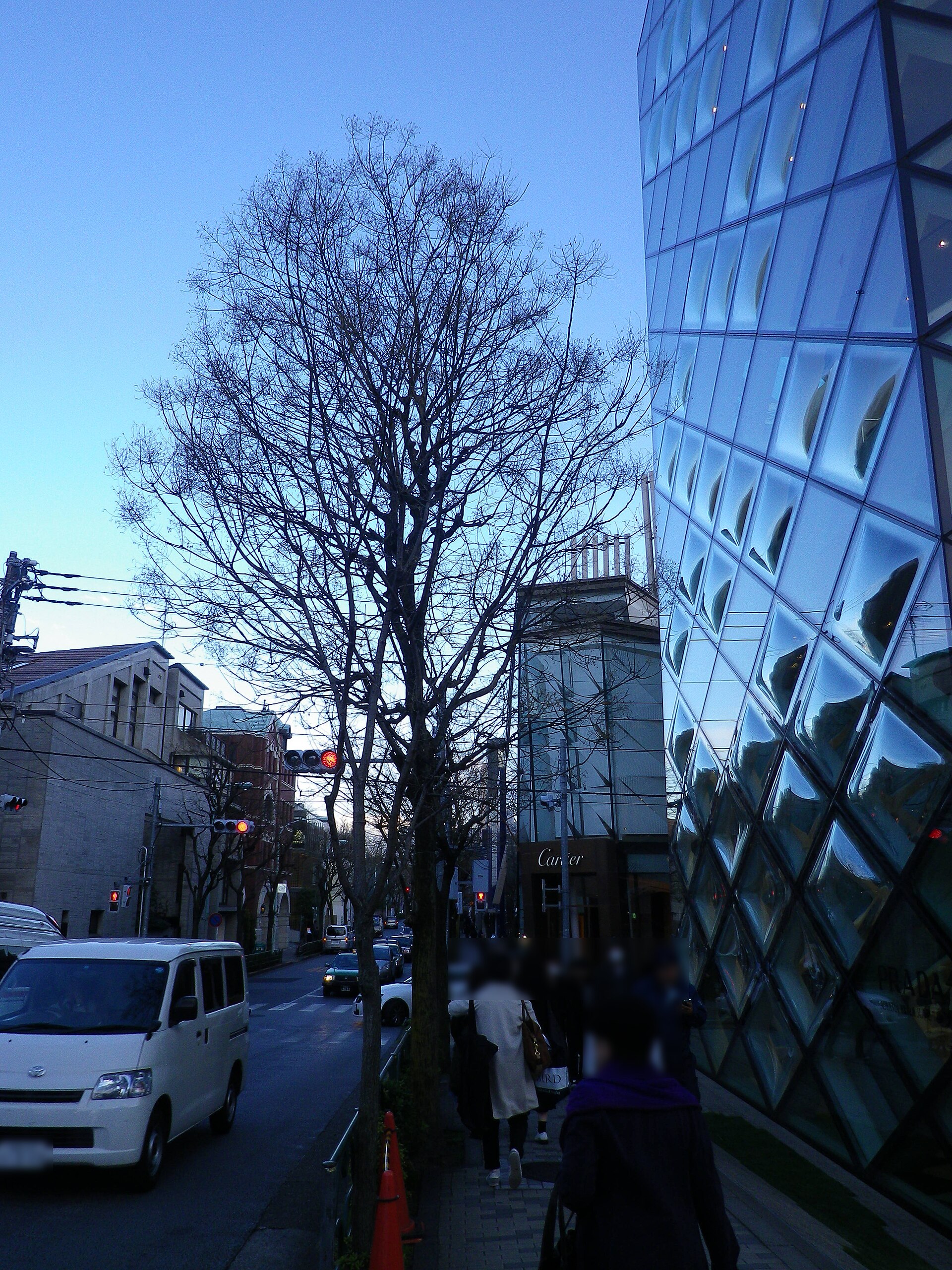
The Prada Aoyama building, completed in 2003 to a design by Herzog & de Meuron, is one conspicuous example of architecture functioning as part of retail identity. Its importance lies less in one brand than in a wider pattern: Aoyama became a place where buildings, streetscape, media visibility and specialized consumption reinforced one another.
Kita-Aoyama and Minami-Aoyama: one name, different urban textures
Kita-Aoyama is closely tied to Gaien, the stadium area, Aoyama-itchome, Gaiemmae and the northern side of Aoyama-dori. Monumental open spaces, sports facilities, offices and the approach toward Omotesando shape its character. Minami-Aoyama contains the cemetery, residential districts, embassies and a dense mixture of architecture, galleries, offices and specialized shops.
The division is not absolute, but it helps explain why “Aoyama” can feel formal and expansive in one block, green and quiet in another, then intensely commercial nearby. The district’s identity comes from the adjacency of these different land-use histories rather than from visual uniformity.
Historical traces you can still see
- Aoyama Cemetery: the scale of early Meiji public land reorganization and the continuing presence of a major metropolitan cemetery.
- Meiji Jingu Gaien: a memorial axis, picture gallery and sporting landscape created from former military ground.
- Aoyama-dori: the durable westward corridor whose form changed from road to streetcar street, national highway and subway-served commercial avenue.
- The contrast between main streets and backstreets: large buildings on valuable frontages beside smaller parcels suited to studios, shops and residences.
- Kita-Aoyama and Minami-Aoyama: different concentrations of institutional space, cemetery land, offices, housing and cultural commerce.
Aoyama through time
| Era | Dominant land use | Institutions and infrastructure | Lasting trace today |
|---|---|---|---|
| Before Edo | Upland routes, valleys and settlements | Local roads | Topography beneath the modern city |
| Edo period | Samurai estates, service towns, village edges | Oyama Road | Aoyama name and westward road corridor |
| Early Meiji | Former feudal land reorganized | Public cemetery and military grounds | Aoyama Cemetery and large institutional parcels |
| Late Meiji–Taisho | Parade ground, ceremony and new transit | Army, streetcars, imperial funeral | Framework for Gaien and the modern avenue |
| 1920s–1930s | Memorial, sport and growing city | Meiji Jingu Gaien, stadium, subway | Picture Gallery axis and sporting landscape |
| Postwar decades | Reconstruction, offices and commerce | Route 246, expanding subway network | High-density frontage along Aoyama-dori |
| Late twentieth century–today | Design, culture, fashion and mixed residence | Galleries, specialist retail, landmark architecture | Large flagship buildings and small backstreet businesses |
Frequently asked questions
Why is Aoyama called Aoyama?
The name is associated with Aoyama Tadanari and the Aoyama family, who received land here after Tokugawa Ieyasu entered Edo in 1590. It later spread from estate- and town-related names into a broader district name.
Was Aoyama always a fashion district?
No. Its fashion and design identity developed mainly after World War II through transport access, consumer growth, architecture, media, galleries, specialist retail and interaction with Omotesando and Harajuku.
How did Aoyama Cemetery shape the neighborhood?
It preserved a very large public institution within an increasingly dense district. The cemetery limited ordinary redevelopment across its grounds and created the green spatial contrast now characteristic of Minami-Aoyama.
What was the Aoyama Parade Ground?
It was a modern army training and ceremonial ground used for drills and imperial military reviews. After Emperor Meiji’s funeral was held there in 1912, part of the site became the setting for Meiji Jingu Gaien.
Is Omotesando part of Aoyama?
The eastern part of Omotesando is closely associated with Aoyama and includes addresses in Kita-Aoyama and Minami-Aoyama, but the avenue continues into Jingumae in Shibuya City. Omotesando, Aoyama and Harajuku overlap culturally without being identical places.
Sources and references
- Minato City, History of Place Names: Akasaka Area.
- Tokyo Metropolitan Park Association, Aoyama Cemetery.
- Tokyo Metropolitan Park Association, History of Metropolitan Cemeteries.
- Meiji Jingu Gaien, Purpose of the Gaien’s Creation.
- Meiji Jingu Gaien, Historical Chronology.
- National Diet Library Digital Collections, mid-nineteenth-century Aoyama-Shibuya kiriezu.
- The Metropolitan Museum of Art, Inoue Yasuji, Review of Troops at the Aoyama Parade Grounds (1888).
Related neighborhood history
For the neighboring district’s different path from shrine landscape and U.S. military housing to street fashion, read The History of Harajuku.
Explore more of Tokyo’s layered cityscape
Browse the Neighborhood Histories, Stories and Self-Guided Walks from TimeWalk Japan to see how roads, institutions and redevelopment shaped other parts of the city.
Walk Tokyo with TimeWalk Japan
Aoyama becomes easier to read when its cemetery, avenues, memorial spaces and backstreets are understood as different historical layers. Join the wider TimeWalk Japan community through the site’s published walks and stories, and look beyond the storefronts to the land uses that made the district possible.