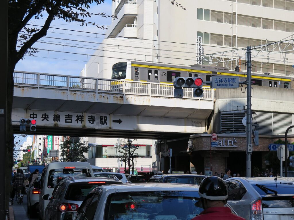
Kichijoji is famous for a beautiful park, fashionable cafés and one of Tokyo’s most desirable residential districts. Yet the neighborhood exists because a catastrophic fire destroyed part of Edo in 1657 and forced displaced residents to build a new village far outside the city. Even its name is a memory of the place they lost: Kichijoji Temple never stood here.
The refugees organized their settlement along the Itsukaichi Kaido, with homes facing the road and long fields stretching behind them. More than two centuries later, a railway station pulled the center of activity away from that old highway. Inokashira Park then added metropolitan leisure, while postwar scarcity created the tiny shop fronts and passages of Harmonica Yokocho.
Modern Kichijoji exists because four very different landscapes accumulated without completely erasing one another: a fire-refugee village, a railway suburb, a park destination and a postwar market town. Its popularity today is not the result of one master plan. It comes from the unusually close coexistence of green space, transport, small commerce and cultural life.
Why Kichijoji Looks the Way It Does Today
| Period | Major Change | Urban Effect | What Can Be Seen Today |
|---|---|---|---|
| Before the seventeenth century | Musashino upland and spring landscape | Topography shaped routes and land use | The descent toward Inokashira Pond |
| 1650s–Edo period | Resettlement along the Itsukaichi Kaido | Road-facing lots with fields behind | The highway line and elongated blocks |
| Meiji railway era | Kōbu Railway and 1899 station opening | A new station-centered node | The rail corridor and converging streets |
| 1910s–1930s | Park, migration and Inokashira Line | Leisure and housing expanded together | Park approaches and two-line access |
| Wartime and postwar | Disruption and station markets | Small-plot commercial recovery | Harmonica Yokocho’s compact grain |
| 1960s–1970s | Rail, road and retail redevelopment | A regional commercial center | Arcades, plazas and large stores |
Geography before the Town
Kichijoji lies on the Musashino upland, the broad terrace west of central Tokyo. Much of the plateau historically had limited surface water, while valleys and spring-fed depressions created sharply different environments. South of the station, the land drops toward Inokashira Pond, associated with the headwaters of the Kanda River system. Gotenyama mediates between the commercial center and this pond landscape, and the short walk downhill still makes the underlying topography visible.
A Community Displaced from Edo
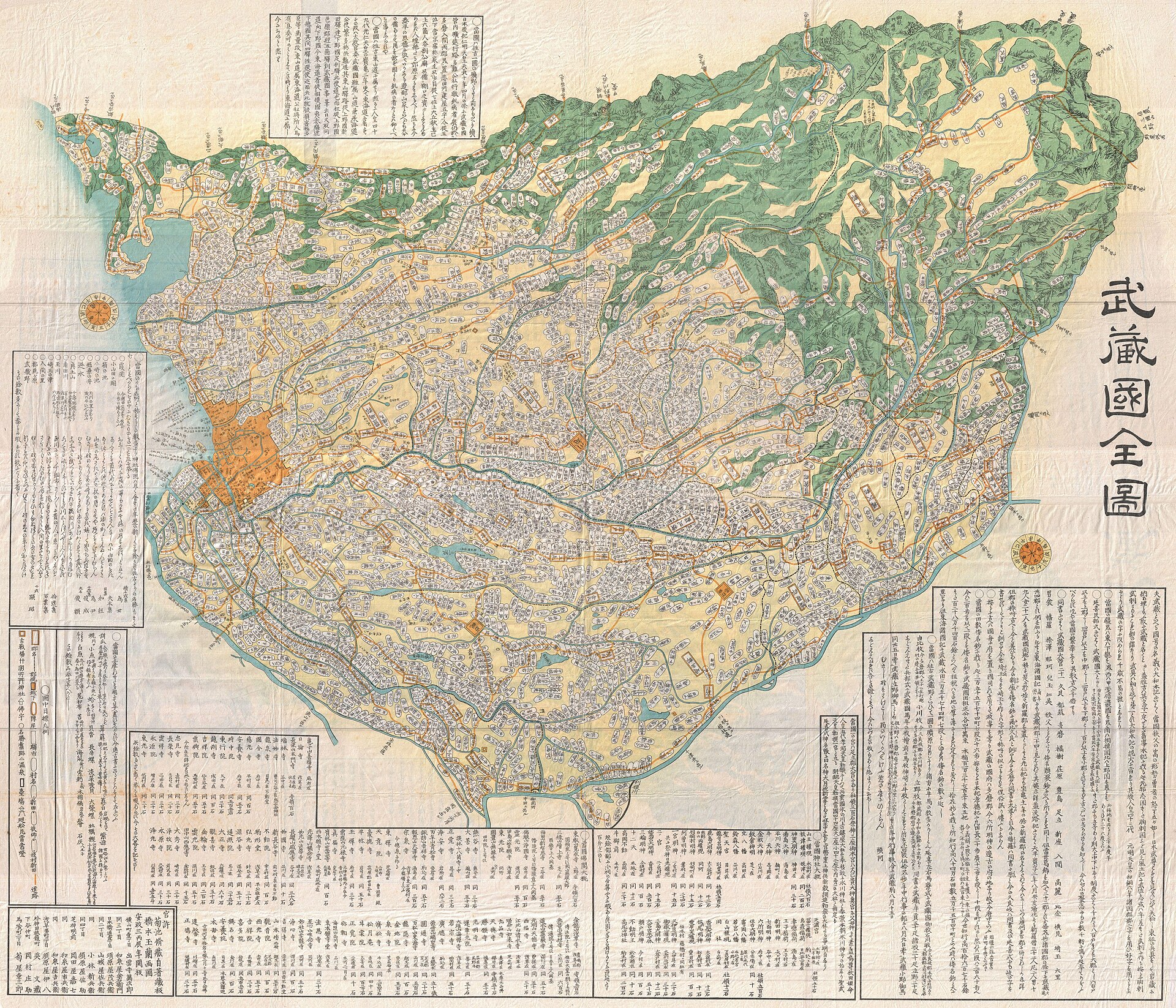
The place-name Kichijoji came from Edo, not from a temple transferred to the present neighborhood. In 1657, the Great Fire of Meireki devastated much of Edo, including the monzen, or temple-front community, associated with Kichijoji temple. The temple was reestablished elsewhere, while some residents received land on the Musashino upland. Municipal accounts place surveying, allocation and settlement across the late 1650s, so the village is best understood as a process rather than a single founding day.
The newcomers entered a landscape of planned cultivation and roadside development. Their new community took the name Kichijoji in memory of the place from which some settlers had come. Calling it a fire-refugee village captures an important origin, but later households, waterworks, farming systems and market connections also shaped the settlement.
The Itsukaichi Kaido and the Shape of Kichijoji Village
The Itsukaichi Kaido was the village’s organizing spine. A kaido was a major road or highway, and this route connected western Musashi with Edo. House plots faced the road, while long narrow fields extended behind them. This strip-like division gave households transport access at the front and agricultural depth to the rear.
The pattern linked rural production to the city. Crops, fuel and other goods moved toward Edo, while urban demand and supplies moved outward. Water remained a constraint on the upland. Later railways, road widening and subdivision altered the old land pattern, but the highway’s east–west line and the orientation of some streets and parcels remain legible.
From Village to Railway Suburb
In 1889, Kichijoji and neighboring settlements became part of Musashino Village under the modern municipal system. The same year, the Kōbu Railway opened through western Tokyo, but trains initially passed without a Kichijoji stop. Kichijoji Station opened in 1899. The railway was nationalized in 1906 and later became part of the Chūō Line.
The station gradually changed the district’s center of gravity. The old village had been oriented toward the highway and farmland; the railway concentrated passengers, shops and services at a new node. It did not instantly create the modern commercial center, but it changed land values and made regular travel to the expanding city easier.
Inokashira Park and the Making of a Leisure Suburb
Inokashira Pond had long been known as a scenic and water-source landscape. Tokyo City planned a public park on former imperial land, which was granted for that purpose in 1913. Inokashira Onshi Park opened on May 1, 1917; onshi indicates an imperial gift.
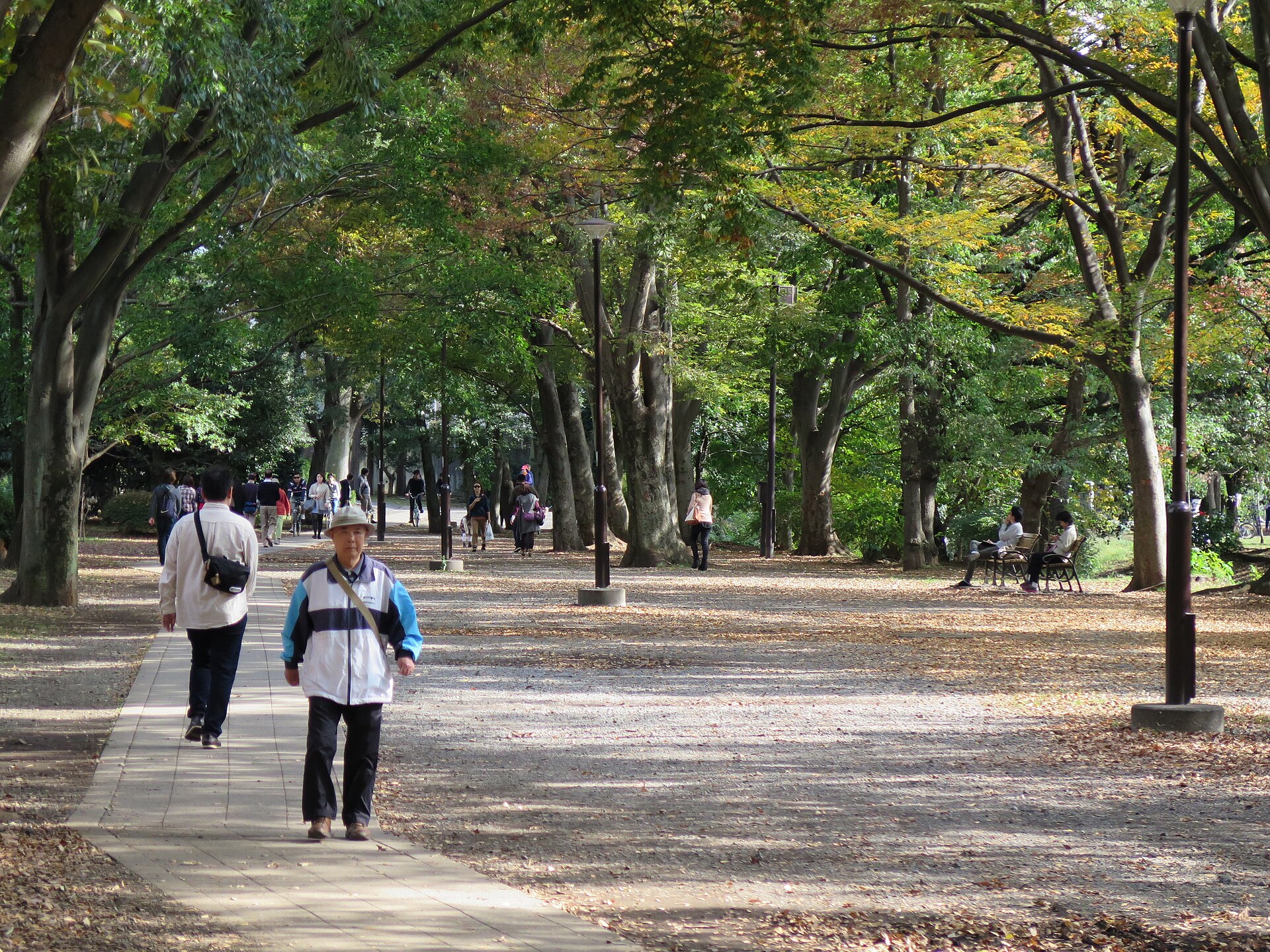
The park gave Kichijoji a second axis of growth. The station became an arrival point for visitors as well as commuters. Leisure and residential development reinforced one another, while preservation of the pond and wooded slopes limited some forms of development south of the station and made green space central to Kichijoji’s identity.
Earthquake Migration and the Interwar Suburb
The Great Kanto Earthquake of 1923 devastated central and eastern parts of the metropolitan region. Kichijoji’s importance lies less in direct destruction than in the movement that followed. Households, schools and businesses looked toward western suburbs where land was available and rail access was improving. Fields were subdivided into residential streets, and retail and educational functions expanded.
The Teito Electric Railway opened from Shibuya to Inokashira Park in 1933 and extended to Kichijoji in April 1934. The line later became today’s Keio Inokashira Line. Its arrival created an interchange with the Chūō corridor and widened Kichijoji’s commercial and cultural connections.
War, Industry and Air Raids
During the 1930s and 1940s, the wider Musashino area became closely tied to military production. Railways carried workers and materials, and western Tokyo became part of the air-war landscape. Air-raid damage was uneven: it is misleading to describe Kichijoji as either wholly destroyed or wholly spared. Transport and daily life were disrupted, and the station district entered the postwar period amid shortages.
The Postwar Market and Harmonica Yokocho
After 1945, the station became the focus of urgent small-scale commerce. Food, clothing and necessities were sold through stalls and compact shops. Some trade belonged to the legally ambiguous environment described as a yami-ichi, or black market, while other activity was ordinary postwar street commerce. Station-front space was divided into narrow frontages and passages.
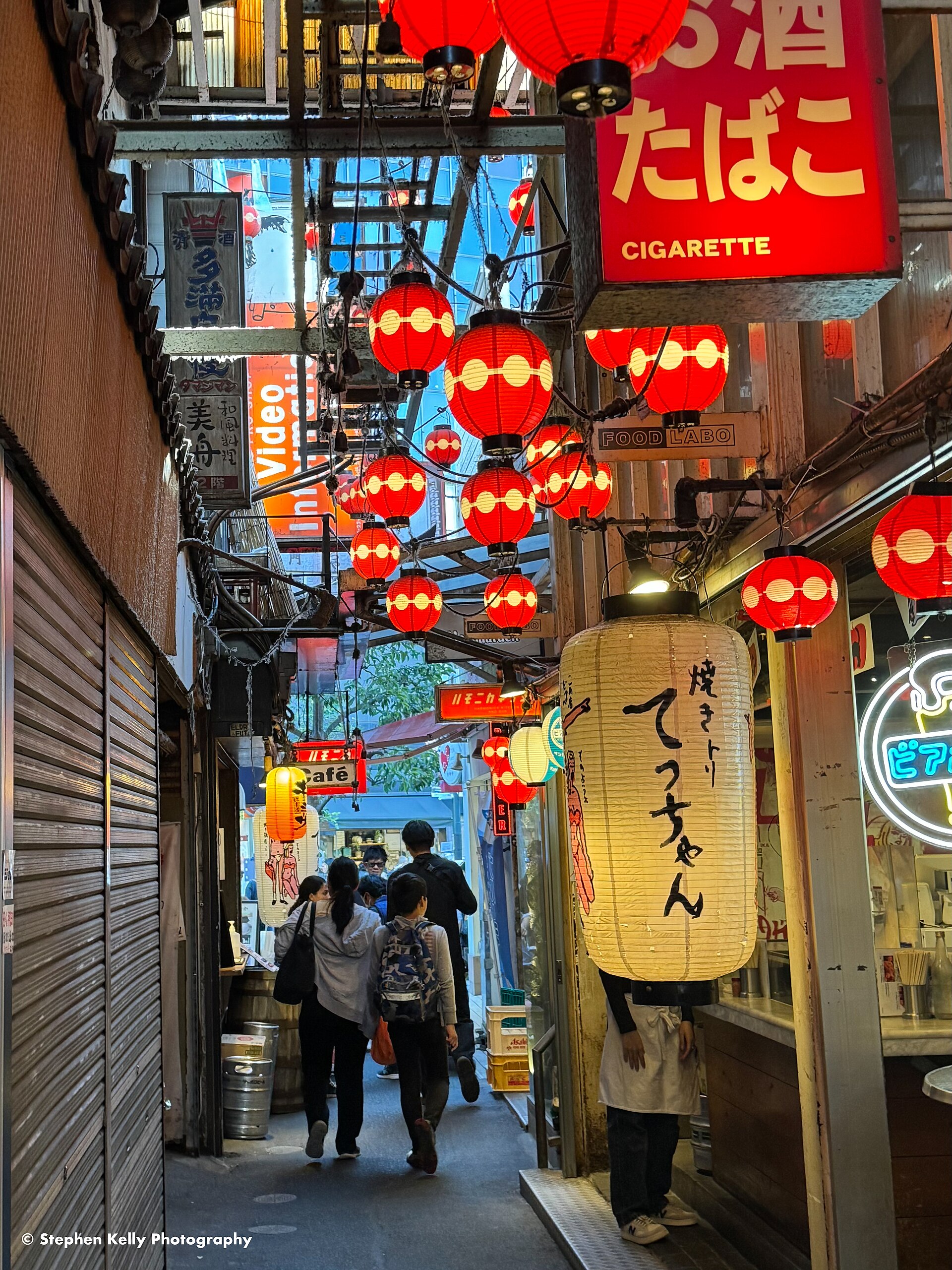
Harmonica Yokocho takes its name from tiny repeated shop openings said to resemble harmonica reeds. A yokocho is a narrow side street or alley. The present yokocho is not an unchanged survival from 1945: tenants, buildings and uses evolved. What remains most powerfully is the compact scale created by postwar scarcity and station-centered demand.
Rebuilding the Station District
From the 1960s into the 1970s, Chūō Line elevation and expanded track capacity reorganized crossings and circulation. Station buildings, bus facilities, plazas and roads concentrated movement in a more deliberately planned center. Department stores and station-linked retail increased Kichijoji’s regional pull, while Sunroad, Daiyagai and Heiwa-dori were modernized as major shopping streets.
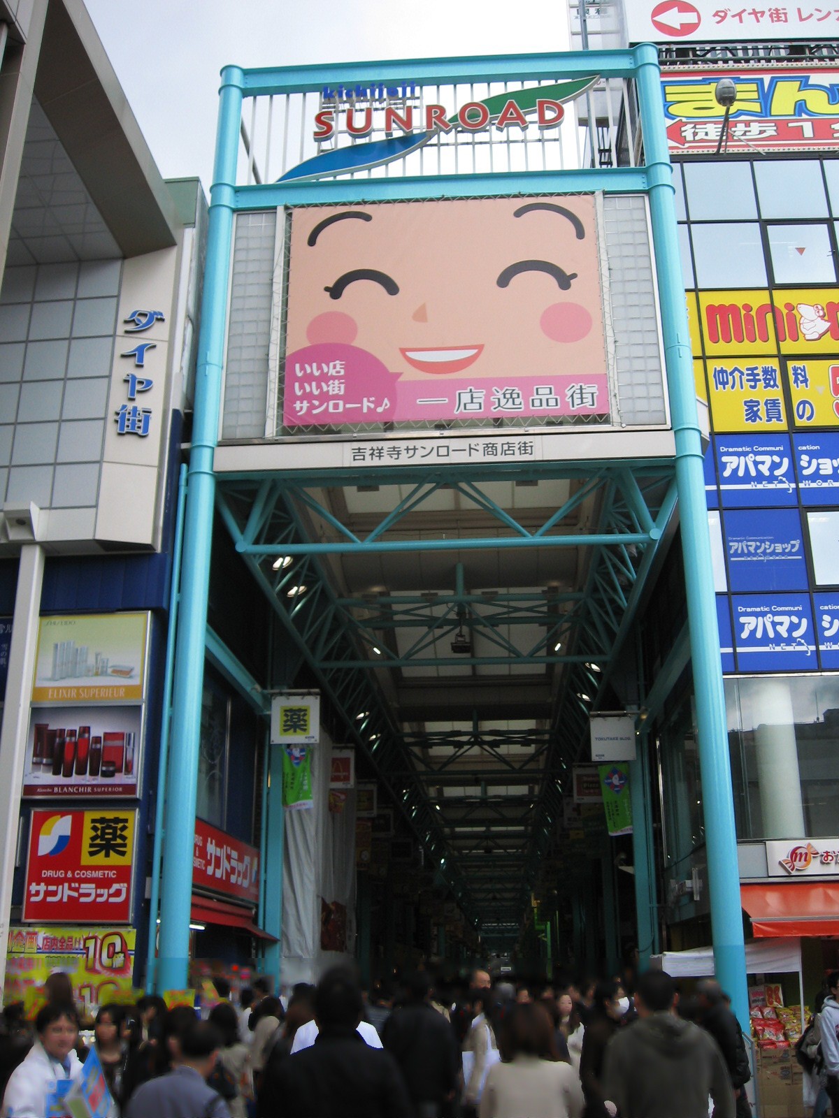
Redevelopment did not produce a uniform downtown. Large buildings required assembled land and capital. Small shops persisted where parcels remained fragmented or intimate pedestrian environments retained value. The adjacency of department store, arcade, alley and residential street is an outcome of uneven redevelopment.
How Kichijoji Became a Cultural Center
Kichijoji’s cultural reputation developed gradually. Interwar suburban growth created audiences for cinemas and cafés; postwar population growth and railway access expanded them. Bookstores, secondhand bookshops, theaters, jazz cafés, live-music venues and creative businesses clustered around the station. Two railway lines, varied rents, dense pedestrian traffic and the nearby park supported a changing ecology of music, publishing, film, manga, theater and café culture.
One District, Several Urban Landscapes
North of the station, Harmonica Yokocho preserves the smallest grain, Sunroad organizes heavier pedestrian movement, and department stores represent capital-intensive metropolitan growth. Farther north, the Itsukaichi Kaido recalls the village’s older structure. South and southwest, streets descend through Gotenyama toward Inokashira Park. Kichijoji’s identity comes from the proximity of highway village, railway interchange, postwar market, redevelopment center, residential suburb and metropolitan park.
What Historical Traces Can Be Seen Today
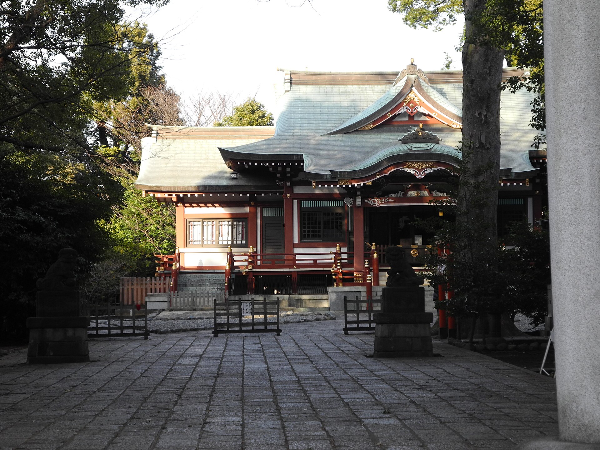
The clearest traces are the Itsukaichi Kaido, surviving parcel orientations, Musashino Hachimangu, the rail corridors, Harmonica Yokocho’s passages, Sunroad and the station plazas, and the slope toward Inokashira Pond. Many layers survive not as original buildings but as alignments, gradients, lot dimensions and abrupt changes of scale.
Timeline
- 1657: The Great Fire of Meireki devastates Edo.
- Late 1650s: Resettlement and land allocation lead to Kichijoji Village.
- 1889: Musashino Village is formed; the Kōbu Railway opens through the area.
- 1899: Kichijoji Station opens.
- 1906: The railway is nationalized.
- 1917: Inokashira Onshi Park opens on May 1.
- 1923 onward: Post-earthquake migration accelerates suburban growth.
- 1934: The Teito Electric Railway reaches Kichijoji.
- After 1945: Station-front markets form the environment associated with Harmonica Yokocho.
- 1960s–1970s: Rail, road and retail redevelopment reshape the station district.
FAQ
Why is the neighborhood called Kichijoji if there is no Kichijoji temple there?
The name came with residents associated with the temple-front community in Edo. The temple itself did not move here.
Was Kichijoji founded after the Great Fire of Meireki?
The 1657 fire was the trigger, but settlement unfolded across the late 1650s.
Why was the Itsukaichi Kaido important?
It organized village transport and land division, with house lots facing the road and fields behind.
When did Kichijoji Station open?
It opened in 1899, ten years after the railway line reached the area.
How did Inokashira Park change the area?
Its 1917 opening made the pond landscape a metropolitan leisure destination and strengthened nearby suburban housing.
Did Harmonica Yokocho begin as a postwar black market?
It emerged from the wider post-1945 station market environment, which included informal and black-market trade as well as everyday retail.
What remains of the old Kichijoji village today?
The Itsukaichi Kaido, parcel orientations and local religious geography preserve important traces.
Is Kichijoji part of Tokyo’s 23 wards?
No. Kichijoji is in Musashino City, outside the 23 special wards.
Conclusion
Kichijoji’s modern form emerged through accumulation. Displacement from Edo supplied a name and an early community. The Itsukaichi Kaido organized village land. Railways redirected movement. Inokashira Park joined suburban residence to metropolitan leisure. Earthquake-era migration, wartime disruption, postwar markets and high-growth redevelopment each added a new scale of street and commerce. The narrow fronts of Harmonica Yokocho, the broad flow of Sunroad, the highway line, Gotenyama’s slopes and the open park landscape belong to different historical systems that were never completely erased by later change.
Sources and References
- Musashino City, historical and town-planning materials on Kichijoji, including Kichijoji no machi wa and Kichijoji machizukuri no ayumi. Accessed July 22, 2026.
- Tokyo Metropolitan Government, official history and information for Inokashira Onshi Park. Accessed July 22, 2026.
- Tokyo Metropolitan Park Association, chronology of metropolitan parks. Accessed July 22, 2026.
- Keio Corporation, corporate history of the Teito Electric Railway and Inokashira Line. Accessed July 22, 2026.
- Musashino City and Mitaka City public historical materials concerning wartime Musashino and Inokashira Park. Accessed July 22, 2026.
Related Neighborhood Histories
Compare Kichijoji with the history of Koenji and the history of Shimokitazawa.
Related Stories
Explore more TimeWalk Japan stories on Tokyo’s railways, postwar markets, parks and suburban development through the English Stories archive.
Related Self-Guided Walks
No verified Kichijoji self-guided walk is currently linked to this neighborhood history.
Walk Tokyo’s History with TimeWalk Japan
Visit the TimeWalk Japan English homepage for current historical walks, articles and event information.