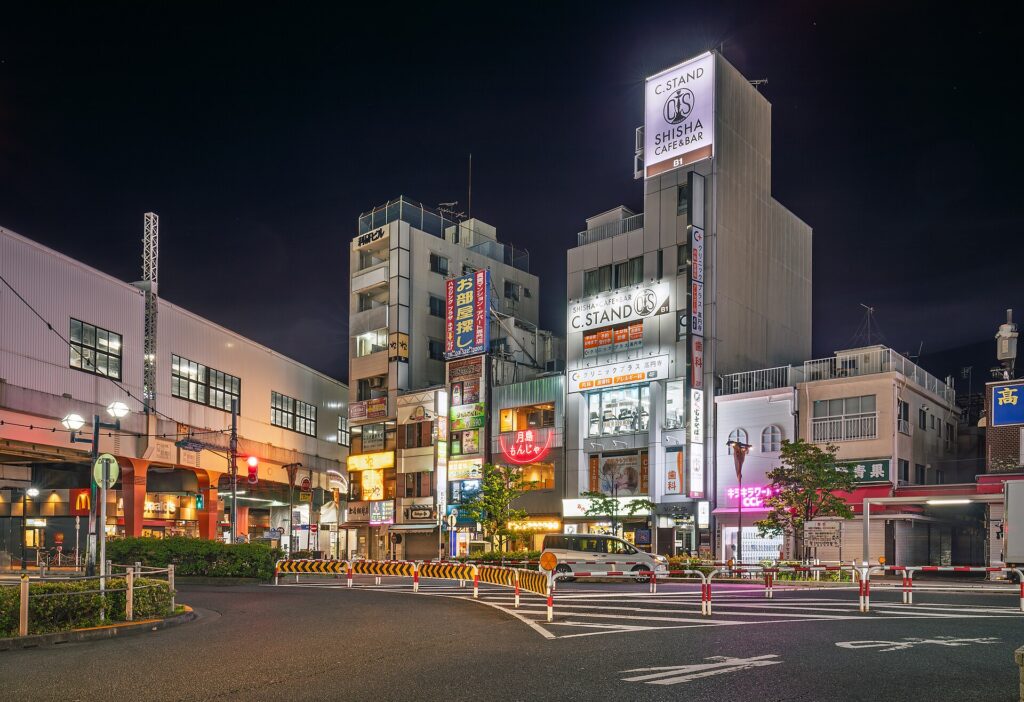
Tokyo’s punk neighborhood was built on top of a vanished river and named after a Buddhist temple that most visitors never see. Today Koenji is known for live houses, vintage clothing, tiny bars and one of Japan’s largest street-dance festivals. None of those identities began with a nightlife master plan.
The neighborhood started as a farming village shaped by the Momozono River. A railway station opened in 1922, and the Great Kanto Earthquake pushed more residents and religious institutions toward Tokyo’s western suburbs. Shopping streets grew around the station; postwar merchants created dense networks of small premises; and those inexpensive, independent spaces later gave musicians, second-hand dealers and alternative culture room to survive.
Modern Koenji exists because an old village landscape was never completely erased. A buried river still bends beneath a greenway, temples stand beyond the nightlife streets, and a festival invented by local shopkeepers now fills the district with dancers. Its counterculture did not appear in spite of local history—it became possible because the railway suburb inherited small plots, commercial streets and community institutions from everything that came before.
Quick Facts
- Japanese name: 高円寺
- Municipality: Suginami City, Tokyo
- Main access: Koenji, Shin-koenji and Higashi-koenji stations
- Historical layers: Village settlement, river landscape, temples and shrines, railway suburb, shopping streets, festival, music and counterculture
- Related walks: 2 routes available
Where Exactly Is Koenji?
Koenji Station is the center of the neighborhood in most people’s mental map, but a station’s catchment area is not the same thing as a historical district. Today’s official place names, Koenji-kita north of the railway and Koenji-minami to the south, do not reproduce the boundaries of the former Koenji village exactly. The cultural area commonly called Koenji also reaches beyond them.
This matters especially on the southern side. The temple concentration often described as Koenji’s temple town continues into present-day Umezato and nearby districts. This article therefore follows the historical relationships needed to explain Koenji’s formation without treating all of Umezato, Asagaya or Nakano as part of Koenji. Each has a distinct history of its own.
Koenji Before the Station: Land, Water and Settlement
Before the railway, this was part of the Musashino uplands west of Edo. The landscape was not flat in a simple sense. Dry upland surfaces were cut by shallow valleys, and settlement and farming adapted to the difference between higher ground and wetter lowland. The Momozono River flowed eastward through one of these low corridors.
The stream was small and its flow was limited, but it supported agricultural use in the surrounding villages. Water was valuable precisely because the uplands were not naturally rich in surface streams. Fields, paths, religious sites and houses developed in relation to this topography. Archaeological finds in the wider valley show that the upland edges had been used for human activity since much earlier periods, but they should not be read as proof of an unbroken Koenji village stretching back to prehistory.
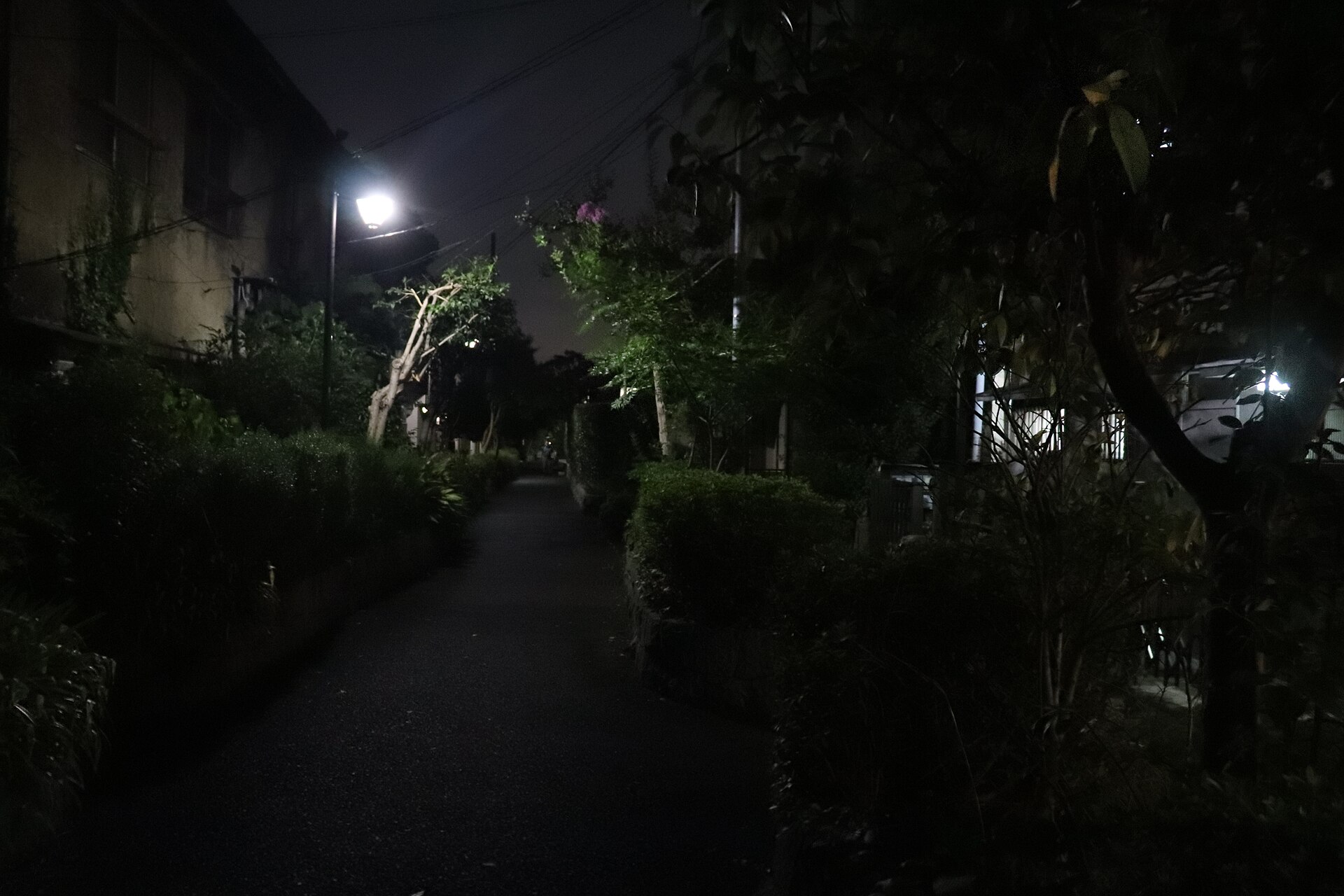
Urbanization changed the river’s function. Household wastewater entered the channel, while the shallow riverbed contributed to flooding. Later river works enclosed sections of the channel and integrated them with modern drainage and sewer infrastructure. The present Momozono River Greenway is therefore not an untouched natural river hidden underground. It is a public landscape built over a heavily altered urban watercourse. Its bends still reveal the line of the old lowland.
The Temple That Gave the Neighborhood Its Name
The Buddhist temple Shukuhōzan Kōen-ji, written 髙圓寺, is the key to the place name. Suginami City’s historical account dates its foundation to 1555. The temple’s grounds were associated with peach trees, and the poetic name Tōen, or “Peach Garden,” also became connected with the surrounding area and river.
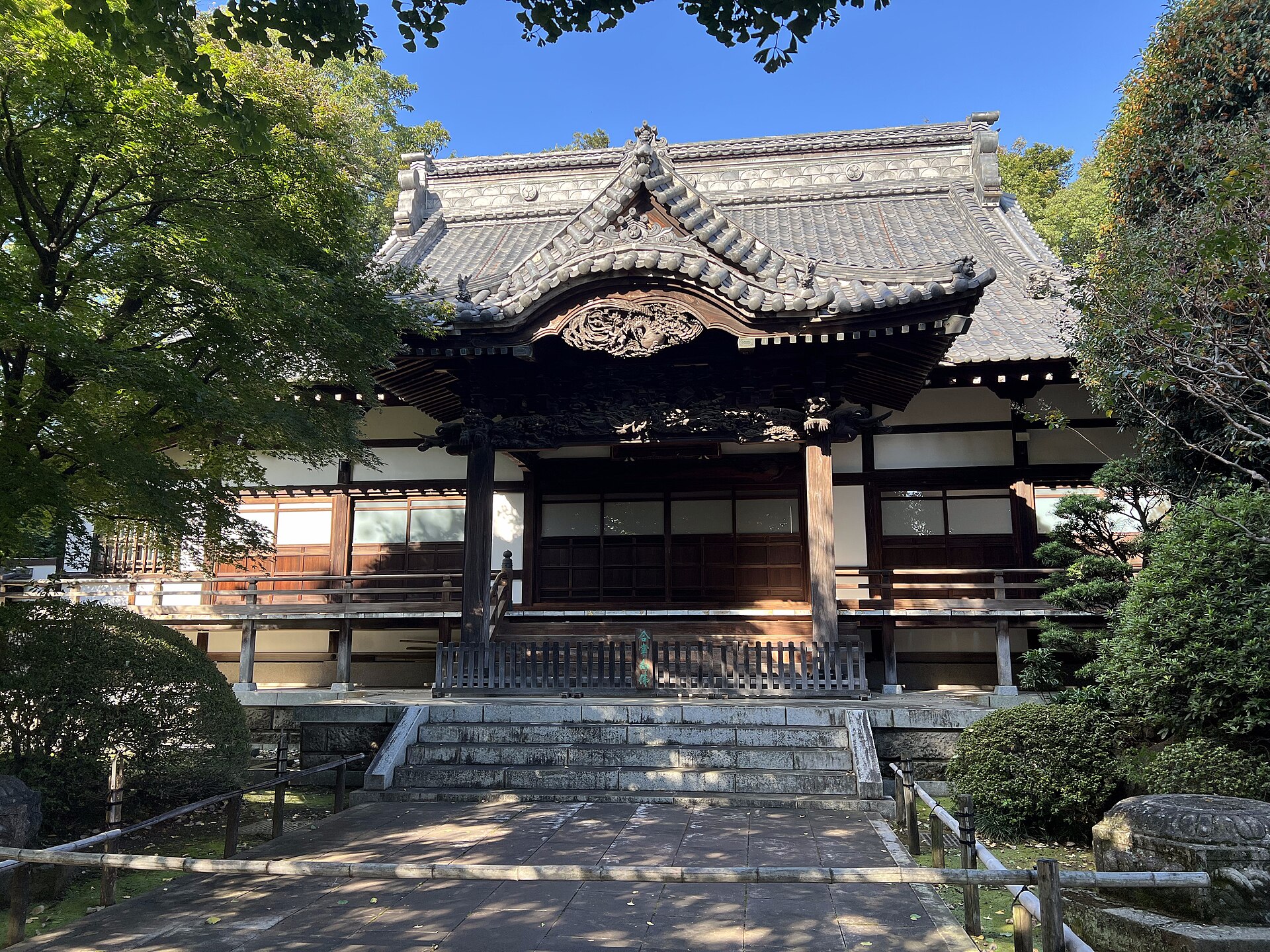
The basic connection between temple and place name is well established. A more colorful account involving the third Tokugawa shogun must be handled differently. According to a local tradition recorded by Suginami City, Tokugawa Iemitsu became familiar with the area through visits connected with falconry, and the village formerly called Ozawa came to be known by the temple’s name. This is a transmitted origin story, not a securely documented administrative order that can be stated without qualification.
Shrines, Fields and the Religious Geography of the Village
Religious sites help reconstruct the village before urban streets obscured its form. Koenji Hikawa Shrine was worshipped as the guardian shrine of Koenji village during the Edo period, while Kōen-ji served as its bettō, a Buddhist temple historically responsible for administering a shrine before the Meiji government’s separation of Buddhism and Shinto.
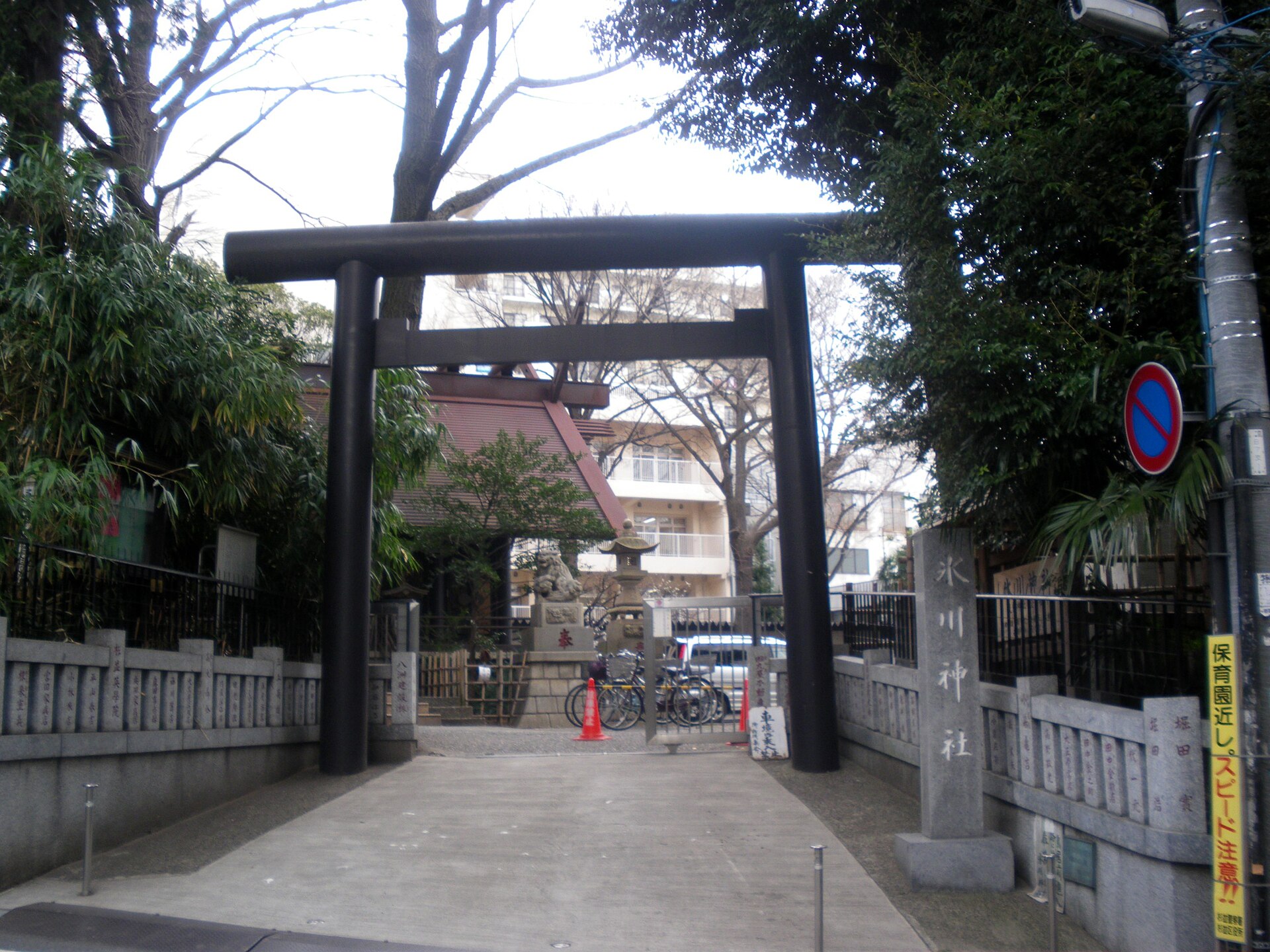
The shrine’s foundation is surrounded by traditions that cannot all be independently verified. Its documented role in village worship, however, is historically important. Koenji Tenso Shrine likewise preserves a religious presence tied to older settlement on the southern side. Together these sites show that pre-railway Koenji was not an empty field awaiting development. It was an organized rural community with cultivated land, water routes, sacred places and customary boundaries.
A Railway Suburb Takes Shape
The first railway turning point came before Koenji had a station. The Kōbu Railway opened through the western suburbs in 1889, with Nakano Station providing the nearest important access. This improved the relationship between the area and central Tokyo, but it did not immediately produce the dense neighborhood seen today.
Koenji Station opened on July 15, 1922. The following year, the Great Kantō Earthquake devastated central and eastern districts of Tokyo. Population and institutions moved toward the less damaged western suburbs, accelerating a process already underway along railway lines. Transport access, available land and the westward expansion of housing combined to transform farmland into residential districts.
The station became a new organizing point. Streets leading to it attracted shops serving commuters and new residents. Yet the older landscape did not vanish at once. Narrow paths, property lines and routes following earlier settlement patterns remained embedded in the expanding city. This overlap helps explain why Koenji feels different from districts planned on a broad modern grid.
Why a Temple District Formed South of the Station
The temples south of Koenji Station are not all remnants of the old village. Many were relocated from more central parts of Tokyo during the city’s modern expansion. Their moves occurred at different times and for different reasons, including street improvement, urban planning, the reorganization of cemetery land and reconstruction after major disasters.
The Great Kantō Earthquake intensified the movement of people and institutions westward, but it should not be used as a single explanation for every temple. The resulting concentration from Koenji-minami toward present-day Umezato records a broader metropolitan process: as central Tokyo was rebuilt and reorganized, religious institutions sought larger or more stable sites in the suburbs. The district is therefore both local and metropolitan history—a temple landscape created through Tokyo’s outward growth.
Shopping Streets and the Everyday City
Railway suburbanization created customers, but shopping streets were built through everyday repetition: commuters walking between station and home, residents buying food and household goods, and small businesses occupying narrow street-front plots. Commercial axes developed on both sides of the tracks, while the long route south toward Shin-koenji connected railway and subway-era centers.
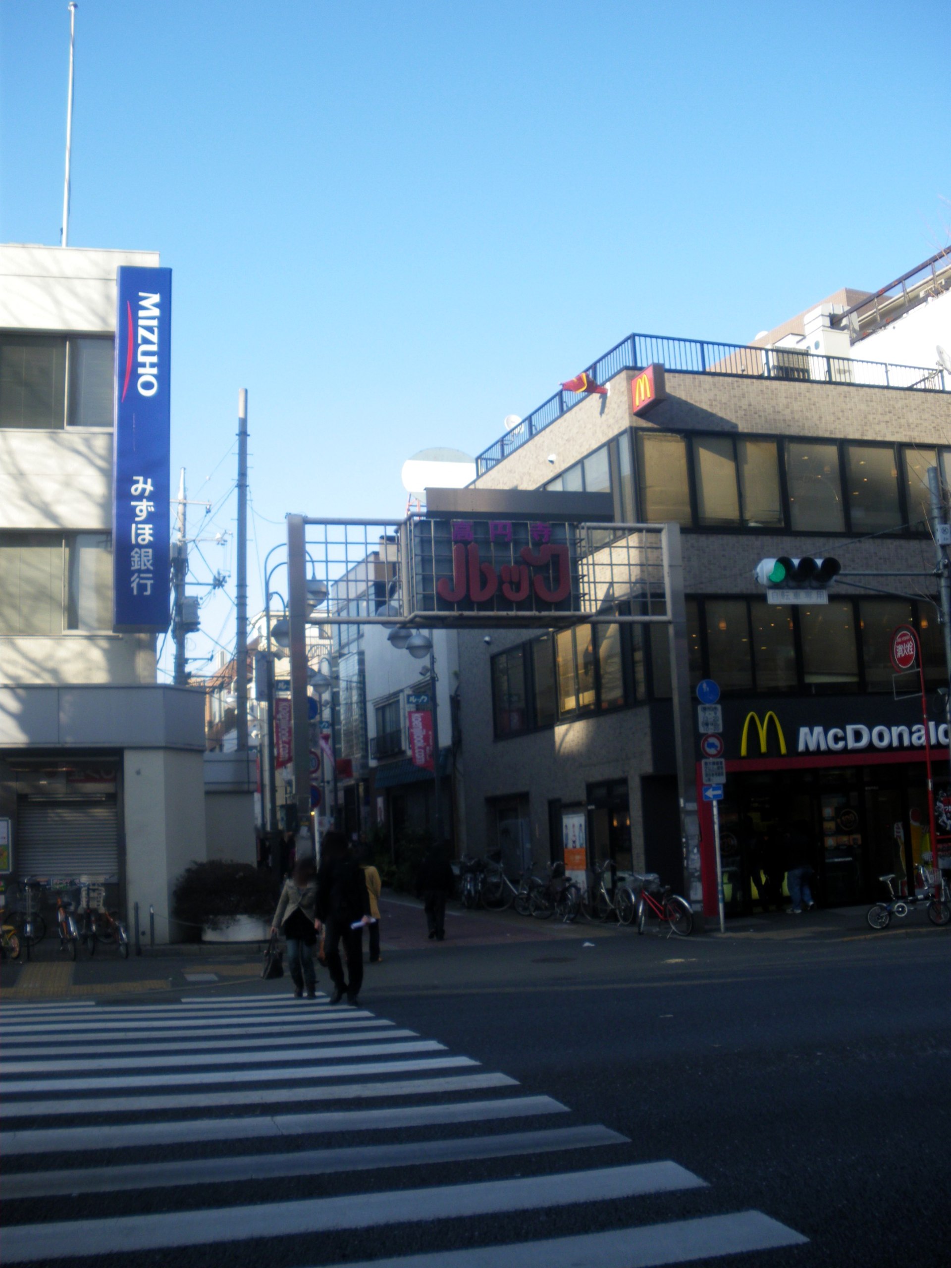
War damage and postwar recovery reshaped these commercial areas. Businesses returned or opened in modest spaces, and shopping associations became important local institutions. The Pal and Look shopping streets south of the station, along with northern arcades and street associations, are not merely visitor attractions. They are the commercial skeleton of a densely inhabited neighborhood.
The same small scale later made room for specialized businesses. A large planned shopping center tends to sort retail into standardized units. Koenji’s older streets offered many independent premises with different sizes, rents and histories. That did not automatically create counterculture, but it gave unusual businesses more opportunities to take root.
A Festival Creates a Public Identity
The Tokyo Koenji Awa Odori began on August 27, 1957, as the “Koenji Baka Odori.” It was organized by the youth section of the shopping association now known as Koenji Pal, partly as a summer promotion intended to energize local commerce. The first event was small and only loosely modeled on Tokushima’s Awa dance.
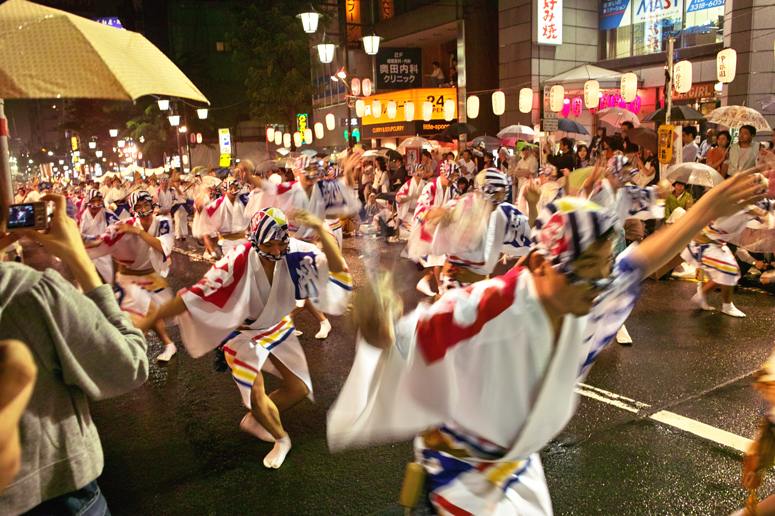
A decisive change came through contact with dancers connected to Tokushima. Instruction became more systematic, local dance groups formed, and in 1963 the event formally adopted the Koenji Awa Odori name. What began as shopping-street promotion developed into a public performance culture sustained by neighborhood organizations, dancers, musicians and long-term exchange with the dance’s home region.
The festival gave Koenji a shared identity visible beyond the neighborhood. It also demonstrates a recurring pattern in local history: small commercial institutions created a platform that later exceeded its original economic purpose.
From Folk and Rock to Punk, Vintage and Independent Culture
Koenji’s reputation for music and alternative culture grew after the war and became especially visible from the late 1960s onward. Folk, rock cafés, small performance venues and the wider culture of the Chūō Line brought musicians, students and audiences into contact. In the 1980s the area became strongly associated with punk and underground music, and it is often described as one of Japan’s key punk neighborhoods. That reputation should not be simplified into a claim that a single movement or event “created” Koenji.
Several conditions overlapped: convenient rail access without central-city scale, a young and changing population, many small commercial units, live houses—Japanese venues designed for amplified performances—and a street culture open to second-hand goods and independent retail. Radical student politics formed part of the period’s atmosphere, but it was one influence among many rather than a complete explanation.
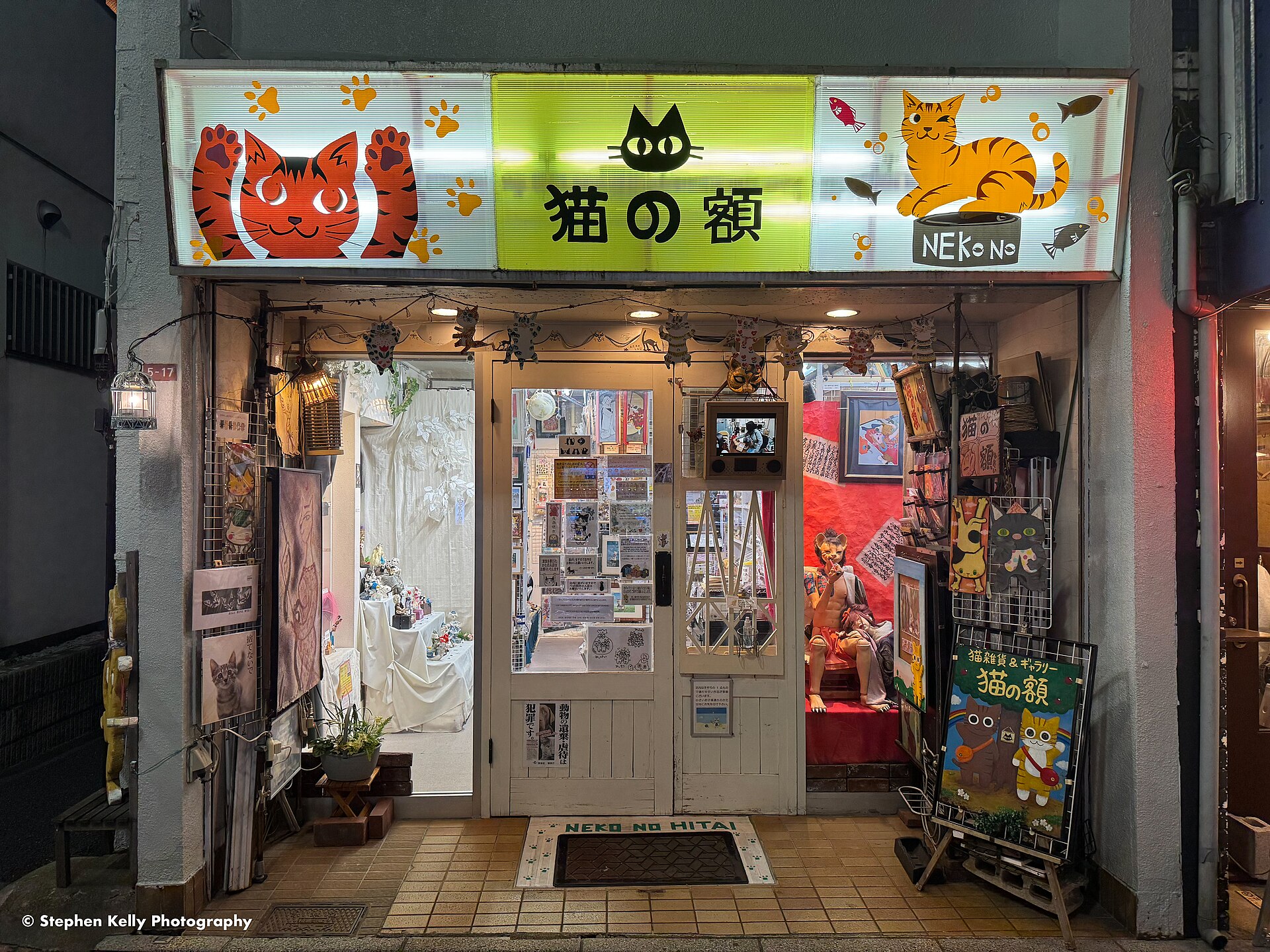
Vintage clothing and independent shops later became another highly visible layer. Their survival cannot be reduced to nostalgia. The physical grain of the neighborhood—short blocks, narrow frontages, pedestrian traffic and connections between several shopping streets—allows many small operators to remain visible. This is an interpretation based on urban form and commercial history, not a claim that every present business descends directly from the postwar period.
How the Past Still Shapes Koenji Today
Koenji’s past remains readable because each period reorganized the area without completely erasing what came before. The Momozono River’s course survives as a greenway and a line of low ground. Kōen-ji, Hikawa Shrine and Tenso Shrine preserve the religious geography of the former village. The station and radiating shopping streets show how railway access remade everyday life after 1922.
The temple district toward Umezato records the displacement and expansion of modern Tokyo. The Awa Odori shows how postwar merchants transformed a local promotion into durable public culture. Small plots, lanes and street-front shops have provided spaces in which music, vintage clothing and independent businesses can repeatedly renew themselves.
Koenji is therefore neither a preserved village nor a counterculture district that appeared from nowhere. It is a neighborhood where rural topography, metropolitan growth and local institutions remain unusually close together.
What You Can Still See Today
- Kōen-ji temple: the namesake temple and the clearest link between the old village and the modern place name.
- Koenji Hikawa Shrine: a guardian shrine of the former village; enter respectfully and avoid disrupting worship.
- Momozono River Greenway: a pedestrian landscape tracing the altered river corridor.
- Koenji Pal and Look shopping streets: the commercial axis between Koenji and Shin-koenji.
- The temple area toward Umezato: evidence of religious institutions moving outward as Tokyo expanded.
- Awa Odori performance streets: ordinary commercial roads that become a civic stage during the festival.
- The station-area independent scene: small shops and live houses that continue Koenji’s reputation for alternative culture; check current opening details directly with each venue.
Walk This History
This article explains why Koenji became the neighborhood seen today. To explore the evidence in sequence, use the Momozono River and Koenji self-guided history walk and the Umezato temple-town walking guide.
Related Stories
Browse the growing Tokyo Neighborhood Histories collection for place-based histories that explain how present-day streets were formed.
Sources and Further Reading
- Suginami City, “Kōen-ji,” local history and cultural-property guide.
- Suginami City, “Koenji Hikawa Shrine” and “Koenji Tenso Shrine.”
- Suginami City, “Momozono River” and “Momozono River Greenway.”
- Suginami City, historical materials on Tokyo Koenji Awa Odori.
- JR East, materials commemorating the 100th anniversary of Koenji Station.
- Suginami City local museum and historical walking-map resources.
- GO TOKYO, Koenji area guide, consulted for current tourism framing.
- Sumitomo Mitsui Trust Realty, Town Archives: Koenji and Nakano, consulted as a secondary overview.