Tokyo’s diplomatic quarter began in a Buddhist temple—after the United States arrived with no embassy of its own.
Today, Azabu is known for embassies, luxury apartments, international schools and restaurants serving communities from around the world. Yet its international identity did not begin with a planned diplomatic district. In 1859, the first United States legation in Edo was established inside Zenpukuji Temple, where a protected religious compound provided space in a city that had never been designed for permanent foreign missions.
That unlikely beginning reveals how modern Azabu was made. Samurai estates on the hills became aristocratic residences, institutions, parks and diplomatic properties. Temple grounds preserved large compounds and older routes. The valley at Azabu-Juban developed as the everyday commercial center serving the neighborhoods above. Because the district lacked a major railway terminal until the subway arrived in 2000, many winding streets and small-scale areas survived longer than they might have elsewhere.
Azabu is therefore not simply “Tokyo’s international neighborhood.” It is a landscape where geography, elite landholding, religion, diplomacy, war and uneven transport access repeatedly reshaped one another. Walk from the Furukawa River lowlands toward Moto-Azabu, Minami-Azabu or Azabudai and that history becomes physical: streets climb sharply, temples occupy slopes, former estates survive as parks or institutional compounds, and new towers rise from terrain first organized centuries ago.
Why Azabu Became a District of Hills, Temples, Estates and Embassies
Azabu’s present character did not arise simply because foreign missions chose the area. Embassies became one layer in a district already shaped by large plots, elevated residential ground, temple precincts, proximity to the political center and relatively fragmented access. Some diplomatic properties reused former elite land, but not every embassy occupies a former daimyo estate and not every former estate became diplomatic land. The pattern developed through many separate transactions across the Meiji, Taisho, prewar and postwar periods.
The same caution applies to Azabu’s reputation as an affluent address. Edo-period Azabu contained high-status warrior compounds, but also temples, farmers, artisans and commoner settlements. The valley-floor commercial world of Azabu-Juban followed a different path from the estate belts of Moto-Azabu or Minami-Azabu, while Kasumicho and the area now called Nishi-Azabu developed in relation to routes leading toward Aoyama and Roppongi. Modern prestige rests on historical layers, not on an unchanged elite identity.
The Azabu Plateau, Valleys and the Furukawa River
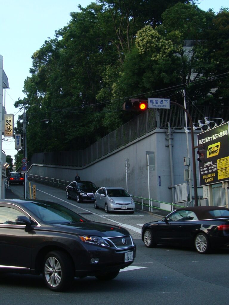
Azabu lies on the southern part of Tokyo’s upland terrain, cut by valleys descending toward the Furukawa River. The river, known downstream as the Shibuya River system, runs along the low ground near Azabu-Juban and Higashi-Azabu. Tributary valleys and erosion created ridges, hollows and steep slopes. Names such as Torii-zaka preserve the importance of these ascents in local orientation.
Topography influenced movement and land use, but it did not mechanically determine social class. Elevated sites could offer air, views and space for large compounds; valley floors concentrated roads, waterways, shops and everyday services. Yet ownership, temple history, political decisions, disasters and transport investment were equally important. The result was a mosaic: broad compounds on some uplands, dense commerce in some lowlands, and narrow residential streets on the slopes between them.
Villages and Religious Sites before Edo
Before the Tokugawa shogunate turned Edo into a vast political capital, the Azabu area consisted of villages, fields, wooded slopes, waterways and religious sites on the edge of the expanding settlement. The name Azabu appears in early modern records in several written forms. Traditions about its origin vary, and the familiar characters meaning “hemp cloth” should not be treated as proof of a single settled etymology.
Temples and shrines provided continuity across later changes. Their precincts served worshippers, held burial grounds and anchored routes through the villages. As Edo expanded, these institutions were absorbed into an increasingly urban landscape, sometimes gaining new patrons and sometimes receiving land through shogunal planning.
Samurai Estates and Temple Lands in the Edo Period
Edo-period Azabu stood beyond the densest merchant core but within the capital’s expanding political geography. Large daimyo and hatamoto estates occupied parts of the uplands, while temples clustered in several zones and agricultural land remained between developed areas. The distribution was never static: fires, estate exchanges, confiscations, inheritances and shogunal orders could alter possession.
The physical scale of warrior estates mattered after 1868. Large parcels were easier to adapt for aristocratic residences, military and government facilities, schools, hospitals, clubs or foreign missions than the finely divided lots of older commercial districts. This did not create a single direct line from daimyo estate to embassy. It created a property structure in which institutional reuse was possible.
How Hills and Valleys Shaped Social and Commercial Space
The contrast between upland estates and valley-floor commerce was especially visible around Azabu-Juban. The low ground near the Furukawa became a service and market area for surrounding residents. Shops, baths, food businesses and entertainment served people from nearby estates, temples and neighborhoods. The area’s identity was therefore connected to both elite demand above and ordinary urban life below.
Slope streets joined these worlds. They were not merely picturesque features; they controlled how residents, servants, merchants, carts and later vehicles moved. Difficult gradients could protect quiet residential pockets while also making mass transit and road improvement expensive. This helps explain why parts of Azabu remained relatively removed from railway stations even as nearby Roppongi, Hiro-o and central Tokyo changed rapidly.
Zenpukuji and Azabu’s Temple Landscape
Zenpukuji in Moto-Azabu is one of the district’s most important religious landmarks. Its long history is associated with the development of Buddhism in the region, while its surviving precinct demonstrates how temple land remained embedded within a modern residential district. Like other historic temples, it should not be read as an untouched fragment of one era: buildings, grounds and surroundings changed through fire, disaster, war and rebuilding.
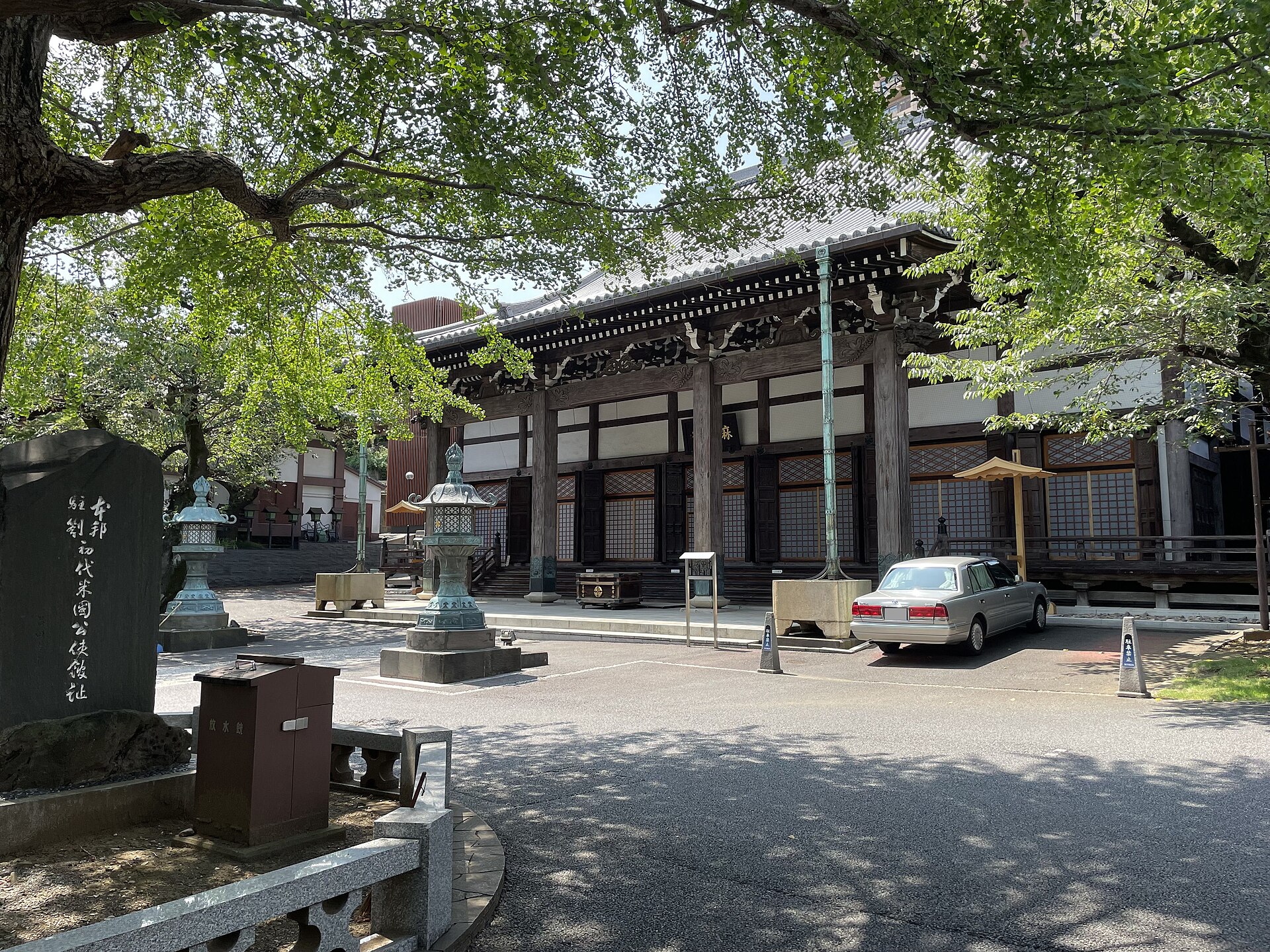
Zenpukuji also entered the history of Japan’s opening. In 1859, the first United States legation in Edo was established at the temple, and Townsend Harris used it as a base during the early treaty-port era. The episode was important, but it did not instantly transform all of Azabu into an international quarter. Early diplomacy was precarious, politically contested and concentrated in specific protected sites.
The Opening of Japan and Early Diplomacy
The arrival of foreign representatives in the late Tokugawa period introduced new security arrangements, translators, guards, servants and supply networks. Temples were often used because they offered sizable compounds inside a city where purpose-built diplomatic buildings did not yet exist. The foreign presence at Zenpukuji belongs to this transitional moment between shogunal urban order and modern diplomatic infrastructure.
After the Meiji Restoration, diplomatic practice became more permanent and bureaucratic. Foreign legations and consulates moved, acquired land and built facilities over time. Azabu’s proximity to Kasumigaseki, Akasaka and the political center made it practical, while large residential plots and quieter uplands made it attractive. The concentration was gradual, not the result of one government plan.
From Daimyo Estates to Aristocratic and Diplomatic Properties
The abolition of domains and changes in the status of the samurai opened former warrior properties to new uses. Some passed to the state, some to members of the new peerage, and others to military officers, business leaders, schools, religious institutions or private developers. Large residences with gardens became an important feature of modern Azabu.
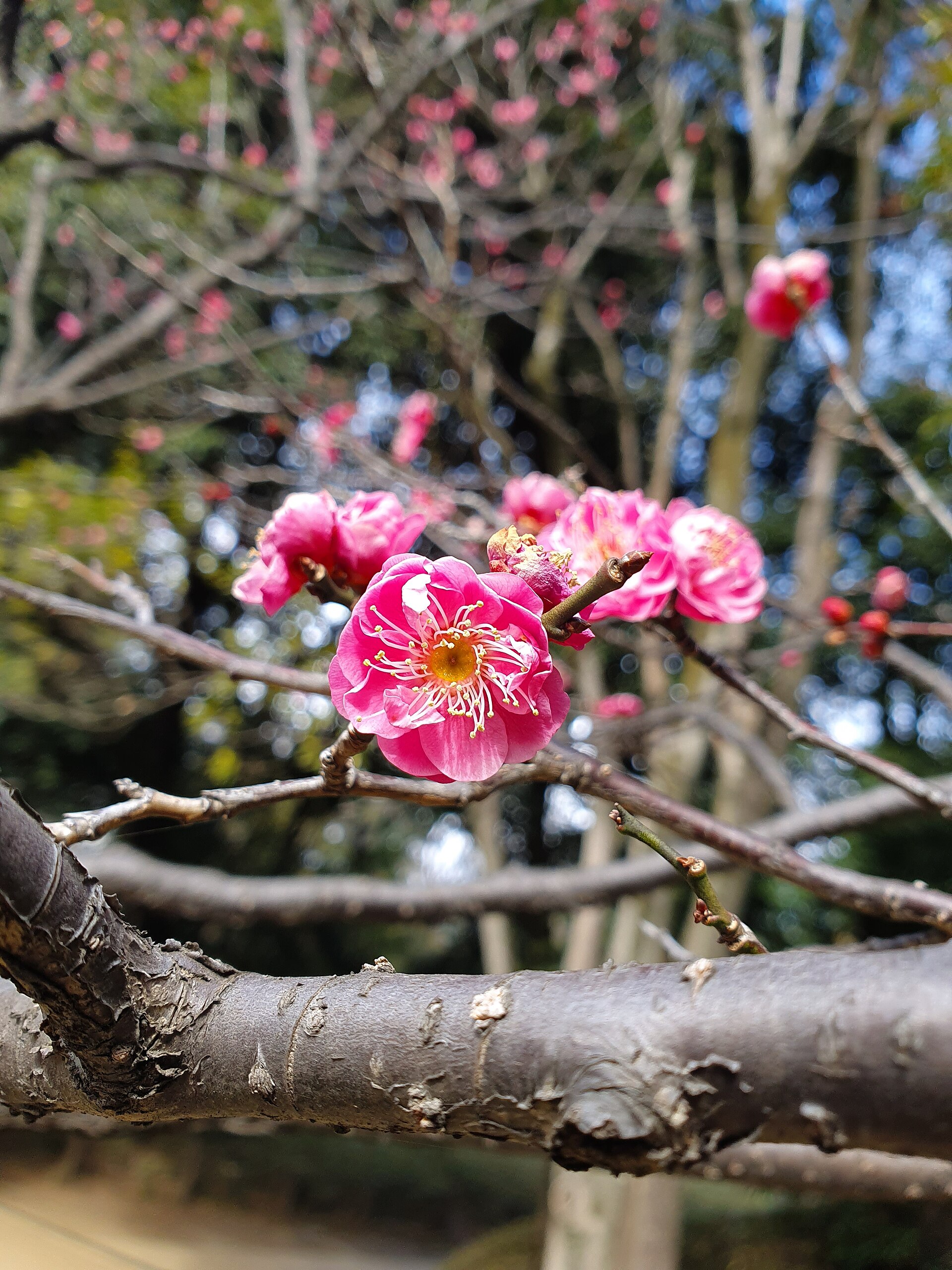
Arisugawa-no-miya Memorial Park preserves one of the clearest land-use sequences. The site was associated with the urban residence of the Morioka domain’s Nanbu lords during the Edo period. It became an imperial residence in the Meiji era and was donated for public use, opening as a park in 1934. Its paths, slopes and pond still reveal the underlying terrain while the park’s ownership history records the transition from daimyo estate to imperial property to civic landscape.
Why Embassies Concentrated in Azabu
Embassies gathered in and around Azabu because several conditions reinforced one another: access to the government district, availability of relatively large and secure sites, an established high-status residential environment, connections to Hiro-o and Roppongi, and later the growth of international schools, churches, shops and services. Once a diplomatic cluster existed, related institutions and foreign-oriented housing found the area increasingly practical.
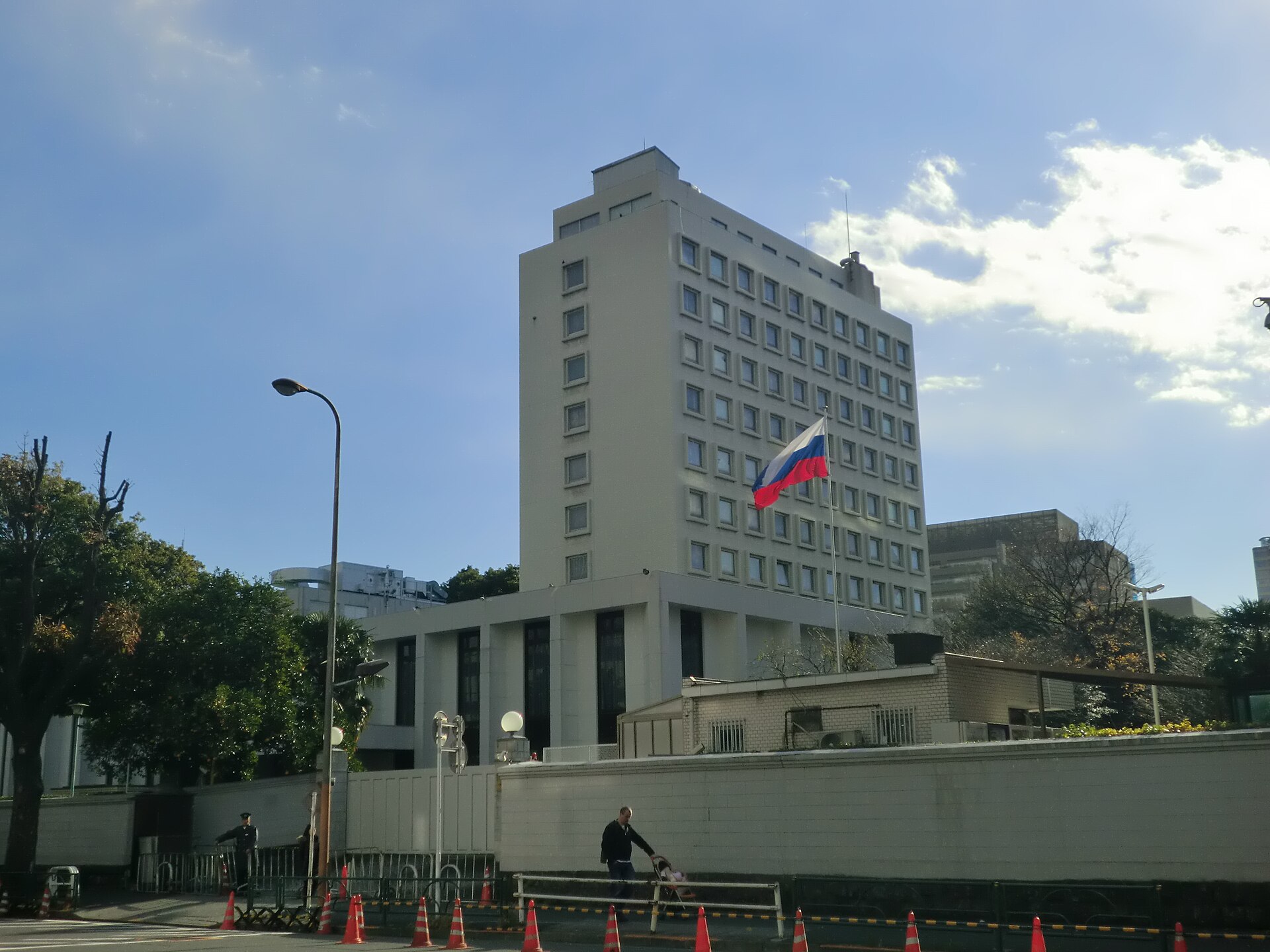
The Russian Embassy in Azabudai is a prominent example of the diplomatic landscape, but the wider pattern must be read property by property. Some missions bought or leased former residential compounds; others assembled sites later or moved from elsewhere in Tokyo. The diplomatic quarter is therefore a network of separate histories rather than a single preserved belt of former daimyo estates.
Azabu-Juban as a Valley-Floor Commercial District
Azabu-Juban developed as the everyday commercial center of the wider district. Its low ground and road junctions brought customers from surrounding hills. Shops, restaurants, public baths, small entertainment venues and seasonal events gave the area a social texture distinct from the quieter estate zones above.
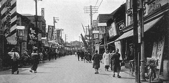
The 1933 view of Azabu-Juban captures a commercial streetscape after the Great Kanto Earthquake but before wartime destruction. It should not be mistaken for Edo scenery. Rather, it shows a modern neighborhood shaped by rebuilding, street transport, shopfront commerce and the changing visual culture of prewar Tokyo.
Streetcars, Buses and the Problem of Access
Streetcars and buses connected Azabu to central Tokyo, but the district never gained the kind of major railway terminal that transformed Shinjuku, Shibuya or Ueno. Steep slopes, irregular streets and fragmented large properties complicated transport planning. Azabu-Juban remained lively, yet for much of the twentieth century it was less directly accessible by rail than nearby districts.
This relative inconvenience had mixed effects. It limited some forms of mass commercial development, supported bus and taxi dependence, and helped preserve pockets of low-rise residential character. At the same time, it placed a burden on residents and businesses. The later arrival of the subway was therefore a major change rather than a minor improvement.
The Great Kanto Earthquake
The 1923 Great Kanto Earthquake affected Azabu unevenly. Ground conditions, building materials, fire spread and local density all mattered. Some areas suffered severe damage, while others escaped the scale of destruction seen in the low-lying eastern city. The earthquake accelerated rebuilding and modernization, but it did not erase the district’s older property pattern.
Commercial streets adapted with new construction and transport arrangements. Elite and institutional compounds also repaired or rebuilt. The key point is regional variation: “Azabu survived the earthquake” is too broad, while “Azabu was destroyed” is equally misleading.
Tokyo Air Raids and Wartime Destruction
The air raids of 1945 caused a deeper rupture across many parts of Minato. Houses, temples, shops and institutional buildings were burned or damaged, though destruction again varied by location. Postwar rebuilding therefore combined surviving walls, trees and property boundaries with entirely new structures.
Claims that Azabu’s old atmosphere exists simply because it escaped wartime fire are inaccurate. What visitors encounter today is a selective survival shaped by reconstruction, lot subdivision, road widening and later redevelopment. Even where a temple or slope retains an old name, the surrounding built environment may date largely from after 1945.
Postwar Housing and the International Community
After the war, Azabu’s residential identity was remade. Large plots were subdivided, apartment buildings appeared and diplomatic or foreign-oriented housing expanded. Nearby occupation facilities and the internationalization of Roppongi contributed to demand, but local schools, churches, supermarkets, clubs and professional networks were equally important in sustaining an international community.
This postwar ecosystem helps explain the modern mix of languages, cuisines and services. It should not be projected directly back to the 1859 legation at Zenpukuji. Early diplomacy and contemporary international life are related through the district’s long institutional history, but they are not a single uninterrupted culture.
Azabu-Juban before and after the Subway
For decades Azabu-Juban was famous partly for being central yet awkward to reach by train. That changed in 2000, when Azabu-juban Station opened on the Tokyo Metro Namboku Line and the Toei Oedo Line. The new connections increased foot traffic, encouraged residential investment and tied the shopping district more closely to the metropolitan rail network.
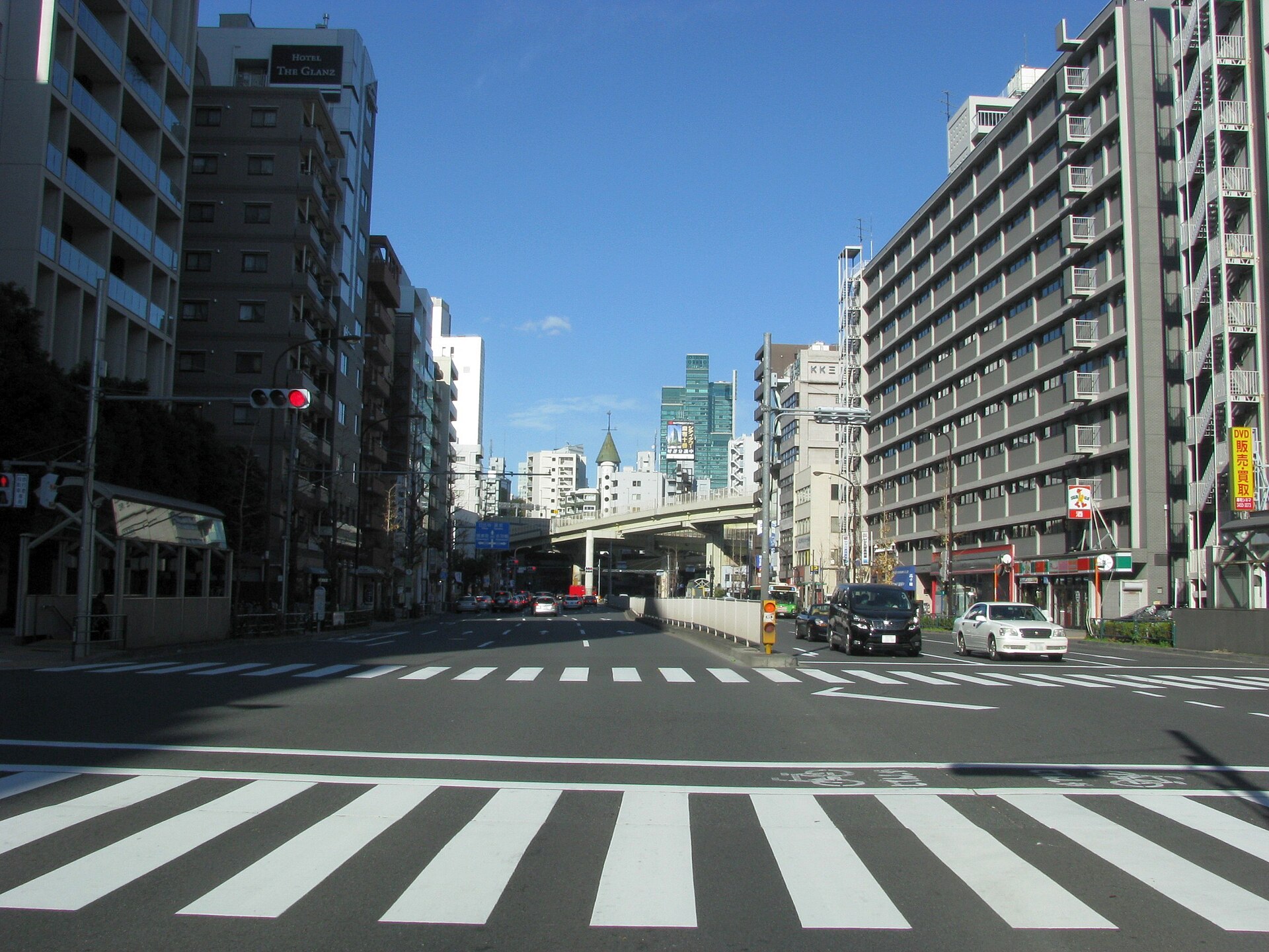
The subway did not create Azabu-Juban’s commerce, but it altered its scale and audience. Long-established businesses, neighborhood festivals and everyday services now coexist with destination restaurants, new apartments and visitors transferring from Roppongi, Meguro or central Tokyo.
Connections with Roppongi, Hiro-o and Akasaka
Azabu’s boundaries make most sense in relation to adjoining districts. Roppongi supplied nightlife, offices and later major redevelopment. Hiro-o reinforced the international residential and institutional network around Minami-Azabu. Akasaka and Kasumigaseki connected the district to government and diplomacy. Nishi-Azabu developed along routes between Aoyama, Roppongi and Hiro-o, while Azabudai faced the political and institutional zone around Toranomon and Kamiyacho.
These connections produced distinct local characters. Moto-Azabu retained temples and winding residential streets; Minami-Azabu combined estate land, parks, schools and embassies; Azabudai became heavily institutional and diplomatic; Nishi-Azabu faced entertainment and arterial-road change; Azabu-Juban remained the principal commercial center.
Redevelopment and the Changing Skyline
Late twentieth- and early twenty-first-century redevelopment reshaped the edges and interior of Azabu. Large projects around Roppongi and Azabudai introduced towers, offices, luxury housing, cultural facilities and new pedestrian routes. Redevelopment can reopen inaccessible land and improve infrastructure, but it can also remove small buildings, alter slope approaches and weaken the visual relationship between old property lines and topography.
The new skyline should therefore be read as another historical layer. It does not cancel the older geography: towers still rise from plateaus, roads descend into valleys, and the contrast between institutional compounds and commercial lowlands remains visible.
What Historical Traces Can Be Seen Today
Begin in Azabu-Juban and notice the low ground near the Furukawa, the concentration of shops and the routes climbing away from the commercial center. Walk toward Zenpukuji to see how a temple precinct occupies the slope between valley and upland. Continue through Moto-Azabu and Minami-Azabu, where walls, schools, embassies and apartment compounds reveal the afterlife of large properties.
At Arisugawa-no-miya Memorial Park, descend through a landscape that preserves the district’s natural relief and a sequence of daimyo, imperial and public ownership. Around Azabudai, compare diplomatic compounds with the new high-rise city. On Torii-zaka and other named slopes, look not for an unchanged Edo road but for the persistence of terrain within a repeatedly rebuilt metropolis.
Timeline
- Before 1600: Villages, fields, waterways and religious sites occupy the uplands and valleys south of Edo.
- Edo period: Samurai estates, temple lands, farms and commoner settlements form a mixed outer-city landscape.
- 1859: The first U.S. legation in Edo is established at Zenpukuji.
- Meiji era: Former warrior land is reorganized for aristocratic, state, military, institutional and private use.
- Late 19th–20th centuries: Foreign missions and international institutions gradually concentrate in Azabu and nearby districts.
- 1923: The Great Kanto Earthquake damages the area unevenly and prompts rebuilding.
- 1934: Arisugawa-no-miya Memorial Park opens to the public.
- 1945: Air raids destroy or damage many buildings across Azabu.
- Postwar decades: Housing, embassies, international schools and foreign-oriented services expand.
- 2000: Azabu-juban Station opens on the Namboku and Oedo lines.
- 21st century: Large redevelopment projects reshape Roppongi and Azabudai while older topography remains legible.
Frequently Asked Questions
Was all of Azabu an elite district in the Edo period?
No. Azabu included high-status warrior estates, but also temples, fields, village land, artisans and commoner commercial areas. Its neighborhoods followed different paths.
Why are there so many embassies in Azabu?
Large sites, proximity to the political center, an established residential environment and the later growth of international institutions all contributed. The pattern developed gradually.
Is every embassy built on a former daimyo estate?
No. Some diplomatic sites reused elite properties, but others were acquired, assembled or relocated through different modern histories.
When did Azabu-Juban get a subway station?
Azabu-juban Station opened in 2000 on the Tokyo Metro Namboku Line and the Toei Oedo Line.
Sources and Further Reading
- Minato City, Azabu regional history materials
- Arisugawa-no-miya Memorial Park: official history
- Zenpukuji Temple
- Ministry of Foreign Affairs of Japan: diplomatic missions
- Toei Subway: Azabu-juban Station
- Tokyo Metro: Azabu-juban Station
- Tokyo Metropolitan Library: Edo and Tokyo historical resources
Related Stories
For more context on how place, routes and records shape the city, read How to Read Old Japanese Maps in Modern Tokyo and Why Most Tokyo Streets Have No Names.
Explore More Neighborhood Histories
Browse the Tokyo Neighborhood Histories directory for more layered accounts of the city.
Walk Tokyo with TimeWalk Japan
Explore Tokyo’s slopes, old districts and changing streets through our English-language events and historical walks.