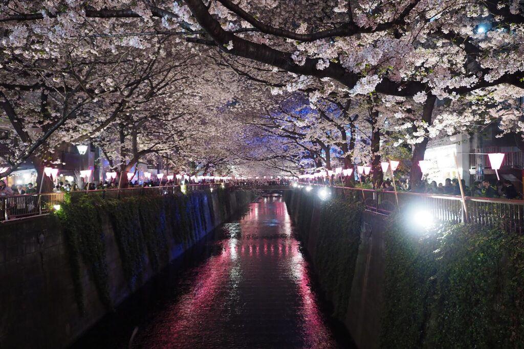
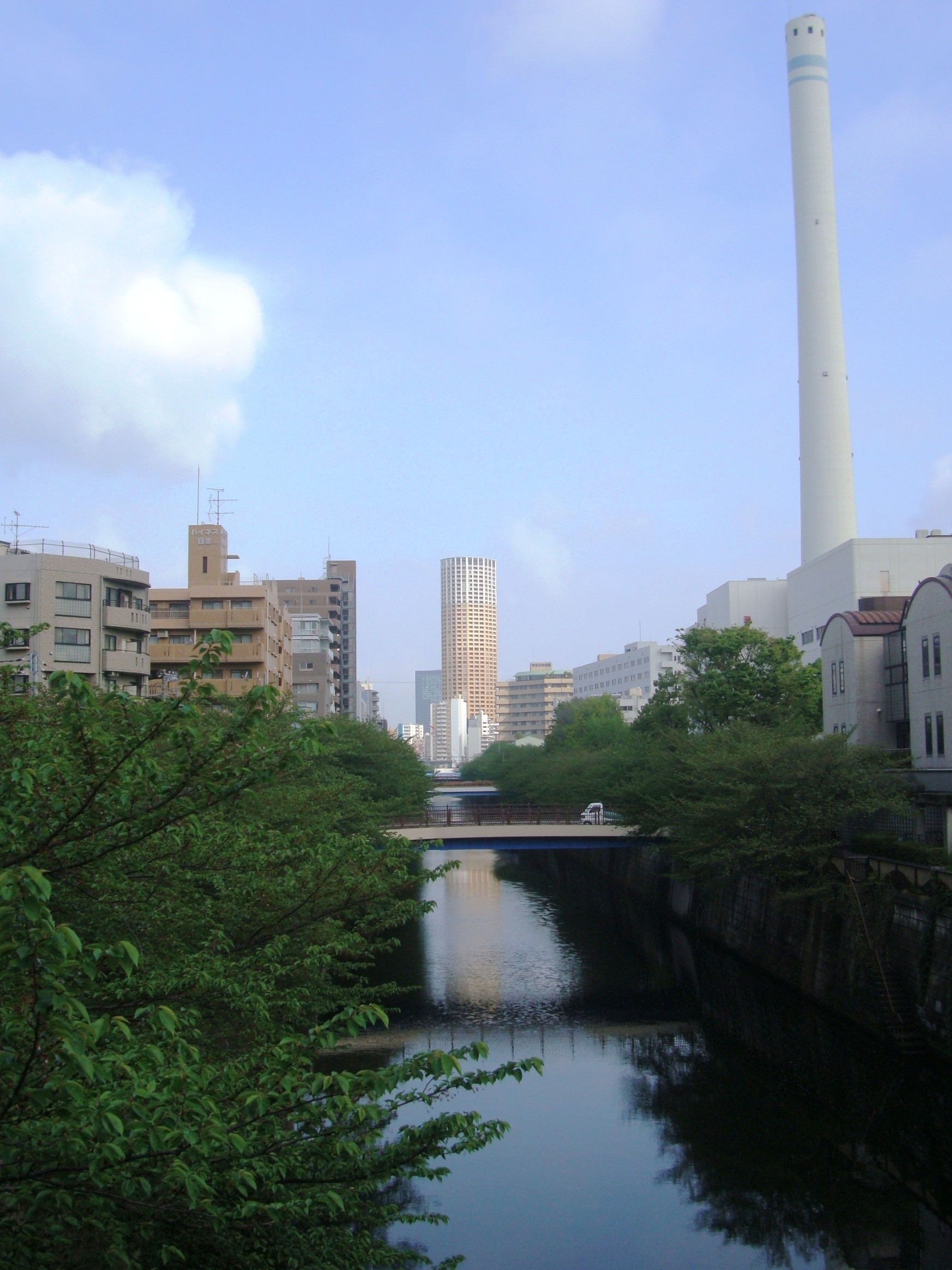
The cherry blossoms that made Nakameguro famous grow above a concrete flood-control channel—built because this fashionable river once repeatedly invaded the neighborhood.
Visitors now photograph petals, cafés and reflections along the Meguro River. The scene feels romantic and almost natural. Yet nearly every element has been engineered: the fixed channel, riverside roads, bridges, planted cherry trees, railway viaduct and detention system that stores stormwater beneath the city.
Before Nakameguro became a lifestyle destination, the valley powered waterwheels, supported farms and workshops, attracted railways and industry, suffered pollution and repeatedly flooded. Its modern appeal was created not by preserving an untouched river, but by transforming dangerous and productive infrastructure into a walkable cultural landscape.
Why Nakameguro Looks the Way It Does Today
The name “Nakameguro” is used today for a commercial and cultural area centered on Naka-meguro Station and the Meguro River. That everyday district crosses modern neighborhood boundaries and should not be confused with the exact limits of the former Nakameguro village. Kamimeguro, Nakameguro and Aobadai are distinct present-day addresses, while Daikanyama and Ebisu lie in neighboring Shibuya City. Meguro Station is also a different station, located farther downstream.
The river valley created both opportunity and risk. Water supported rice fields, irrigation and waterwheels, but the low ground was vulnerable to flooding. Railways improved access and accelerated development, but denser construction increased runoff and pressure on the channel. Industry and population brought jobs and urban services, while also contributing to pollution and crowded riverside land use. The attractive riverfront of today is therefore the result of engineering, maintenance and repeated reinvestment—not an untouched natural landscape.
The Valley, the Plateaus and the Meeting of Rivers
The Meguro River cuts through the southern edge of the Musashino Plateau. Around Nakameguro, slopes rise from a relatively narrow valley floor toward higher ground in Kamimeguro, Aobadai and neighboring districts. The Jakuzure River, now largely culverted, joins the Meguro River system near the station area. Even where a tributary has disappeared beneath roads and greenways, its valley can continue to concentrate stormwater.
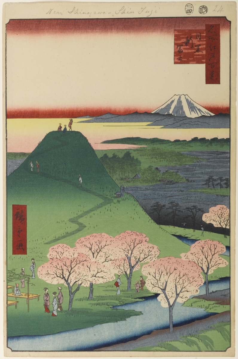
This topography influenced old village boundaries, roads and fields, but historical and modern borders do not align neatly. The broad Meguro landscape shown in Utagawa Hiroshige’s 1857 print helps evoke the plateau-and-valley setting on Edo’s outskirts, although it is an artwork rather than a precise image of modern Nakameguro.
Before the Railway: Villages, Fields and Irrigation
During the Edo period, villages around the upper Meguro River combined rice paddies in wetter lowlands with fields on better-drained ground. River water, tributaries and irrigation channels supported agriculture. The Mita irrigation system also served parts of the wider Meguro area. Water management was local infrastructure: channels had to be divided, cleaned and repaired, and upstream use affected downstream users.
Waterwheels converted flowing water into mechanical power. They commonly milled rice and grain, reducing labor and connecting village agriculture to urban markets. Meguro City’s local-history materials record numerous waterwheel sites in the wider district during the Meiji period. Their importance was not limited to farming. As Tokyo’s economy expanded, some operators adapted water-powered machinery to processing and small-scale manufacturing, including tobacco-related work in the former Nakameguro village area.
Waterwheels: From Milling to Early Industry
The change from milling to processing illustrates an important transition. Water, land and access to Tokyo’s growing market made the river corridor attractive to workshops and manufacturers. Yet the pattern was diverse: not every waterwheel became a factory, and not every later factory depended on water power or river transport. Steam, electricity, roads and railways eventually mattered more than the wheels themselves.
What survived was the industrial logic of the valley. Lower-cost riverside land, mechanical power, transport access and proximity to customers encouraged productive uses. This helped prepare the corridor for the mixed landscape of workshops, warehouses, service yards, housing and larger facilities that developed in the twentieth century.
The Arrival of the Toyoko Line
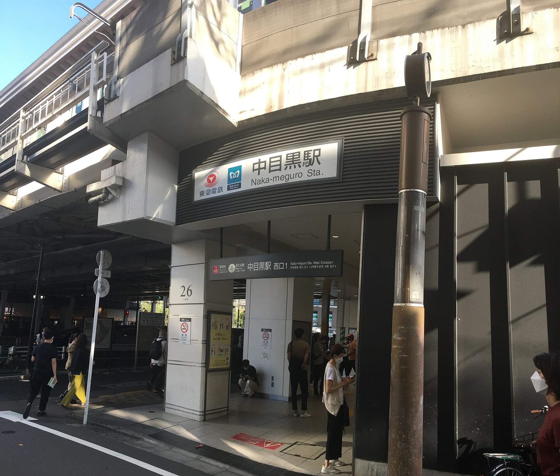
On August 28, 1927, the line between Shibuya and Maruko-Tamagawa opened, and Naka-meguro Station began service with it. The railway connected the valley directly to Shibuya and to developing suburbs toward Yokohama. A place shaped by villages and productive riverfront land became part of a private-railway urban corridor.
The station did not instantly erase older uses. Instead, housing, shops and industry accumulated around them. Better access encouraged subdivision and commuting, especially as Tokyo expanded after the 1923 Great Kanto Earthquake. The station area became a junction between the river’s industrial geography and the railway’s metropolitan geography.
Naka-meguro Becomes a Metropolitan Transport Node
The station’s importance increased again in 1964. The Hibiya Line reached Naka-meguro on July 22, and through-service with the Tokyu line began on August 29. The connection brought central Tokyo’s subway network into direct contact with the southwestern suburban railway corridor. Today Naka-meguro remains the western terminus of the Tokyo Metro Hibiya Line and an interchange with the Tokyu Toyoko Line.
Transport access increased land values and pedestrian activity, but it also produced infrastructure that divided and sheltered space. The elevated railway became both a barrier and, eventually, an asset: its arches and linear footprint would later be reorganized for shops, offices and public circulation.
River Improvement, Urban Growth and Industrial Land Use
River improvement accelerated from the Taisho era into the early Showa period as settlement spread across the valley. Channel straightening, embankments and later concrete revetments increased flow capacity and fixed the river more tightly within the city. Roads along the banks improved access and created planting space, but the engineered corridor also separated daily life from the water.
After the Great Kanto Earthquake, population moved outward from central Tokyo. Nakameguro’s railway access and proximity to Shibuya made it attractive for housing and employment. Wartime air raids damaged parts of Meguro, and postwar rebuilding produced a dense mixture of homes, factories, workshops, transport and public facilities. The river became an urban utility corridor rather than a pastoral edge.
Factories, Workshops, Warehouses and a Polluted River
During the high-growth decades, small industrial and service uses remained woven into residential streets. Workshops and storage buildings did not form one uniform factory district; they varied by block, period and business. The river received polluted runoff and wastewater before sewerage and environmental controls improved. Low flow, urban discharge and heat contributed to odor and poor water quality.
Later water-quality programs included sewer improvements and the supply of advanced-treated reclaimed water to support flow. These measures improved conditions, but the river still requires active management. Tokyo and Meguro City continue to address water quality, litter, combined-sewer overflow and the environmental pressures created by dense urban use.
The Floods That Reshaped the River
The valley remained vulnerable because paved surfaces delivered rainfall to drains and channels quickly. A major flood in July 1981 caused extensive inundation in the Meguro River basin and was followed by emergency river improvements. Additional damaging storms in the 1980s and 1990s reinforced the need for a basin-wide system rather than isolated embankments.
Tokyo’s current river policy for the Meguro basin aims to manage rainfall of 75 millimeters per hour, corresponding to a 1-in-20 annual exceedance scale. The program combines revetment work, bed excavation and detention facilities. This target is not a guarantee against every storm: official inundation scenarios also examine much more extreme rainfall, and inland flooding can occur when local drainage capacity is exceeded.
How the Flood-Control System Works
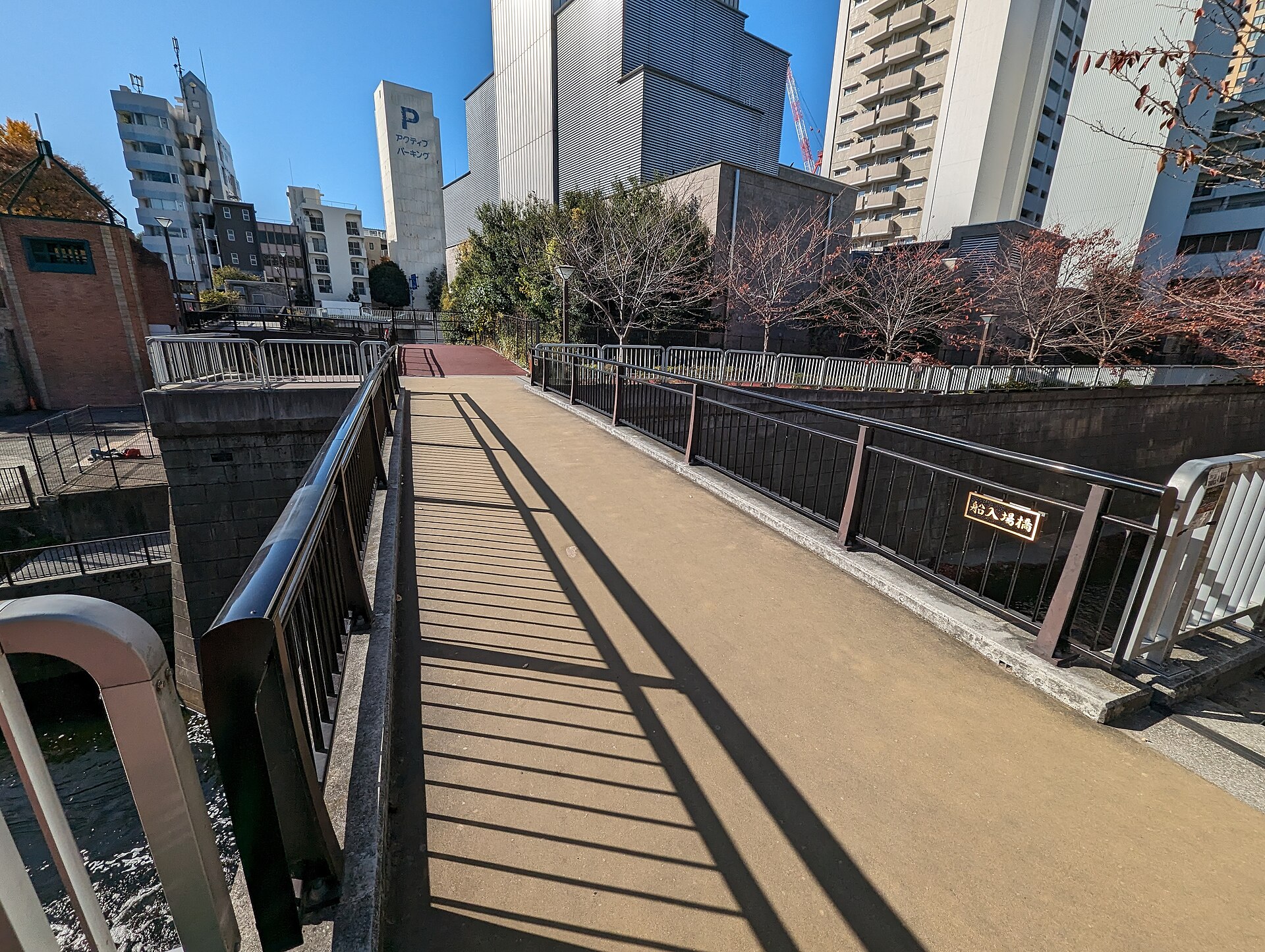
Flood control is distributed across the watershed. River channels carry water downstream; deeper or wider sections increase capacity; and detention basins temporarily store peak flows. The Funairiba detention basin in Meguro and the Ebara detention basin farther downstream in Shinagawa are distinct facilities within the same system. The Ebara intake pictured below is not in Nakameguro, but it demonstrates how downstream storage helps protect the wider basin.
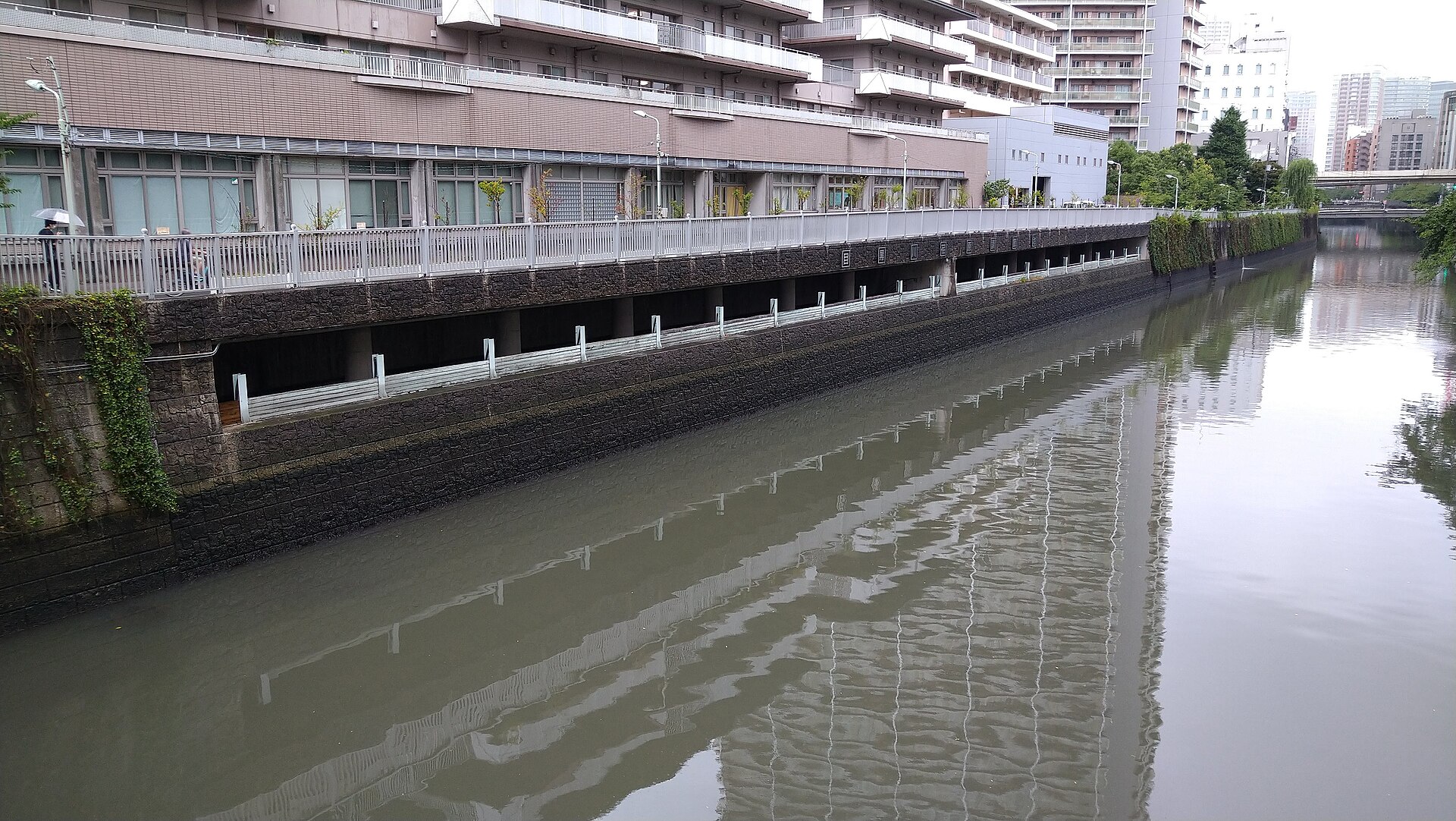
These facilities have continued to operate during recent heavy rain. Their use shows that flood engineering is an ongoing metropolitan service, not a completed historical episode. Concrete walls, warning equipment and restricted access along the river are part of the same system that makes the riverside promenade possible.
From Industrial and Service Land to New Urban Uses
From the late twentieth century, changes in manufacturing, logistics and land prices reduced many industrial and storage uses near central Tokyo. Some properties were rebuilt as apartments, offices or commercial buildings. Others were renovated and reused. These processes should be distinguished: adaptive reuse preserves and modifies an existing structure, while redevelopment may replace it entirely.
Nakameguro’s reputation for converted workshops and warehouses contains real examples, but it is often generalized too freely. A low-rise building with exposed concrete or large doors is not automatically a former factory. The contemporary streetscape is a mixture of surviving work buildings, altered structures and new construction designed to evoke an industrial aesthetic.
The Reinvention of Space beneath the Railway
Nakameguro Koukashita opened on November 22, 2016. The project reorganized roughly 700 meters beneath the elevated Toyoko Line with restaurants, shops, offices and other uses. Rather than hiding the railway, it treated columns, tracks and leftover linear space as the framework of a new district.
The project amplified changes already underway around the river. It linked station foot traffic to side streets and encouraged movement along and across the tracks. Yet modern Nakameguro cannot be credited to a single development. Railway access, river improvements, housing demand, small creative businesses, redevelopment, media attention and the cherry season all reinforced one another.
How the Cherry-Lined River Became Nakameguro’s Image
The cherry trees are a later historical layer. Local accounts associate the first extensive planting with residents following early Showa river improvement, when new banks and riverside roads created a different public landscape. Planting and replanting continued in later decades, including documented work in the early 1980s. The trees visible today are therefore not one unchanged avenue surviving from the Edo period.
The river’s fame grew because several systems converged: a dense station catchment, long continuous walking routes, photogenic bridges, commercial frontage, night lighting, social media and seasonal tourism. The blossoms transformed a flood-control corridor into a powerful place image. That image depends on pruning, inspections, replacement, root management, crowd control, cleaning and cooperation among public agencies, residents and businesses.
Nakameguro Today: Tourism, Daily Life and Maintenance
Outside blossom season, the river remains a neighborhood space used for commuting, deliveries, exercise and everyday errands. Tourism and daily life overlap rather than replace one another. The same narrow banks that create intimacy can become congested, and the same trees that define the district require expensive long-term care.
Historical Traces Visible Today
- Slopes above the river: evidence of the plateau-and-valley terrain that organized fields, roads and settlement.
- The Jakuzure valley: a reminder that culverted tributaries still shape drainage and flood risk.
- The concrete channel: the result of repeated flood-control and urban river projects, not an Edo-period riverbank.
- The railway viaduct: infrastructure that first accelerated urbanization and later became commercial space.
- Mixed building scales: traces of workshops and service land beside apartments, towers and new retail.
- Multiple generations of cherry trees: a managed landscape created after river improvement and renewed over time.
Timeline
- Edo period: Villages use fields, irrigation channels and waterwheels in the Meguro River valley.
- 1857: Hiroshige publishes New Fuji, Meguro, an artistic view of the wider rural Meguro landscape.
- Meiji period: Waterwheels support milling and some processing and manufacturing.
- 1923: The Great Kanto Earthquake accelerates suburban expansion and river-improvement pressure.
- August 28, 1927: The Toyoko Line opens between Shibuya and Maruko-Tamagawa; Naka-meguro Station opens.
- Early Showa: Residents are associated with cherry planting along newly improved riverbanks.
- July 22, 1964: The Hibiya Line reaches Naka-meguro.
- August 29, 1964: Through-service begins between the subway and Tokyu line.
- July 1981: Severe flooding prompts emergency improvements in the basin.
- 1980s onward: Channel works and detention facilities expand flood capacity.
- November 22, 2016: Nakameguro Koukashita opens beneath approximately 700 meters of elevated railway.
Frequently Asked Questions
Why is Nakameguro famous today?
It combines the Meguro River, cherry trees, strong rail access, walkable streets, restaurants, shops, offices and a design-oriented urban image. That popularity rests on much older layers of river engineering, industry and transport.
Was Nakameguro once an industrial district?
Parts of the river corridor contained factories, workshops, warehouses and service uses, but the area was always mixed with housing, shops and public infrastructure. It was not one uniform industrial zone.
Why were there waterwheels along the Meguro River?
Flowing water provided mechanical power for rice and grain milling. Some operators later used that power for processing and small-scale industry.
When were the cherry trees planted?
Large-scale planting is associated with river improvement in the early Showa period, followed by later planting and replacement. The avenue consists of multiple generations of trees.
Why is the Meguro River in a concrete channel?
Urban growth and repeated flooding led to channel engineering, revetment construction, bed excavation and integration with a wider flood-control system.
Does flood control mean the area can no longer flood?
No. The system reduces risk but cannot eliminate it, especially during rainfall beyond design targets or when local drainage is overwhelmed.
Are Nakameguro’s cafés really inside former warehouses?
Some buildings have been reused, but many are new or substantially rebuilt. A building’s former use should be confirmed individually rather than guessed from its appearance.
Sources and Further Reading
- Meguro City: The Waterwheels of Meguro
- Meguro City: The Meguro River
- Meguro City: Rivers of Meguro
- Meguro City: The Place Name Jakuzure
- Meguro City: Protecting the Meguro River Cherry Landscape
- Meguro City: Meguro River Water-Quality Measures
- Tokyo Metropolitan Government: Meguro River Basin
- Tokyu: History of the Toyoko Line
- Tokyu: Opening of Nakameguro Koukashita
Related Stories
Read Tokyo’s Hidden Rivers: How Streams Became Roads, Sewers and Greenways for more on the Jakuzure River and other altered waterways. Explore more urban history in the Stories archive.
Related Neighborhood Histories
Browse the Tokyo Neighborhood Histories directory for other districts shaped by railways, rivers and redevelopment.
Related Self-Guided Walks
See the Self-Guided Walks directory for published independent routes.
Walk Tokyo with TimeWalk Japan
Explore Tokyo’s rivers, railways and changing neighborhoods through English-language historical events and walks.