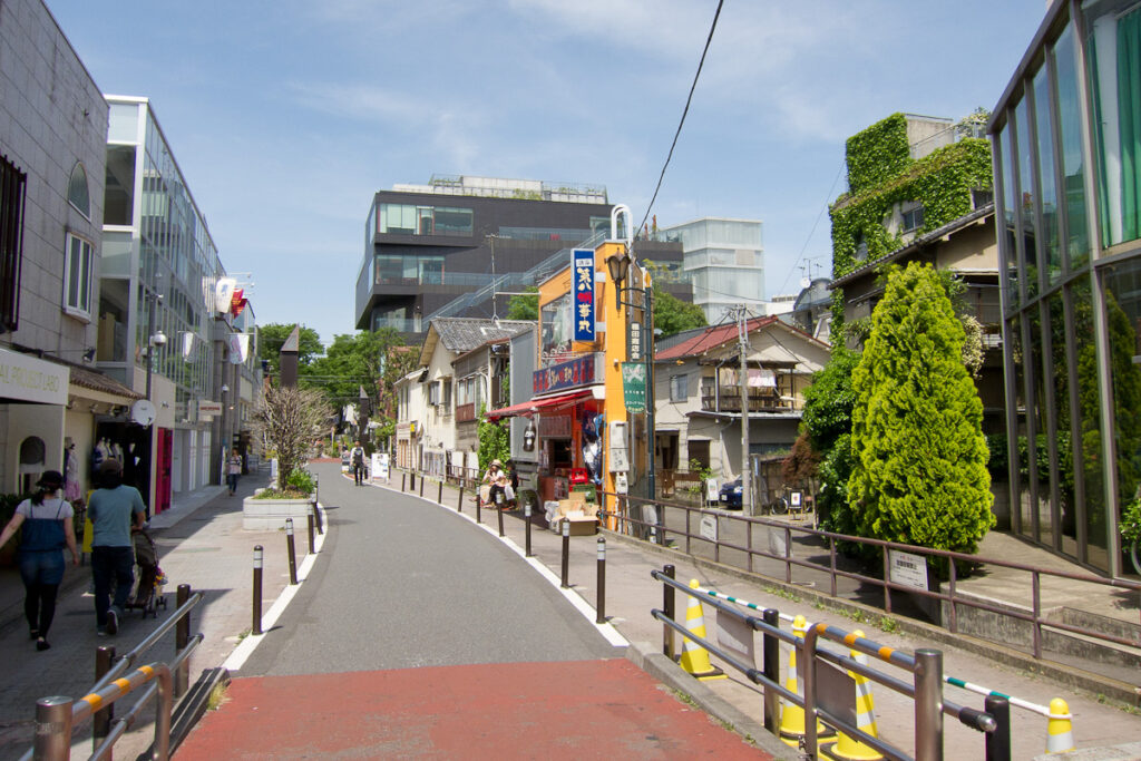
Walk south from Meiji-jingumae into Cat Street and the route bends gently between shops, cafés and side streets. That curve is a clue: Shibuya City officially lists it as the Former Shibuya River Promenade. Many of Tokyo’s “hidden rivers” are former surface streams or watercourses that were covered, rebuilt as culverts, or incorporated into sewer and drainage infrastructure during urbanization. Their routes may survive above as roads, paths, greenways, parks or building plots. But not every old river still flows underground in its natural form: water may have been diverted, placed in pipes or box culverts, combined with sewer systems, or replaced at the surface by a later reclaimed-water feature. Valley floors, curving lanes, bridge names, boundaries and old maps can reveal a vanished channel—and because the valley still collects runoff, flood risk does not necessarily vanish with the river.
Quick Answer: What Are Tokyo’s Hidden Rivers?
A hidden river in Tokyo is usually a former open stream, river branch or watercourse whose surface channel has been covered or radically altered. In Japanese, ankyo means a covered or enclosed waterway: flow may pass beneath slabs, through a box culvert, inside a pipe, or within infrastructure managed as a sewer or drain. The space above may become a road, greenway or park.
The romantic phrase “buried river” is useful only if it does not hide the engineering. Some routes still carry spring water or stormwater; some are sewer trunks; some have diverted or minimal ordinary flow. A visible stream on a greenway may be a later landscape feature supplied with highly treated reclaimed water. Cat Street follows the memory of the upper Shibuya River route; the open Shibuya River appears south of Shibuya Station near Inari Bridge, and from Tengenji Bridge downstream it is called the Furukawa.
A Vocabulary for Reading Water in Tokyo
A river or stream follows a natural drainage system, although its banks, bed and course may be engineered. An open channel is simply a reach where the water surface is visible; it is not necessarily natural. Legal classification and everyday names may differ.
A canal or aqueduct, such as Tamagawa Josui or Senkawa Josui, was deliberately excavated for water supply or irrigation. It should not be confused with a natural valley stream. A culvert, or ankyo, encloses a watercourse beneath a cover, pipe, tunnel or box structure. A sewer trunk carries wastewater, stormwater or both, depending on the local system; a storm drain specifically removes rainwater. An old river route may be reused by sewer infrastructure, but that does not mean every culvert carries sewage.
A greenway is a linear park or pedestrian route. Many follow former channels, but not all do. A reclaimed-water stream is a surface feature supplied with advanced-treated wastewater. It can restore visible water and habitat value without reopening the original river.
Tokyo Is a City of Plateaus and Valleys
Much of western Tokyo sits on the Musashino Plateau, cut by valleys formed by streams, springs and erosion. Shibuya City Library describes the district as a landscape of one river, five plateaus and many valleys, with roughly 35 meters between higher and lower points. Modern roads, railways and buildings disguise the relief, but a short walk can still move from a ridge to a narrow valley floor.
When channels were covered, their valleys did not disappear. Streets on the old floor may remain level while parallel roads climb. Sudden dips, oddly shaped blocks and administrative boundaries can preserve the geometry of a watershed.
Before the Streets: Waterways in Edo and Its Outskirts
Edo depended not only on the Sumida River, castle moats and major canals, but also on small streams, springs, irrigation ditches and village watercourses. They supplied domestic water where conditions allowed, watered fields, drained low ground, powered waterwheels, marked boundaries and supported habitat. Navigable channels carried goods, but not every small stream supported boats.
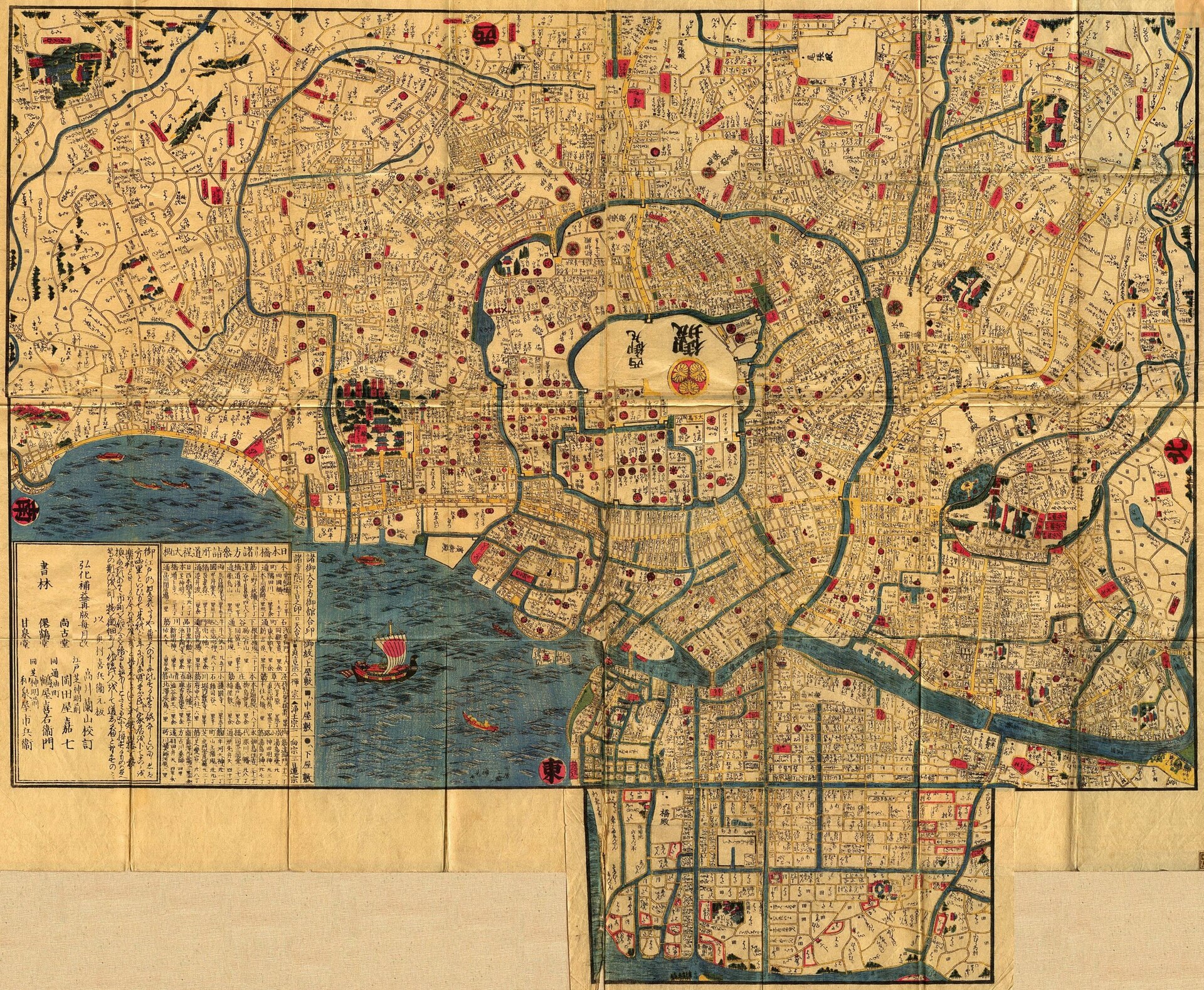
Artificial aqueducts added another layer. Kanda Josui and Tamagawa Josui brought water toward the city, while canals and moats structured defense and transport. The broad 1847 map below shows Edo as a city organized by water; it is not a precise survey of every tributary in modern Shibuya, Suginami, Setagaya or Meguro.
Why Tokyo Covered So Many Streams
Before modern sewer networks, urban streams received household wash water, workshop discharge and street runoff. Pollution varied by place and period, but population growth, dense housing, industry, sediment and reduced flow created serious sanitary complaints in many shallow rivers.
- Flood control: shallow channels overflowed during intense rain.
- Sanitation: covering polluted reaches removed open wastewater from streets and homes.
- Sewer construction: former channels offered low routes for trunk sewers and drains.
- Land and movement: the surface could support roads, paths, parks and maintenance access.
- Postwar growth: rapid building and infrastructure investment accelerated many projects.
The 1964 Olympics are part of the story, not the whole story. Olympic-era redevelopment mattered in some places, but culverting began before the Games and continued afterward. Each river had its own schedule and combination of flood, sanitation, sewerage and land-use pressures.
What Physically Happens When a River Is Culverted?
There is no universal cross-section. Engineers may place slabs over a channel, rebuild it as a reinforced-concrete box culvert, route flow through pipes, divert it, or incorporate the route into a sewer trunk. Groundwater, springs, wastewater and stormwater may be separated, combined or redirected. That is why “the old river is still flowing just below your feet” can be misleading: the name and route may survive while the physical channel and hydraulic function have changed completely.
How to Spot a Former River
- Topography: a narrow valley, higher ground on both sides, or a level route beside climbing streets.
- Street form: a long curving lane, linear path, rear-lot alignment or chain of pocket parks.
- Names and structures: bridge posts, names ending in -bashi, water-related place names and boundaries following the low line.
- Documents: historical maps, contours, municipal histories, river plans, sewer information and hazard maps.
These are clues, not proof. A curved street is not automatically a river; a greenway is not automatically an old channel; manholes show utilities, not a specific buried watercourse. Test the landscape against maps and official records.
Cat Street and the Upper Shibuya River
Shibuya City’s official road-name list includes “Former Shibuya River Promenade (Cat Street).” The route through Jingumae is now a commercial pedestrian environment, but its long, gently bending line relates to the upper Shibuya River system and the channel remembered as the Onda River in some sources. Names and section boundaries vary in historical accounts, especially where the Kōhone River, Udagawa and tributaries are discussed.
Cat Street’s paving, planting, shops and property lines are modern; they do not preserve the riverbank exactly. The nickname’s origin also has competing explanations. Shibuya local histories associate the children’s song “Haru no Ogawa” with the Kōhone River near Yoyogi, but Cat Street as a whole should not be called the song’s single confirmed setting.
Where the Shibuya River Reappears
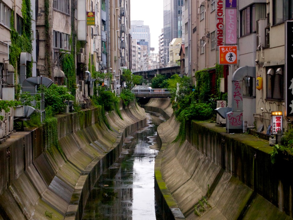
South of Shibuya Station, water becomes visible near Inari Bridge. Shibuya City Library describes the open reach from Inari Bridge to the Minato City boundary at Tengenji Bridge as the Shibuya River; downstream, the name changes to Furukawa. Public space beside the engineered channel was reshaped through the Shibuya Stream redevelopment.
The photograph below was made in 2011, before today’s redevelopment landscape. It documents the open river downstream of Inari Bridge, not the exact appearance visitors see in 2026.
Shibuya River, Furukawa and Reclaimed Water
In March 1995, Tokyo began supplying advanced-treated reclaimed water from the Ochiai Water Reclamation Center to the three Jonan rivers: the Shibuya River–Furukawa, Meguro River and Nomikawa. This “clear-flow revival” improves water quantity and environmental conditions in existing open channels. It is not the same as uncovering the upper Shibuya River, and the visible flow is not maintained only by natural springs.
Furukawa at Hiroo Before Modern Engineering
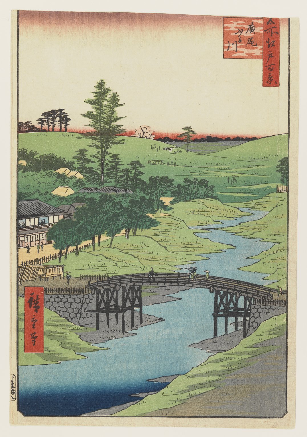
Utagawa Hiroshige’s mid-nineteenth-century view of the Furukawa at Hiroo evokes a waterside landscape before modern embankments, roads and sewerage. It is an artwork, not a survey: its channel width, buildings, vegetation and flow cannot be measured as technical evidence. It shows the downstream Furukawa, not the former channel beneath Cat Street.
Momozono River: From Flood-Prone Stream to Greenway
Suginami City describes the Momozono River as a shallow stream with one source at Benten Pond in Amanuma. It flooded after heavy rain. In 1965 it was converted into sewer infrastructure, and a park opened above it on April 1, 1969. Today the Momozono River Greenway runs about 1,600 meters through shopping streets and residential neighborhoods south of Kōenji.
This is not a natural river preserved unchanged below a park. It is an example in which flood control, sanitation, sewer construction and public-space creation became one urban project.
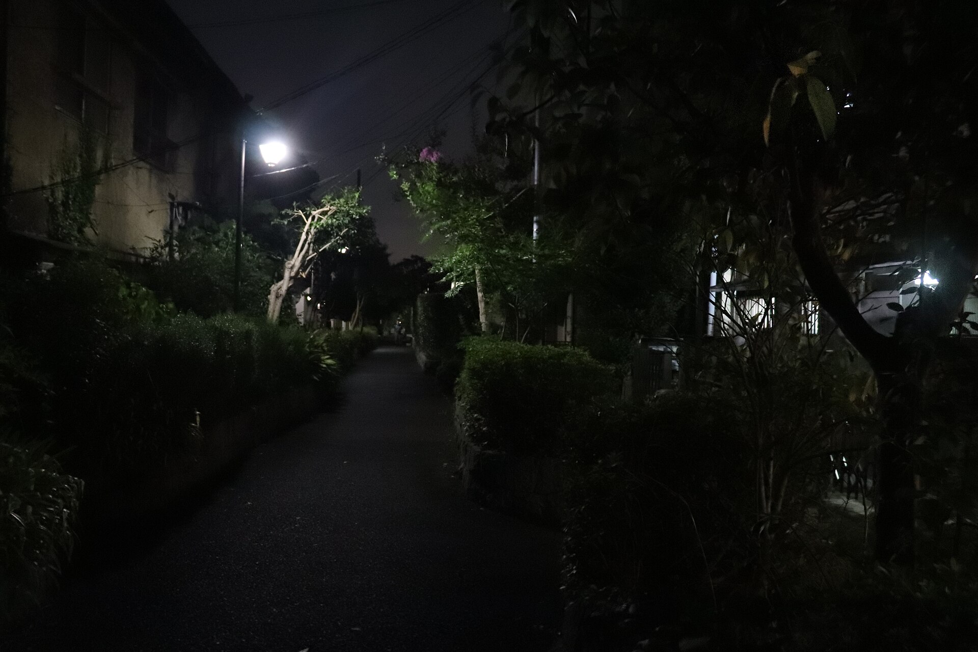
Kitazawa River: A Culvert Below, a New Stream Above
Setagaya City’s Kitazawa River Greenway extends about 4.3 kilometers from Akatsutsumi through Daita, Daizawa and Ikejiri. The river was culverted during sewer development. From the mid-1990s, residents and the city created a surface stream in part of the corridor using advanced-treated reclaimed water from Ochiai; the project was completed in 1996.
The visible water is therefore a later landscape feature above the culverted route, not the original river fully restored to its natural channel. It is not drinking water, and supply may stop during heavy-rain warnings. The Kitazawa system meets the Karasuyama River route and connects toward the Meguro River watershed, but the surface streams and underground sewer hydraulics should not be treated as one identical flow.
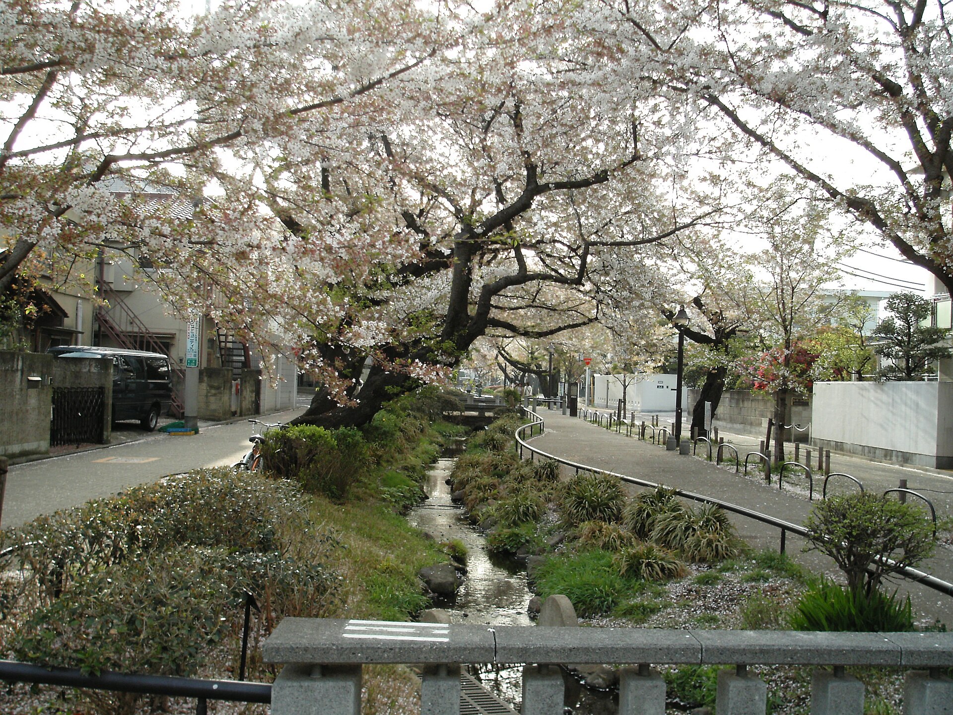
Meguro’s Five Rivers: Different Outcomes
Meguro City identifies five Class B rivers: the Meguro River, Jakuzure River, Tachiai River, Nomikawa River and Kuhonbutsu River. The city states that, except for the Meguro River and part of the Nomikawa, they have been culverted as sewer trunks and used as greenways. Their underground structures are not identical.
- Meguro River: an open, engineered river with flood-control works and reclaimed-water support.
- Jakuzure River: largely a greenway over a sewer trunk; its valley remains relevant to inland flooding.
- Tachiai River: 7.41 km in total; Tokyo identifies 6.66 km upstream of Tsukimibashi as sewer trunk and 0.75 km downstream as open channel.
- Nomikawa: partly open and partly incorporated into sewer infrastructure.
- Kuhonbutsu River: covered in 1974 in Meguro’s account and remembered by the greenway near Jiyūgaoka.
Jakuzure River and the flood risk that remained
On July 10, 2025, short, intense rain caused inland flooding in parts of Kamimeguro and Gohongi around the Jakuzure valley. Meguro reported rainfall above 50 millimeters per hour across the wider area and a full sewer trunk. Tokyo described interacting factors including localized rain, topography and road-drainage capacity. Residents questioned whether renewal works contributed, and the ward requested investigation; the works should not be described as the confirmed cause.
What Tokyo Gained—and Lost
Culverting created sanitation improvements, sewer capacity, drainage infrastructure, roads, parks, pedestrian links and usable land. For residents facing a shallow polluted stream that overflowed, these were not abstract benefits.
The losses were also real: visible water, aquatic habitat, cooling, play, everyday awareness of topography and a direct connection to local history. Greenways and reclaimed-water features recover some public value, but they do not recreate the original river system.
Why Flood Risk Can Survive
Rain still runs downhill. In a paved city, less water infiltrates into soil and more reaches drains and sewers quickly. If rainfall intensity exceeds inlet or pipe capacity, water can surcharge or collect on the surface. This inland flooding is distinct from a river overtopping its banks. Basements, underpasses and low entrances can be especially vulnerable.
An old river road is not automatically dangerous, and higher ground is not automatically safe. Use current Tokyo rainwater-inundation maps, ward hazard maps, weather warnings and closure information. Historical maps explain terrain; they do not replace present safety guidance.
Reclaimed Water Is Not Daylighting
- Reclaimed-water stream: a new visible feature on a greenway, such as Kitazawa.
- Clear-flow revival: reclaimed water supplied to an existing open river.
- River restoration: ecological or channel improvement within a river corridor.
- Daylighting: reopening a buried stream to the surface.
- Memorial landscape: paving, planting or bridge markers that recall water without carrying the original flow.
How to Research a Hidden River Responsibly
- Check the current river manager and sewer authority.
- Compare historical maps with a modern map.
- Use contours or elevation data to identify the valley.
- Record bridge names, posts and explanatory plaques.
- Trace greenway continuity without entering private land.
- Check flood and inland-water hazard maps.
- Confirm construction, closures and water operation.
- Treat oral history as valuable but not sufficient proof.
Old maps may be distorted in scale and orientation. Do not force them onto modern parcels with false precision. See How to Read Old Japanese Maps—and Use Them to Walk Modern Tokyo. For artificial supply channels, read How Edo Supplied Water to a Million People.
Safety: Never Enter a Culvert or Sewer
Hidden-river walking is urban observation, not underground exploration. Never enter a culvert, sewer, drain, construction area or maintenance passage. Do not lift manhole covers or open gates. Stay on public roads and open greenways, avoid low river corridors during rain or thunderstorm forecasts, follow closure signs and water-level warnings, and respect homes, schools and private property.
Three Practical Walks
Cat Street to the visible Shibuya River
Meiji-jingumae/Harajuku → Cat Street → Miyashita Park area → Shibuya Station → Shibuya Stream → Inari Bridge. Allow about 45–60 minutes for roughly 2.5 km without long stops. Use public crossings and plazas only; never descend the river banks. Shibuya Station works can change routes, so follow current signs.
Momozono River Greenway
Begin south of Kōenji Station and follow the greenway east toward Higashi-Kōenji and Nakano. The official Suginami section is about 1.6 km, suitable for 30–45 minutes before stops. Keep speeds low around pedestrians and residents.
Kitazawa River Greenway
From the Shimokitazawa/Setagaya-Daita area, follow the greenway southeast through Daizawa toward Ikejiri and the Karasuyama confluence. The scenery changes by section; reclaimed water is not continuous in the same form along all 4.3 km. Do not drink the water or treat it as a bathing stream.
Frequently Asked Questions
What does ankyo mean?
It means a covered or enclosed watercourse. Depending on the site, it may be a slab-covered channel, box culvert, pipe or underground channel.
Is there really a river under Cat Street?
Cat Street is officially the Former Shibuya River Promenade and follows the memory of the upper river route. The underground infrastructure should not be imagined as an unchanged natural channel.
Where does the Shibuya River become visible?
Near Inari Bridge south of Shibuya Station. It is called the Shibuya River to Tengenji Bridge and the Furukawa downstream.
Are culverted rivers the same as sewers?
Not automatically. Some former rivers became sewer trunks; others are culverts, drains or diverted channels. Culvert describes enclosure; sewer describes function.
Is the stream on Kitazawa River Greenway natural?
No. The visible stream is a later landscape feature supplied with advanced-treated reclaimed water above the culverted route.
Do hidden-river valleys still flood?
They can. Topography continues to concentrate runoff, and intense rain may exceed street-inlet or sewer capacity.
Is it legal to enter a culvert?
No public visit is implied. Entering sewers, drains, culverts, work sites or maintenance passages is dangerous and prohibited.
Can Tokyo uncover buried rivers again?
Daylighting is technically possible, but it requires space, hydraulic design, ownership, utilities, flood planning and public decisions. Reclaimed-water landscaping is not the same thing.
Sources and Further Reading
- Shibuya City Library: Tracing Shibuya’s river lines
- Shibuya City: Official road nicknames
- Suginami City: Momozono River Greenway
- Setagaya City: Kitazawa River Greenway
- Meguro City: River management
- Tokyo Bureau of Sewerage: Reclaimed water
- Tokyo Bureau of Sewerage: Jonan inundation assumptions
Read the City as a Watershed
The watercourse did not simply vanish. It changed shape, name, management and function inside the modern city. Culverting answered problems of sanitation, flooding, traffic and land use, while also hiding habitat and everyday contact with water.
A careful walk brings the watershed back into view without entering the underground system. Follow the valley, compare old maps, read bridge names and distinguish natural streams from sewers, greenways and reclaimed water. For a larger contrast in flood engineering, read The Arakawa River Is Man-Made. Explore more TimeWalk Japan Stories, Self-Guided Walks, or history events.
Featured image credit: Photo by Rs1421, via Wikimedia Commons, CC BY-SA 3.0.