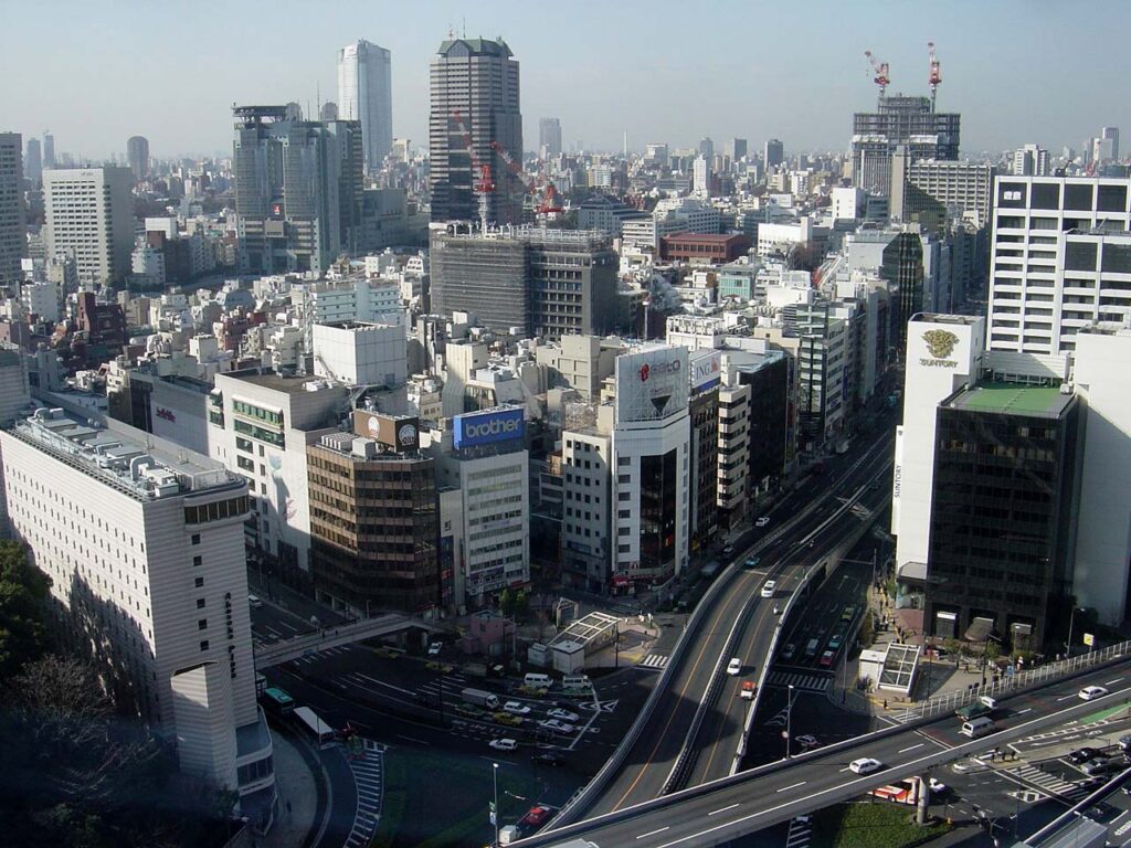
Tokyo’s political back rooms grew beside a vanished castle gate—where samurai estates later became palaces, army land, television studios and discreet geisha restaurants.
Today, Akasaka is a district of ministries, broadcasters, hotels, restaurants, nightlife and high-end housing. To visitors unfamiliar with Japan, these roles can appear unrelated. Yet they all grew from one unusually durable geography: a strategic entrance to Edo Castle, large warrior compounds, steep slopes and a position beside the country’s political center.
The old gate disappeared, but its function survived. Akasaka-mitsuke remained a transport junction. Daimyo estates became imperial, military, governmental and institutional land. Smaller service streets evolved into a hanamachi and restaurant district where politicians, officers, executives and journalists met behind closed doors. Broadcasting later added a media economy, while hotels and subways turned the area into an international center of hospitality.
Modern Akasaka therefore exists because each political era reused the same landscape. The district’s defining story is not simply “from samurai to skyscrapers,” but the continuous conversion of access, land and hospitality into power.
Why Akasaka Became What It Is Today
Three conditions reinforced one another. First, Akasaka stood beside the outer edge of the shogun’s castle and later beside Japan’s national government. Second, Edo-period landholding left both large compounds and fine-grained town quarters. Third, the district became a junction between Nagatacho, Aoyama, Roppongi and the palace-side city. Each new regime found uses for this geography.
Former elite land could become imperial, military, governmental, diplomatic or institutional property. Smaller streets near Hitotsugi and Akasaka Tamachi supported shops, restaurants and entertainment. Ryotei—high-end traditional restaurants with private rooms and formal service—connected the district to political, military and business networks, while the hanamachi was a regulated community of geisha houses and related businesses. These were related systems, not interchangeable terms.
Geography: Plateau Edges, Slopes, the Outer Moat and Tameike
Akasaka occupies broken upland west of the central government district. Ridges and slopes divide short distances into distinct environments. The former outer-moat line at Akasaka-mitsuke and Tameike defined the eastern edge of the district’s historical world, while roads climbed west toward Aoyama and south toward Roppongi.
Tameike, literally “reservoir pond,” was once a large body of water associated with Edo’s water and defensive landscape. It was gradually reduced and filled, but the low corridor survives in roads, infrastructure and the relationship between Akasaka and the government-business zones to the east. The slopes remain equally important: they separated compounds, temples, residential pockets and commercial streets, creating internal differences that persist.
Before Edo: Hitotsugi and the Landscape Beyond the Castle
Before Edo expanded into a political metropolis, the area included fields, woodland, paths and settlements. Hitotsugi—preserved in local names and memory—referred to a premodern locality beyond the early castle-centered town. Evidence does not support projecting today’s Akasaka 1–9 chome onto that earlier landscape.
The transformation began as the Tokugawa shogunate enlarged Edo Castle and reorganized the surrounding countryside. Land that had been peripheral became strategically valuable because it stood on an approach to the castle and on routes toward the western uplands.
Akasaka-mitsuke and Edo Castle’s Southwestern Defenses
A mitsuke was a guarded gate or checkpoint in a castle’s defensive network. Akasaka-mitsuke controlled an approach across the outer moat on Edo Castle’s southwest side. The gate joined military function with daily circulation: retainers, merchants, messengers and travelers passed through a landscape of bridges, water, stone walls and controlled roads.
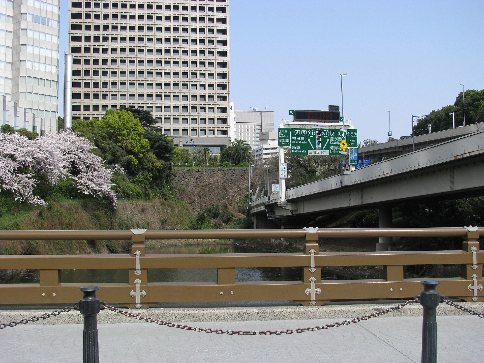
The surviving stonework and Benkei-bori are now in Kioicho, Chiyoda City, not within modern Minato City’s Akasaka addresses. Their importance lies in defining Akasaka’s historical entrance and in explaining why the area remained a traffic node after the castle gate disappeared.
The Edo Period: Outer Defenses, Estates and Town Quarters
Late Edo maps show a mosaic rather than a single neighborhood. Daimyo estates—massive compounds maintained by feudal lords, often functioning like small cities with samurai residences, gates, gardens, storehouses and service buildings—occupied broad parcels. Between them lay temples, shrines, service routes and commoner quarters such as Akasaka Tamachi, Shinmachi and Ura-denmacho. Residents provided goods, transport, labor and entertainment to the surrounding warrior city.
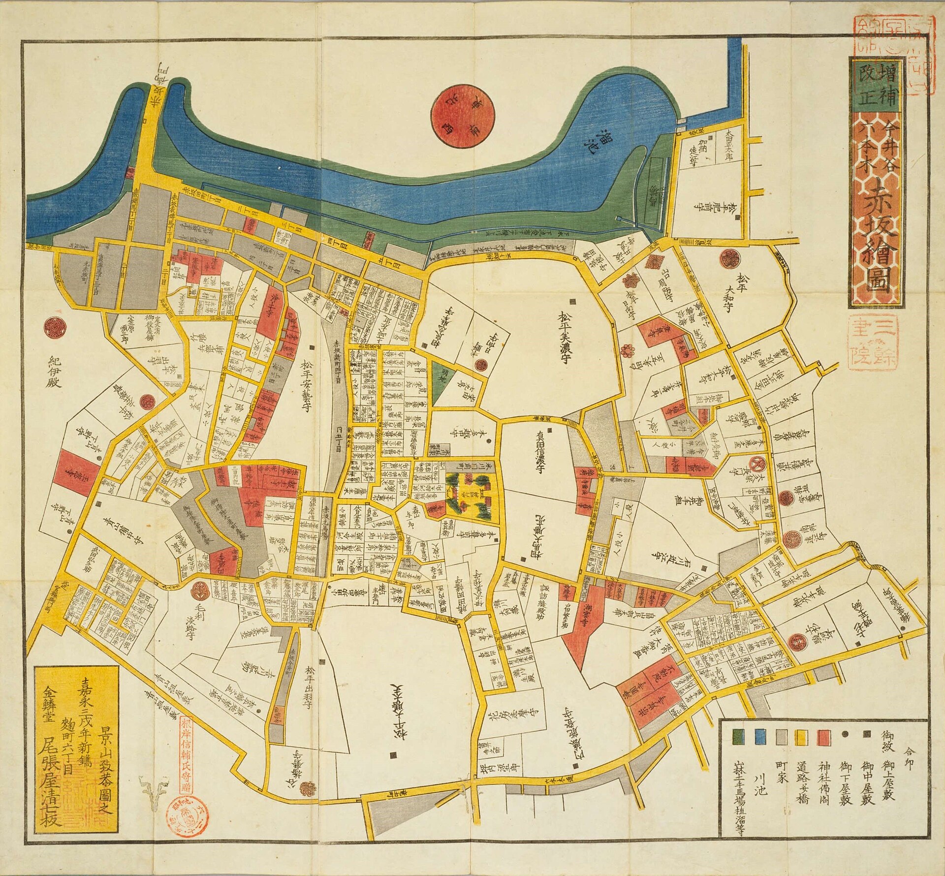
Kiriezu were practical, commercially published sectional maps. They are invaluable for identifying estates and routes, but their orientation and scale vary; they should not be read as north-up modern survey maps. Their strongest lesson is structural: Akasaka combined large enclosed grounds with narrow, socially mixed corridors.
Shrines, Slopes and the Internal Geography of Akasaka
Akasaka Hikawa Shrine anchors the quieter western side of the district. The shrine traces its origins to the tenth century and was moved to its present site in the eighteenth century under Tokugawa Yoshimune. Its wooded grounds and great ginkgo occupy a terrain of slopes and former estate boundaries that contrasts with the commercial streets near Akasaka-mitsuke.
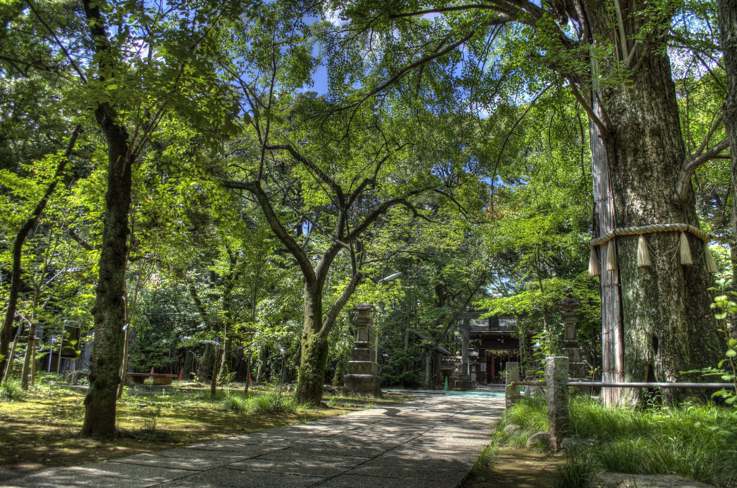
Named slopes were working infrastructure. They linked ridge-top compounds with lower streets, directed movement around walls and made adjoining blocks feel separate. The later hanamachi developed within this fine-grained geography, close enough to political and military clients yet set in streets suited to discreet, appointment-based hospitality.
From Feudal Estates to Imperial, Military and Government Land
The Meiji Restoration dismantled the status system that had sustained daimyo residences. Former estates passed through state seizure, sale, reassignment and subdivision. Some became imperial or aristocratic property; others served the army, government offices, schools, residences of officials or private development. The process was parcel-specific, not a universal conversion of estates into institutions.
Akasaka’s advantage was the availability of substantial sites close to the new political center. The same walls and elevated grounds that had suited warrior households could accommodate barracks, official residences and ceremonial facilities. Meanwhile, the old town quarters continued to support commerce and services.
Akasaka Palace and the State Landscape of Moto-Akasaka
Moto-Akasaka contains the most monumental example of state reuse. The present State Guest House, Akasaka Palace, was completed in 1909 as the Crown Prince’s residence on land associated with the former Kishu Tokugawa estate. The neo-Baroque building later served several governmental purposes before being renovated and opened as Japan’s State Guest House in 1974.
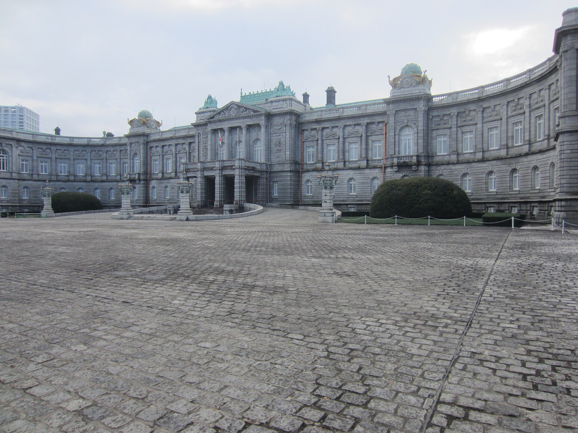
This history belongs to a specific compound in Moto-Akasaka. It should not stand in for the whole district. Its importance is that it shows how former feudal land became a stage for imperial architecture, national ceremony and diplomacy.
Military Institutions, Memory and the Modern District
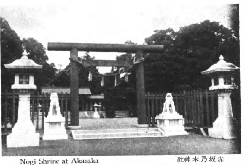
Modern Akasaka also became a military landscape. The Third Infantry Regiment of the Imperial Guard occupied a major site around present-day Akasaka 4–5 chome. Nearby, General Nogi Maresuke’s residence and the shrine established after his death created a memorial landscape linking military service, imperial loyalty and public commemoration.
Political violence also marked the district. During the February 26 Incident of 1936, rebel officers attacked leading statesmen, including former prime minister and finance minister Takahashi Korekiyo at his Akasaka residence. The preserved site in what is now Takahashi Korekiyo Memorial Park places national crisis within the geography of elite residences and military facilities.
The Rise of the Akasaka Hanamachi and Ryotei Culture
Akasaka’s entertainment economy grew from the service towns of the Edo period and expanded in the modern city. A hanamachi was an organized “flower town” of geisha houses, training, booking relationships and associated businesses. Ryotei provided private dining rooms, cuisine and formal hospitality. Nightlife included a much wider range of bars, restaurants and venues.
Akasaka’s location made this infrastructure valuable. Government ministries and the Diet lay nearby; military and naval circles, shipping interests, financiers and politicians needed places for banquets and relationship-building. Geisha performance and ryotei service offered established protocols for hosting. The result was not a hidden government but an urban hospitality system serving elite networks.
The hanamachi concentrated particularly around parts of Akasaka Tamachi and the slopes near Hikawa. Its fortunes rose and fell with war, regulation, changing corporate entertainment and redevelopment. A smaller geisha community continues the tradition, but present numbers and businesses should be treated as changeable rather than as fixed historical facts.
Streets, Trams and a Central Entertainment District
Modern transport widened Akasaka’s clientele. Streetcars and improved roads connected the district to Shimbashi, Aoyama, Yotsuya and the palace-side city. Akasaka-mitsuke remained a junction after the gate vanished because the underlying route network still converged there.
Rail and subway access later reinforced the division of roles within the district. Akasaka-mitsuke Station became a major interchange, Akasaka Station served the Hitotsugi and TBS side, and Tameike-sanno connected the eastern edge to government and business corridors. Restaurants and entertainment clustered where transport, offices and older hospitality streets overlapped.
The Great Kanto Earthquake and Prewar Akasaka
The 1923 Great Kanto Earthquake affected Akasaka unevenly. The district did not experience the same continuous fire devastation as some low-lying eastern wards, yet buildings and infrastructure were damaged and rebuilding altered streets and construction. Surviving compounds, local fire patterns and new development produced different outcomes from block to block.
Prewar Akasaka therefore combined older town streets, modern restaurants, military compounds, elite homes and new transport. It was already a district where political authority and commercial hospitality met before wartime mobilization intensified the military presence.
Air Raids and Postwar Reconstruction
Air raids in 1945 destroyed or damaged large parts of Minato, including Akasaka. The loss of buildings disrupted the hanamachi and ordinary residential life, while military defeat ended the institutional order that had shaped major sites. Reconstruction took place through temporary buildings, new restaurants, offices, housing and the reassignment of former military land.
Postwar Akasaka benefited from proximity to the reconstituted government in Nagatacho and Kasumigaseki. Political parties, ministries, companies and journalists generated demand for meeting places. Hotels, banquet halls and dining establishments expanded this ecosystem, while bars and clubs added a less formal nightlife economy.
Hotels, the 1964 Olympics and International Hospitality
Tokyo’s preparations for the 1964 Olympics accelerated hotel construction and international hospitality. Around Akasaka-mitsuke, new roads and large hotels linked the political center with foreign visitors, conferences and corporate entertainment. This was a metropolitan zone crossing modern ward boundaries.
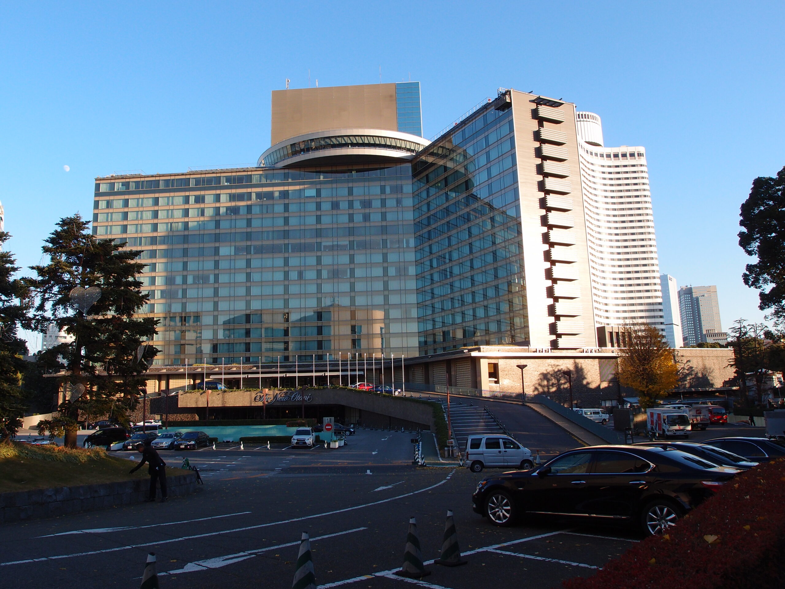
Hotel New Otani opened in 1964 in Kioicho, Chiyoda City, on the former Fushimi-no-miya estate, not inside Minato City’s Akasaka. Its scale, gardens and banquet capacity nevertheless helped make the Akasaka-mitsuke area a center of international and political hospitality. The example shows how functional Akasaka extends beyond the current address boundary.
TBS, Broadcasting and Akasaka Sacas
Broadcasting added another network industry. Tokyo Broadcasting System established its long-term Akasaka base and developed radio and television operations there. The broadcasting center made the district a workplace for producers, performers, technicians, journalists and corporate partners, reinforcing nearby restaurants and late-hour services.
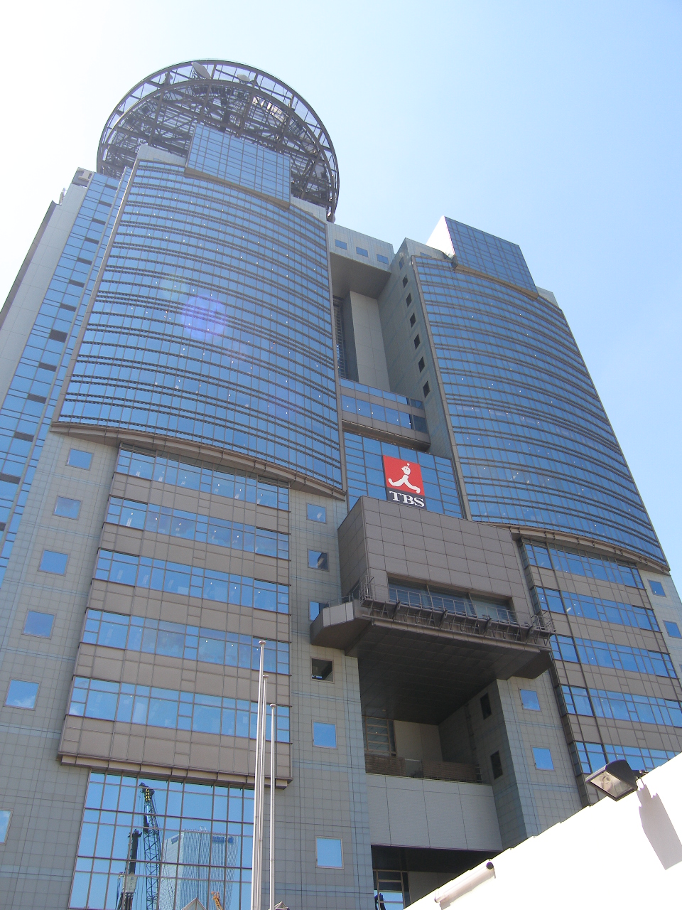
The Akasaka Sacas redevelopment, opened in 2008, integrated broadcasting, performance, offices, housing and public space around Akasaka Station. It reused a large institutional media site rather than erasing the district’s older logic: a major compound beside fine-grained commercial streets, connected to government and entertainment networks.
Why Politics, Business and Hospitality Still Cluster Here
Akasaka remains useful because several forms of proximity coincide. Nagatacho and Kasumigaseki are close; subway lines connect multiple business centers; hotels and restaurants provide rooms for meetings; media organizations circulate information; and established entertainment streets offer varied levels of formality.
This is an inherited urban system. Edo’s gate and routes created access. Warrior estates created large parcels. Meiji institutions reused those parcels. The hanamachi and ryotei developed specialist hospitality. Postwar hotels and broadcasting scaled those functions for an international, corporate metropolis.
Akasaka Today: Different Histories within One District
Akasaka-mitsuke and Akasaka 3-chome retain the logic of gate, junction and commercial frontage. The Tameike side follows the former moat and reservoir corridor toward government offices and business districts. Akasaka 4–5 chome combines Hitotsugi, TBS, former military land and large redevelopment.
Akasaka 6-chome contains Hikawa Shrine, steep slopes, residential streets and traces of the hanamachi environment. Akasaka 7–9 chome holds the Nogi memorial landscape, Takahashi Korekiyo’s former residence site, parks, former elite properties and modern redevelopment. Moto-Akasaka is dominated by imperial and state land uses, above all the State Guest House.
These zones are connected historically but are not interchangeable. Nor do the names Akasaka, Moto-Akasaka, Kioicho, Nagatacho and Tameike describe identical boundaries across time.
What Historical Traces Can Be Seen Today
At Akasaka-mitsuke, compare the modern interchange with the stonework and moat on the Kioicho side. Around Hikawa Shrine, read the wooded precinct, slopes and narrow approaches as evidence of Akasaka’s internal topography. At Nogi Shrine and Takahashi Korekiyo Memorial Park, modern memory occupies former residential and military landscapes.
Around TBS and Akasaka Sacas, the scale of the media compound contrasts with the surrounding restaurant streets. In Moto-Akasaka, the State Guest House demonstrates the state reuse of former elite land. None of these places preserves an entire period unchanged; together they reveal how parcels, routes and terrain carried old functions into new institutions.
Akasaka’s Historical Layers
| Historical layer | Main land use | Institutions and social networks | Surviving trace | Present-day role |
|---|---|---|---|---|
| Before Edo | Fields, woodland and settlements | Local communities and religious sites | Place names and terrain | Underlying neighborhood geography |
| Edo period | Outer defenses, daimyo estates and town quarters | Shogunate, warrior households and service trades | Moat, gate stonework, slopes, shrines and parcel patterns | Transport node and mixed streets |
| Meiji to prewar Showa | Imperial, military, governmental and elite residential land | State, armed forces, diplomats and politicians | State Guest House, Nogi landscape and former residence sites | Ceremonial, memorial and public land |
| Modern hanamachi | Geisha houses, ryotei and entertainment streets | Hospitality, political, financial and military networks | Street pattern, surviving businesses and cultural practice | Dining and nightlife identity |
| Postwar growth | Hotels, offices, broadcasting and restaurants | Government, corporations, media and international visitors | Hotels, TBS and transit interchanges | Political-business-media cluster |
| Contemporary Tokyo | Mixed-use redevelopment, offices, housing and culture | Media companies, developers, residents and visitors | Akasaka Sacas, parks and preserved sites | Layered central-city district |
Timeline
- Before 1600: Hitotsugi and nearby lands form a rural and settled landscape beyond the early castle town.
- Early Edo period: Edo Castle expands; Akasaka-mitsuke, the outer moat and Tameike shape the southwestern approach.
- Edo period: Daimyo estates, warrior land, temples, shrines and commoner quarters form a mixed district.
- 1730s: Akasaka Hikawa Shrine is moved to its present site under Tokugawa Yoshimune.
- 1868 onward: Former estate land is reassigned to imperial, military, state, residential and private uses.
- 1909: The Crown Prince’s palace, now the State Guest House, is completed in Moto-Akasaka.
- 1923: The Great Kanto Earthquake damages Akasaka unevenly and prompts rebuilding.
- 1936: Takahashi Korekiyo is assassinated at his Akasaka residence during the February 26 Incident.
- 1945: Air raids cause widespread destruction and end the prewar military landscape.
- 1964: International hotel construction around Akasaka-mitsuke supports the Tokyo Olympics and postwar business travel.
- 1974: Akasaka Palace begins service as the State Guest House after renovation.
- 2008: Akasaka Sacas opens around the TBS complex.
Frequently Asked Questions
Why is Akasaka called Akasaka?
The name literally means “red slope.” Several origin traditions exist, but no single explanation should be treated as certain. The name was attached historically to a wider area than today’s addresses.
Is Akasaka-mitsuke inside modern Akasaka?
The name identifies Akasaka’s historic gateway and today’s transport area, but the surviving gate stonework and Benkei-bori are on the Kioicho side in Chiyoda City.
Was Akasaka always an entertainment district?
No. Edo-period Akasaka combined defenses, warrior estates, religious sites and service towns. Its hanamachi, ryotei and broader nightlife developed in distinct phases.
What is the difference between a hanamachi and a ryotei?
A hanamachi is an organized geisha district with geisha houses and related businesses. A ryotei is a high-end traditional restaurant offering private dining and formal hospitality; a ryotei may work with geisha but is not the same institution.
Is Hotel New Otani in Akasaka?
It is in Kioicho, Chiyoda City, near Akasaka-mitsuke. It belongs to the wider hotel and political-hospitality zone surrounding Akasaka, not to Minato City’s Akasaka addresses.
Why did TBS locate in Akasaka?
Akasaka offered a large central site with access to government, business and entertainment networks. Broadcasting then reinforced the district’s late-hour services and information economy.
Sources and References
- Minato City, Place-name history of the Akasaka area
- Minato City, Akasaka Central District Urban Development Guidelines
- National Diet Library Search and Digital Collections
- Cabinet Office, State Guest House, Akasaka Palace: History
- Akasaka Hikawa Shrine: Official history
- Hotel New Otani Tokyo: About and history
- TBS Holdings: Corporate history
- Akasaka Geisha: About the Akasaka hanamachi
Related Stories
For context on the castle landscape and historical maps, read How to Read Old Japanese Maps in Modern Tokyo.
Related Neighborhood Histories
Compare Akasaka with the neighboring History of Roppongi and History of Azabu, or browse the Tokyo Neighborhood Histories directory.
Related Self-Guided Walks
Browse available routes in the Self-Guided Walks directory.
Walk Tokyo with TimeWalk Japan
Akasaka’s history is easiest to understand at street level, where slopes, former moat lines, old compounds and hospitality streets meet. Join TimeWalk Japan on Meetup for English-language walks and history events.